Wikimedi'Òc
Modes d'emploi

Cet album fait partie des albums
Cet album photos contient les sous-albums suivants :


Herman Van Loon Carte particuliere des cotes de Normandie 07711323 binary.png - Verdy p

Almanach Nouvelle Chronique de Jersey 1891 carte localisation Îles de la Manche.jpg - Man vyi

Cartenormandie1758.jpg - Traeb~commonswiki

Channel Islands 1913 Baedeker.jpg - Smiley.toerist
UBBasel Map Kanalinseln 1685-1686 Kartenslg Mappe 238-32.tif - Basel University Library

Sarnia Insula et Insula Caesarea by Blaeu 1665.jpg - Ratzer

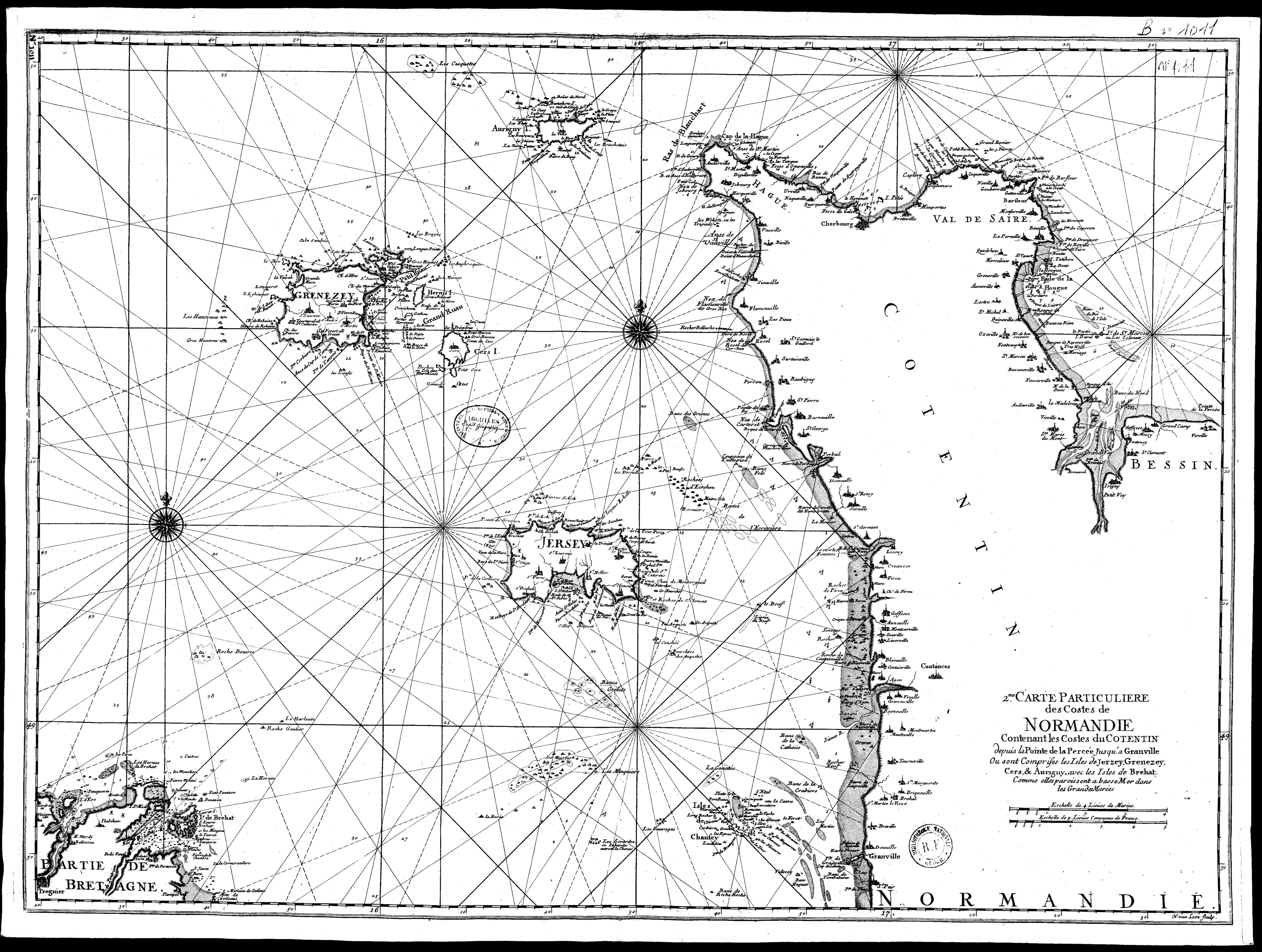
Manche-Van Loon 1753.jpg - Ratzer

Channel Islands-G van Keulen ca 1790.jpg - Ratzer

"Sarnia Insula, vulgo Garnsey, et Insula Caesaria, vernacule Jarsey" (22071584770).jpg - Tm

30 of 'Sark; a practical guide ... 5th edition' (11243885624).jpg - Artix Kreiger 2

63 of 'The Atlantic Islands as Resorts of Health and Pleasure ... Illustrated' (11075861524).jpg - Artix Kreiger 2

Sarnia Insvla… - Atlas Maior, vol 5, map 58 - Joan Blaeu, 1667 - BL 114.h(star).5.(58).jpg - Enyavar

Les Dirouilles map by Angus Faed 1940.jpg - Ratzer

A general chart of the islands of Guernsey, Jersey, Serq, Herm, Jethou and Alderney - btv1b530128098.jpg - Gzen92Bot

A general chart of the islands of Guernsey and Jersey, Sark, Herm, Jethou and Alderney - btv1b53012763p.jpg - Gzen92Bot

The coast of NORMANDIE from cherbourg to Coutances also the islands of Guern sey, Jersey, Alderney (NYPL b13909432-1640587).jpg - Fæ