Wikimedi'Òc
Modes d'emploi

Cet album fait partie des albums
Cet album photos contient les sous-albums suivants :


Cartenormandie1758.jpg - Traeb~commonswiki
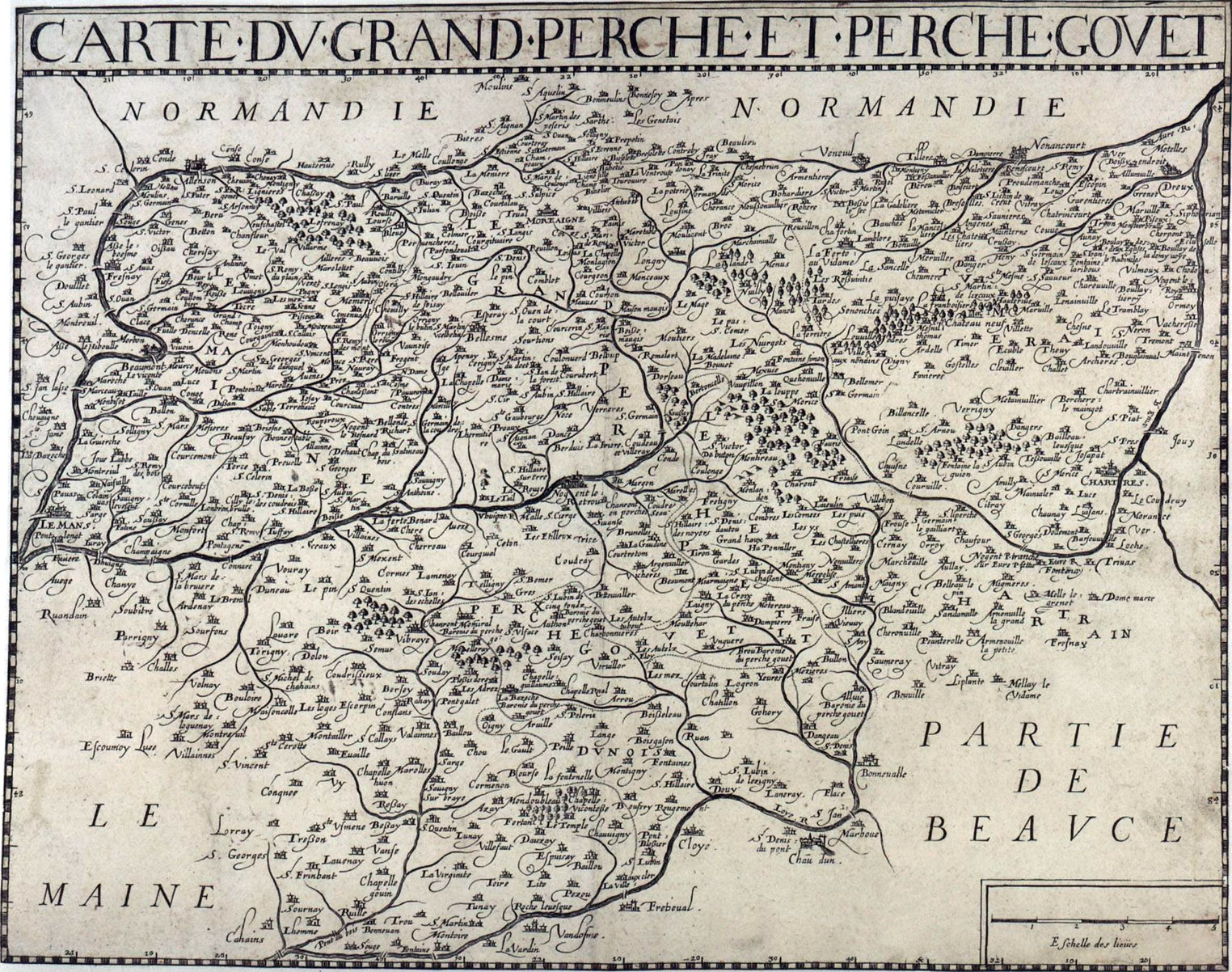
Carte Perche.jpg - William C. Minor

PaysdHoulme.jpg - William C. Minor
Tessier1864.jpg - HaguardDuNord

Doyennevaucelles.JPG - Karldupart

CDF Paris-Rouen carte.jpg - Neantvide

1771 Bonne Map of Normandy, France - Geographicus - Normandie-bonne-1771.jpg - BotMultichillT

PSM V51 D318 Place names of brittany and normandy.png - Ineuw

FecampVicomte.png - Jchancerel

163 of 'Danske minder i Normandiet ... Med tre kårt' (11244605073).jpg - FlickreviewR 2

337 of 'Géographie. I. La France. Quatrième édition, entièrement remaniée, etc' (11221103175).jpg - Artix Kreiger 2
D-Day the 6th of June - Normandy 1944 LOC 94681943.tif - Fæ

D-Day the 6th of June - Normandy 1944 LOC 94681943.jpg - Fæ
Sketch of the environs of Shelbyville, Wartrace & Normandy, Tennessee LOC 99448857.tif - Fæ

Sketch of the environs of Shelbyville, Wartrace & Normandy, Tennessee LOC 99448857.jpg - Fæ
Sketch of the environs of Shelbyville, Wartrace & Normandy, Tennessee LOC 99448858.tif - Fæ

Sketch of the environs of Shelbyville, Wartrace & Normandy, Tennessee LOC 99448858.jpg - Fæ

D-day Normandy - the invasion and the first 48 days of action with the 743rd tank battalion in France LOC 2012593210.jpg - Fæ

Bocage country - 1944.png - Gog the Mild

Guettard-1780--carte mineralogique-14--normandie--picardie--gournay-aumale-beauvais-breteuil.png - Pueblo89

Carte topographique des costes maritimes de Normandie depuis le Port Embessin jusqu'à Hugueville... - btv1b55011012n (1 of 2).jpg - Gzen92Bot