Wikimedi'Òc
Modes d'emploi

Cet album fait partie des albums
Cet album photos contient les sous-albums suivants :


Narrow Seas map.jpg - ChristiaandeWet
This is a specimen of the manner in which sea charts are commonly drawn, by help of the sides of a regular poligon, shewing the points of the compass card. The corners of the poligon being joined, do become the points and RMG F0053.tiff - Fæ

Carte des courants de la Manche et de la Mer du Nord.jpg - Ridens62
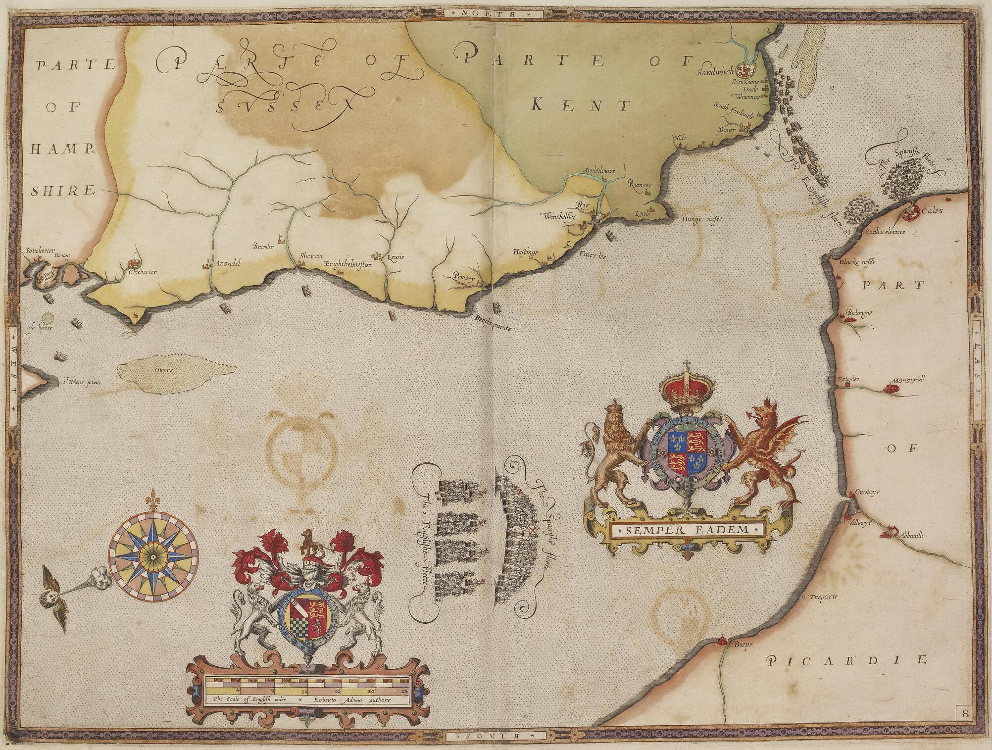
The Armada Plates (BM 1888,1221.8.9).jpg - Enyavar
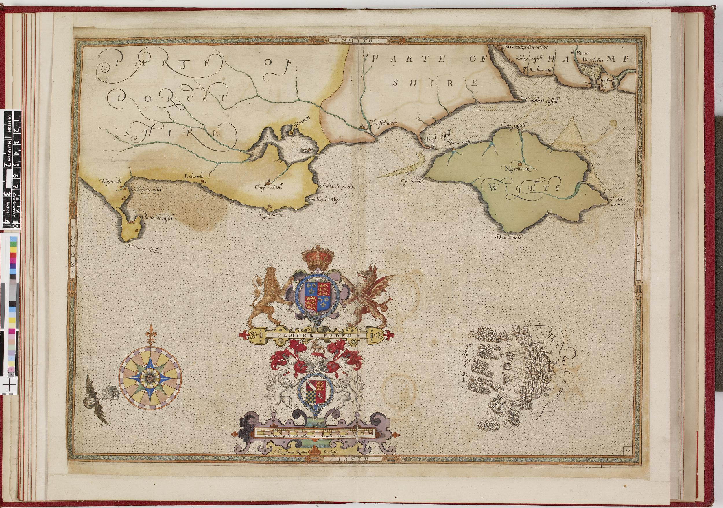
The Armada Plates (BM 1888,1221.8.8).jpg - Copyfraud

Zee Caerte van Engelants Eijndt, Alsoe hem tselfde Landt verthoont beginnende van Sorlinges tot Pleijmondt - Doer Lucas Iansz Wagenaer - btv1b53225455x (2 of 3).jpg - Gzen92Bot

Admiralty Chart No 2147 River Durdent to Cayeux, Published 1894, Large Corrections 1951.jpg - Kognos

A chart of the entrance into the Channel - btv1b530102349 (1 of 2).jpg - Gzen92Bot

Zee caerte van Engelants Eyndt, alsoe hem tselfde Landt verthoont beginnede van Sorlinges tot Pleymondt. Finis Angliae orae maritimae descriptio, et facies, a Sorlingis ad Pleymoutham. Doer Lucas Jansz Wagenaer. RMG L8557-001.jpg - Fæ
Zee caerte van Engelants Eyndt, alsoe hem tselfde Landt verthoont beginnede van Sorlinges tot Pleymondt. Finis Angliae orae maritimae descriptio, et facies, a Sorlingis ad Pleymoutham. Doer Lucas Jansz Wagenaer. RMG F0351.tiff - Fæ