Wikimedi'Òc
Modes d'emploi

Cet album fait partie des albums
Cet album photos contient les sous-albums suivants :


Arakanese expansion in the 1630.png - Win Kyaw

Mrauk U Kingdom Peak (1603).svg - EmeraldRange
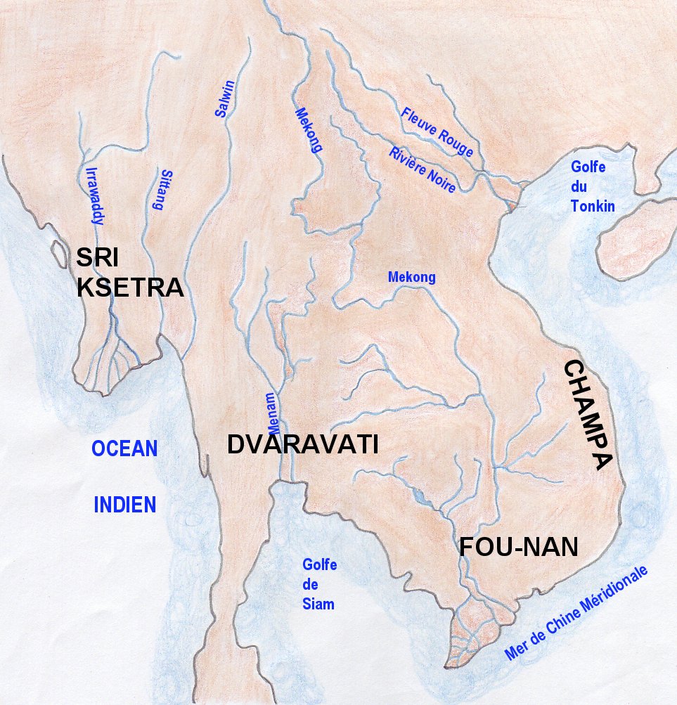
Map indianized kingdoms indochina.jpg - EdC

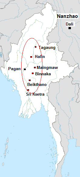
Pyu sites.png - Kmusser

Burma 1.png - Mahahahaneapneap

Partition of India.PNG - ARR8

VOCBirma.jpg - Robbtt

The Tribes Of Burma - map.png - Haabet
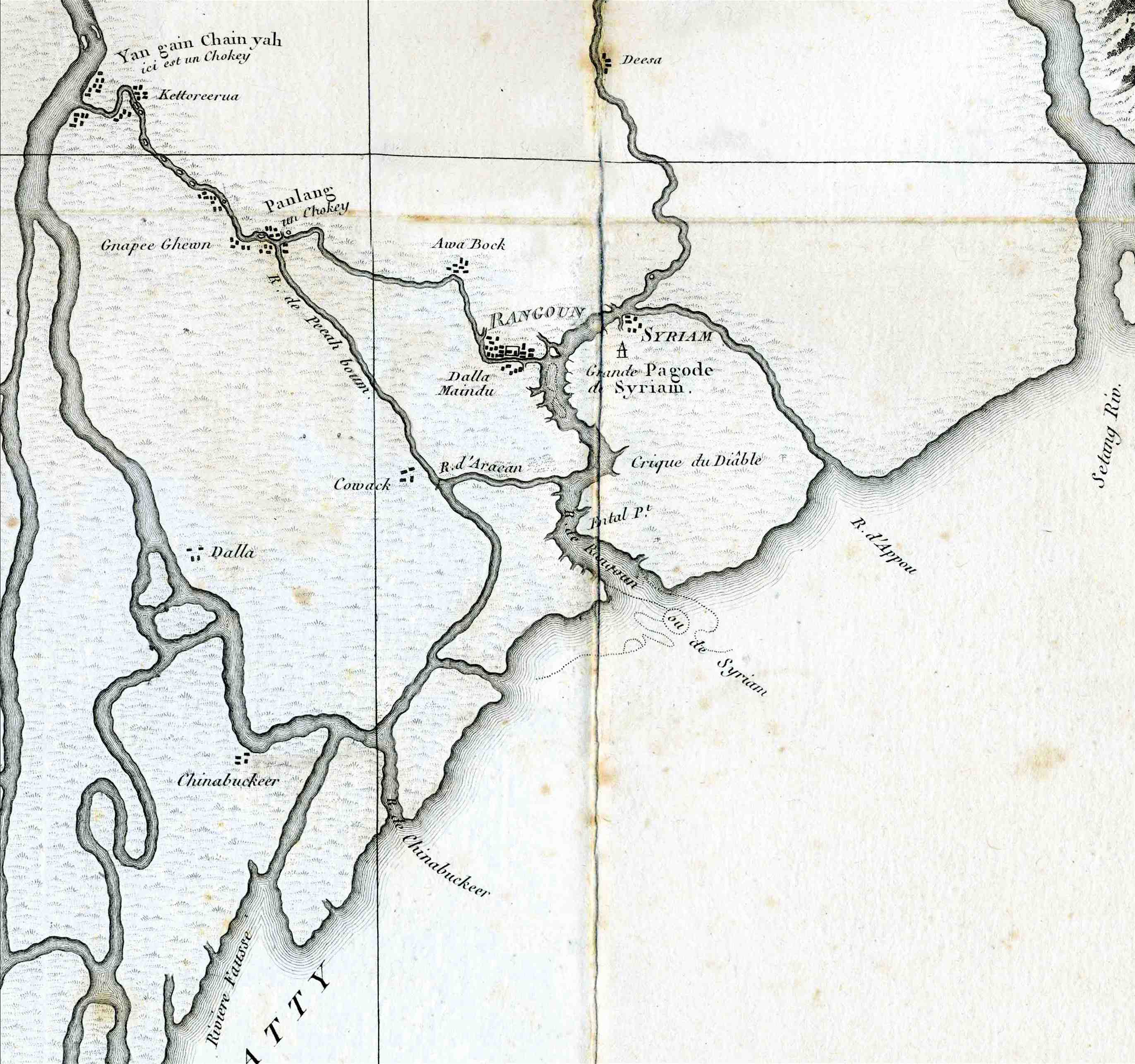
Sirião, Syriam.jpg - Victorcouto

Attack on Ayutthaya (1549).svg - Sodacan

Joppen1907BritishBengalBritishBurmaA.jpg - MALLUS
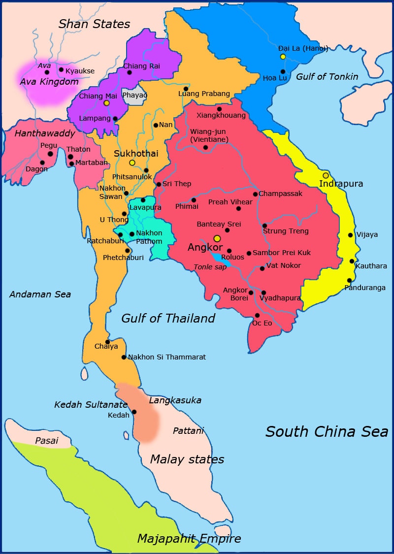
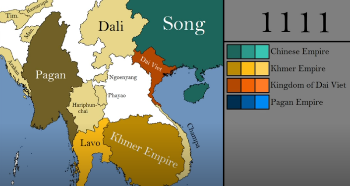
Map-of-southeast-asia 1300 CE.png - Javierfv1212
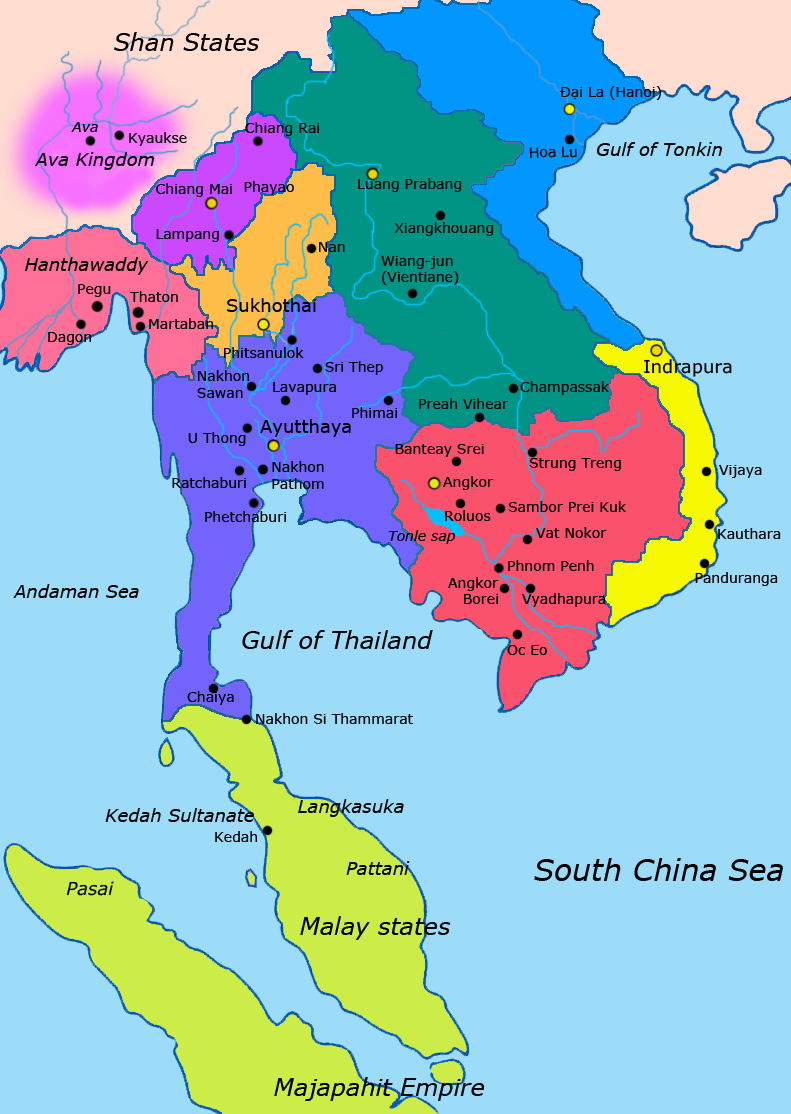
Map-of-southeast-asia 1400 CE.png - Yourlocallordandsavior

Bengale Tiré de "Oud en nieuw Oost-Indien" par François Valentyn (1724-26) Dianga.jpg - Victorcouto

Bengale Tiré de "Oud en nieuw Oost-Indien" par François Valentyn (1724-26).jpg - Victorcouto
Pyu Realm.png - Hybernator

Southeast Asian Historical Mandalas.svg - Gunkarta

Battle of Naungyo.png - Hybernator

Burma in 1450.png - Hybernator

Burma (Myanmar) in 1545.png - Hybernator

Burma (Myanmar) in 1530.png - Hybernator
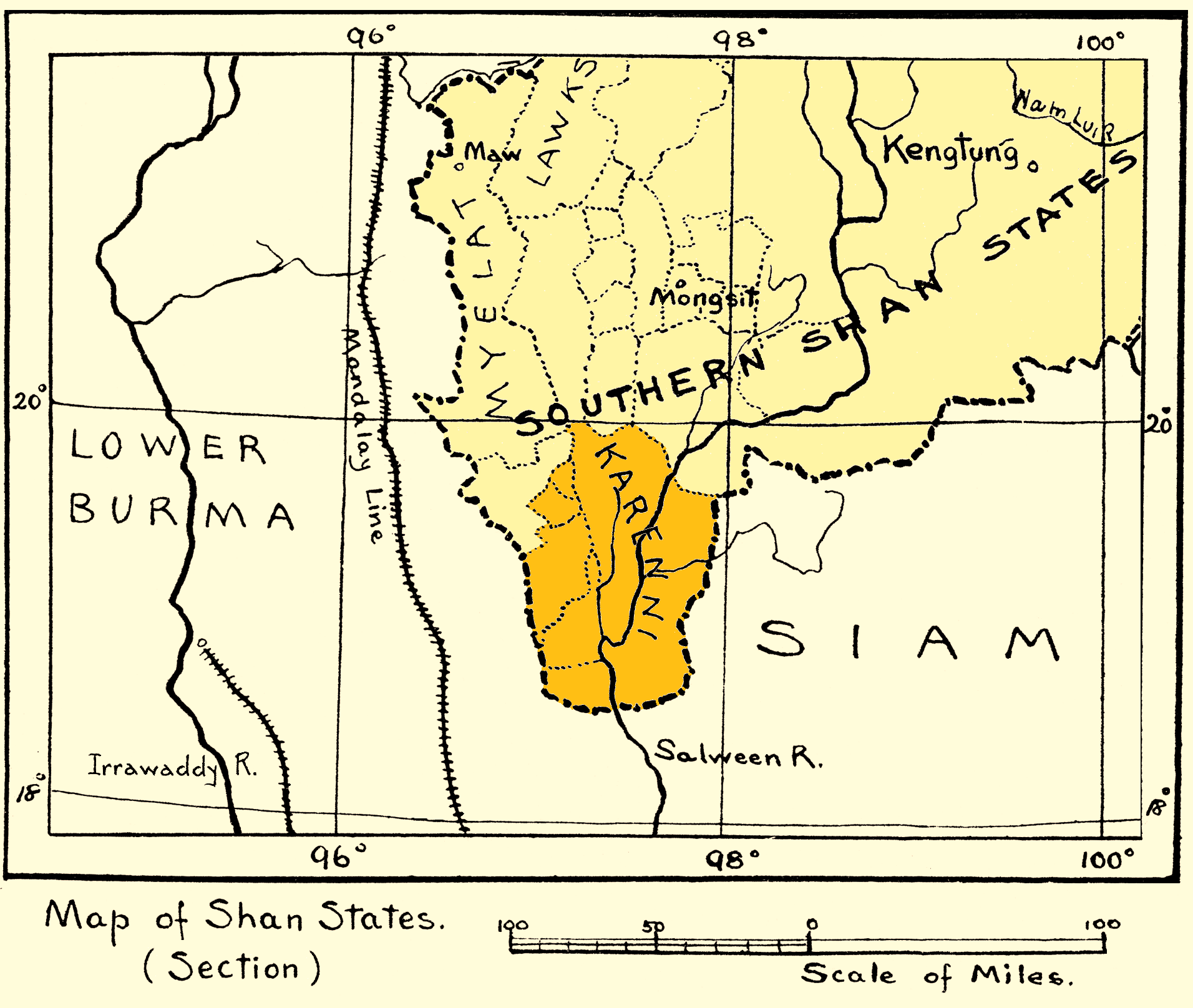
Map of Karenni States-1917.png - Xufanc

阿瓦王朝1370.jpg - 金楼白象

孟国.jpg - 金楼白象
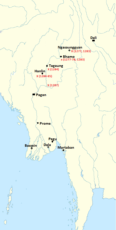
Mongol invasions of Burma (1277-87).png - Hybernator

阿瓦王朝.jpg - 金楼白象

AVA KINGDOM.jpg - 金楼白象

The military history of the Madras engineers and pioneers, from 1743 up to the present time (1881) (14773048952).jpg - Fæ

Afoot and afloat in Burma (1922) (14782088075).jpg - Fæ

Burma (Myanmar) in 1530 km.png - Nisetpdajsankha

Map-of-southeast-asia 1400 CE-es.svg - Rowanwindwhistler

Burma c. 1350.png - Hybernator
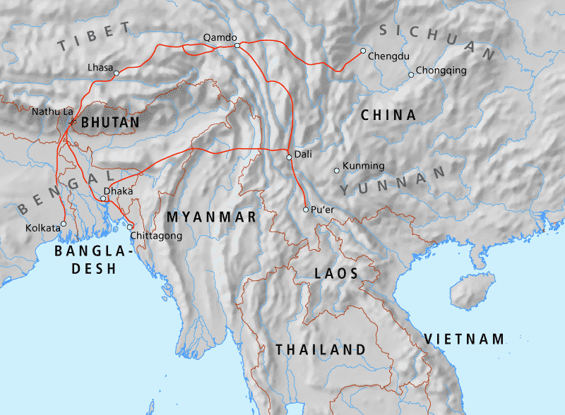
Map of the Tea-Horse road.png - Redgeographics

Geological Evolution of Myanmar .png - Eunicecyl

96 of 'Across Chrysê, being the narrative of a journey of exploration through the South China border lands from Canton to Mandalay ... With ... maps ... and ... illustrations (including a portrait), etc' (11087143623).jpg - Artix Kreiger 2

The Hump and Burma Road.png - Seasonsinthesun

North and South Vietnam.png - Phurbutsering

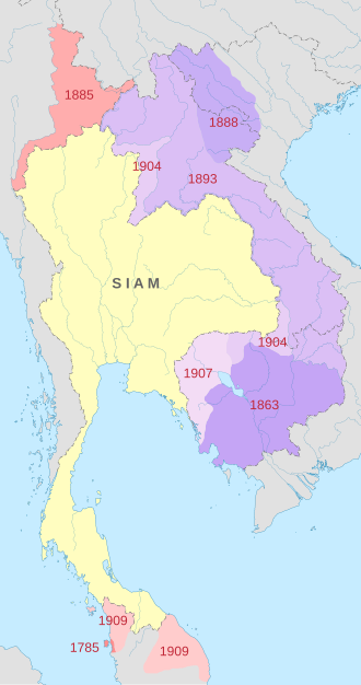
Map of Siam (territorial cessions).svg - Milenioscuro

Map of Siam and French Indochina.svg - Milenioscuro

Map of the Rattanakosin Kingdom.svg - Milenioscuro

Konbaung empire map at its pick.png - Assaf tal4

Mongol invasions of Burma (1277-87)-es.svg - Rowanwindwhistler

Burma in 1450-es.svg - Rowanwindwhistler

Map-of-southeast-asia 1300 CE-es.svg - Rowanwindwhistler

Manipur map of Khagemba Period.png - Simon0117
Manipur of loiyumba period.png - Simon0117
Ninearmieswar.jpg - NewFrontierHistoryEng
Tavoywars.jpg - NewFrontierHistoryEng

Map of Siam and French Indochina -by Milenioscuro- (modified Thai language).png - Nix Sunyata

Indochina 1300 CE.png - Ltn12345

ThalangWar.jpg - NewFrontierHistoryEng
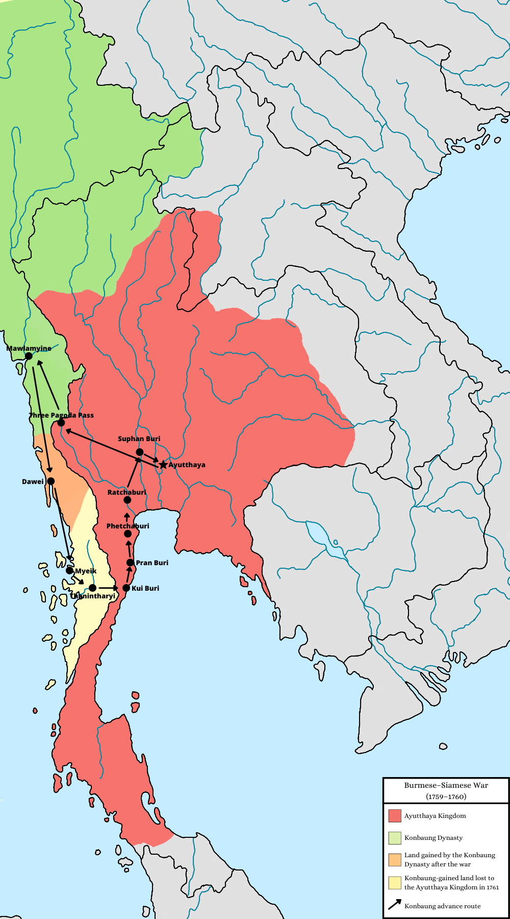
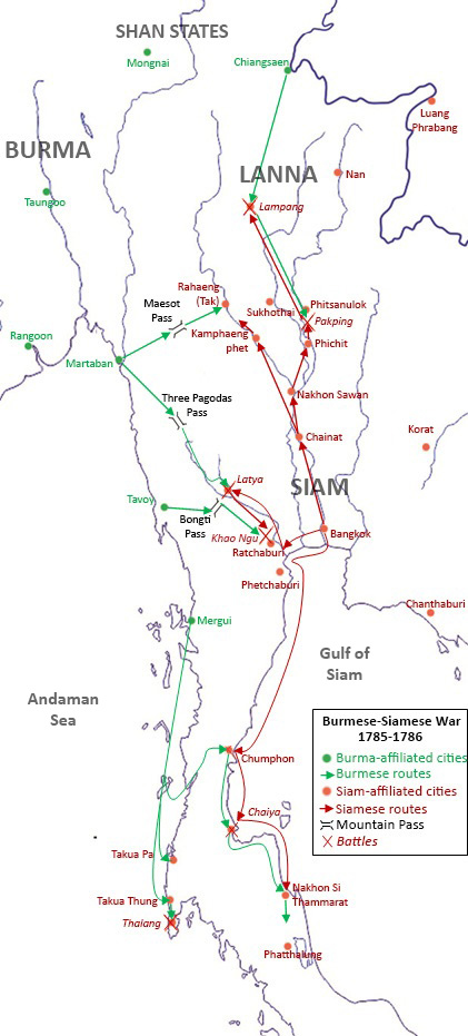
Burmese-Siamese War (1759-1760).png - EditingGuy564738
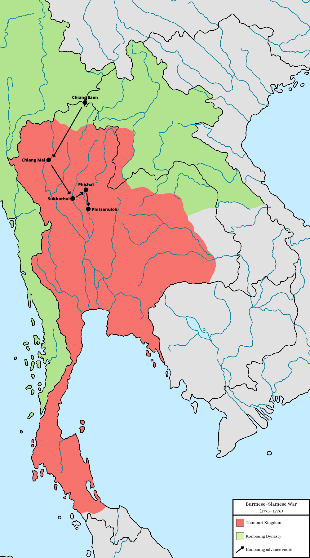
Burmese-Siamese War (1775-1776).png - EditingGuy564738

Burmese-Siamese War (1797-1798).png - EditingGuy564738

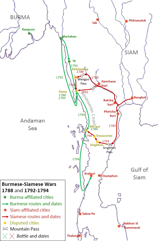
Burmese-Siamese War (1802-1805).png - Yourlocallordandsavior
AthiWungyiWar.jpg - NewFrontierHistoryEng

Mongol empire 1290 and the travel of Marco Polo.png - Laska666

Chiangmai1774.jpg - NewFrontierHistoryEng

Bangkaeofinal.jpg - NewFrontierHistoryEng

Civil war in Birma (2023).png - Nom Katan
Ava–Hanthawaddy War 1401–1403 Overview.png - Hybernator
Ava–Hanthawaddy War 1401–1403 Prome area.png - Hybernator

Pyu city-states map.svg - Mupper-san

Mongol invasions of burma.png - Akinneyfluorse

Pyu city-states physical map.svg - Kanguole

Rakhine mrauk u kingdom.jpg - Win Kyaw