Wikimedi'Òc
Modes d'emploi

Cet album fait partie des albums


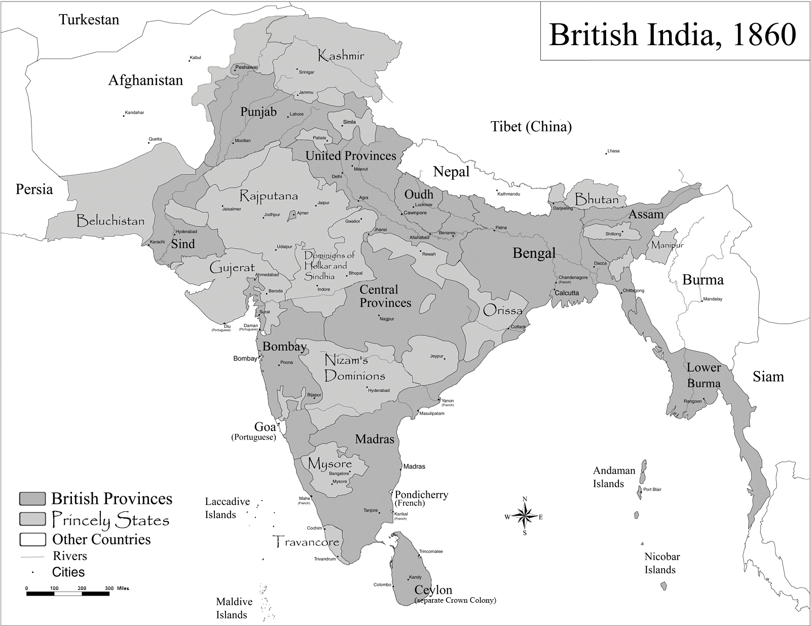
British India.png - Kmusser

Hindoostan map 1814.jpg - Slick-o-bot

Volker-Karte der Indischen Welt 1847.jpg - Planemad

Railroads in Burma.jpg - RegentsPark

Political Divisions of the Indian Empire, 1909.jpg - Xn4

Burma Northern section.jpg - Arilang1234

BurmaMap1922.png - Haabet

Burma indo china 1886.jpg - Chaoborus

Joppen1907BritishBengalBritishBurmaA.jpg - MALLUS

IndiaPolitical1893ConstablesHandAtlas.jpg - MALLUS

IndianEmpireCeylon1915.jpg - MALLUS

Key to Section maps, plates 22 to 36, of the Indian Empire.jpg - Yann

1911 Map of British India showing crop land dedicated to opium jute indigo sugarcane and other crops.jpg - AmyNorth

Map of Burma (Central Section) from The Imperial Gazetteer of India (1907-1909).jpg - Co9man

The Indian Empire Map from Imperial Gazetteer of India,Vol 6, published 1886.PNG - Anand2202

India 1819-1909.svg - Ле Лой

Free homes in Manitoba and the Canadian North-West (microform) (1886) (20631623951).jpg - Fæ

India (1899).jpg - Lucius Castus

British Raj.svg - Sbb1413

Burma Province 1931.png - XrysD

Рисунок к статье «Британская Индия». Военная энциклопедия Сытина (Санкт-Петербург, 1911-1915).jpg - Schekinov Alexey Victorovich
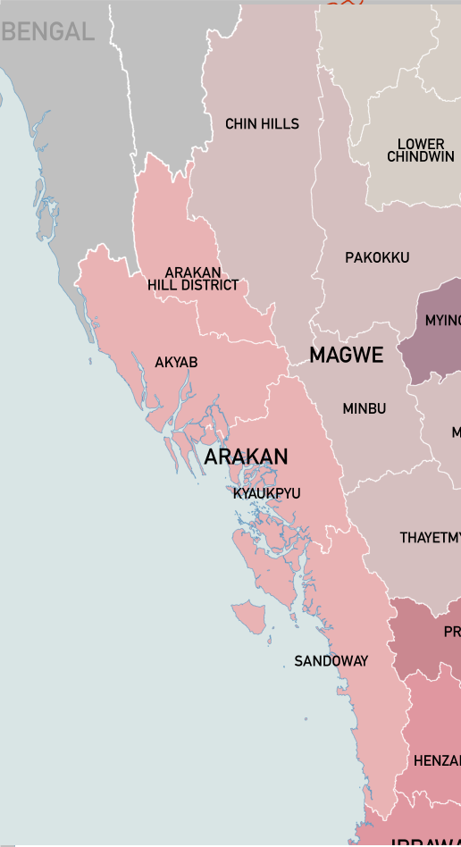
Arakan Division 1931.png - Fez Cap 12

223 of 'In Journeyings Oft. A sketch of the life and travels of Mary C. Nind' (11146119353).jpg - Artix Kreiger 2

British India-es.svg - Rowanwindwhistler

British Raj-es.svg - Milenioscuro

Burma Province 1931 UNLABELLED.png - XrysD

영국령 버마.png - Antonychris

Colonial Boundaries in Southeast Asia.jpg - Zoozaz1