Wikimedi'Òc
Modes d'emploi

Cet album fait partie des albums


Siam (Thailand) and Shan States in 1892 Map by Britannica.jpg - Artanisen

Burma Siam and Anam Map 1859 Edward Weller.png - Artanisen

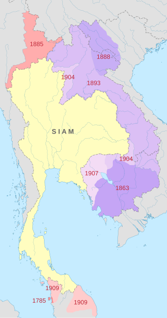
Siamese territorial concessions (1867-1909).gif - Sieger Junge

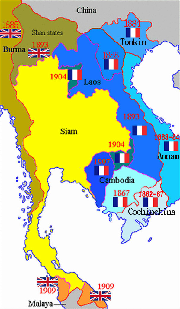
Siamese territorial concessions (1867-1909) with flags.gif - World Imaging
French Indochina expansion.jpg - Ras67
Map of Shan States1917.png - Xufanc
暹罗的领土丧失(1867-1909).png - Sieger Junge

Burma (Myanmar) in 1530.png - Hybernator
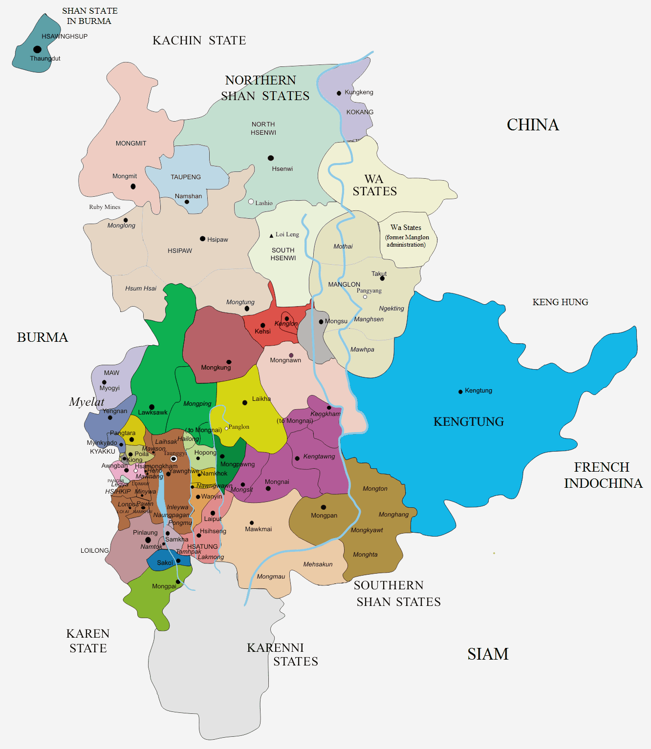
Shan States-Map.png - Xufanc

Map of Siam, Laos, Cambodia, and Shan States (1884).jpg - Dahlfred

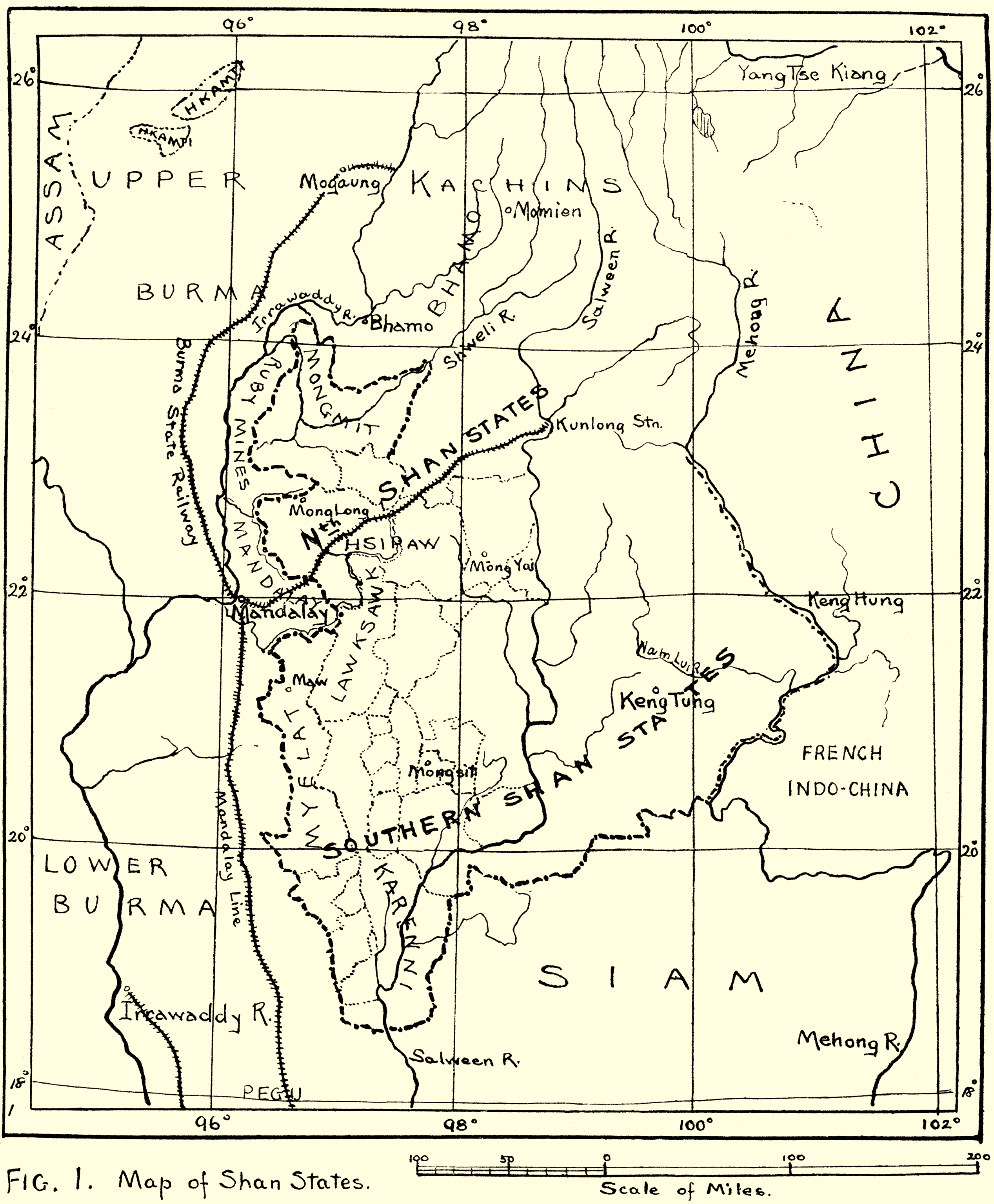
In farthest Burma - the record of an arduous journey of exploration and research through the unknown frontier territory of Burma and Tibet (1921) (14784320135).jpg - SteinsplitterBot

Northern section of Map of Siam, Laos, Cambodia, and Shan States (1884).jpg - Xufanc

Shan-S-IGI.jpg - Xufanc

Shan States map section-Shans at home.(1910).jpg - Xufanc

Burma (Myanmar) in 1530 km.png - Nisetpdajsankha

Map of Siam (territorial cessions).svg - Milenioscuro

Map of Siam and French Indochina.svg - Milenioscuro

Map of Siam and French Indochina -by Milenioscuro- (modified Thai language).png - Nix Sunyata

Shan.png - Jolle