Wikimedi'Òc
Modes d'emploi

Cet album fait partie des albums
Cet album photos contient les sous-albums suivants :


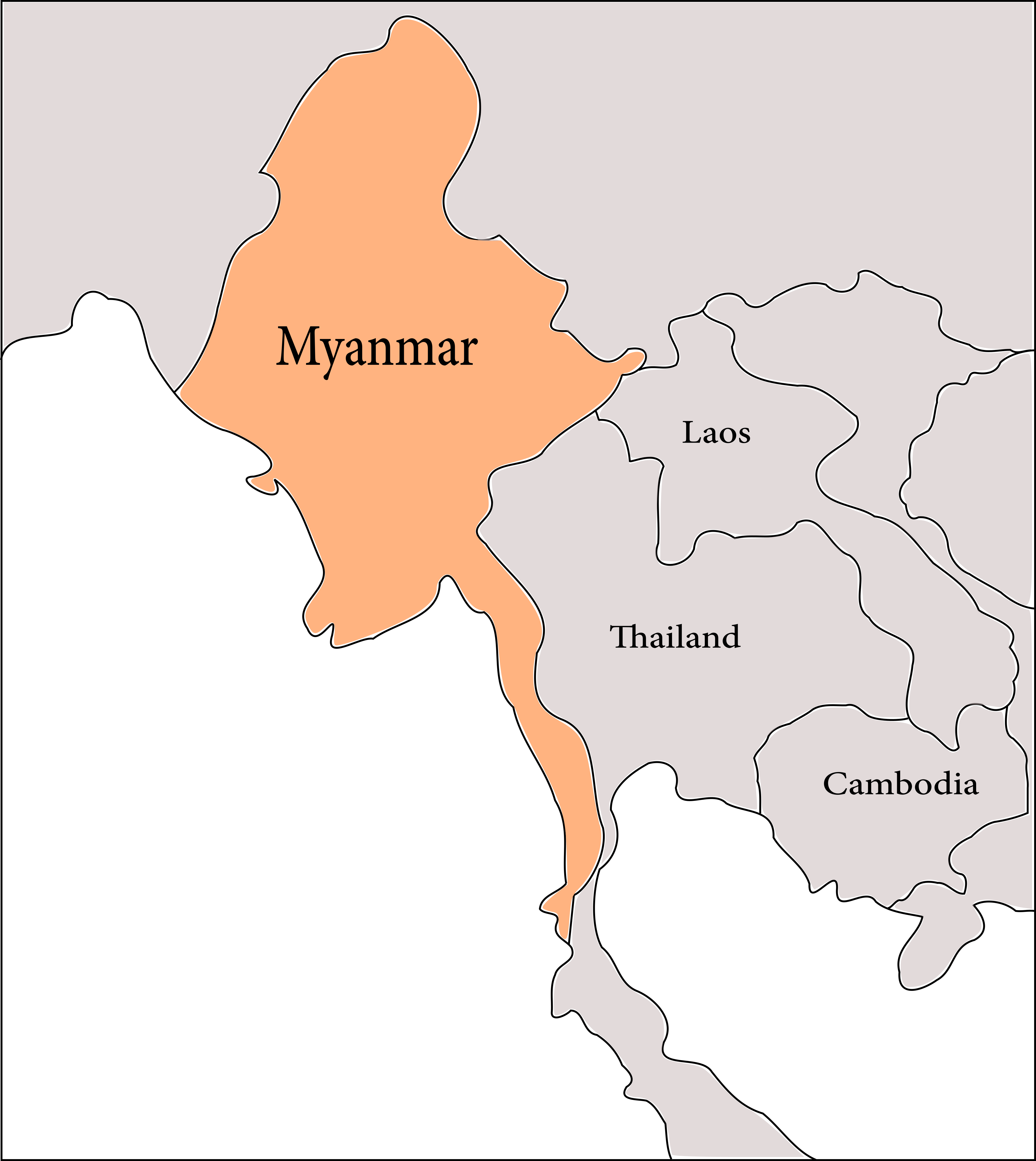
Two Geopolitical Regions of Myanmar.png - Al Bagania

The map of Upper Burma (1885).png - Al Bagania

G-46 L - Patkai Range - Assam and Burma, Naga Hills & Sibsagar Dists, Sadiya Frontier Tract and Tribal Area, Upper Chindwin and Myitkyina Dists and Unadministered Area - txu-pclmaps-oclc-6633879-patkai-range.jpg - DaxServer

Map by the US Army Map Service - B-47 J - Thailand & Malaya - Phuket & Nagorn Sridharmraj - burma and thailand - txu-pclmaps-oclc-6633879-thailand-malaya.jpg - DaxServer

Map by the US Army Map Service - C-47 C - Bokpyin - Burma, Mergui District - burma and thailand - txu-pclmaps-oclc-6633879-bokpyin.jpg - DaxServer

Map by the US Army Map Service - C-47 D - Prachuab Girikhan - Burma, Thailand - Mergui District. Jumbhorn and Prachuab Girikhan Provinces - burma and thailand - txu-pclmaps-oclc-6633879-prachuab-girikhan.jpg - DaxServer

Map by the US Army Map Service - D-47 B - Ye - Amherst & Tavoy Districts, Burma - burma and thailand - txu-pclmaps-oclc-6633879-amherst-tavoy.jpg - DaxServer

Map by the US Army Map Service - D-46 O & P - Port Cornwallis - Andaman & Nicobar Islands. Andaman Islands - burma and thailand - txu-pclmaps-oclc-6633879-port-cornwallis.jpg - DaxServer

Map by the US Army Map Service - E-47 B - Loi-Kaw - Burma, Thailand. Karenni & Southern Shan States. Mea Haung Saun Province - burma and thailand - txu-pclmaps-oclc-6633879-loi-kaw.jpg - DaxServer

Map by the US Army Map Service - D-46 U & V - Port Andaman - Andaman & Nicobar Islands. Andaman Islands - burma and thailand - txu-pclmaps-oclc-6633879-port-andaman.jpg - DaxServer

Map by the US Army Map Service - E-47 M - Pegu - Burma. Insein, Pegu, Tharrawaddy, Thaton and Toungoo Districts - burma and thailand - txu-pclmaps-oclc-6633879-pegu.jpg - DaxServer

Map by the US Army Map Service - E-47 G - Toungoo - Burma. Pegu, Salween, Tharrawaddy and Toungoo Districts and Karenni - burma and thailand - txu-pclmaps-oclc-6633879-toungoo.jpg - DaxServer

Map by the US Army Map Service - F-46 B - Comilla - Bengal & Eastern States, Sylhet District. Noakhali & Tippera Districts and Chittagong Hill Tracts. Tripura State - burma and thailand - txu-pclmaps-oclc-6633879-comilla.jpg - DaxServer

Map by the US Army Map Service - E-47 S - Rangoon - Burma. Hanthawaddy, Insein, Pegu, Pyapon & Rangoon Town Districts - burma and thailand - txu-pclmaps-oclc-6633879-rangoon.jpg - DaxServer

Map by the US Army Map Service - F-46 H - Chittagong - Bengal & Eastern States, Bakarganj, Chittagong and Noakhali Districts and Chittagong Hill Tracts - burma and thailand - txu-pclmaps-oclc-6633879-chittagong.jpg - DaxServer

Map by the US Army Map Service - F-46 J - Falam - Assam and Burma. Lushai Hills District. Chin Hills and Upper Chindwin Districts and Arakan Hill Tracts - burma and thailand - txu-pclmaps-oclc-6633879-falam.jpg - DaxServer

Map by the US Army Map Service - F-46 I - Rangamati - Assam, Bengal and Burma, Lushai Hills Dist, Chittagong Dist and Chittagong Hill Tracts, Arakan Hill Tracts - txu-pclmaps-oclc-6633879-rangamati.jpg - DaxServer

Map by the US Army Map Service - F-46 D - Tiddim - Assam, Burma. Lushai Hills District and Manipur State. Upper Chindwin and Chin Hills Districts - burma and thailand - txu-pclmaps-oclc-6633879-tiddim.jpg - DaxServer

Map by the US Army Map Service - F-46 P - Mount Victoria - Assam & Burma. Lushai Hills District. Akyab, Chin Hills & Pakokku Districts and Arakan Hill Tracts - burma and thailand - txu-pclmaps-oclc-6633879-mount-victoria.jpg - DaxServer

Map by the US Army Map Service - F-46 O - Paletwa - Assam, Bengal, Burma. Lushai Hills Dist, Chittagong Dist and Chittagong Hill Tracts, Akyab District and Arakan Hill Tracts - burma and thailand - txu-pclmaps-oclc-6633879-paletwa.jpg - DaxServer

Map by the US Army Map Service - F-47 B - Hsenwi - Burma & China. Bhamo District and Northern Shan States. Yunnan Province - burma and thailand - txu-pclmaps-oclc-6633879-hsenwi.jpg - DaxServer

Map by the US Army Map Service - F-47 D - Keng Ma - Burma, China. Northern Shan States. Yunnan Province - burma and thailand - txu-pclmaps-oclc-6633879-keng-ma.jpg - DaxServer

Map by the US Army Map Service - F-47 E - Chenyuan - China, Yunan Province - burma and thailand - txu-pclmaps-oclc-6633879-chenyuan.jpg - DaxServer

Map by the US Army Map Service - F-47 F - Ningerh - China. Yunnan Province - burma and thailand - txu-pclmaps-oclc-6633879-ningerh.jpg - DaxServer

Map by the US Army Map Service - F-47 K - Kengtung - Burma, China. Kengtung State. Yunnan Province - burma and thailand - txu-pclmaps-oclc-6633879-kengtung.jpg - DaxServer

Map by the US Army Map Service - F-47 U - Mong Pan - Burma. Southern Shan States - burma and thailand - txu-pclmaps-oclc-6633879-mong-pan.jpg - DaxServer

Map by the US Army Map Service - G-16 O - Jowai - Assam. Cachar, Khasi & Jaintia Hills, Nowgong and Sylhet Districts - burma and thailand - txu-pclmaps-oclc-6633879-jowai.jpg - DaxServer

Map by the US Army Map Service - G-46 D - Nij Laluk - Assam. Balipara Frontier Tract and Lakhimpur District - burma and thailand - txu-pclmaps-oclc-6633879-nij-laluk.jpg - DaxServer

Map by the US Army Map Service - NC 47-2 Bokpyin - burma - txu-oclc-6924198-nc47-2.jpg - DaxServer

Map by the US Army Map Service - ND 46-4 Ama - burma - txu-oclc-6924198-nd46-4.jpg - DaxServer

Map by the US Army Map Service - ND 47-10 Palauk 1959 ed. - burma - txu-oclc-6924198-nd47-10-cop.2.jpg - DaxServer

Map by the US Army Map Service - NC 47-6 Kra Buri - burma - txu-oclc-6924198-nc47-6.jpg - DaxServer

Map by the US Army Map Service - ND 47-10 Palauk 1962 ed. - burma - txu-oclc-6924198-nd47-10.jpg - DaxServer

Map by the US Army Map Service - ND 47-14 Mergui - burma - txu-oclc-6924198-nd47-14.jpg - DaxServer

Map by the US Army Map Service - ND 47-2 Ye - burma - txu-oclc-6924198-nd47-2.jpg - DaxServer

Map by the US Army Map Service - ND 47-6 Tavoy - burma - txu-oclc-6924198-nd47-6.jpg - DaxServer

Map by the US Army Map Service - NE 46-12 Henzada - burma - txu-oclc-6924198-ne46-12.jpg - DaxServer

Map by the US Army Map Service - NE 46-15 Sinma - burma - txu-oclc-6924198-ne46-15.jpg - DaxServer

Map by the US Army Map Service - NE 46-16 Bassein - burma - txu-oclc-6924198-ne46-16.jpg - DaxServer

Map by the US Army Map Service - NE 46-16 Bassein and Vicinity verso - burma - txu-oclc-6924198-ne46-16a.jpg - DaxServer

Map by the US Army Map Service - NE 46-3 Kyaukpyu - burma - txu-oclc-6924198-ne46-3.jpg - DaxServer

Map by the US Army Map Service - NE 46-4 Thayetmyo - burma - txu-oclc-6924198-ne46-4.jpg - DaxServer

Map by the US Army Map Service - NE 46-7 Sandoway - burma - txu-oclc-6924198-ne46-7.jpg - DaxServer

Map by the US Army Map Service - NE 47-1 Pyinmana - burma - txu-oclc-6924198-ne47-1.jpg - DaxServer

Map by the US Army Map Service - NE 46-8 Prome - burma - txu-oclc-6924198-ne46-8.jpg - DaxServer

Map by the US Army Map Service - NE 47-13 Rangoon - burma - txu-oclc-6924198-ne47-13.jpg - DaxServer

Map by the US Army Map Service - NE 47-13 Rangoon and Vicinity verso - burma - txu-oclc-6924198-ne47-13a.jpg - DaxServer

Map by the US Army Map Service - NE 47-14 Moulmein - burma - txu-oclc-6924198-ne47-14.jpg - DaxServer

Map by the US Army Map Service - NE 47-5 Toungoo - burma - txu-oclc-6924198-ne47-5.jpg - DaxServer

Map by the US Army Map Service - NE 47-9 Pegu - burma - txu-oclc-6924198-ne47-9.jpg - DaxServer

Map by the US Army Map Service - NF 46-10 Cox's Bazar - burma - txu-oclc-6924198-nf46-10.jpg - DaxServer

Map by the US Army Map Service - NF 46-11 Mount Victoria - burma - txu-oclc-6924198-nf46-11.jpg - DaxServer

Map by the US Army Map Service - NF 46-12 Myingyin - burma - txu-oclc-6924198-nf46-12.jpg - DaxServer

Map by the US Army Map Service - NF 46-14 Akyab - burma - txu-oclc-6924198-nf46-14.jpg - DaxServer

Map by the US Army Map Service - NF 46-15 Myohaung - burma - txu-oclc-6924198-nf46-15.jpg - DaxServer

Map by the US Army Map Service - NF 46-16 Yenangyaung - burma - txu-oclc-6924198-nf46-16.jpg - DaxServer

Map by the US Army Map Service - NF 46-3 Mawlaik - burma - txu-oclc-6924198-nf46-3.jpg - DaxServer

Map by the US Army Map Service - NF 46-4 Wuntho - burma - txu-oclc-6924198-nf46-4.jpg - DaxServer

Map by the US Army Map Service - NF 46-7 Gangaw - burma - txu-oclc-6924198-nf46-7.jpg - DaxServer

Map by the US Army Map Service - NF 47-1 Mong Mit - burma - txu-oclc-6924198-nf47-1.jpg - DaxServer

Map by the US Army Map Service - NF 46-8 Shwebo - burma - txu-oclc-6924198-nf46-8.jpg - DaxServer

Map by the US Army Map Service - NF 47-10 Lai-Hka - burma - txu-oclc-6924198-nf47-10.jpg - DaxServer

Map by the US Army Map Service - NF 47-11 reliability diagram, notes, glossary verso - burma - txu-oclc-6924198-nf47-11a.jpg - DaxServer

Map by the US Army Map Service - NF 47-13 Yamethin - burma - txu-oclc-6924198-nf47-13.jpg - DaxServer

Map by the US Army Map Service - NF 47-14 Mong Pan - burma - txu-oclc-6924198-nf47-14.jpg - DaxServer

Map by the US Army Map Service - NF 47-15 Amphoe Mae Chan - burma - txu-oclc-6924198-nf47-15.jpg - DaxServer

Map by the US Army Map Service - NF 47-5 Maymyo - burma - txu-oclc-6924198-nf47-5.jpg - DaxServer

Map by the US Army Map Service - NF 47-6 Mong Yai - burma - txu-oclc-6924198-nf47-6.jpg - DaxServer

Map by the US Army Map Service - NF 47-9 Mandalay - burma - txu-oclc-6924198-nf47-9.jpg - DaxServer

Map by the US Army Map Service - NF 47-9 Mandalay, Burma and Vicinity verso - burma - txu-oclc-6924198-nf47-9a.jpg - DaxServer

Map by the US Army Map Service - NG 46-12 Tamanthi - burma - txu-oclc-6924198-ng46-12.jpg - DaxServer

Map by the US Army Map Service - NG 46-16 Paungbyin - burma - txu-oclc-6924198-ng46-16.jpg - DaxServer

Map by the US Army Map Service - NG 47-1 Putao - burma - txu-oclc-6924198-ng47-1.jpg - DaxServer

Map by the US Army Map Service - NG 46-8 Sibsagar - burma - txu-oclc-6924198-ng46-8.jpg - DaxServer

Map by the US Army Map Service - NG 47-13 Bhamo - burma - txu-oclc-6924198-ng47-13.jpg - DaxServer

Map by the US Army Map Service - NG 47-5 Maingkwan - burma - txu-oclc-6924198-ng47-5.jpg - DaxServer

Map by the US Army Map Service - NG 47-9 Myitkyina - burma - txu-oclc-6924198-ng47-9.jpg - DaxServer
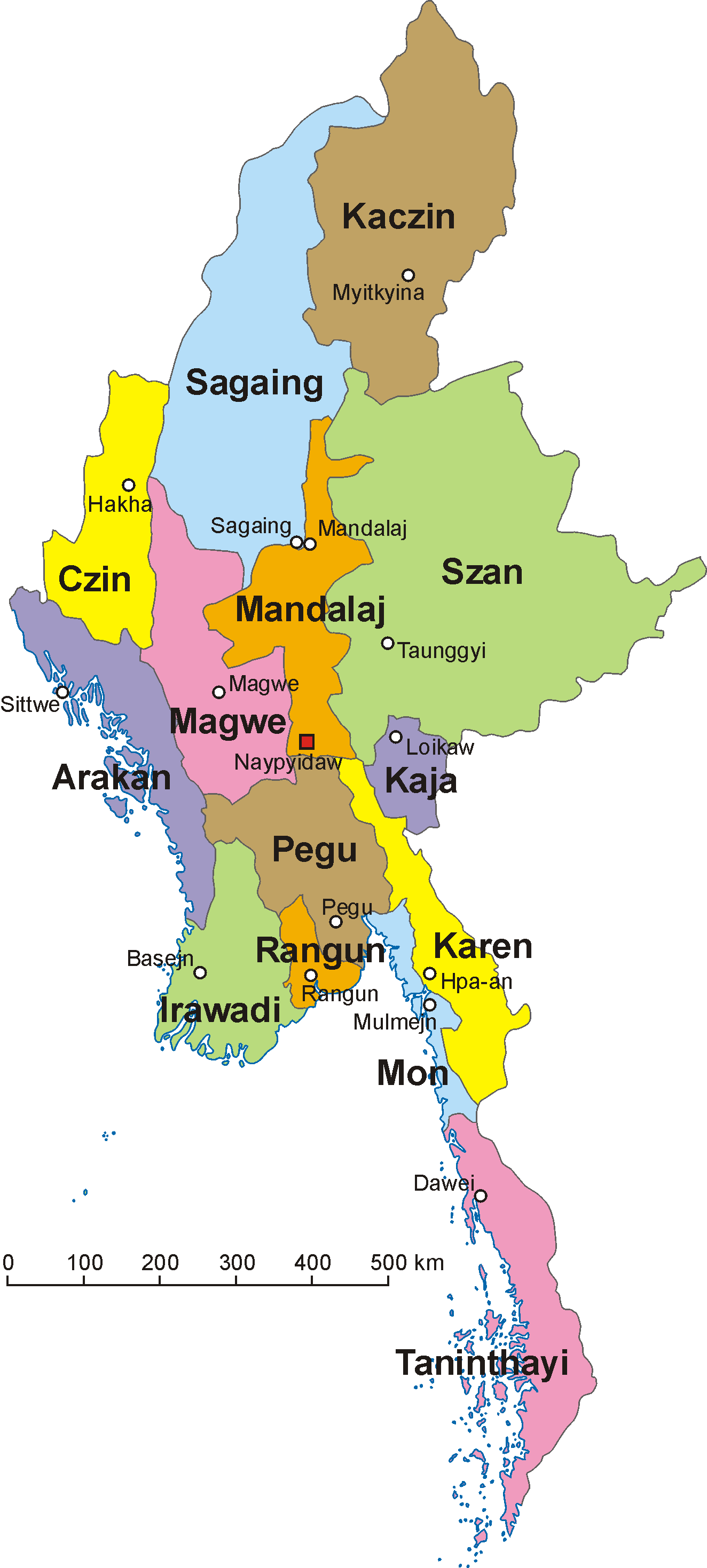
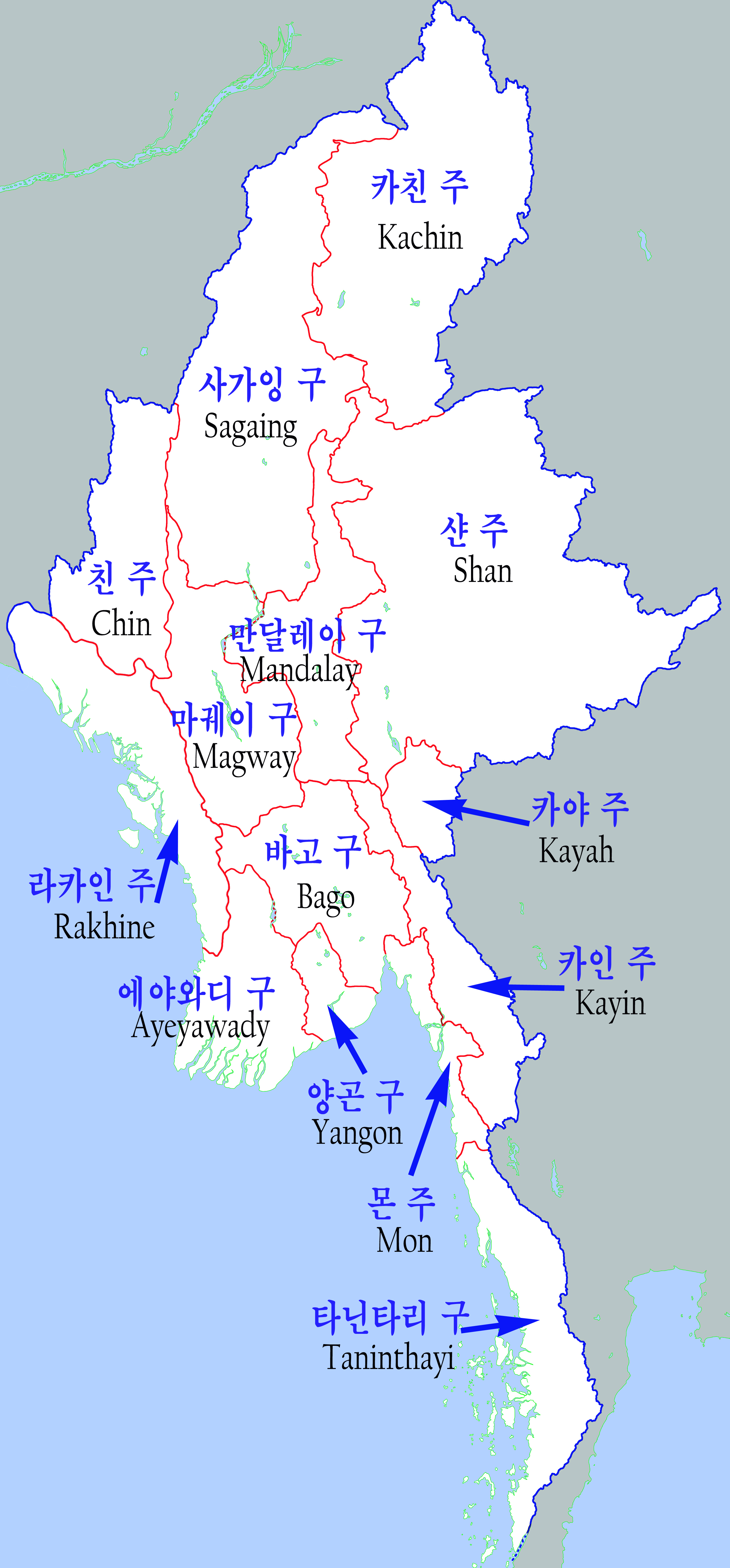
Myanmar-Divisions and States.png - Auchwaswisser~commonswiki

107.35149E 34.75769N.png - Zhong~commonswiki
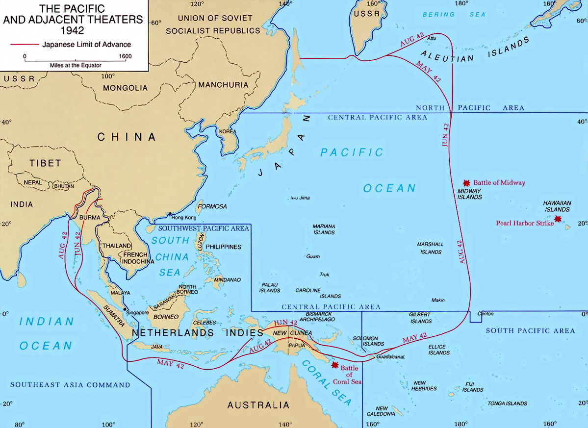
PacificTheaterAug1942.jpg - Gladiool
Myanmar-outline-map.png - Mahahahaneapneap
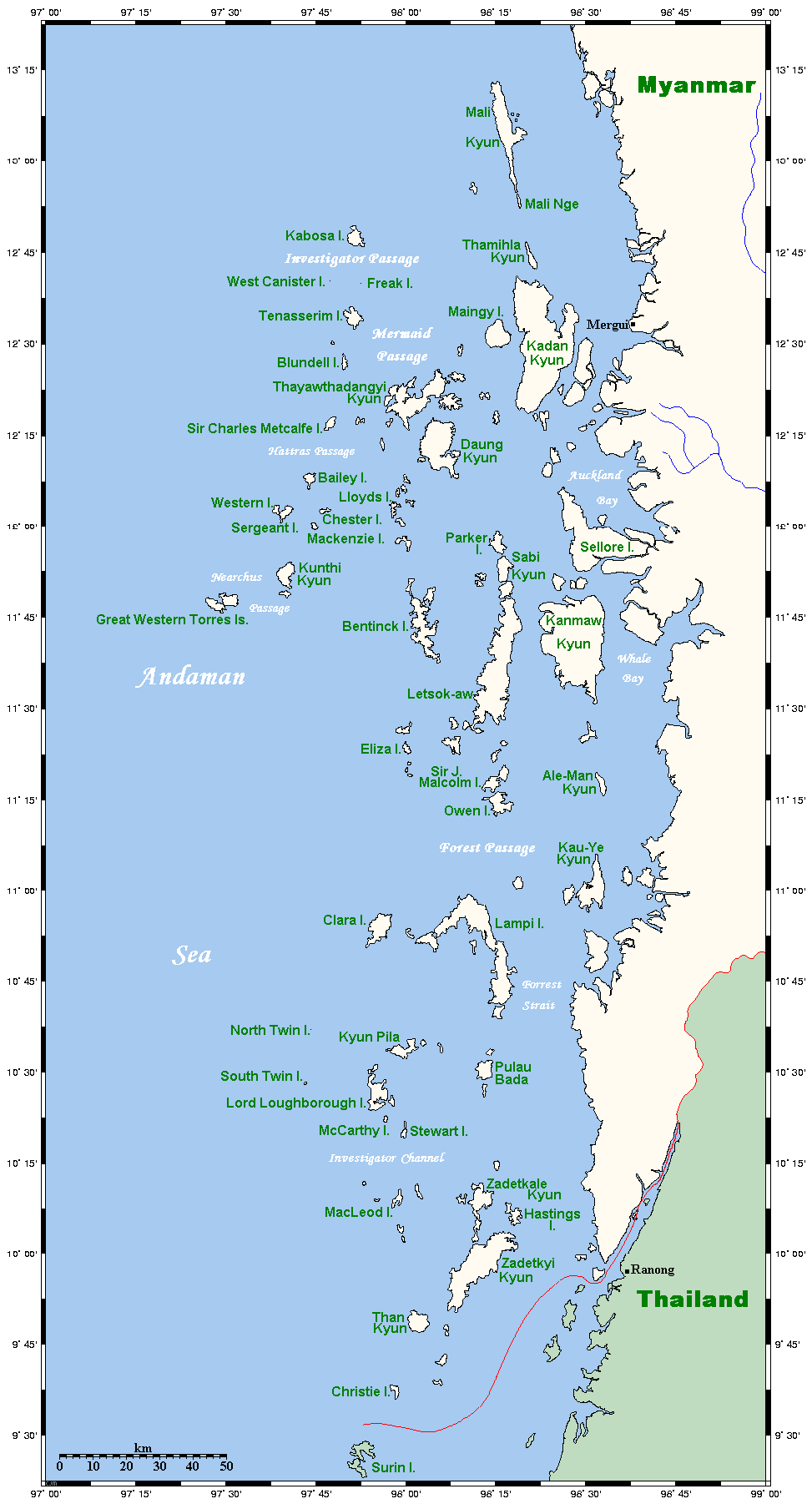
MerguiArchipelagoMap.png - Ppntori

Hinthada district map.jpg - Hintha

Pathein district map.jpg - Hintha

Irrawaddy Watershed.gif - PimRijkee

Maps of Kokang.png - Jasonzhuocn
Burma-administrative map.png - File Upload Bot (Magnus Manske)

GADM MMR Outline.svg - Gringer

Thayet-District-Burma-2010.png - Bejnar

Gangaw-District-Burma-2010.png - Bejnar

Kanmaw Island relief.png - Blofeld Dr.

Estrada da Birmania.png - André Koehne
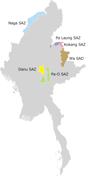
SAZs & SAD of Burma.png - Yue

KarteInleSee.png - OgreBot

MapMraukU.png - MGA73bot2
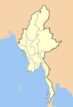
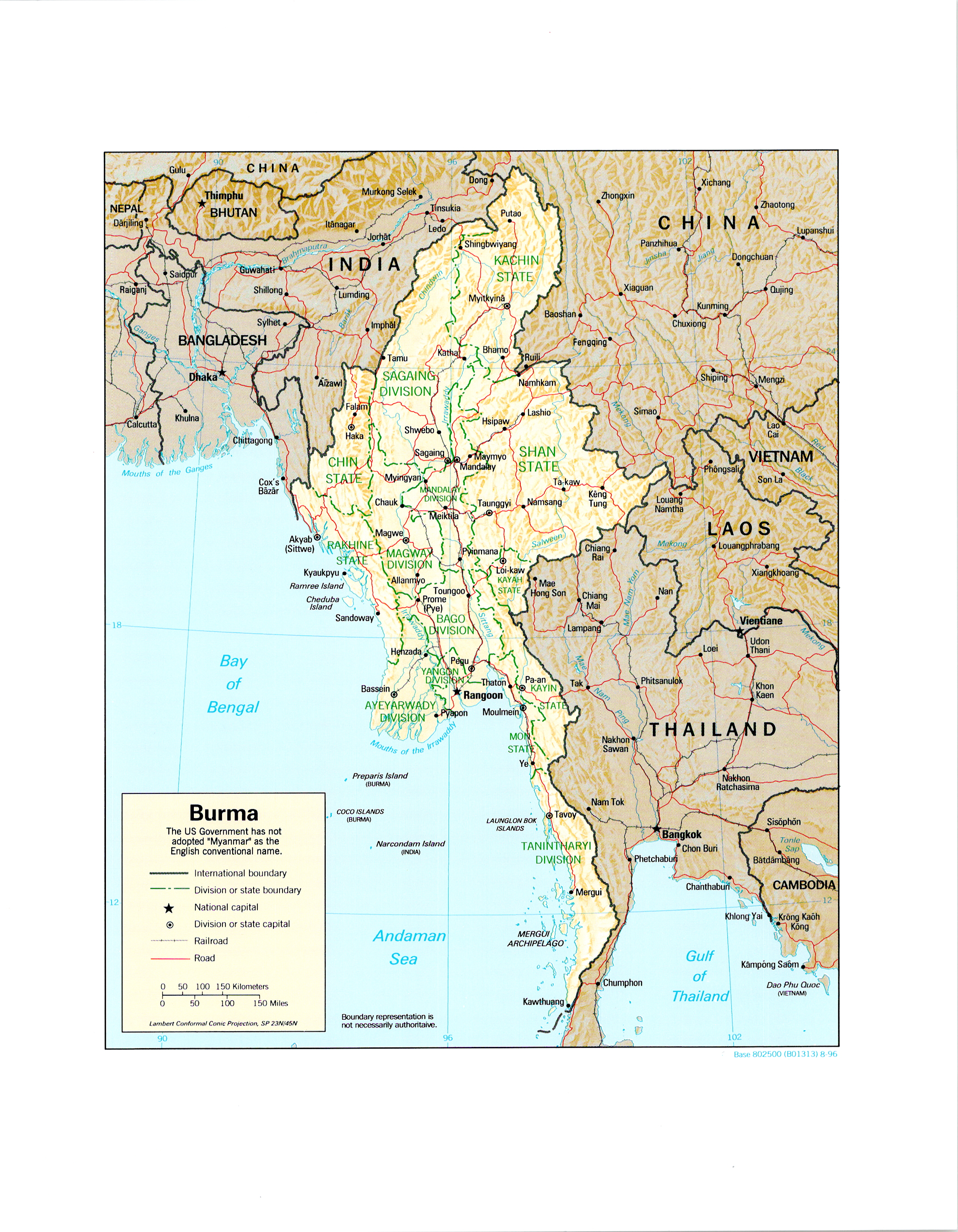
Map Myanmar.png - MGA73bot2

SAZs & SAD of Myanmar - ru.svg - Kaidor

MapMraukU.svg - MGA73bot2

MapNgapaliBeach.svg - MGA73bot2

Dai Map.jpg - Naingshin
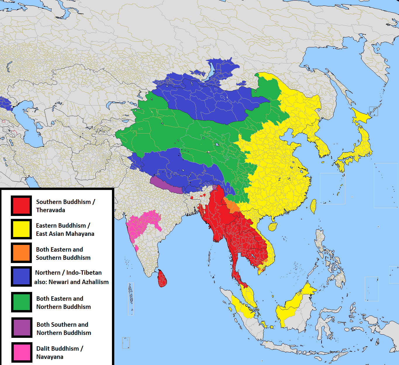
Buddhist sects.png - SpinnerLaserzthe2nd

阿瓦王朝1370.jpg - 金楼白象

孟国.jpg - 金楼白象

Shwedagon Pagoda 3.JPG - C1815

阿瓦王朝.jpg - 金楼白象
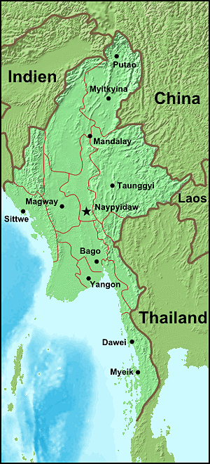
Burma-map.png - Gloyacks

Wa state.png - WikiEditor2004

01 map of kachin state.jpg - S. K. Samuels

Myawaddy street (cropped).jpg - Ceever

Terremoto birmania.jpg - JoaquinVasquez6

Terremoto de birmania de abril de 2016.jpg - JoaquinVasquez6

Major Sino-Tibetan groups.png - Sgnpkd

Phangsang.jpeg - Wdwdbot

Mi Lan.jpg - Wdwdbot

Pegu map.jpg - Shyamal

緬甸若開人分布圖.jpg - Liang Yu

Path5215-4-1-1-13-8-6-4.png - Eunicecyl
Text3305-6-7-7.png - Eunicecyl

2016 Rangun, Pagoda Szwedagon (076).jpg - Halavar

Map of Maungdaw District in Rakhine State (Arakan).png - Haffaz

Dawei Shin Koe Shin Map.jpg - Paingpeace

Myanmar administrative divisions by & of forest cover.png - Austiger

Zawtika Martaban Myanmar.jpg - Notthebestusername

Txu-oclc-10552568-nf47-3.jpg - Geographyinitiative
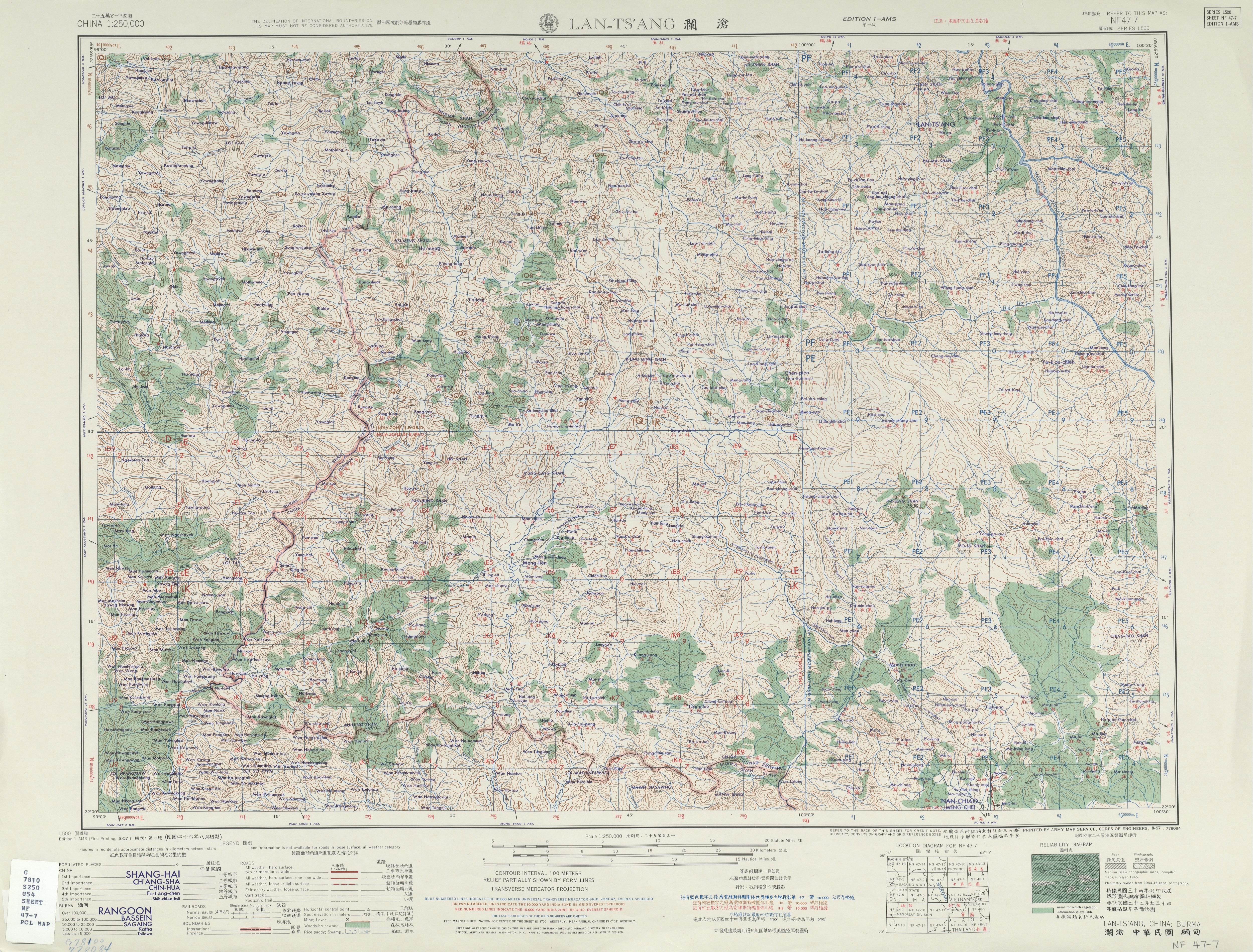
Txu-oclc-10552568-nf47-7.jpg - Geographyinitiative

Burma religions Map 2.png - D A R C 12345

Myanmar Panhandle.svg - Eschwanitz

20200206 131859 Market Mawlamyaing anagoria.jpg - Anagoria

Map of Mandalay Palace.jpg - Kantabon

Map of Andaw.jpg - Sophieschafer99

Reversed Map of South Asia.gif - Rnrctg

Lower Myanmar districts Map.svg - Kantabon

FLII Myanmar.png - PhnomPencil

Laos–Myanmar border.png - Euro know

1944 MAP OF ASIA from the book - “The War in Outline 1939-1943 Materials for the Use of Army Orientation Course” prepared by the War Department - (IA warinoutline193900unit 0) (page 178 crop).jpg - Ooligan

Death Cases in 2021 Myanmar protests.svg - Kantabon

Percentage of Households using electricity for lighting by State and Region.svg - Kantabon

Myanmar Solar Power Project 2020.svg - Kantabon

Power Plants in Myanmar.svg - Kantabon
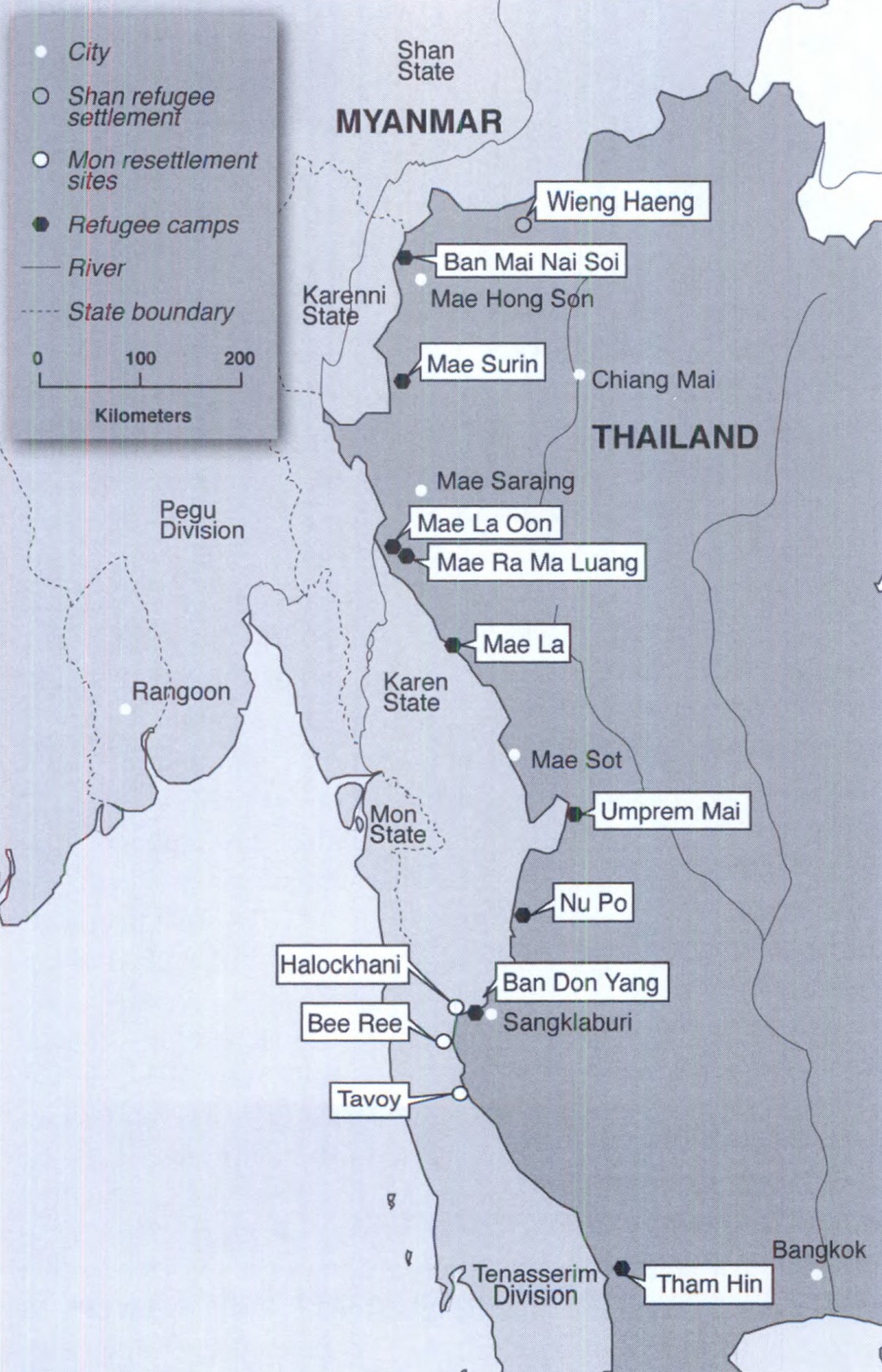
Refugee and Resettlement Sites along Thai-Burma Border.jpg - Zoozaz1

Myanmar regions by HDI.png - Venezuela3

Map - Mong Yang Town - Villages - 2048px.jpg - Numonly

AH 1 in Myanmar.svg - Kantabon

AH Network in Myanmar MM Sub.svg - Kantabon

Myanmar adm location map numbered.png - Foxy1219

Location of Thermal Power Plants in Myanmar.png - Kantabon

Location of Hydropower and Solar Power Plants in Myanmar.png - Kantabon

Myitsone and nearby Projects.png - Kantabon
Konbaung 1767 Map 2.png - Yourlocallordandsavior
Burma (Myanmar) - DPLA - 4dda1966c281dc94373cedea555b439f.jpg - DPLA bot

Burma (Myanmar) - DPLA - a933d65f02434fc199d1078f8a93ced7.jpg - DPLA bot

Burma (Myanmar) - DPLA - 2d0d217acb61f1a2e33e71853bbcda0f.jpg - DPLA bot

Thantlangmap.png - Renamed user gQJ1mEYT6fcIDPZgfo8f

ECHO Burma Myanmar Basemap A4 Portrait.png - OptimusPrimeBot

20171109 Rohingya Crisis Myanmar Bangladesh.png - OptimusPrimeBot

20171023 Myanmar Conflict Northern Rakhine.png - OptimusPrimeBot
20171023 Myanmar Conflict Northern Rakhine.pdf - OptimusPrimeBot
20171106 Myanmar-Bangladesh-Rohingya crisis.pdf - OptimusPrimeBot

ECHO Daily Map (10).jpg - OptimusPrimeBot

Myanmar Dry Zone Townships.svg - Mupper-san

Map of present day Manipur & its former territory Kabaw Valley ("Kabo Tampak" in Classical Meitei language), which is in present day Myanmar (Burma).jpg - Haoreima

Myanmar-control.svg - Courier New

Myanmar OpenStreetMap Road tagging version 20240531.png - Seastar3879

From Shanghai to Calcutta.png - SecretName101