Wikimedi'Òc
Modes d'emploi

Cet album fait partie des albums
Cet album photos contient les sous-albums suivants :


UK scotland.png - Ningyou

Map of Marilyns.png - Ras52

Kishvarhoi podshohii muttahida.png - FrancisTyers~commonswiki

CommonTravelArea.png - NerdyNSK
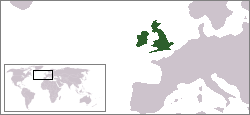
Location Great Britain and Ireland.png - Electionworld

WWII Divide and Conquer 12.jpg - Edgar Allan Poe
Uk outline map2.PNG - Obersachse

Bi-density.png - Cmdrjameson

Atlantic Isles.png - Setanta Saki

Atlantic Isles.PNG - Setanta Saki
Amfidromieën.jpg - SenneVerpoorten

BIThumbMap BI.png - Ras52

Britske ostrovy 01.PNG - File Upload Bot (Magnus Manske)

Crown dependencies location.png - TomPhil

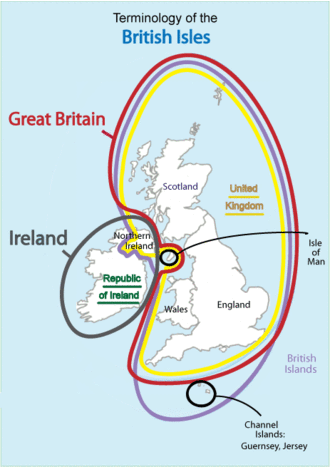
British Isles terms.gif - Tóraí

British Isles Highlighted.png - Fl

Ireland (island) in Europe.png - Asarlaí
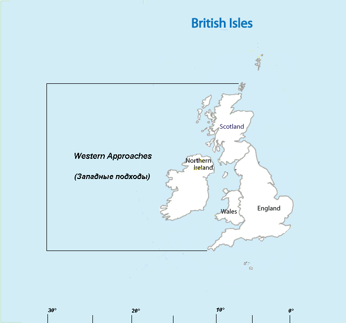
Western Approaches.PNG - Боцман

TheBritishIsles.png - TheBritishExplorer

British Isles - UK & Ireland.png - AnonMoos

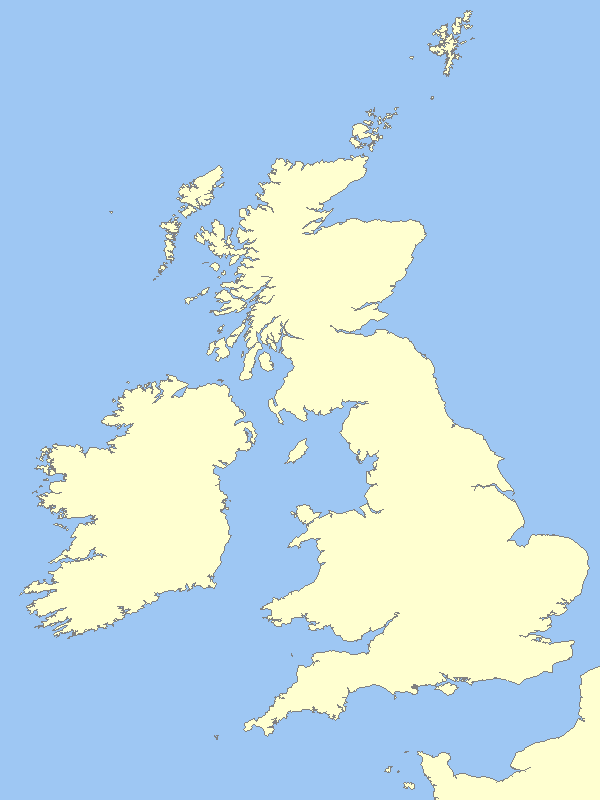
LocationBritishIsles-noborders.png - Rockfang
3peaks.png - Kicior99

Map of the administrative geography of the British Isles.jpg - Chumwa

Map of the administrative geography of the British Isles with postcode areas.jpg - Chumwa

Map - Kingdom of the Isles 2 (png).png - Brianann MacAmhlaidh
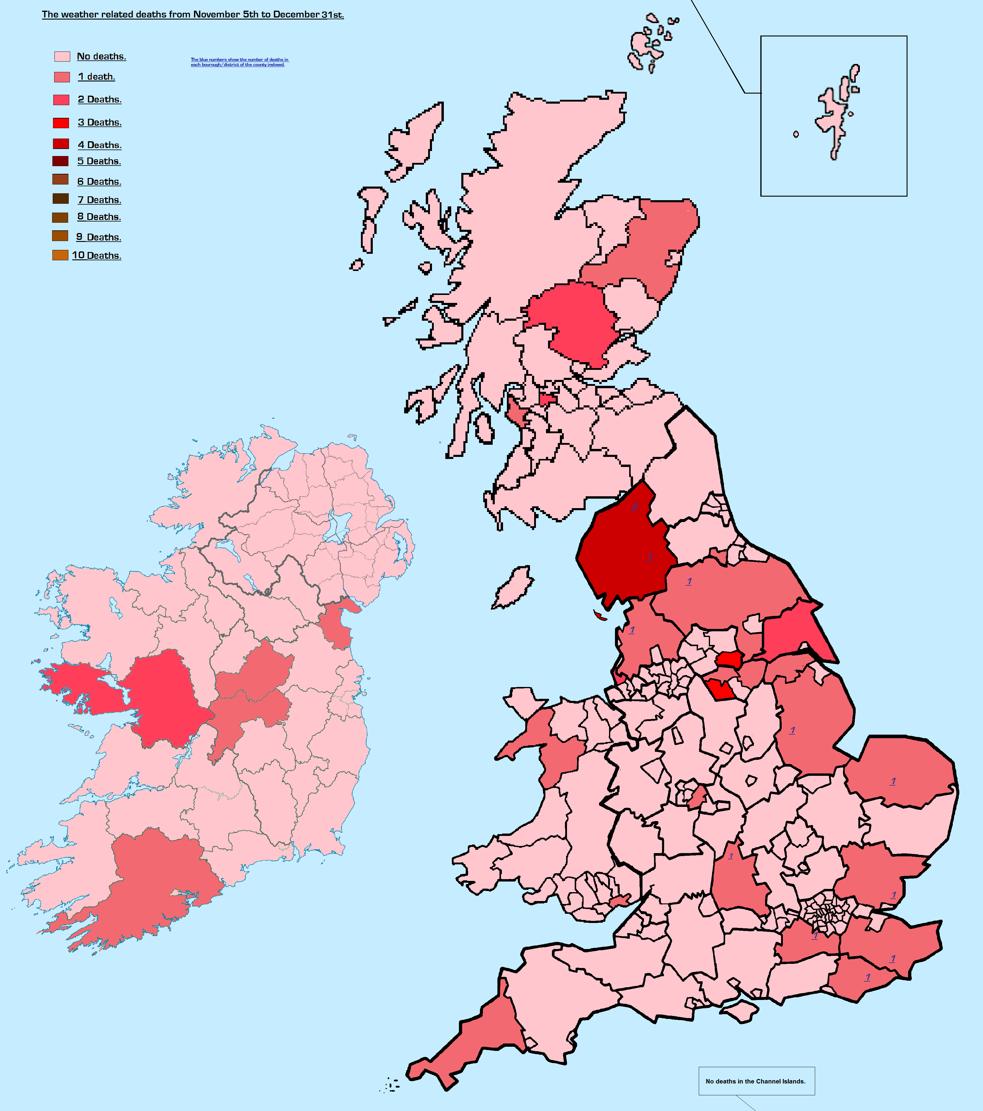
The British Isles winter weather event deaths of 2010.png - SreeBot

British Isles Venn Diagram-en (3).png - SreeBot

Gaelic British Isles.jpg - Ronhjones
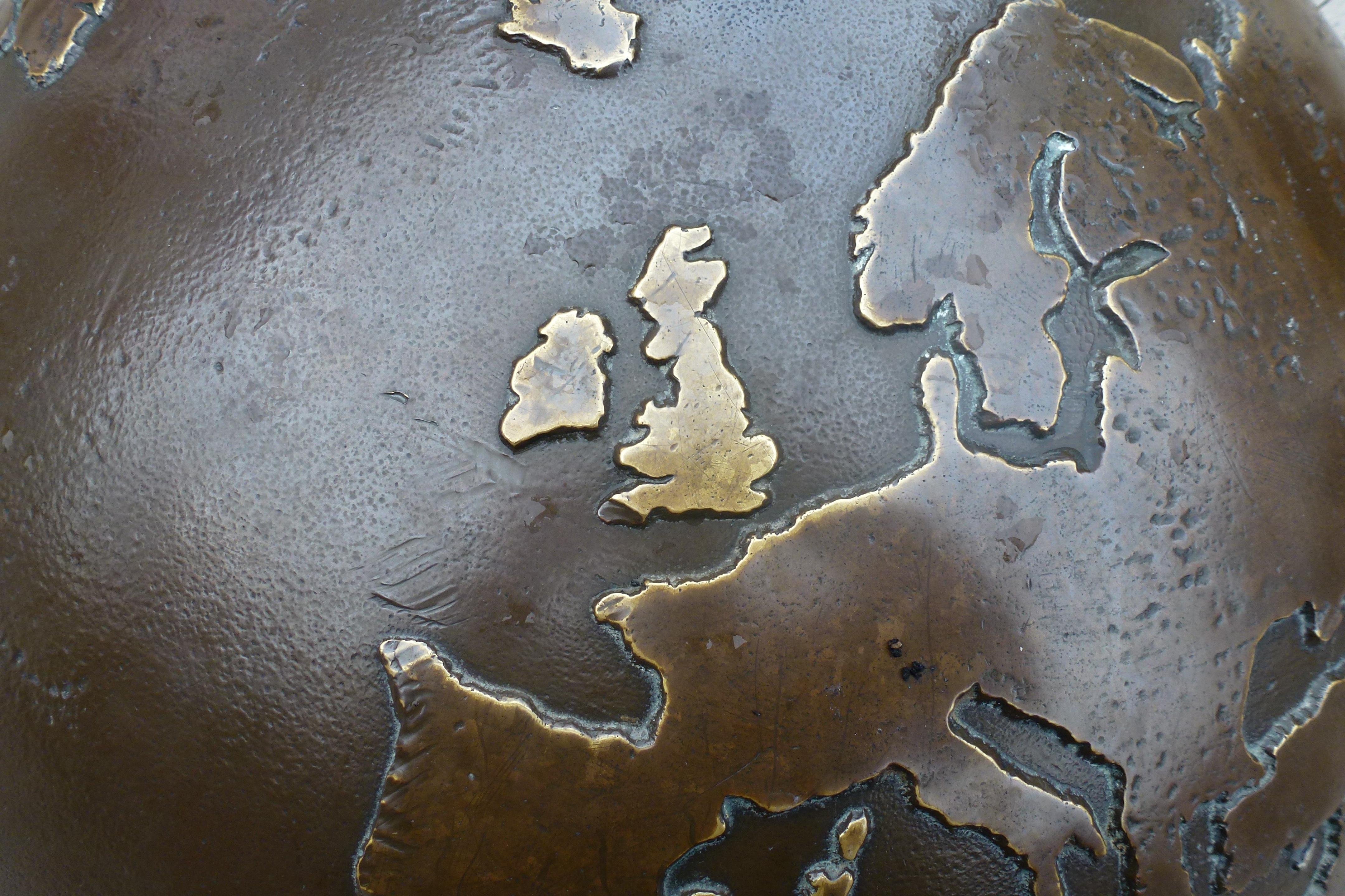
KIngs Lynn globe close up.JPG - Greenpenwriter
Patrol area USA submarines.gif - Ipvariabile

North Channel.png - Hogweard

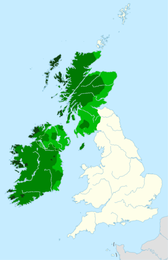
British Isles Scotland.png - Rock drum
Echmarcach mac Ragnaill (map).png - Brianann MacAmhlaidh

Echmarcach mac Ragnaill (map2).png - Brianann MacAmhlaidh

Map of the Location of the Kingdom of Northumbria.png - Sermadison

Lisbon Portugal 067 (5107498155).jpg - File Upload Bot (Magnus Manske)
GPC Polygon Clipper difference.gif - BD2412
GPC Polygon Clipper intersection.gif - BD2412
GPC Polygon Clipper union.gif - BD2412
GPC Polygon Clipper xor.gif - BD2412
Lǫgmaðr Guðrøðarson (map1).png - Brianann MacAmhlaidh

Lǫgmaðr Guðrøðarson (map2).png - Brianann MacAmhlaidh
British Isles slope map.png - PawełS
British Isles 7C kingdoms with Bernicia and Deira.gif - WikiLeon

An introduction to the study of prehistoric art (1915) (14775789264).jpg - Fæ

B&Q Locations.jpg - OgreBot

003 British Isles.png - Gooneranar

Location map of British Isles.png - Paasikivi

United Kingdom Scilly islands.png - Xeyarlear
Geograph depth small.png - Bjh21

Islas.brit.png - JuanCamacho

551 of 'The Earth and its Inhabitants. The European section of the Universal Geography by E. Reclus. Edited by E. G. Ravenstein. Illustrated by ... engravings and maps' (11271325606).jpg - Artix Kreiger 2

552 of 'The Earth and its Inhabitants. The European section of the Universal Geography by E. Reclus. Edited by E. G. Ravenstein. Illustrated by ... engravings and maps' (11127505116).jpg - Artix Kreiger 2

576 of 'The Earth and its Inhabitants. The European section of the Universal Geography by E. Reclus. Edited by E. G. Ravenstein. Illustrated by ... engravings and maps' (11121239944).jpg - Artix Kreiger 2

556 of 'The Earth and its Inhabitants. The European section of the Universal Geography by E. Reclus. Edited by E. G. Ravenstein. Illustrated by ... engravings and maps' (11269859356).jpg - Artix Kreiger 2
Broxtowe.jpg - Wdwdbot

British Isles mountains over 610m in height (called P610s).gif - Britishfinance

BIThumbMap SCO ISLES.png - Cactus.man

Gaels.png - CelticBrain

The Gaels.png - CelticBrain

Map of the British Islands, showing the locations of the Herds in Harting's list.png - Billinghurst

Distribution of Scandinavian place names in England (4479234771).png - Eyes Roger
Stamp of Albania - 1966 - Colnect 325903 - Soccer Player Map of Great Britain.jpeg - Gone Postal

The Atlantic Archipelago.png - McBaer

Irish And English Regions.png - Alberto Tozetto De Mello D´Onofrio

BBC television weather chart - 1936-11-13.jpg - Pigsonthewing

English Irredentist Map.png - Charlieo308

Porto 15 31 05 217000.jpeg - Robot8A

PAT - United Kingdom and Ireland.gif - Babelia

The British Isles - DPLA - 754a18890d9772a126dbfe9387c37c31.jpg - DPLA bot

British Isles - DPLA - bf20bc676c64f84a6a8cde84afd94ab8.jpg - DPLA bot

Кельцкія народы Брытанскіх астравоў.png - Frantishak

The British Isles - DPLA - 4ac696f2ac1d82378c706acb29975c32.jpg - DPLA bot

Ham sandwich theorem 2d.png - Cmglee
Blank Map of the Republic of Ireland and the 4 British islands in British territory.png - GuilhermeGolvino

Brittiskaoarna.gif - Gerrynobody

Maeneo chini ya taji la Uingereza.PNG - Kipala