Wikimedi'Òc
Modes d'emploi

Cet album fait partie des albums
Cet album photos contient les sous-albums suivants :


Harlech dome.png - Babybrew6

Wales topo test.png - David.Monniaux
Mappa an Mor Keltek.png - QuartierLatin1968

WalesNumbered.png - QuartierLatin1968

Chwe Chenedl Geltaidd.png - QuartierLatin1968
WalesNumbered2003.png - Essin

WalesRef1997.png - Renamed user OCfxJKu7j2
Map of Wales.GIF - Nk
Wales fire services numbered.png - Jordi Roqué

Welsh 2003 non-administrative counties flood damage July 24 2007.png - Anameofmyveryown

Welsh principal areas flood damage July 24 2007.png - Anameofmyveryown
South Wales.png - File Upload Bot (Magnus Manske)

Map o hunaniaeth Gymreig.PNG - Adam7davies~commonswiki

North Wales (1).png - File Upload Bot (Magnus Manske)

Wales location map.png - Koryakov Yuri

Wales outline map with UK.png - Jza84

Mid & West Wales.png - File Upload Bot (Magnus Manske)

South Wales 2.png - File Upload Bot (Magnus Manske)

North Wales 2.png - File Upload Bot (Magnus Manske)

UK, Wales, Population Density.PNG - OgreBot
CymruWales.png - Rhyshuw1~commonswiki

Province of Cardiff.png - Thomas Gun
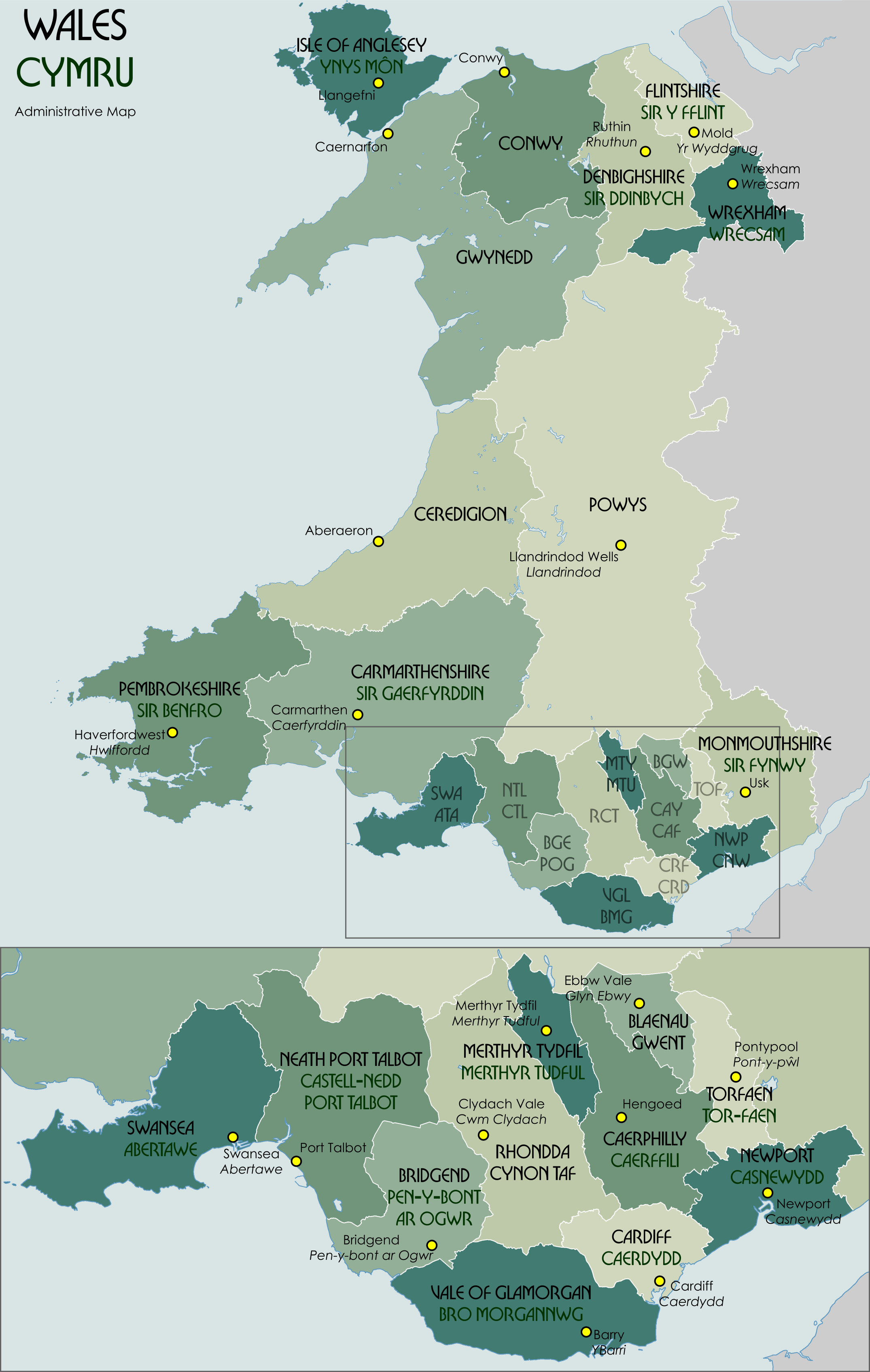
Wales Administrative Map 2009.png - XrysD

Wales.rivers.lakes.jpg - Notuncurious

Ordnance Survey 1-250000 - SH.jpg - OrdnanceSurveyBot

Ordnance Survey 1-250000 - SM.jpg - OrdnanceSurveyBot

Ordnance Survey 1-250000 - SN.jpg - OrdnanceSurveyBot

Ordnance Survey 1-250000 - SR.jpg - OrdnanceSurveyBot
Ordnance Survey 1-250000 - SH.tif - OrdnanceSurveyBot
Ordnance Survey 1-250000 - SJ.tif - OrdnanceSurveyBot
Ordnance Survey 1-250000 - SM.tif - OrdnanceSurveyBot
Ordnance Survey 1-250000 - SN.tif - OrdnanceSurveyBot
Ordnance Survey 1-250000 - SO.tif - OrdnanceSurveyBot
Ordnance Survey 1-250000 - SR.tif - OrdnanceSurveyBot
Ordnance Survey 1-250000 - SS.tif - OrdnanceSurveyBot
Ordnance Survey 1-250000 - ST.tif - OrdnanceSurveyBot

Wales locator.png - Dr. Blofeld~commonswiki

Wales SRTM.png - PawełS

Map National Museum Wales.jpg - Bukk

Rhayader rads.png - Bulwersator
Painscastle rads.png - Bulwersator

WalesPoliceSouth(council areas).png - MGA73bot2

WalesPoliceNorth(council areas).png - MGA73bot2

WalesPoliceDyfedPowys(Council areas).png - MGA73bot2
All wales path.png - Hogyn Lleol
Newradnor rads.png - Bulwersator
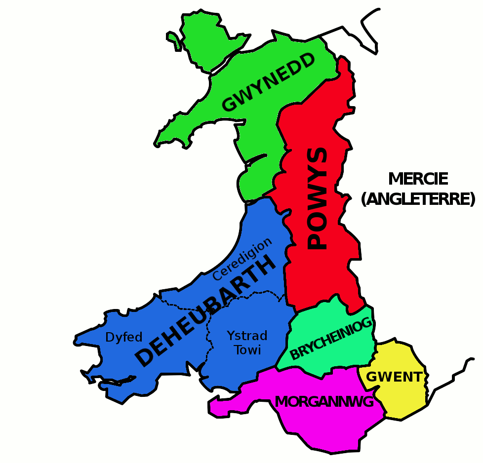
Deheubarth.png - File Upload Bot (Magnus Manske)

Vale of Glamorgan map.png - Blofeld Dr.

West Wales 1.png - RobinLeicester

Mid Wales 1.png - RobinLeicester
36 hour rainfall totals and evidence of erosion in West Wales, 8th-9th June 2012.tif - Redavenbk
WalesSwansea1974.png - ~riley
Wales Administrative 1974 Blank.png - XrysD

Wales Swansea Bay City Region locator map.png - RB211Trent~commonswiki
Cymru6.png - Llywelyn2000

I'r fyddin fechgyn gwalia! Cas gwr nid cas ganddo elyn ei wlad. Cymru am byth! LCCN2003662905.jpg - Fæ

Mid Wales.png - Ccmpg

Born In England 2011 Census Wales.png - SkateTier

West Wales 2.PNG - Arthunter

CymruWlybSych.jpg - AlwynapHuw

Wales Administrative 2009 v5 Welsh.png - XrysD

Restructuring of Local Authority in Wales Option 1.png - Llywelyn2000

Restructuring of Local Authority in Wales Option 2.png - Llywelyn2000
Mid & Weast Wales FRS area.png - G-13114

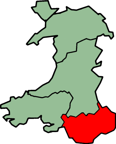
Wales in Red.png - Dr. Blofeld

Conwy Bay.gif - Dr. Blofeld

Stone walls of North Wales Category from Open Street Map.PNG - Llywelyn2000

Wales Köppen.png - Redtitan
Aberporth Airport location.jpg - MARKELLOS

WalesPoliceGwent(Council areas).png - OgreBot
Clwyd districts.png - Akbys
National Grid (Britain) WV banner (SN).jpg - Seagull123

19 of 'The Marches of Wales. Notes and impressions on the Welsh Borders, etc' (11225628773).jpg - Artix Kreiger 2

Ordnance Survey One-Inch Sheet 117 Bala & Welshpool, Published 1963.jpg - Kognos

Ordnance Survey Quarter-inch sheet 12 South Wales, published 1967.jpg - Kognos

Ordnance Survey quarter-inch sheet Wales and the Marches, published 1963.jpg - Kognos

Map bele ffig 2.jpg - Duncan Brown

Map bele ffig 4.jpg - Duncan Brown

Map bele ffig 3.jpg - Duncan Brown

Map bele ffig 5.jpg - Duncan Brown
Ordnance Survey One-Inch Sheet 117 Bala & Welshpool, Published 1947.jpg - Kognos

Welsh weekly newspapers.jpg - Llemiles

North Wales Roads & Sea.png - DankJae

North Wales Rail.png - DankJae

Rhwng Gwy a Hafren.png - Jr8825

Cantrefi Cymru.png - Jason.nlw

DeesideBUA.png - Eopsid

CaerdyddBUA.png - Eopsid

Percentage white by unitary authority in Wales (Census 2011).png - EmaresEmares
NWNGR Parliamentary proposals map.jpg - Hachirokutetsu

LeghKembra.jpg - Brwynog

National-forest-wales-woodland-sites.jpg - Titus Gold

Admiralty Chart No 1484 Plans in Cardigan Bay, Published 1966 New Edition 1967.jpg - Kognos

Accurate Map of Carmarthen Shire Drawn from an Actual Survey, with various Improvements. Illustrated with Historical Extracts relative to the Air, Soil, Natural produce, Trade & Manufactures ; (en bas -) An Accurate... - btv1b530571262.jpg - Gzen92Bot

Dyfed an Brycheiniog Map.png - That Northern Irish Historian
13071 2019 3727 Fig1.webp - Ernsts
Joseph Kappen Port Talbot map.tif - Structuralists

Pembroke Castle - geograph.org.uk - 4972415.jpg - GeographBot

Counties in Wales which demand the control of the Crown Estates EN.png - Llywelyn2000

Rheoli Ystad y Goron yng Nghymru - Devolving the Crown Esate in Wales.png - Llywelyn2000

Wales Administrative 2009 v5 Welsh (cropped).png - Llywelyn2000

Welsh Dyke Map.png - Editor account 2222

Wales 1039-63 (King Gruffudd ap Llywelyn) cy.svg - Llywelyn2000