Wikimedi'Òc
Modes d'emploi

Cet album fait partie des albums
Cet album photos contient les sous-albums suivants :


England hill regions.jpg - Stemonitis

English North-South divide.png - Broman178
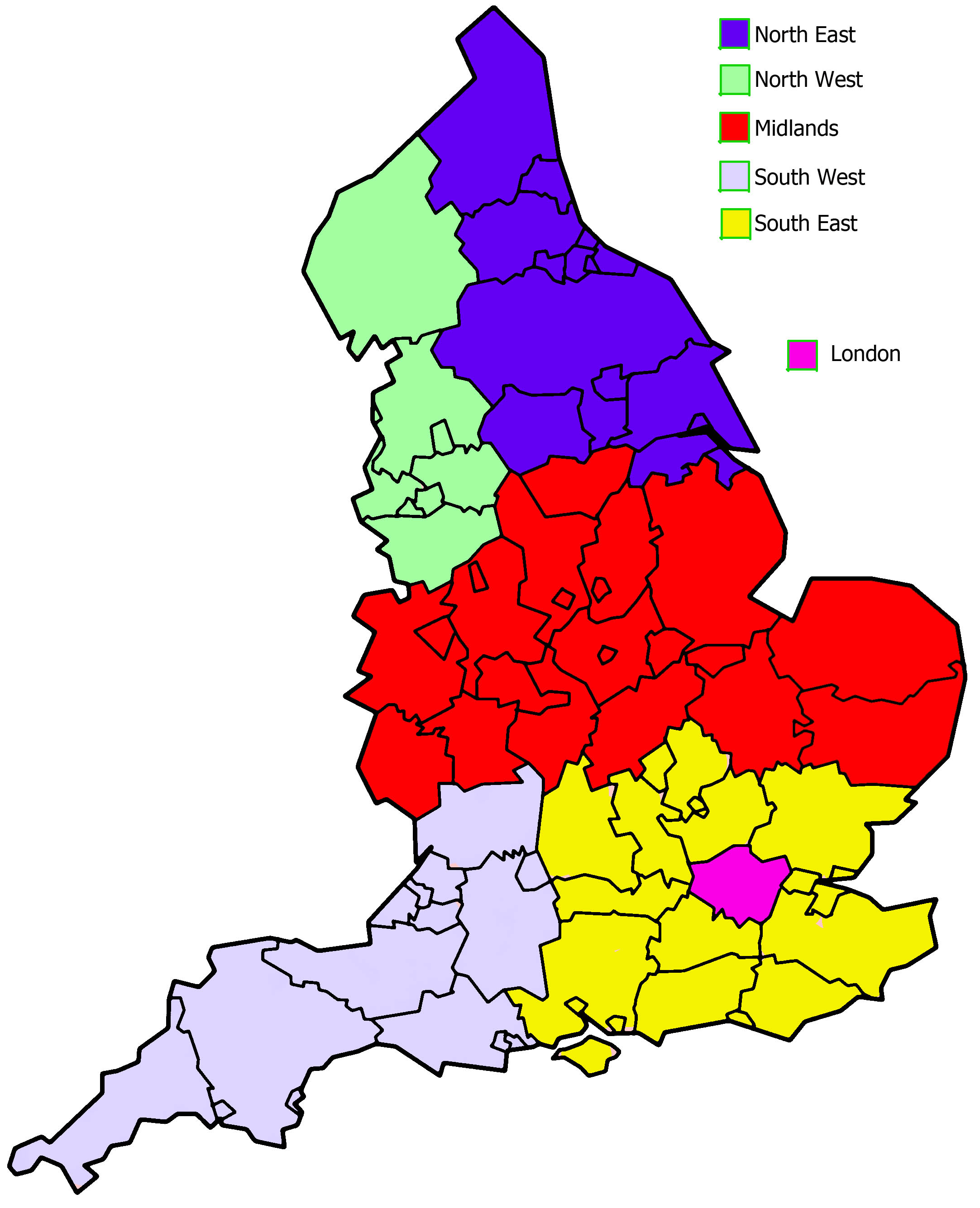
England midlands as census.jpg - Chaosdruid

英超0809分布改圖.png - File Upload Bot (Magnus Manske)
England south of the humber and east of the isle of wight.png - Phil Bridger
M1 base.png - JoKalliauer

M1 hard shoulder.png - EricITOworld
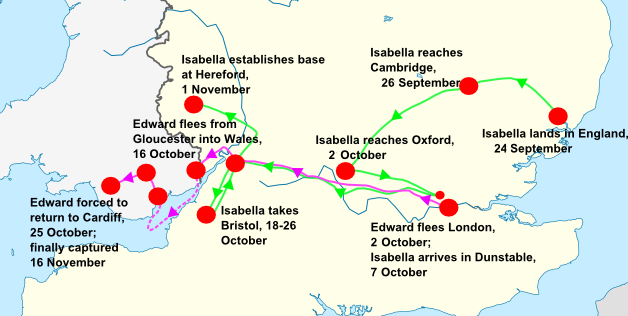
Isabella's invasion route (1326).png - John

Map of NUTS 3 areas in England by GVA per capita (2007).png - Jolly Janner

Coal mining in England by county.jpg - Bazonka

England counties population-ar (crop).png - باسم

County tops.jpg - Wipsenade

ENG-southeast.png - Balou46

North Midlands, General District & County Map as of 2013.png - FrancisIdents

EnglandPopulation2011.png - Yaxley499

EnglandPopulationDensity2011.png - Yaxley499

Born Outside England 2011 Census.png - SkateTier

Wales, Central and S England slope map 50 m.png - PawełS

N England slope map 50 m.png - PawełS

A complete geography (1902) (14766126771).jpg - Fæ
English Districts by Population Map.pdf - Jmendelowitz
England Districts by Populatin Map 2.pdf - Jmendelowitz

Teees Valley Map.png - Ross Burgess

The Downs map.jpg - Jan Arkesteijn

Asser map.png - OgreBot

HonourofAlbemarle.png - Joeroeq

Reading GreaterLondon.png - Eopsid

After Action Report - Dresden - NARA - 100384478 (page 2).jpg - US National Archives bot
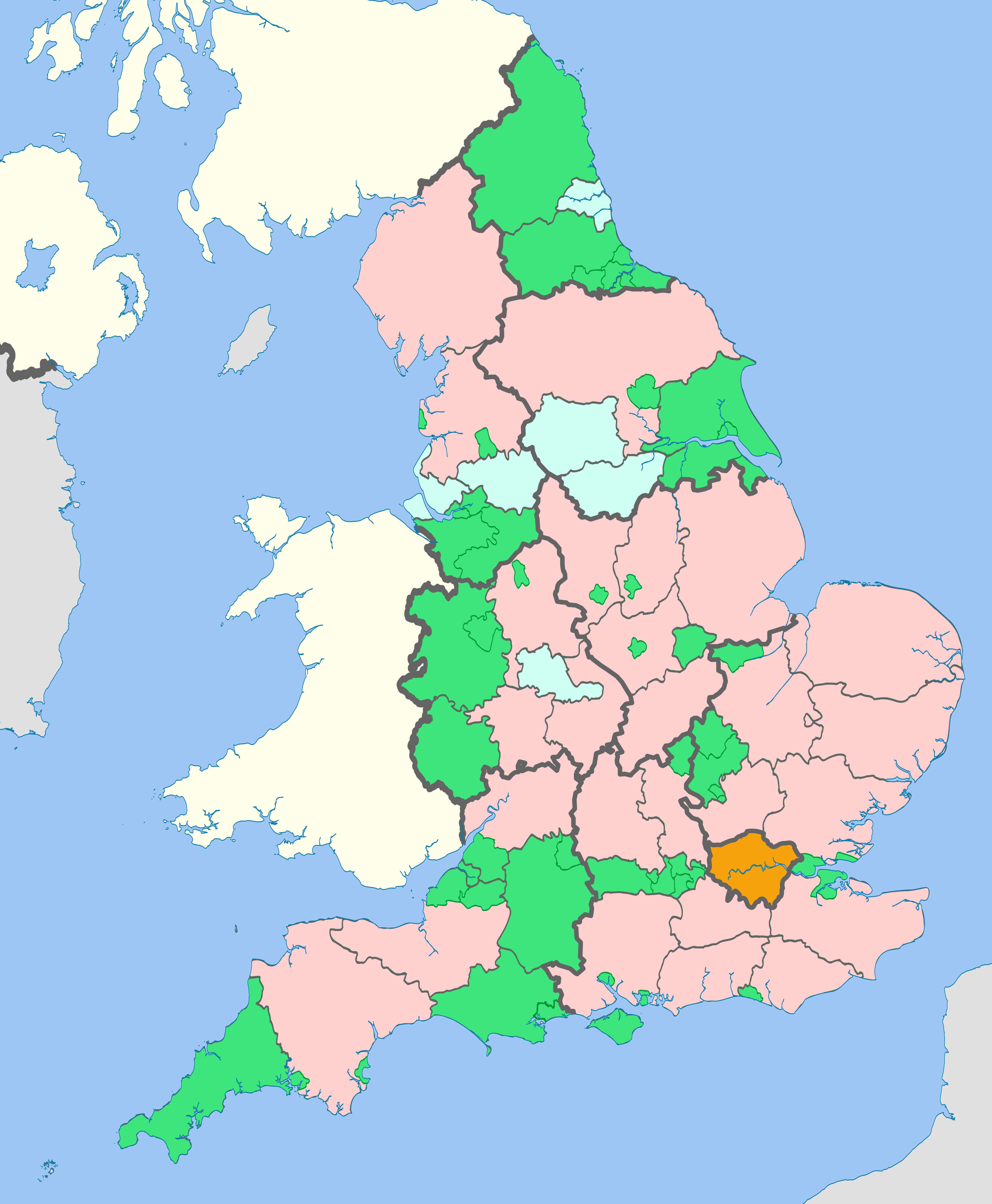
English regions and counties by type 2019.jpg - The Equalizer

2011 RUCLAD Assignments England.jpg - J mareeswaran
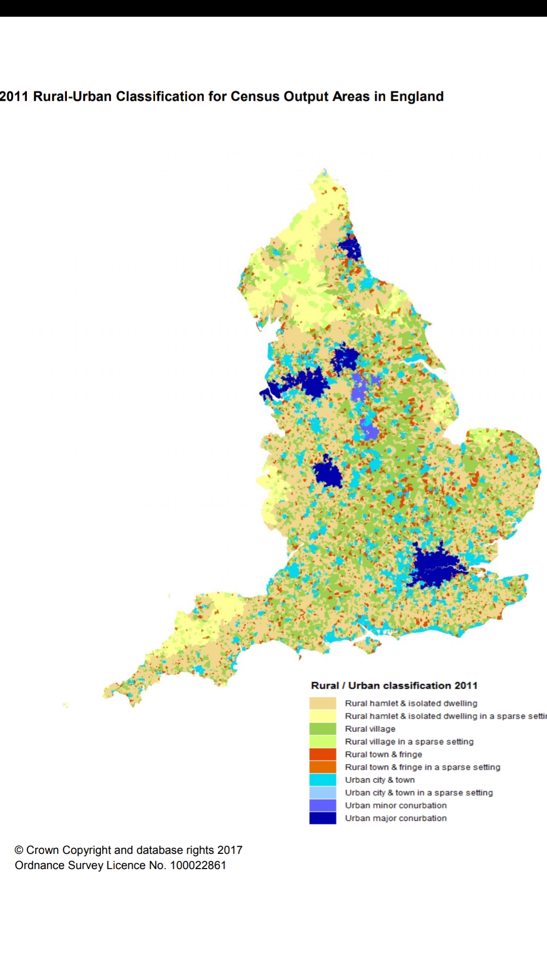
2011 Rural Urban classification by census Output Areas in England.jpg - J mareeswaran

2011 Rural Urban classification by Local Authorities in England 01.jpg - J mareeswaran

イギリス屋外野宿者数.png - Fnweirkmnwperojvnu

BRITAIN INTO EUROPE 2.jpg - Mwoolliams

Gothic brick in England.png - Ulamm
Location map of Basset Domesday manors.png - Ipsden

Nordsee EN-B-DK.png - Ulamm
Gotischer Backstein Nordsee & westl. Ostsee.png - Ulamm

Genetic structure in England.png - CelticBrain

English regions and counties by type 2021.jpg - Delusion23

Threefold division of England circa 1115.jpg - Bodrugan

ENG Map 1975 CWC Venues.png - BuddhikaW88

Buss Distribution England.png - ThirteenToThirty

Rutland districts 1971.gif - MRSC

Surrey local government 1961-1971.png - MRSC

England Local Government Map.png - XrysD

Map Showing the Territory of the Forest of Arden.jpg - Acne trumpet
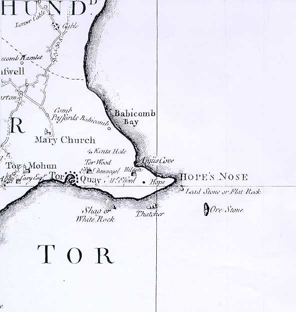
Map of Torquay, 1795.jpg - Devonian1776

Northern England (county names) in the English Middle Ages.png - Fortuna imperatrix mundi
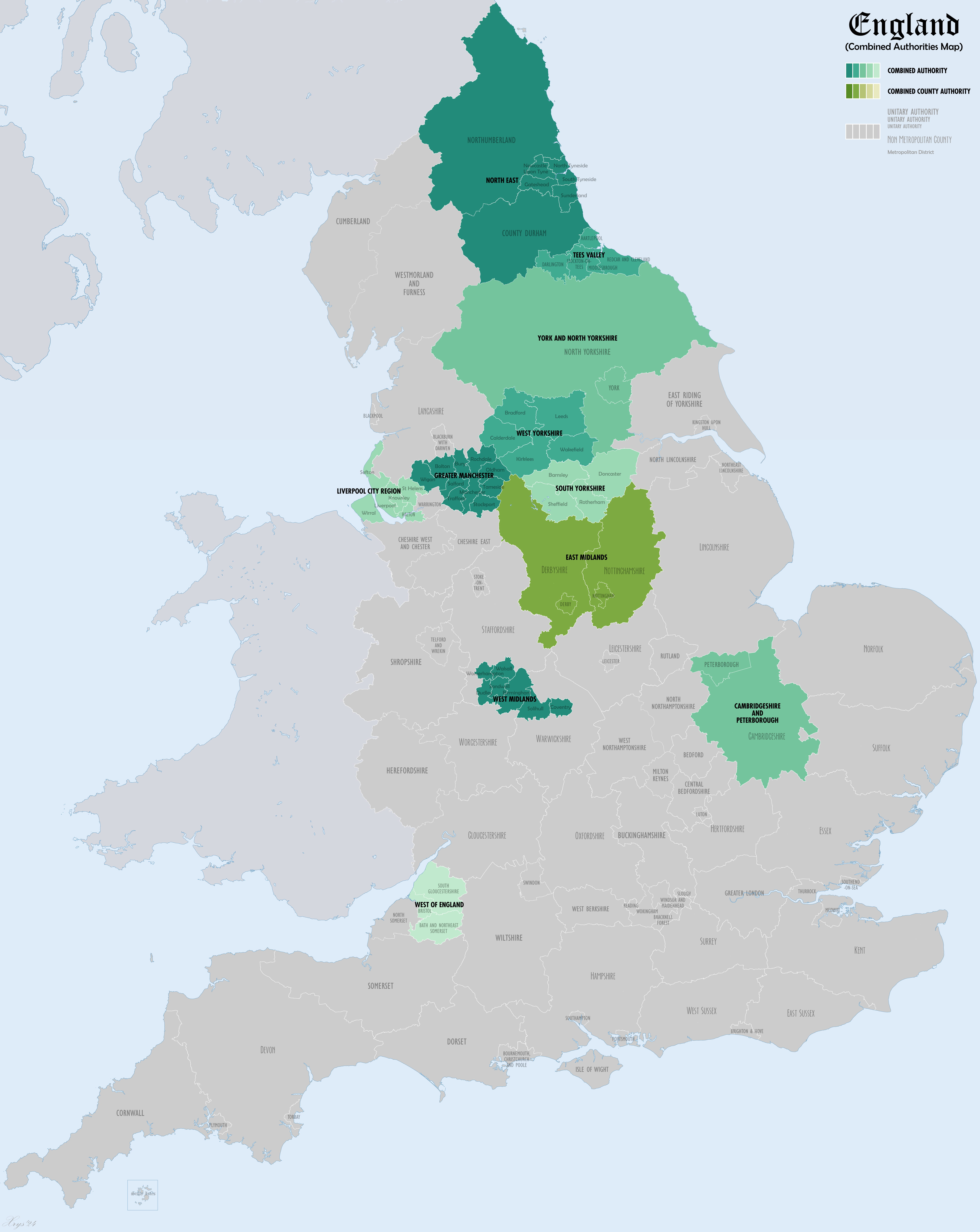
England Combined Authorities Map.png - XrysD

Map showing the traditional, geographical county of Bedfordshire, England.png - RealCounties

Map showing the traditional, geographical county of Berkshire, England.png - RealCounties

Map showing the traditional, geographical county of Buckinghamshire, England.png - RealCounties

Map showing the traditional, geographical county of Cambridgeshire, England.png - RealCounties

Map showing the traditional, geographical county of Cornwall Kernow, England.png - RealCounties

Map showing the traditional, geographical counties of England.png - RealCounties

Map showing the traditional, geographical county of County Durham, England.png - RealCounties

Map showing the traditional, geographical county of Essex, England.png - RealCounties

Map showing the traditional, geographical county of Devon, England.png - RealCounties

Map showing the traditional, geographical county of Cumberland, England.png - RealCounties

Dorset Map.png - RealCounties

Hampshire Map.png - RealCounties

Hertfordshire Map.png - RealCounties

Herefordshire Map.png - RealCounties

Gloucestershire Map.png - RealCounties

Huntingdonshire Map.png - RealCounties

Kent Map.png - RealCounties

Lancashire Map.png - RealCounties
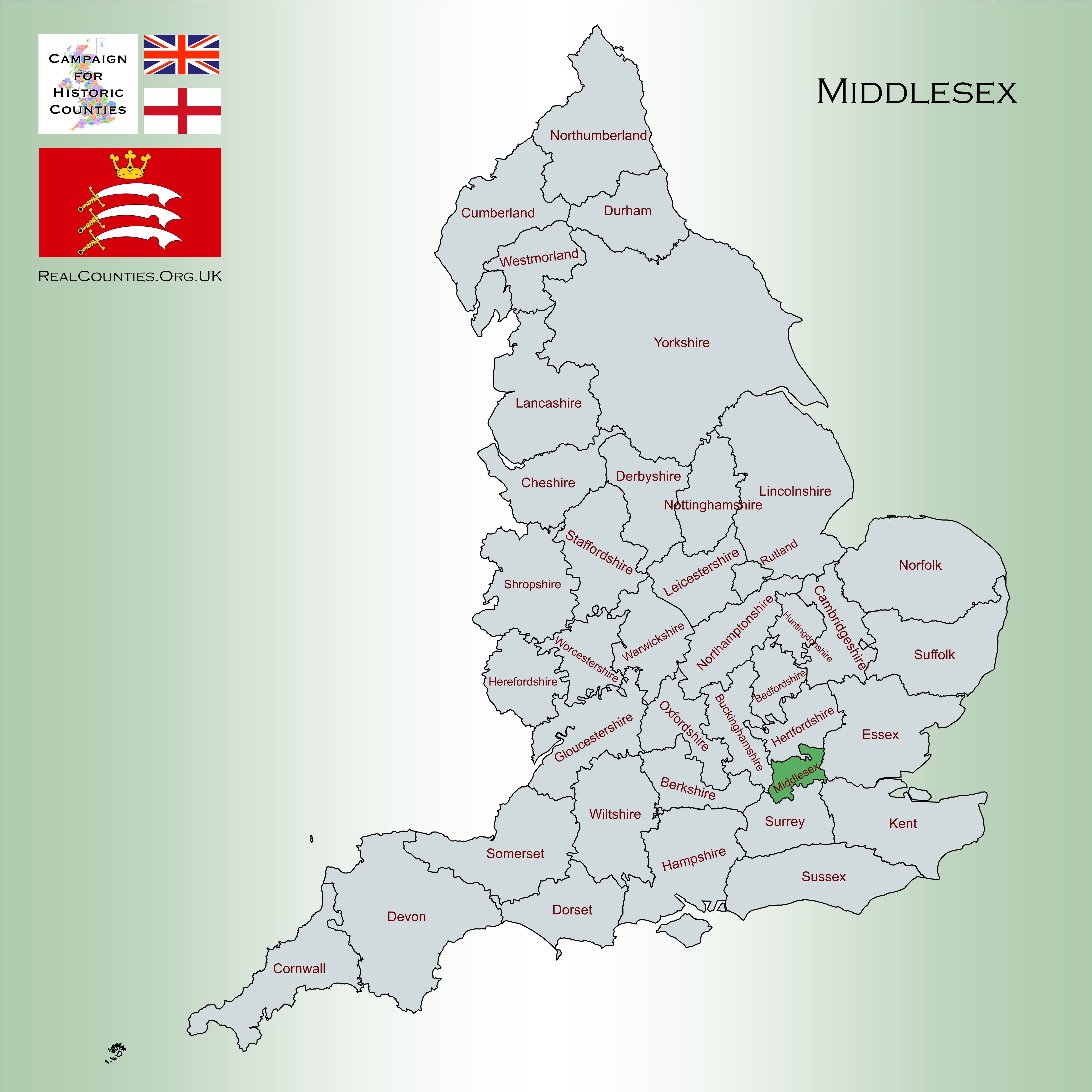
Middlesex Map.png - RealCounties

Leicestershire County Map.png - RealCounties

Lincolnshire Map.png - RealCounties

Northumberland Map.png - RealCounties

Norfolk Map.png - RealCounties

Northamptonshire Map.png - RealCounties

Oxfordshire Map.png - RealCounties

Nottinghamshire Map.png - RealCounties

Rutland Map.png - RealCounties

Shropshire Map.png - RealCounties

Somerset Map.png - RealCounties

Staffordshire Map.png - RealCounties

Suffolk Map.png - RealCounties

Surrey Map.png - RealCounties

Sussex Map.png - RealCounties

Westmorland Map.png - RealCounties

Warwickshire Map.png - RealCounties

Wiltshire Map.png - RealCounties

Worcestershire Map.png - RealCounties
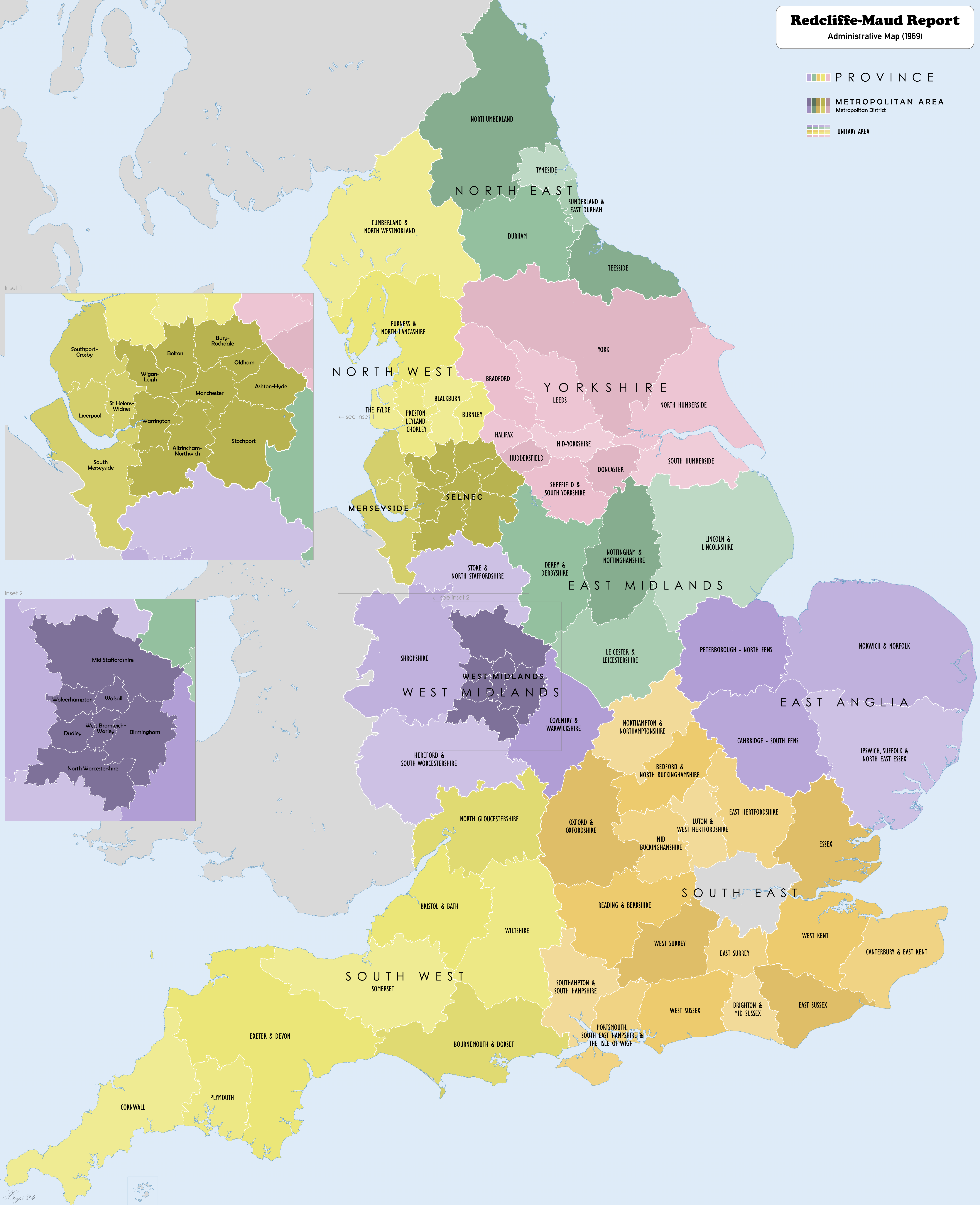
RedcliffeMaudReportMap1969.png - XrysD

Georges map.jpg - Evan T Jones

Map of the brotherhood of Neal.png - Willyman42

Northern England historic counties.png - Plarety2

Premier League Stadium Capacity.png - Whadcock

Map of Morpeth UK.png - Fragglet

Top 6 Constituencies by Faith Group.png - BritishSikh

Largest Non-Christian Group by Constituency.png - BritishSikh

Largest Non-Christian Group by Constituency 2.png - BritishSikh

English Combined Authorities Locator.svg - BryceIII

Runcorn.jpg - AdairF

Anglo-Scottish Marches v1.png - Lategreatanddeadpics