Wikimedi'Òc
Modes d'emploi

Cet album fait partie des albums
Cet album photos contient les sous-albums suivants :


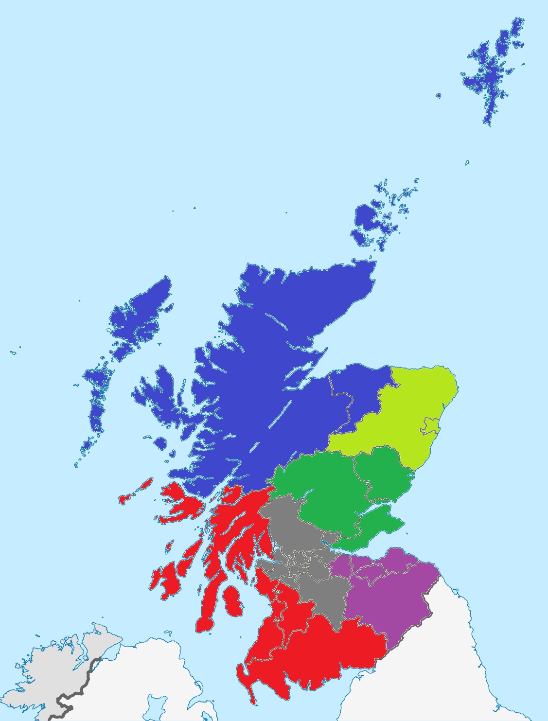
Girlguiding Scotland County Map (2023).png - LoloBurn25

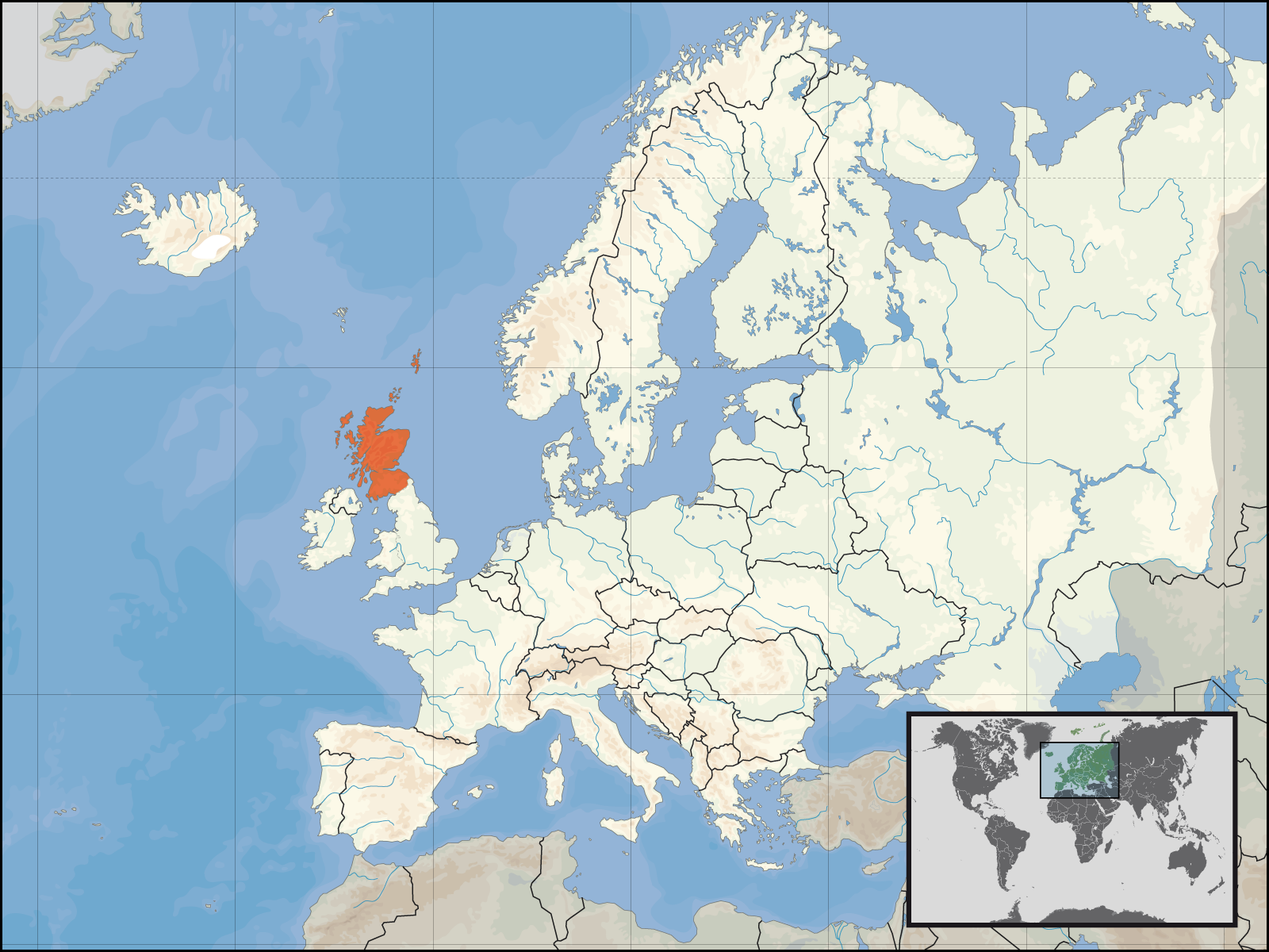
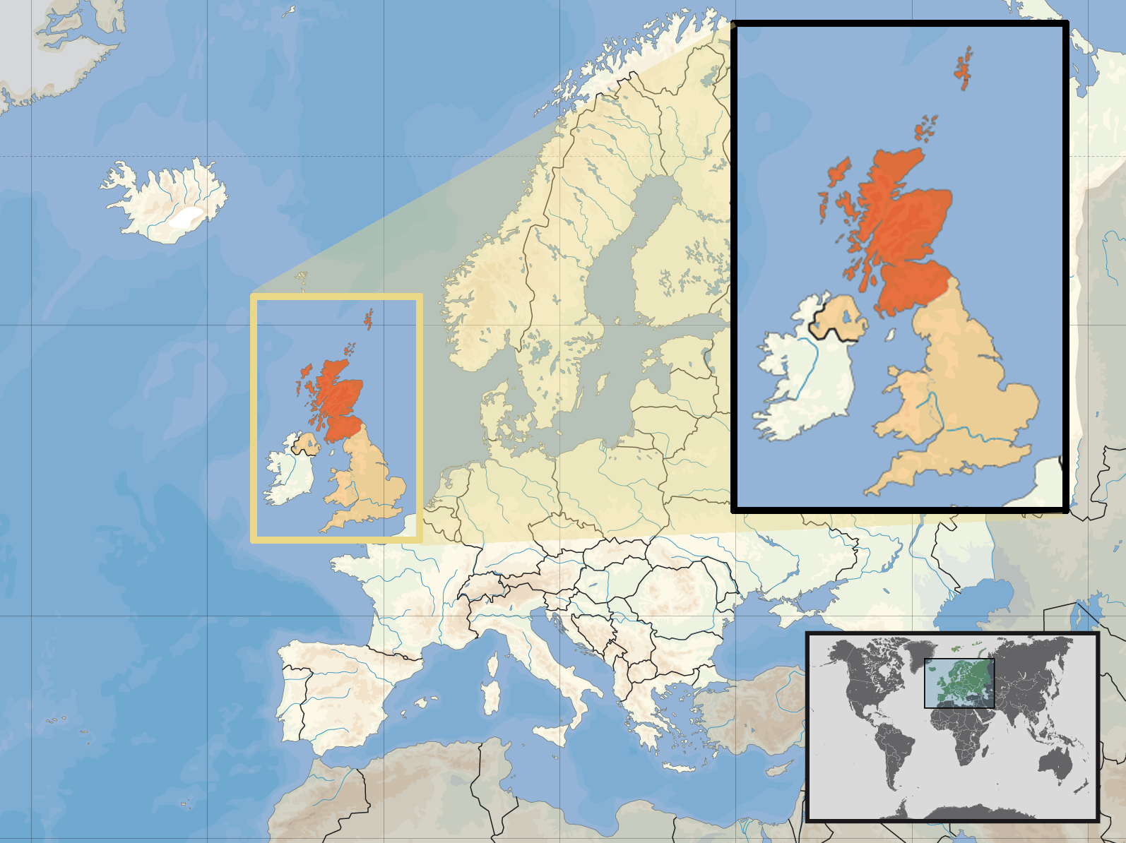
Scotland (independent) in Europe.png - Rosswi88

Anglo-Scottish Marches v1.png - Lategreatanddeadpics

Scotlland satellite image.jpg - Edbrown05~commonswiki
Scottish clan map blank.png - Gsl~commonswiki

Scottish clan map.png - QuintusPetillius

Hebridesmap.png - Kelisi

Chwe Chenedl Geltaidd.png - QuartierLatin1968
Chwe Chenedl Geltaidd syml.png - QuartierLatin1968

Topographical Map of Traditional Galloway.png - SFC9394
Scotloc topo dark.png - SFC9394
Scotloc original.png - SFC9394
Scotloc topo light.PNG - SFC9394

Scotland council areas.gif - Asta~commonswiki

Highland towns.gif - Asta~commonswiki

Rhins of Galloway Map.png - SFC9394

Map of Loch Ryan.png - SFC9394

ScotlandLieutenancies.png - Ayack
Ecosse carte physique.png - Sting

MapOfAyrshire.png - Holly Cheng
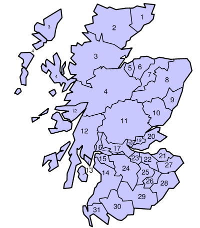
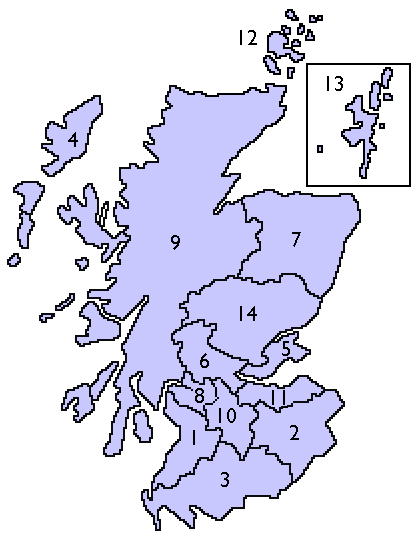
ScotlandCountiesNumbered.png - Essin
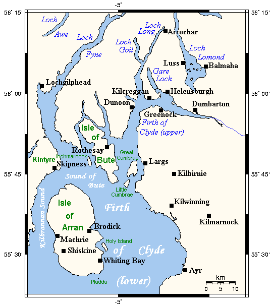
Firthofclydemap.png - Voyager

Scotland grevskap.jpg - Electionworld
Scotland map.png - Electionworld

Boat of Garten Elgin, Keith & Portessie RJD 38.JPG - Irate

Scotland1974Numbered.png - 32X

ClanMacaulay-map-lochbroom01.png - Celtus~commonswiki

Scotch regions.png - Briangotts

Scottish Highlands and Lowlands.png - Jrockley
NHS Health Boards.PNG - Angusmclellan

Scottish 1996 council areas flood damage July 24 2007.png - Anameofmyveryown

Scottish 1997 non-administrative counties flood damage July 24 2007.png - Anameofmyveryown

Scottish counties flood damage July 24 2007.png - Anameofmyveryown
Europe location SCO 2.png - Rab-k

Europe location SCO 3.png - Rab-k

BIThumbMap SCO.png - Ras52

Scotland map-fr.jpg - Sting

Scotland map-en.jpg - Sting
Edinburgh Zoo location.png - Jrockley

BrideiCamp.jpg - Calgacus
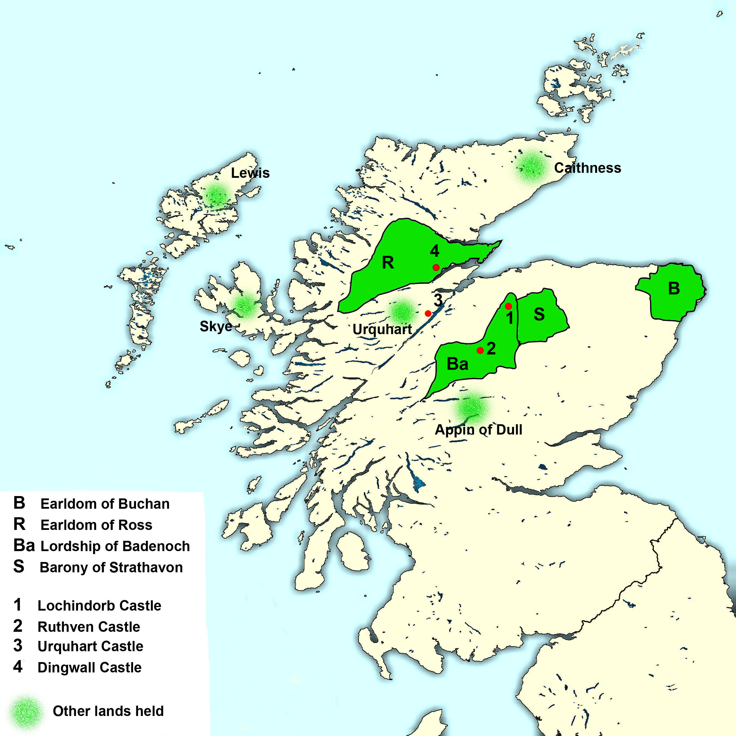
Wolf of Badenoch Lands2.jpg - Billreid

Galloway.modern.names.Ptolemy.map.png - Notuncurious
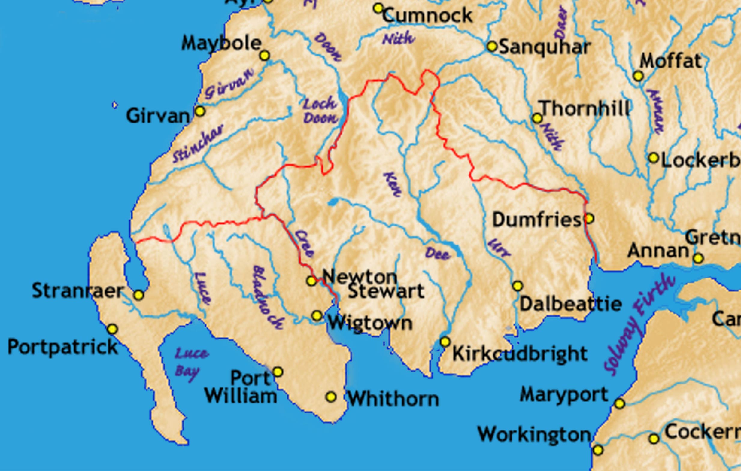
Galloway.rivers.towns.jpg - Notuncurious

Scotland sections of Munro's tables.jpg - Cnbrb

Ss rain 08071412.jpg - Scotland2345

Clyde.catchment.Scotland.jpg - Notuncurious
Clyde.tributaries.jpg - Notuncurious

Spey.catchment.Scotland.jpg - Notuncurious

Spey.tributaries.jpg - Notuncurious

Tay.catchment.Scotland.jpg - Notuncurious
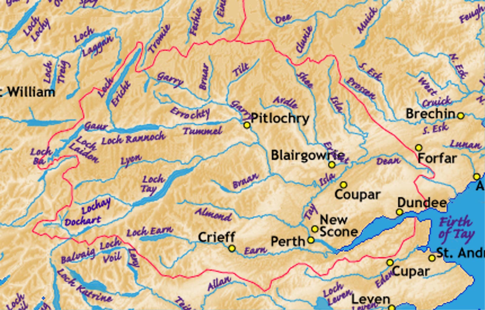
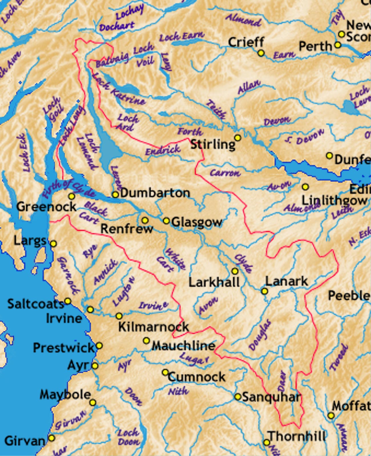
Tay.tributaries.jpg - Notuncurious
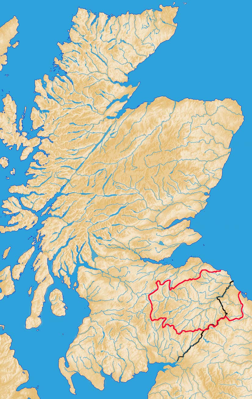
Tweed.catchment.Scotland.jpg - Notuncurious

Tweed.tributaries.jpg - Notuncurious

Map of Speir's school.jpg - Rosser1954
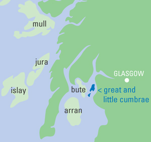
Cumbrae locale.jpg - Finavon
Europe location SCO2.png - Von Sprat

Fullarton estate 1828.jpg - Angusmclellan

FirthofLornmap.png - File Upload Bot (Magnus Manske)

Lochalsh sketch map.jpg - Aymatth2

Lochalsh.jpg - Aymatth2
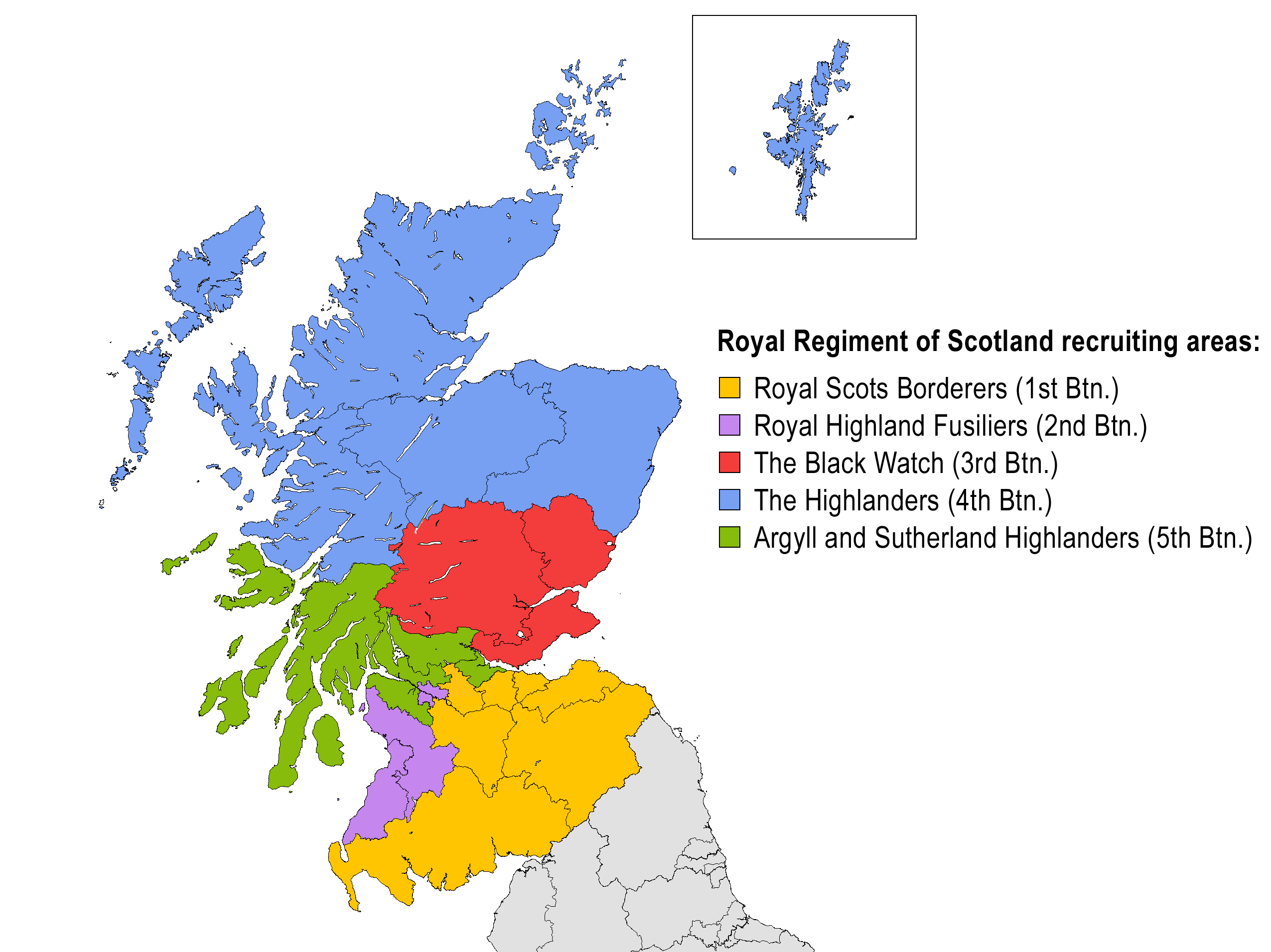
Royal Regiment of Scotland recruiting areas.png - Noclador

ScottishBusOperators.png - Llamadrama~commonswiki
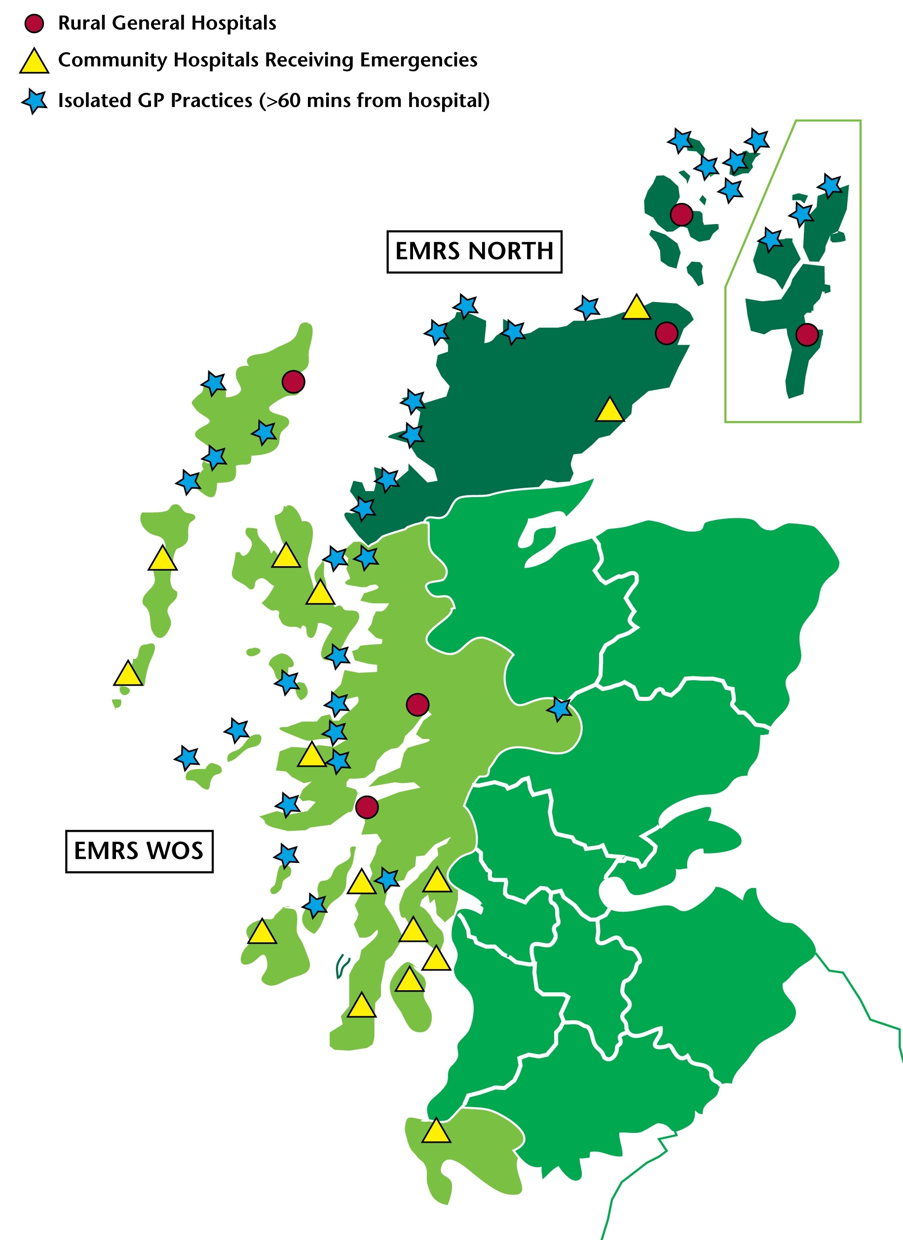
EMRSmap.jpg - Ras67

Revised Royal Regiment of Scotland recruiting areas.png - Ldopa

Highlands lowlands fr.png - Aaker
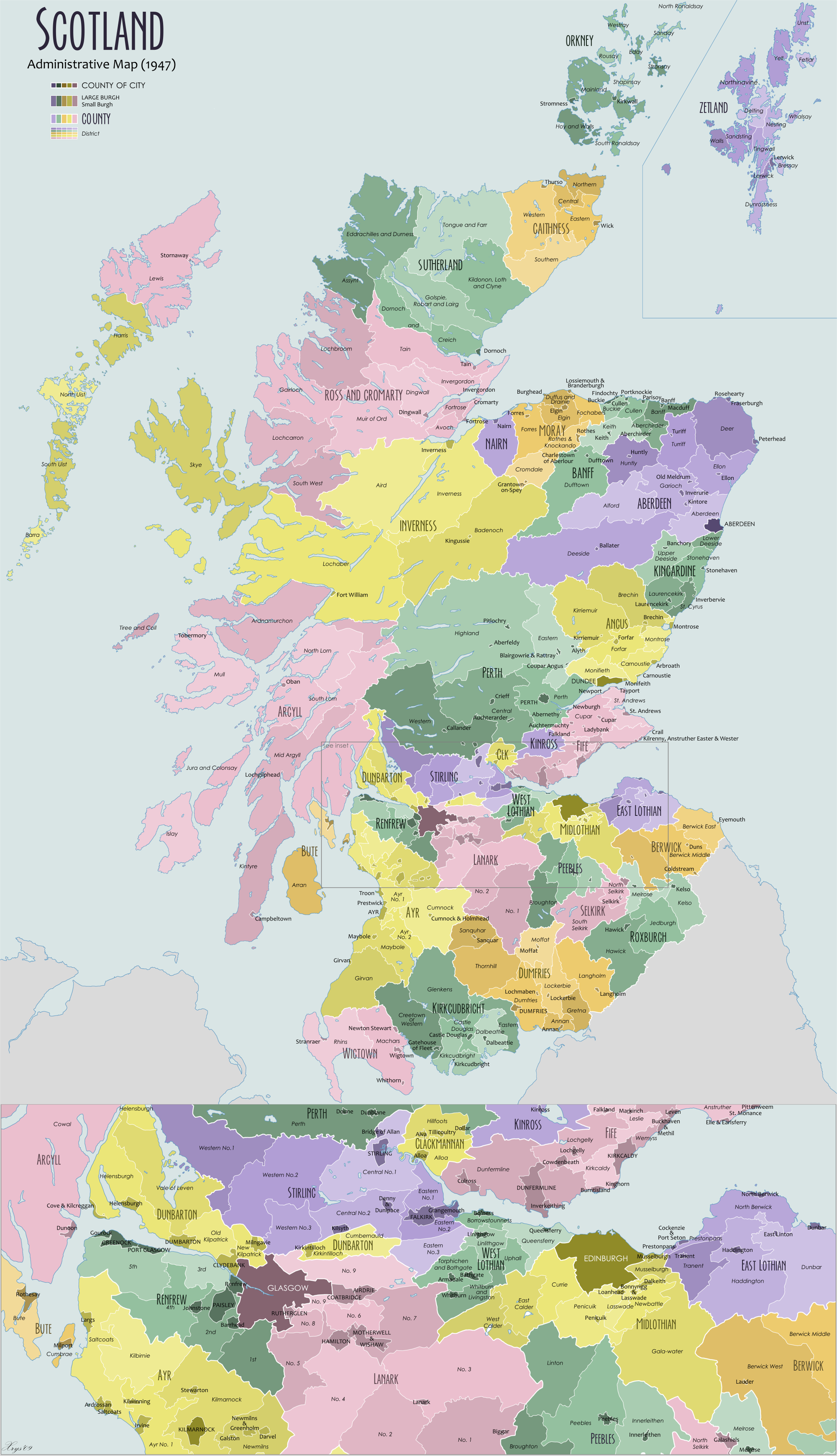
Scotland Administrative Map 1947.png - XrysD

Provinces of South-West Scotland.jpg - Calgacus

Medieval carrick.jpg - Calgacus

Anglo-Scottish.border.modern.png - Notuncurious

Macaulay of Lewis map.png - Brianann MacAmhlaidh

Revised Royal Regiment of Scotland recruiting areas2.png - Ldopa

Revised Royal Regiment of Scotland recruiting areas4.png - Ldopa

Revised Royal Regiment of Scotland recruiting areas5.jpg - Ldopa
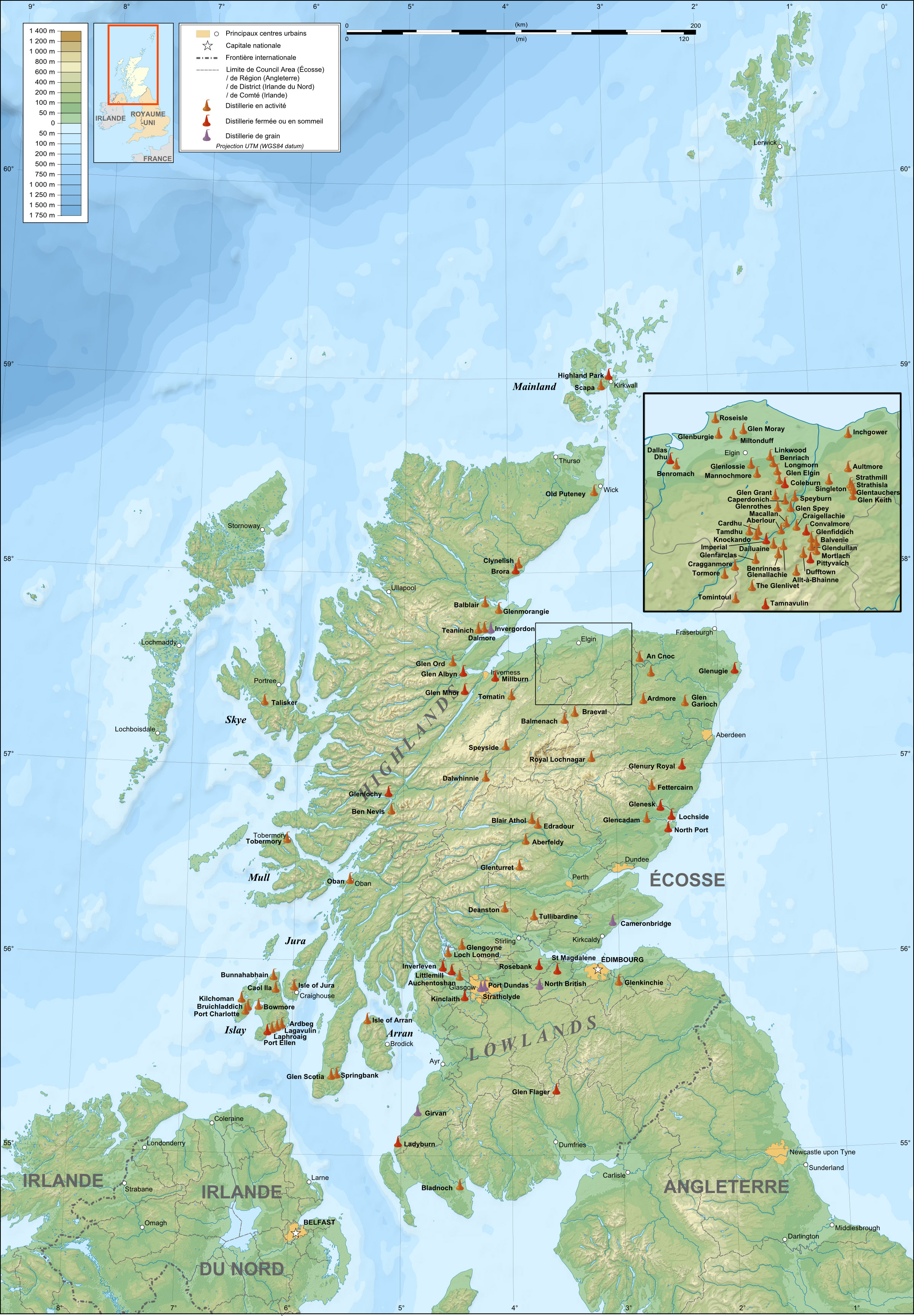
Scotland map of whisky distilleries-fr.jpg - Ayack

Farm Medium.jpg - Breadmurderer
Smc map.jpg - Aweepoof

Location of Auchencairn.png - HelioSmith

Fionnla Dubh mac Gillechriosd (map).png - Brianann MacAmhlaidh

Paul Mactire map.png - Brianann MacAmhlaidh

Leod Macgilleandrais (map).png - Brianann MacAmhlaidh

Ljótólfr (map).png - Brianann MacAmhlaidh

Stewartry and Carrick 4.png - Billreid

Þórketill Þórmóðsson (map).png - Brianann MacAmhlaidh

Kingdom of Man and the Isles map (island groups).png - Brianann MacAmhlaidh

14thC Scottish Economy.jpg - Sabrebd
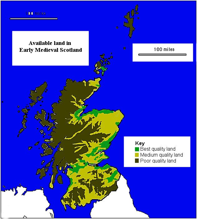
Early Medieval Economy.jpg - Sabrebd

SCOport-fr-parts.png - Philippe Giabbanelli

Early Medieval Scotland - Zones.png - File Upload Bot (Magnus Manske)

Cowal peninsula landsat.png - File Upload Bot (Magnus Manske)
ScotlandCountiesBlank.png - File Upload Bot (Magnus Manske)

You are Here - geograph.org.uk - 1441895.jpg - GeographBot

Regions2011.png - Gsm2407
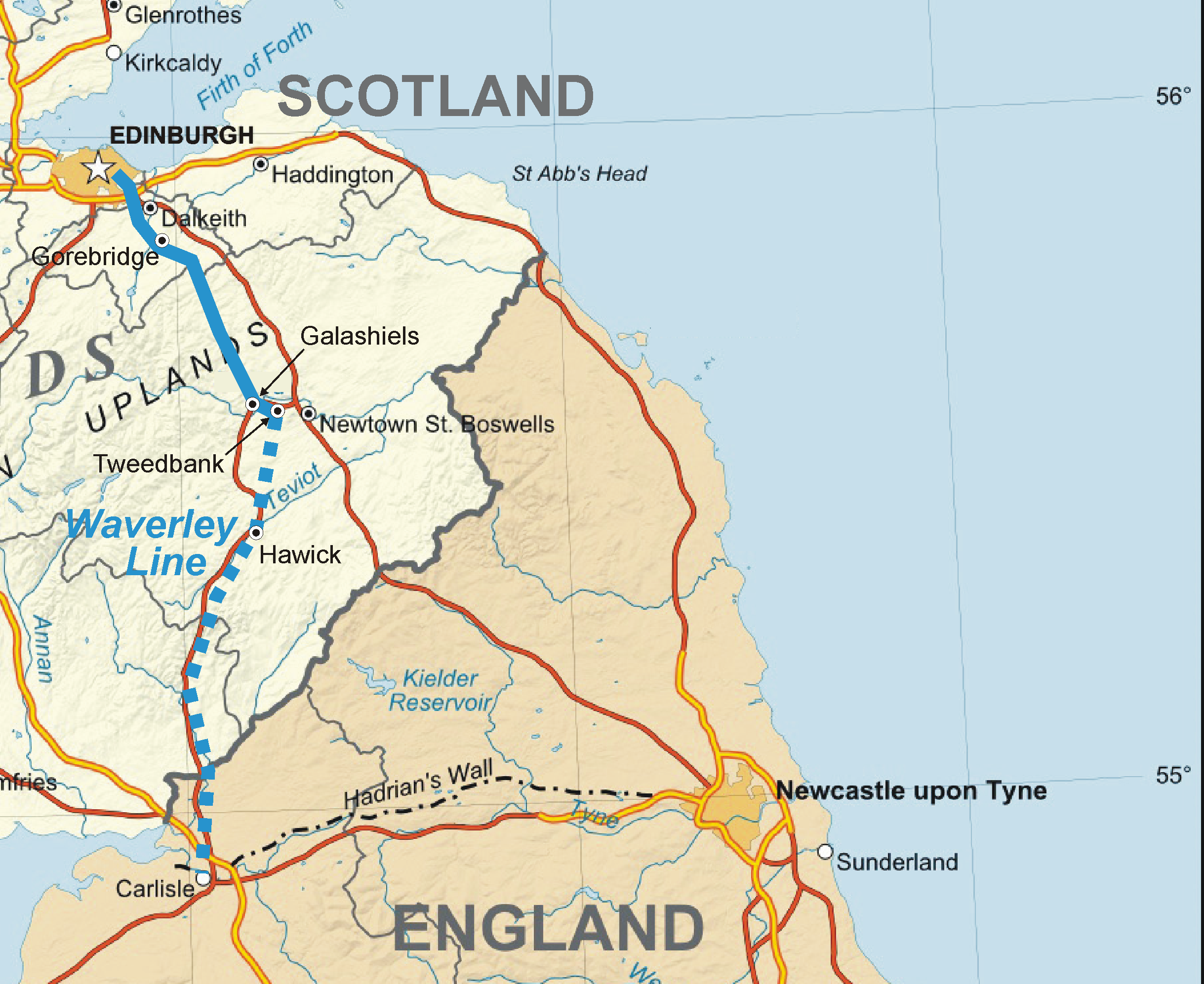
Waverley Line.png - Classical geographer
A9 Scotland.jpg - Eschenmoser
Scotland1996Blank.png - MGA73bot2

Outerhebridesharris.png - Orionist

Highlands location.png - Hogweard
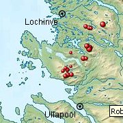
Lochinve i Ullapool.jpg - Llywelyn2000

A93 Scotland.png - Eschenmoser

A92 Scotland.png - Eschenmoser

A94 Scotland.png - Eschenmoser

Cartina Scozia Nord Est.png - MGA73bot2

Highlands costa occidentale 3000000 best.png - MGA73bot2

Highlands nord.png - MGA73bot2
Pictish kingdoms with Fidach.png - Lordpeyre

River Forth course 3.png - VanguardScot

Loch Fleet National Nature Reserve Borders.jpg - Tr!sie

Yezhoù Bro-Skos.jpg - Lekemok
Scotland Administrative 2009 Blank.png - XrysD

T.S.West 1976 Macaulay Institute, Aberdeen.jpg - TLW1958
Scotland, map for "Lijst van golfbanen in Scholtand".jpg - Tristan Surtel
Stroma OS map.png - Prioryman

West of scotland2.png - CourtlyHades296

Scotland map of whisky distilleries-de.png - Chumwa
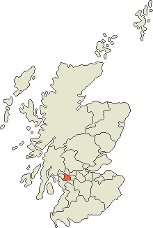
Renfrewshire map.png - Takhirgeran Umar

Council areas Scotland.gif - Takhirgeran Umar
Glasgow map.png - Takhirgeran Umar

RCHAMSInventories.png - OgreBot
Skócia térkép.png - RFARKAS

Population density map in Scotland from the 2011 census.png - SkateTier

Cowal peninsula landsat.jpg - Hogweard

Whiskyregionenkarte Schottlands.png - OgreBot
RenfrewshireCraigends.png - Cerevisae

Roman Catholicism in Scotland.png - Renamed user OCfxJKu7j2

Map of Scotland, with rites in archaeology. Wellcome M0002544.jpg - Fæ
Melrose map.jpg - MGA73
Bothwell-kart.jpg - MGA73

Corrieyairack Pass Map.png - GifTagger

Delvine och Tay samt högland Kopia.png - GifTagger
Scotland slope map 50 m.png - PawełS

Scotland ayres and language.jpg - Billreid

Britische Hauptlinien Eisenbahn-Diagramm Waverley Line.png - Pechristener

West of scotland population.png - Innotata

Cruachan horseshoe2.jpg - Munro1986

Map of the Almondell & Calderwood Country Park.jpg - Munro1986

Location of the Beecraigs Country Park.jpg - Munro1986
Scotland Köppen.png - Redtitan

Lieux de L'Abbé, de Walter Scott.png - Uuetenava

Isles 1266.jpg - Joeroeq

Laid 1.gif - CampbellF

Garve to Ullapool Railway Sketch Map.jpg - MurdoMondane

Scotland-Tour-ALL (38584791902).png - Hiàn (alt)

Scotland-Tour-27 (24745005668).png - Hiàn (alt)

Scotland-Tour-22 (26840794509).png - Hiàn (alt)

스코틀랜드 독립투표.png - Communist 1968

Map of Oswald distribution in Scotland 1690-1800.jpg - I love rpgs

Scotland Map.png - Topbanana
Scotland Map (Firth of Clyde Detail).png - Topbanana

COVID-19 Map of Scotland.png - Jxseph14
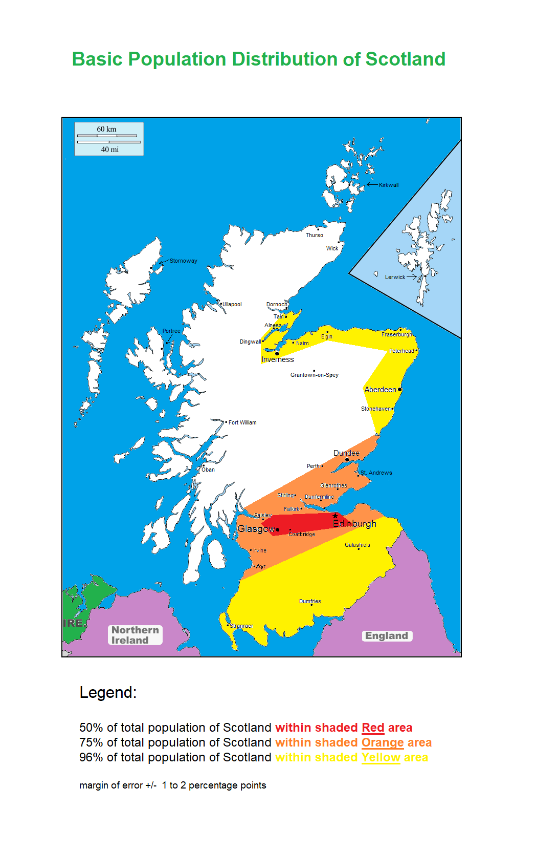
Basic Population Distribution of Scotland.png - QuakerIlK

Fife coastal path map.jpg - Arcaist

Scottish council areas and national parks.jpg - Tsanders5555

Welcome to Scotland's seas.png - Kroger4

Mapping a group pool, revisited (4382146079).png - Eyes Roger

Sgùrr nan Ceathreamhnan.png - Sledbird

2018-01-01-00 00 2018-01-01-23 59 CORINE Land Cover Corine Land Cover (22).jpg - Sentinel user

British and Irish Isles after Scottish independence.png - Sbb1413

WallsAdrian.jpg - ValeriaKholzakova

Scotland (0 Shetland) council areas.png - Ulamm

Scotland (core) council areas.png - Ulamm

Highland PICT Map.jpg - TMallinson

EMRS Map.png - TMallinson

Brochs from Canmore (all).png - Optimum Cheese
Brochs from Canmore (excluding possibles).png - Optimum Cheese

Location plan.webp - AH2026

Olvir Rosta article map.png - Brianann MacAmhlaidh
ShintyNorthSouthDistricts.GIF - Sologoal

Rock map of Scotland.jpg - Oxyman