Wikimedi'Òc
Modes d'emploi

Cet album fait partie des albums
Cet album photos contient les sous-albums suivants :


Middlesex Canal (Massachusetts) map, 1801.jpg - Daderot

Braggville 1850-1880, Map of.svg - Simtropolitan
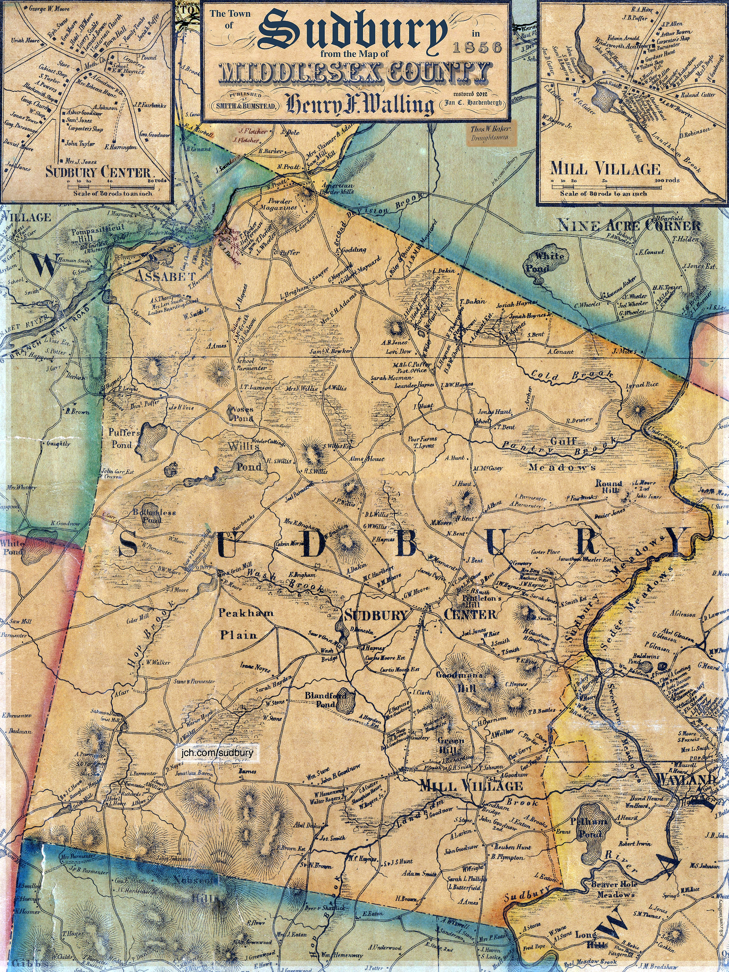
Sudbury in 1856 from Walling's.jpg - Magnolia677

Sudbury Center 1856 from Walling.jpg - Bodysurfinyon

City of Melrose (9472522369).jpg - File Upload Bot (Magnus Manske)

City of Marlborough (9138716834).jpg - File Upload Bot (Magnus Manske)

Map of parts of Middlesex & Essex counties, showing the rail road routes between Salem, Lowell, Boston & Methuen (9136153363).jpg - File Upload Bot (Magnus Manske)

Map of the town of Natick, Middlesex Co. Mass. (3886419537).jpg - File Upload Bot (Magnus Manske)

Reading town of Reading (3855702559).jpg - File Upload Bot (Magnus Manske)
Course of canal to Charlestown Millpond (3856249050).jpg - File Upload Bot (Magnus Manske)

Plan of Framingham Plantation 1699 (3370515494).jpg - File Upload Bot (Magnus Manske)
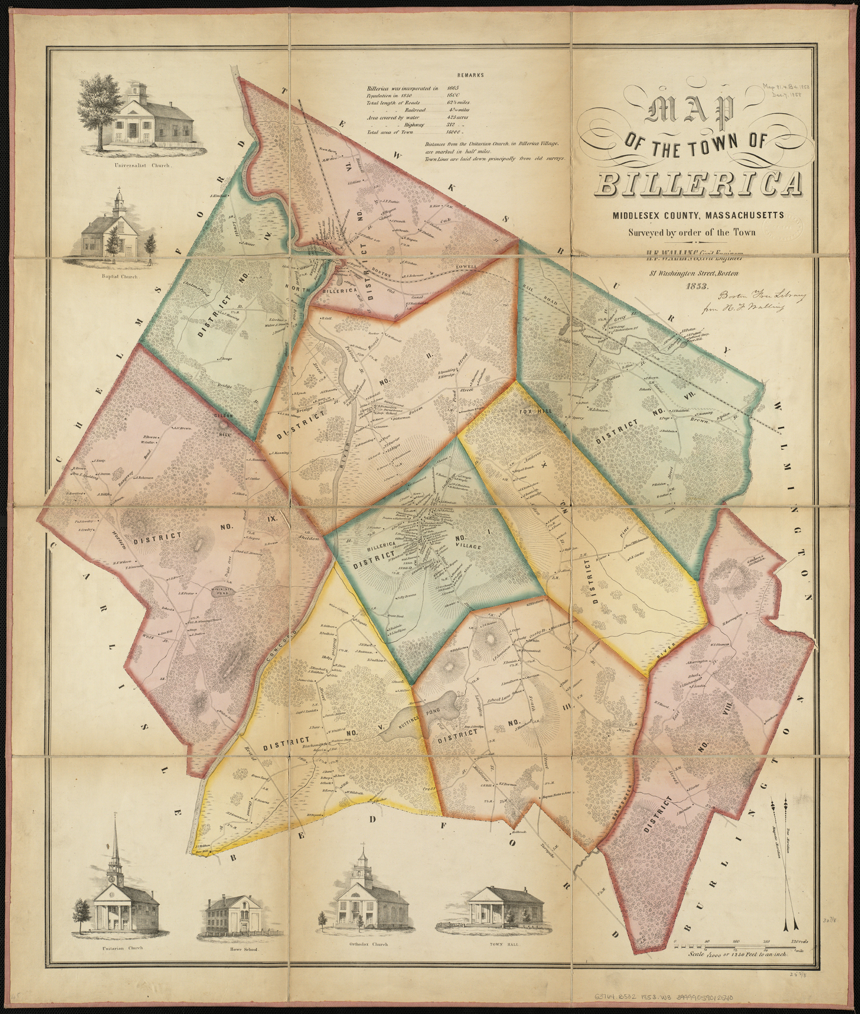
Map of the town of Billerica, Middlesex County, Massachusetts (3370514168).jpg - File Upload Bot (Magnus Manske)

Cliftondale, Saugus and East Saugus, Massachusetts (2675934908).jpg - File Upload Bot (Magnus Manske)

Plan showing proposed method of introducing the water of Mystic Pond into Charlestown (2674374843).jpg - File Upload Bot (Magnus Manske)

Plan of Middlesex County, Massachusetts (2674373783).jpg - File Upload Bot (Magnus Manske)

Map of the water region of the county of Middlesex exhibiting the mode of supplying Boston... (2674178777).jpg - File Upload Bot (Magnus Manske)

Historic fields and mansions of Middlesex (1874) (14784262715).jpg - Broichmore

1896 map of Beaver Brook Reservation (BHL40352840).jpg - Fæ

Cyclists' road map of Massachusetts part 8 (14773163899).jpg - Ser Amantio di Nicolao

Cyclists' road map of Massachusetts part 5 (14773303477).jpg - Ser Amantio di Nicolao

Cyclists' road map of Massachusetts part 7 (14773165910).jpg - Ser Amantio di Nicolao

Cyclists' road map of Massachusetts part 6 (14959488142).jpg - Ser Amantio di Nicolao

55 of 'History of Middlesex County, Massachusetts ... Illustrated' (11276428324).jpg - Artix Kreiger 2

43 of 'History of the town of Marlborough, Middlesex County, Massachusetts, etc' (11239315764).jpg - Artix Kreiger 2

Plan of lands on Sylvan Heights, Newton to be sold by Samuel A. Walker on Saturday, June 28th, 1851 at 4 o'clock p.m. LOC 2012592600.jpg - Fæ

1906 Boston and Northern Street Railway map.png - Pi.1415926535
1845 North Billerica Map (IA 1845NorthBillerica).pdf - Fæ
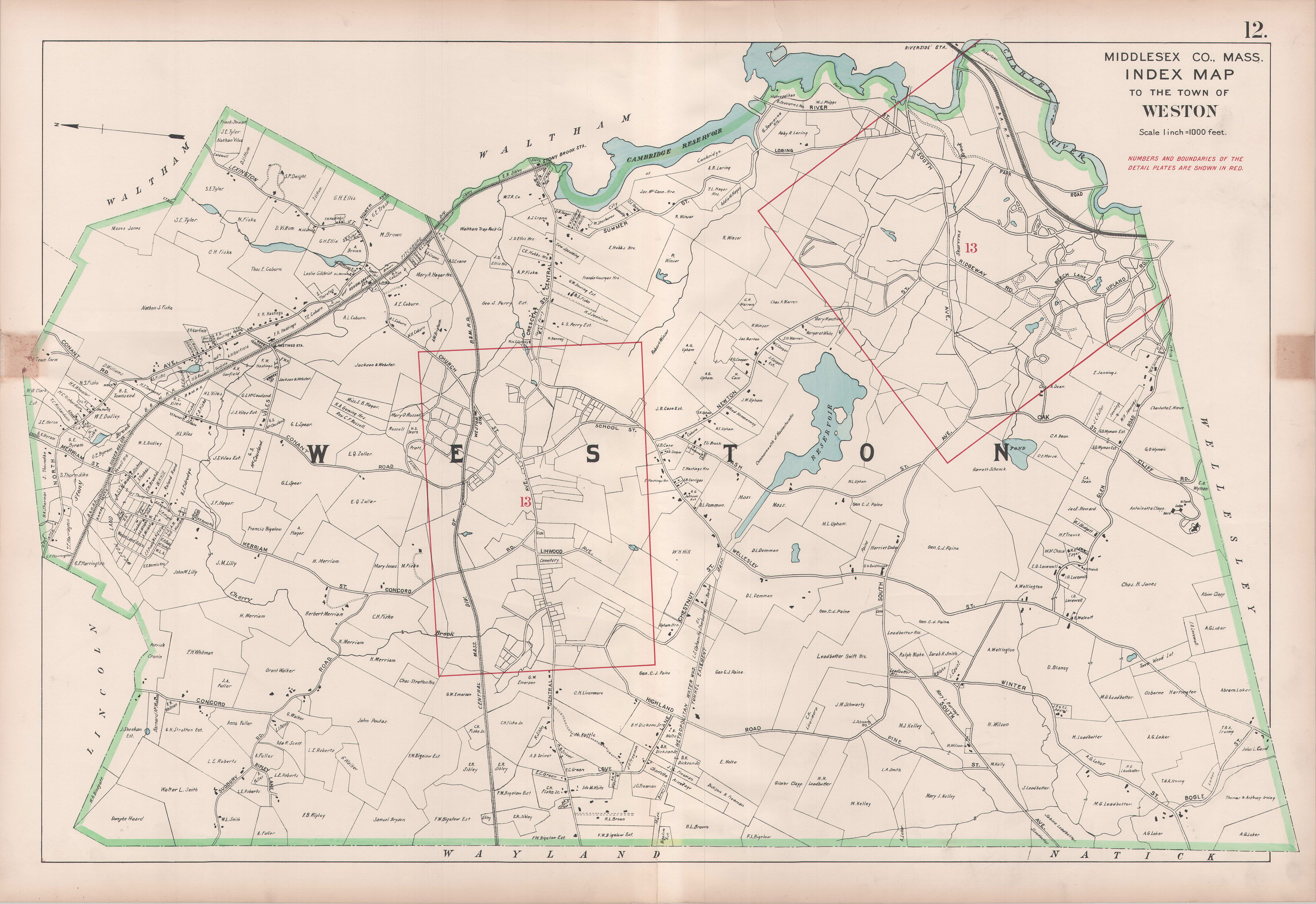
1908 map of Weston, Massachusetts.jpg - Pi.1415926535

1891 (circa) Map showing drives from the Walker-Gordon Laboratory, 203 Claredon St., Boston, to the Laboratory Farm in Wellesley, Massachusetts, by Geo. H. Walker & Co, from the Digital Commonwealth - commonwealth wd376694j.jpg - Daderot

1831 A map of the town of Groton, Middlesex County, Mass, by Caleb Butler, Pendleton's Lithography, from the Digital Commonwealth - commonwealth 1257bd171r.jpg - Daderot

Metropolitan State Hospital, County Sanatorium and Minuteman Golf Club map detail - Topographic maps of Arlington, Belmont, Lexington Massachusetts 1946 (cropped).jpg - Ooligan

Map of the Town of Melrose, Middlesex County, Massachusetts ... - btv1b53102644w.jpg - Gzen92Bot

Plan of Billerica made by John G. Hales, dated 1831 - DPLA - 08c616913bccb8d5a00bf8f8a62e81a1.jpg - DPLA bot
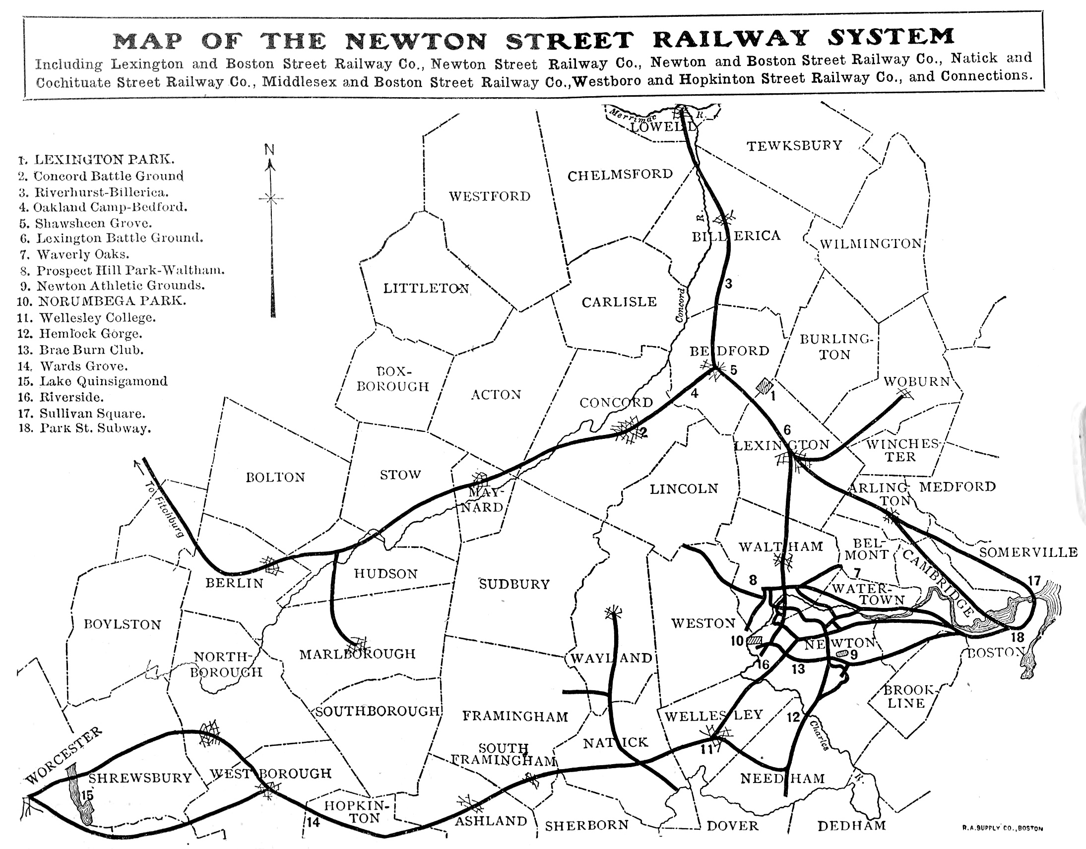
1908 map of Newton Street Railway and connecting lines.jpg - Pi.1415926535

Atlas of Middlesex County, Massachusetts, by Geo. H. Walker & Co., 1889, from the Digital Commonwealth - 6 commonwealth 1j92k2337 image access full.jpg - Enyavar

1848 Map of Essex & part of Middlesex counties, showing the rail road routes between Salem, Lowell, Boston & Lawrence, by Samuel Nott, from the New York Public Library - 232c8f50-5112-0134-813a-00505686a51c.jpg - Daderot