Wikimedi'Òc
Modes d'emploi

Cet album fait partie des albums
Cet album photos contient les sous-albums suivants :


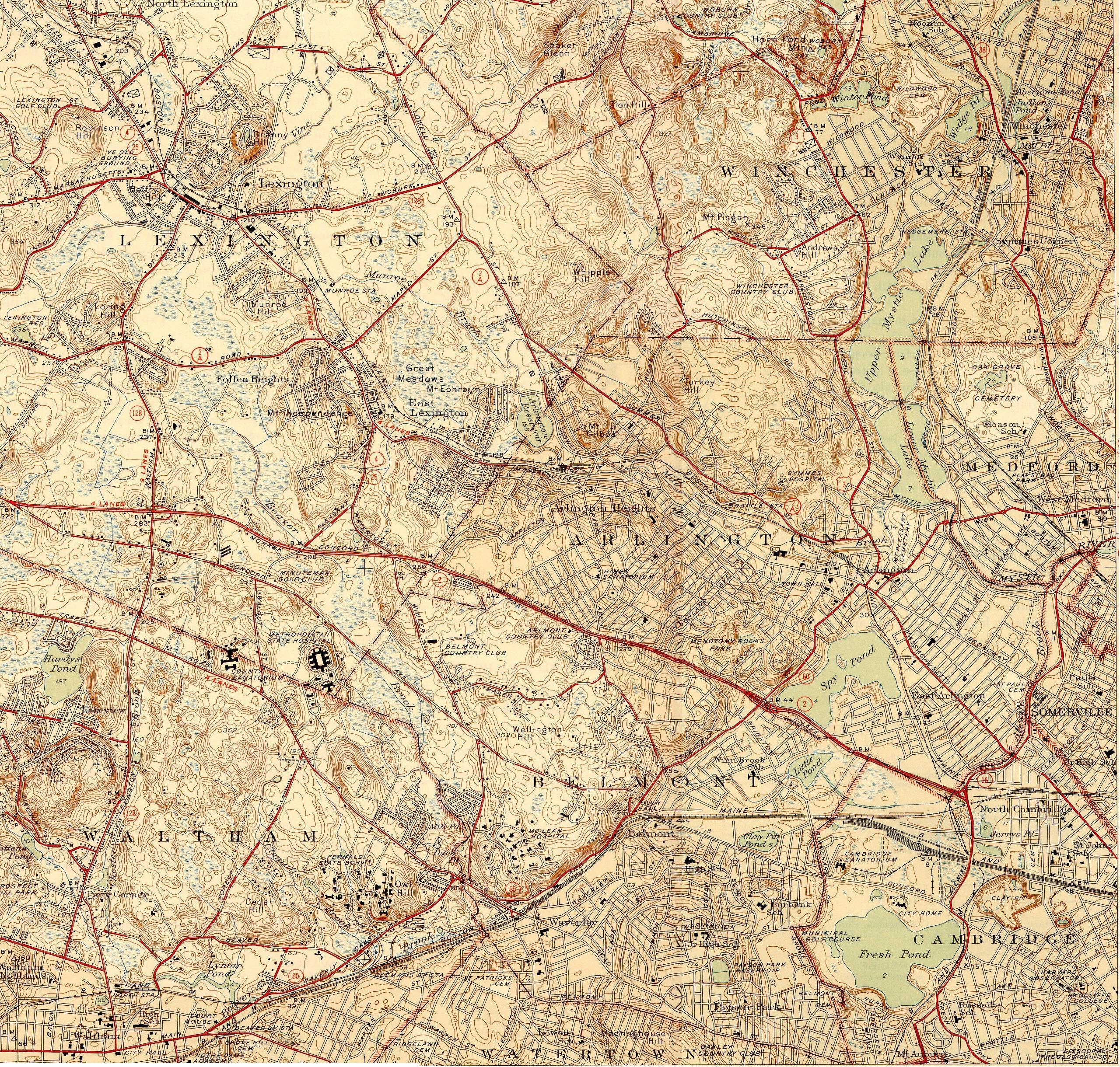
Topographic maps of Arlington, Belmont, Lexington Massachusetts 1946.jpg - Daderot

Henry Bond map of Watertown Massachusetts.gif - MarmadukePercy

1940 Census Enumeration District Maps - Massachusetts - Middlesex County - Belmont - ED 9-51 - ED 9-73 - NARA - 5832399 (page 1).jpg - US National Archives bot

1940 Census Enumeration District Maps - Massachusetts - Middlesex County - Belmont - ED 9-51 - ED 9-73 - NARA - 5832399 (page 2).jpg - US National Archives bot

1950 Census Enumeration District Maps - Massachusetts (MA) - Middlesex County - Belmont - ED 9-90 to 133 - NARA - 12549107.jpg - US National Archives bot

1894 map of Arlington and Belmont, Mass. by Edward A. Jones from Arlington City Directory (IA arlingtoncitydir1894arli) (page 11 crop).jpg - Ooligan

Atlas of Middlesex County, Massachusetts, by Geo. H. Walker & Co., 1889, from the Digital Commonwealth - 48 commonwealth 1j92k2337 image access full.jpg - Enyavar

Atlas of Middlesex County, Massachusetts, by Geo. H. Walker & Co., 1889, from the Digital Commonwealth - 58 commonwealth 1j92k2337 image access full.jpg - Enyavar

Atlas of Middlesex County, Massachusetts, by Geo. H. Walker & Co., 1889, from the Digital Commonwealth - 59 commonwealth 1j92k2337 image access full.jpg - Daderot

Atlas of Middlesex County, Massachusetts, by Geo. H. Walker & Co., 1889, from the Digital Commonwealth - 60 commonwealth 1j92k2337 image access full.jpg - Daderot

1871 Map of Somerville, Arlington & Belmont, engraved for the Somerville, Arlington & Belmont directory, by Mason & Elliot, from the New York Public Library - fd3862f0-6c76-0134-da11-00505686a51c.jpg - Daderot