Wikimedi'Òc
Modes d'emploi

Cet album fait partie des albums
Cet album photos contient les sous-albums suivants :


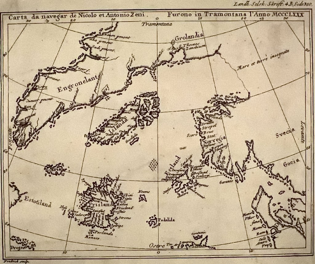
Map by nicolo zeno 1558.jpg - Hohum

U234 map de.png - Fook~commonswiki

U234 map clean.png - Fook~commonswiki

Atlantic Bridge locator.PNG - Roke~commonswiki
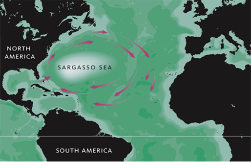
Sargasso.png - Pasixxxx
NC aircraft trans-Atlantic flight, 1919.jpg - Infrogmation

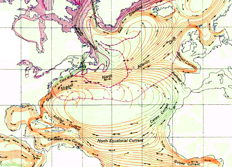
Nordatlantiska strömmar, Nordisk familjebok.png - Lokal Profil

Nordatlantik hafen.jpg - Martas011

UK shipping forecast zones.png - Emoscopes
OmegaNasaLiberiaNorwayDakotaglobe.png - RosarioVanTulpe~commonswiki

Labrador sea map with state labels.png - Kmusser
North Atlantic Gyre.png - Jrockley

EdwardWright-MapforSailingtoAzores-1599.jpg - Jacklee

Etaf-routes-1964.jpg - Bwmoll3

Isnet93.png - Snævar

Dectra Atlantic.jpg - Bin im Garten

Rear map.jpg - Belg4mit
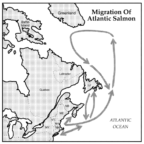
Ocean migration of Altantic salmon.gif - Epipelagic

N-Atlantic-grav.png - File Upload Bot (Magnus Manske)

Carte reduite de la mer du nord Zusammengezogene Karte des Nordmeeres Bellin 1772.jpg - Kallewirsch

Two-Maps Trail.png - Portolanero

Columbus 1492-IF.png - Portolanero

APN2002-figure110.png - Reb40
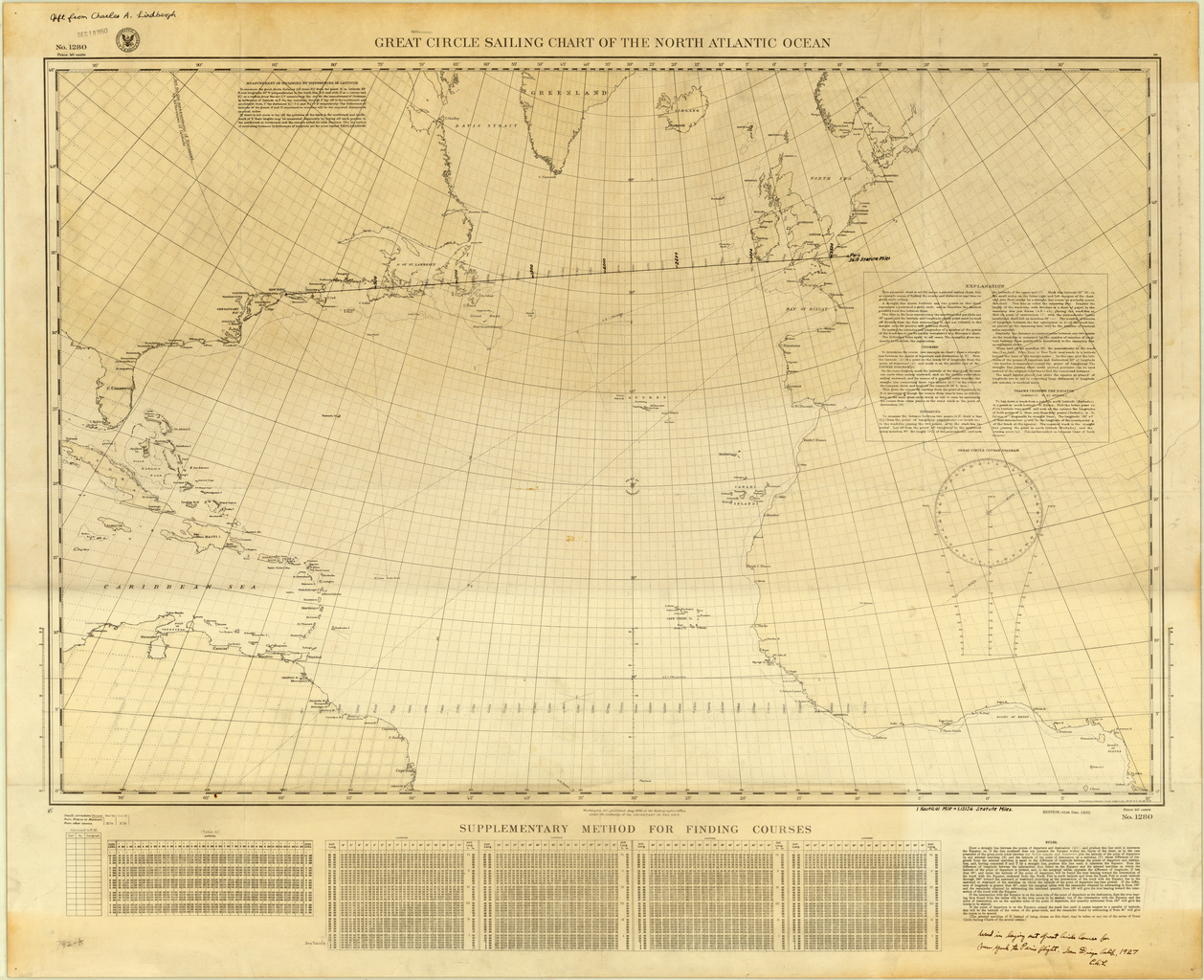
Great Circle Sailing Chart of the North Atlantic Ocean.png - SarahStierch

Atlantic puffin range2.jpg - Cwmhiraeth

Atlantic puffin range4.jpg - Cwmhiraeth

A new generall chart for the West Indies of E. Wrights projection vul. Mercators chart (9495451052).jpg - File Upload Bot (Magnus Manske)

Remarques sur la navigation de terre-neuve à New-York afin deviter les courrants et les bas-fonds au sud de Nantuckett et du Banc de George ... (8642335579).jpg - File Upload Bot (Magnus Manske)

A new chart of the Atlantic or Western Ocean (8345826935).jpg - File Upload Bot (Magnus Manske)

Remarques sur la navigation de terre-neuve à New-York afin deviter les courrants et les bas-fonds au sud de Nantuckett et du Banc de George ... (8249585309).jpg - File Upload Bot (Magnus Manske)
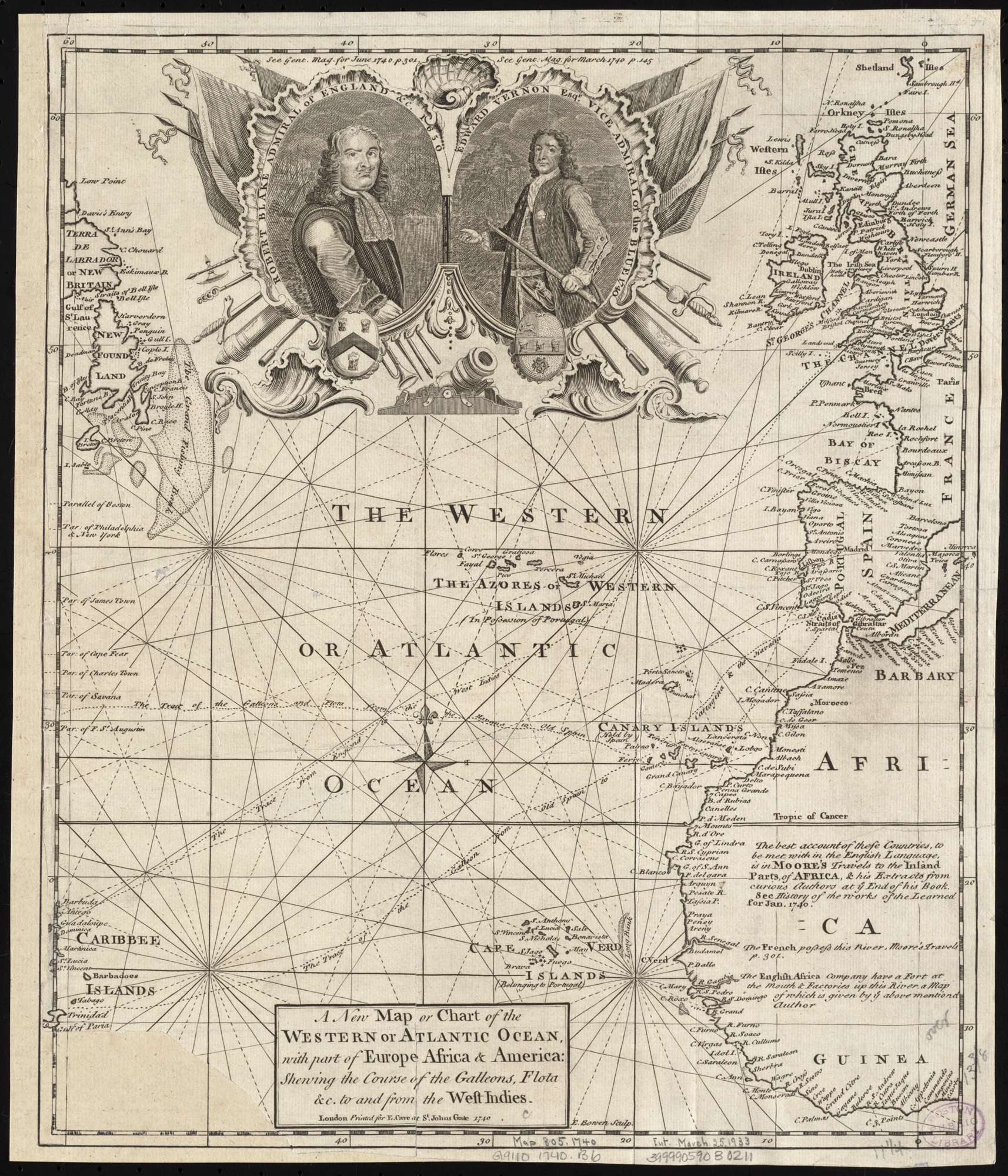
A new map or chart of the Western or Atlantic Ocean, with part of Europe Africa & America, showing the course of galleons, flota &c. to and from the West Indies (8249491781).jpg - File Upload Bot (Magnus Manske)

General chart, of the North Atlantic, or Western Ocean, from the equator to 62° north latitude, according to the latest, surveys and observations (7537852226).jpg - File Upload Bot (Magnus Manske)

Mar del nort (5961371400).jpg - File Upload Bot (Magnus Manske)

A new map or chart in Mercators projection, of the Western or Atlantic Ocean, with part of Europe, Africa and America (5960812477).jpg - File Upload Bot (Magnus Manske)

North Atlantic Ocean, southeast coast of North America, including the Bahamas and Greater Antilles (2674797097).jpg - File Upload Bot (Magnus Manske)

Hydrological map of the Atlantic Ocean, extending from the southernmost part of North America to Europe (2674723037).jpg - File Upload Bot (Magnus Manske)

2013-12-12 48h North Atlantic surface forecast.gif - Matthiasb

2013-12-22-05-32-UTC 48h North Atlantic surface forecast.gif - Matthiasb
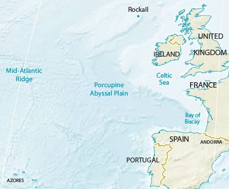
Porcupine Abyssal Plain.jpg - Micromesistius

1935 base rev2.png - GifTagger

Atlantic hurricane graphic.png - GifTagger

Equimap2.jpg - Nicoliemaria
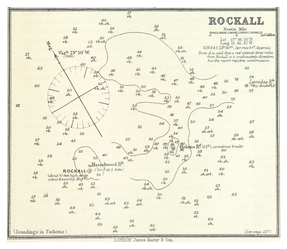
IMRAY(1884) p0231 ROCKALL.jpg - Metilsteiner

Mohn Contour map of the North Ocean.jpg - Dreizung

Rider's Bermuda; a guide book for travelers, with 4 maps (1922) (14598265200).jpg - SteinsplitterBot

The algae-vegetation of the Faeröese coasts, with remarks on the phyto-geography (1905) (17762206310).jpg - Fæ
Atl south well.jpg - Innotata

North-AtlanticOG.jpg - Innotata

FMIB 49941 Section of the Atlantic Ocean from Paris to Newfoundland.jpeg - BMacZeroBot

FMIB 36746 Gulf-Stream - Trajet de ce courant a travers les Petites Antilles, la Mer des Caraibes, le Detroit du Yucatan, la Golfe du.jpeg - BMacZeroBot

FMIB 37448 Meridiens et Paralleles de l'ocean Atlantique septentrional sur und carte marine.jpeg - BMacZeroBot

FMIB 37459 Meridiens et Paralleles de l'ocean Atlantic septentrional sur une Mappemonde.jpeg - BMacZeroBot

Bell telephone magazine (1922) (14753105761).jpg - Fæ

1650 Johannes Janssonius map Iceland Bus Enchuyser Island.JPG - Kallewirsch

Bulletin de l'Acadmie impriale des sciences de St.-Ptersbourg (20422276532).jpg - Fæ

The magazine of American history with notes and queries (1877) (14766718462).jpg - SteinsplitterBot

Ridpath's history of the world - being an account of the principal events in the career of the human race from the beginnings of civilization to the present time - comprising the development of social (14594213748).jpg - Fæ

Mid northern atlantik.PNG - Pfeiffer3f

Mid northern atlantik ann.png - Pfeiffer3f

The Bell System technical journal (1922) (14752797601).jpg - SteinsplitterBot

The Bell System technical journal (1922) (14753547484).jpg - SteinsplitterBot

The Bell System technical journal (1922) (14775734853).jpg - SteinsplitterBot
Visualize historical hurricane tracks.tiff - Caballero1967

Pascaerte van Groen-landt,Yslandt, Straet Davids en Ian Mayen eylandt hoemen de selvige van Hitlandt en de Noortcusten van Schotlandt en Yrlandt beseylen mach (NYPL b13908778-1619049).jpg - Fæ

Southwestern Approaches image location map.jpg - Zaher.Kadour
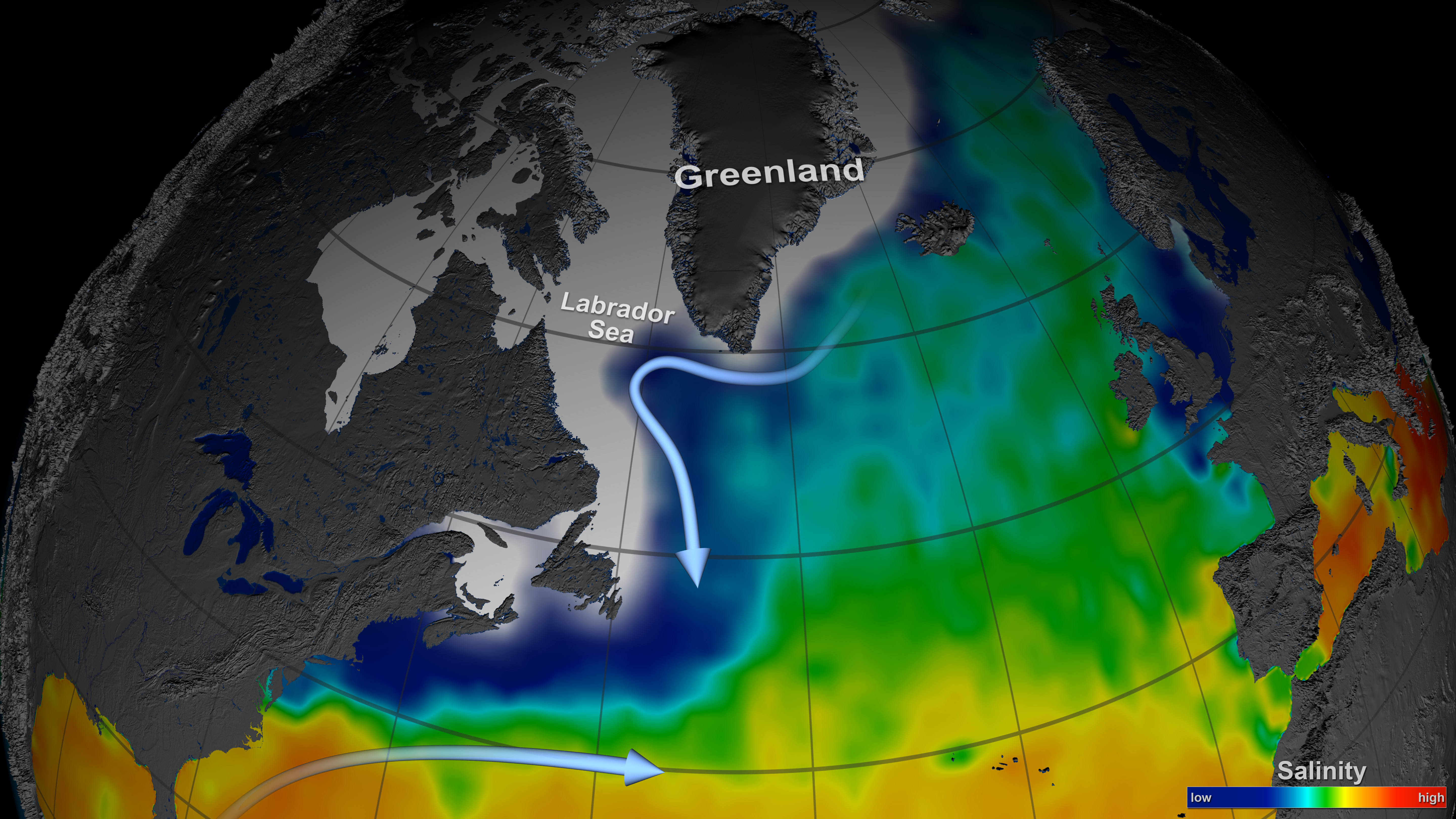
NASA's Aquarius Sees Salty Shifts (8512915213).jpg - Vanished Account Byeznhpyxeuztibuo

Heimkynni hafdiska.png - Pálmi Snær
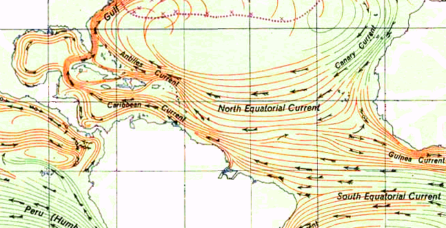
Caribbean current.png - Che12Guevara
2017AtlanticHurricaneTrackingChart.png - Thegreatdr
North Atlantic Ocean. Chart shewing deep sea soundings and the tracks of the telegraph cables laid between Europe and America by the Telegraph Construction and Maintenance Company in 1865, 1866, 1869. With sections of the RMG F0489.tiff - Fæ

Atlantic Oceanic Control.gif - L'amateur d'aéroplanes
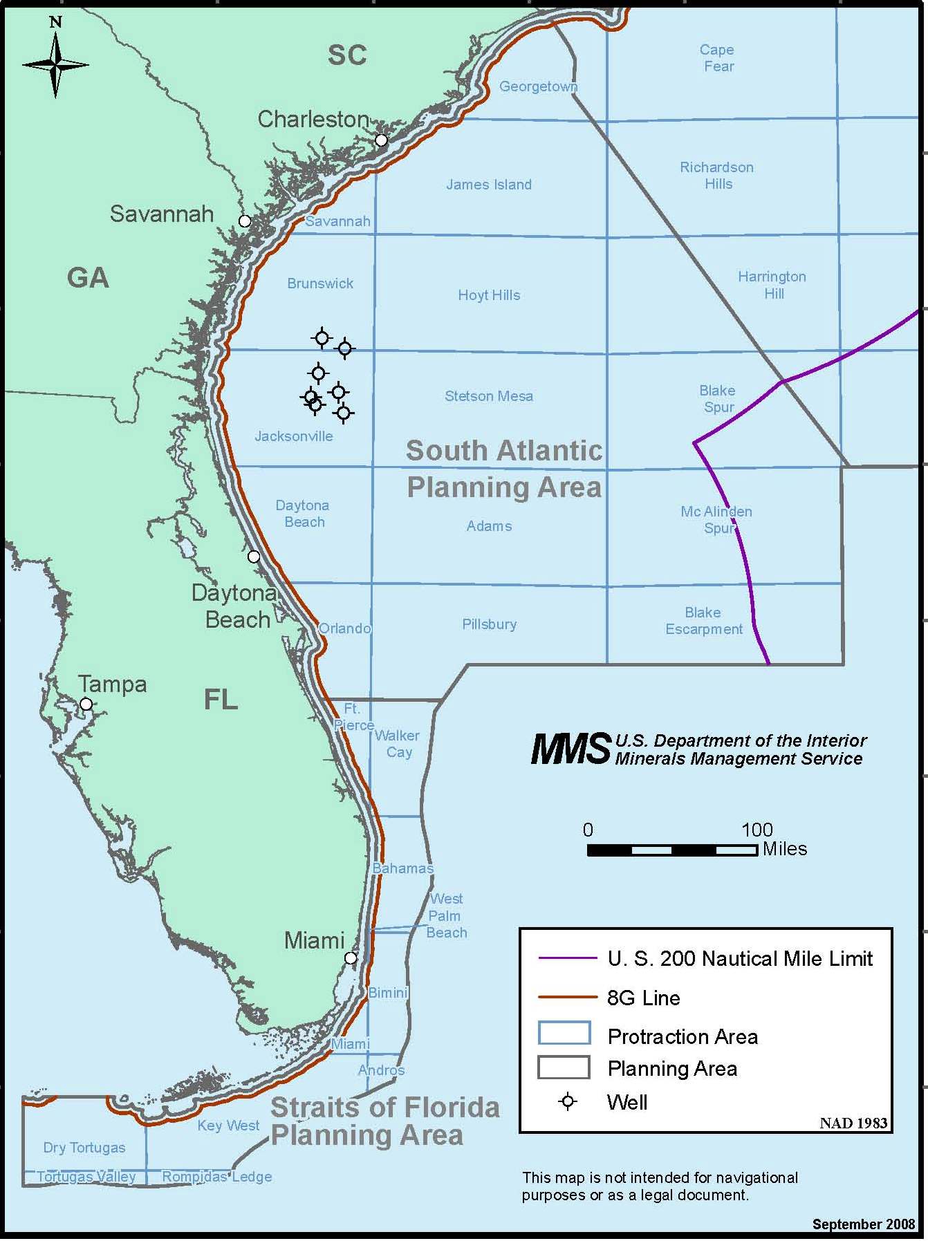
PropVAOffshoreLeaseSale.jpg - FSock

Golf-áramlat.jpg - Capucettorosso

456 of '(Our Earth and its Story- a popular treatise on physical geography. Edited by R. Brown. With ... coloured plates and maps, etc.)' (11223408994).jpg - Artix Kreiger 2

701 of '(The Great Ice Age and its relation to the antiquity of man.)' (11120331215).jpg - Artix Kreiger 2

1036 of 'La Terra, trattato popolare di geografia universale per G. Marinelli ed altri scienziati italiani, etc. (With illustrations and maps.)' (11246892456).jpg - FlickreviewR 2

267 of 'The British Empire- its geography, resources, commerce, land-ways and water-ways' (11120568343).jpg - Artix Kreiger 2

208 of '(Physiography- an introduction to the study of nature ... With illustrations and coloured plates.)' (11267992386).jpg - Artix Kreiger 2

540 of 'The Earth and its Inhabitants. The European section of the Universal Geography by E. Reclus. Edited by E. G. Ravenstein. Illustrated by ... engravings and maps' (11126292044).jpg - Artix Kreiger 2

541 of 'The Earth and its Inhabitants. The European section of the Universal Geography by E. Reclus. Edited by E. G. Ravenstein. Illustrated by ... engravings and maps' (11124715203).jpg - Artix Kreiger 2

23 of 'The Earth and its Inhabitants. The European section of the Universal Geography by E. Reclus. Edited by E. G. Ravenstein. Illustrated by ... engravings and maps' (11127605604).jpg - Artix Kreiger 2

24 of 'The Earth and its Inhabitants. The European section of the Universal Geography by E. Reclus. Edited by E. G. Ravenstein. Illustrated by ... engravings and maps' (11126810984).jpg - Artix Kreiger 2
Plan of Mr. Fitch's steam boat Annual passage of the herrings. LCCN2004671567.tif - Fæ

Arran's Greenock-St George's Bay route 1868.png - Fortuna imperatrix mundi

Der Atlantische Ocean.jpg - Higgenhorscht
Admiralty Routeing Chart 5124(4) North Atlantic Ocean April, Published 1964.jpg - Kognos

Admiralty Routeing Chart 5124(5) North Atlantic Ocean May, Published 1964.jpg - Kognos

Admiralty Routeing Chart 5124(11) North Atlantic Ocean November, Published 1963.jpg - Kognos

Admiralty Routeing Chart 5124(9) North Atlantic Ocean September, Published 1962.jpg - Kognos

Admiralty Routeing Chart 5124(6) North Atlantic Ocean June, Published 1963.jpg - Kognos

Admiralty Routeing Chart 5124(7) North Atlantic Ocean July, Published 1963.jpg - Kognos

Admiralty Routeing Chart 5124(8) North Atlantic Ocean August, Published 1963.jpg - Kognos

Latitudinal Compression of Surface Temperatures - NARA - 7384901.jpg - US National Archives bot

Labrador sea map.png - Myrhonon

Atlantic puffin range.svg - Edoarado

VoltaDoMar.jpg - Redgeographics

Vendée-Arctique-Les Sables-d'Olonne parcours.png - Jug81

Acadian deportation map.jpg - Maestrobistro

Atlantic hurricane graphic-it.gif - Fernandopescia

Diversity in the Ecological Soup (422234138).png - Eyes Roger

Oceano Atlántico no Boke of Idrography de Jean Rotz (1542).jpg - One2

North Atlantic Area Map.jpg - Zoozaz1

Admiralty Routeing Chart 5124(10) North Atlantic Ocean October, Published 1968.jpg - Kognos

Shanwick Map.PNG - Rab-k

Viking settlements in North America.png - HistoryMaker18

Carta náutica de Manoel Ferreira (c. 1760).jpg - One2

1771 Hydrographical map of the Atlantic Ocean, extending from the southermost part of North America to Europe, by William Gerard de Brahm and Peter Andrews, from the Digital Commonwealth - commonwealth 3f462v57w.jpg - Daderot

Der Atlantische Ocean, 1835.jpg - Universalis

Trasa rejsu Chatki Puchatków przez Atlantyk.png - Bingola

Admiralty Routeing Chart 5124(12) North Atlantic Ocean December, Published 1969.jpg - Kognos

Admiralty Chart No 2058A North Atlantic, Published 1937.jpg - Kognos

Air Canada 1970.jpg - Universalis

Carte réduite de l'Océan Occidental comprenant les Côtes d'Europe et d'Afrique depuis le 52 Degré de Latitude Septent(riona)le jusqu'à l'Equateur et les Cotes d'Amérique opposées - Dressée au Depôt des... - btv1b59732785.jpg - Gzen92Bot

A map of the king of Great Britain's dominions in Europe, Africa and America.jpg - Universalis

Great Circle Sailing Chart of the North Atlantic annotated by Lindbergh.jpg - Indefatigable2
R-Ttransform fault pt.2.JPG - Siyajkak

Admiralty Chart No 2058b North Atlantic Route Chart, Published 1945.jpg - Kognos

Admiralty Chart No 5375 North Atlantic Ocean Magnetic Variation 1970 and Annual Rates of Change, Published 1970.jpg - Kognos

Admiralty Chart No 2058c North Atlantic Route Chart, Published 1945.jpg - Kognos

Great Atlantic Sargassum Belt.webp - PalauanLibertarian

Great Atlantic Sargassum Belt.jpg - Hohum

Lidl Map.svg - MapNerd777
NATO 1955.jpg - Babelia

North Atlatic Ocean IHO.png - Episcophagus

Discovery of North America.jpg - Universalis
Jgrc22985-fig-0001-m.jpg - Notobiogeochemclass

Admiralty Chart No 4011 North Atlantic Eastern Portion, Published 1965.jpg - Kognos

Stevenson 1911 atlasofportolanc00magg 0028 XVI Atlantic.jpg - Kognos

Admiralty Chart No 2060 North Atlantic Ocean, Eastern Part, Published 1851.jpg - Kognos

Admiralty Chart No 5095 Gnomonic Chart of the North Atlantic, Published 1914.jpg - Kognos

Admiralty Chart No 5095a Gnomonic Chart of the North Atlantic, Published 1937.jpg - Kognos

North Atlantic Ocean, 1882.jpg - Babelia

540+541 of 'The Earth and its Inhabitants. The European section of the Universal Geography by E. Reclus. Edited by E. G. Ravenstein. Illustrated by ... engravings and maps'.jpg - Babelia

Karte des Atlantischen Oceans.jpg - Babelia

North Atlantic Ocean, 1893.jpg - Babelia