Wikimedi'Òc
Modes d'emploi

Cet album fait partie des albums
Cet album photos contient les sous-albums suivants :


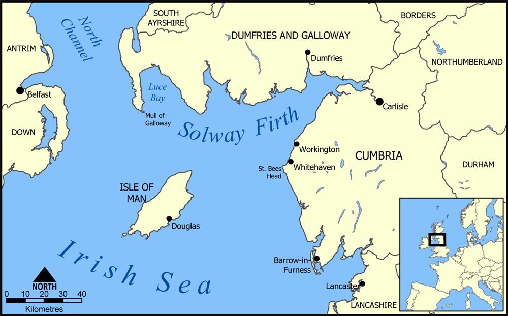
Solway Firth map.png - NormanEinstein

Locatie Ierse Zee.PNG - Michiel1972
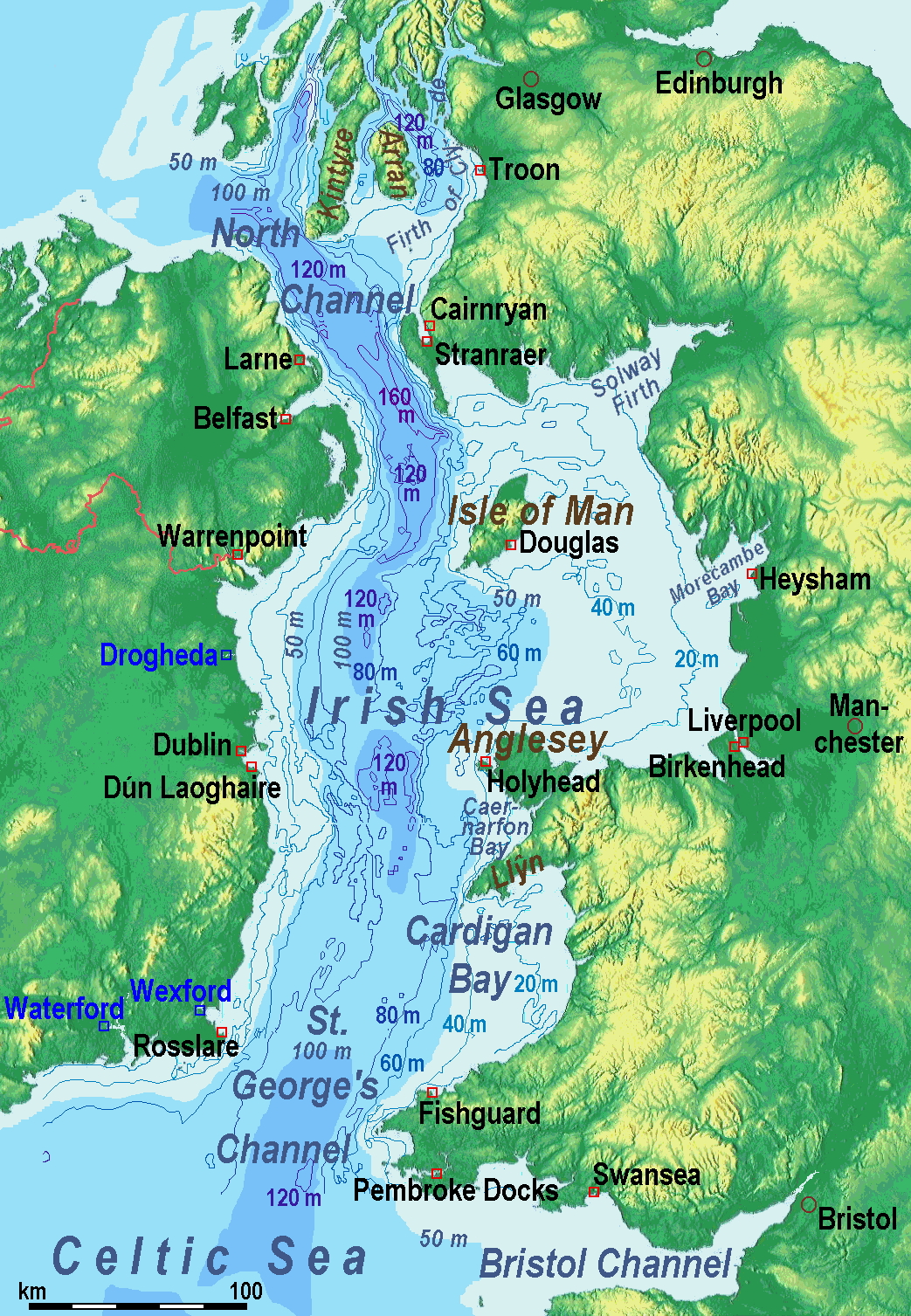
IrishSeaReliefMap.jpg - Ulamm

Nord Ostsee Hafen.jpg - Martas011
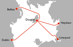
Steam packet route map.png - Joe200576

Steam packet route map.svg - Trex2001

North Channel.png - Hogweard

PSM V83 D344 Map of the irish sea.png - Ineuw

IrishSeaReliefMap hr.jpg - MaGa

IrishSeaReliefmap.png - Ulamm
Irish Sea – relief, ports, limits.tif - Ulamm

Isle of Man Brit Isles Sect 3.svg - Visitor from Wikishire

FMIB 36858 Marees de la Manche et de la Mer du Nord Indication des lignes cotidales (Amphidromie).jpeg - BMacZeroBot

FMIB 36895 Marees de la Mer d'Irlande Indication des Libnes Cotidales.jpeg - BMacZeroBot

FMIB 43875 Height of the Tides in St George's Channel.jpeg - BMacZeroBot

9 of 'The Navigation of the Irish Sea ... with a guide to the navigation of the port of Liverpool, and chart of Liverpool Bay' (11237856673).jpg - Artix Kreiger 2

202 of '(Black's Guide to the Isle of Man.)' (11234284593).jpg - Artix Kreiger 2

Admiralty Chart No 1825a The Irish Sea, Published 1925.jpg - Kognos

Admiralty Chart No 1824a East Coast of Ireland, Published 1886.jpg - Kognos

British Channel Bay of Biscay Chart 1780.jpg - Kognos

Location Irish Sea.png - Myrhonon

Admiralty Chart No 1825b Irish Sea Sheet II, Published 1868.jpg - Kognos

A Correct Chart of the Irish Sea & C. exhibiting a view of the several Islands & Bays touch'd at by M. Thurot, in his Attempt upon Ireland (BM 1871,1209.103).jpg - Copyfraud

Admiralty Chart No 1411 Braich-y-Pwll to Clogher Head, Published 1954.jpg - Kognos

Admiralty Chart No 1826 Burrow Head to Liverpool, Published 1953.jpg - Kognos

Admiralty Chart Catalogue 1967 Page 019 Index B2.jpg - Kognos

A general chart of Saint George's Channel... - btv1b530105978 (1 of 7).jpg - Gzen92Bot

A new and correct mapp of St Georges Channell... - btv1b53010410f (1 of 2).jpg - Gzen92Bot

A chart of the Irish sea... - btv1b53010627r.jpg - Gzen92Bot

A new hydrographical survey of the North and Saint George's Channels... - btv1b53010686s (1 of 2).jpg - Gzen92Bot

A chart of the West and South-West coast of Ireland, from the mouth of the river Shannon to Waterford haven - btv1b53010997s (1 of 2).jpg - Gzen92Bot

The Province of Leinster Divided into its Counties wherein are distinguished all the Borroughs &c. - By H. Moll Geographer - btv1b530569130.jpg - Gzen92Bot

A new and original survey of the North and St George's channels... - btv1b53010440p (1 of 2).jpg - Gzen92Bot

Irish Sea location map.svg - Dr Greg