Wikimedi'Òc
Modes d'emploi

Cet album fait partie des albums
Cet album photos contient les sous-albums suivants :


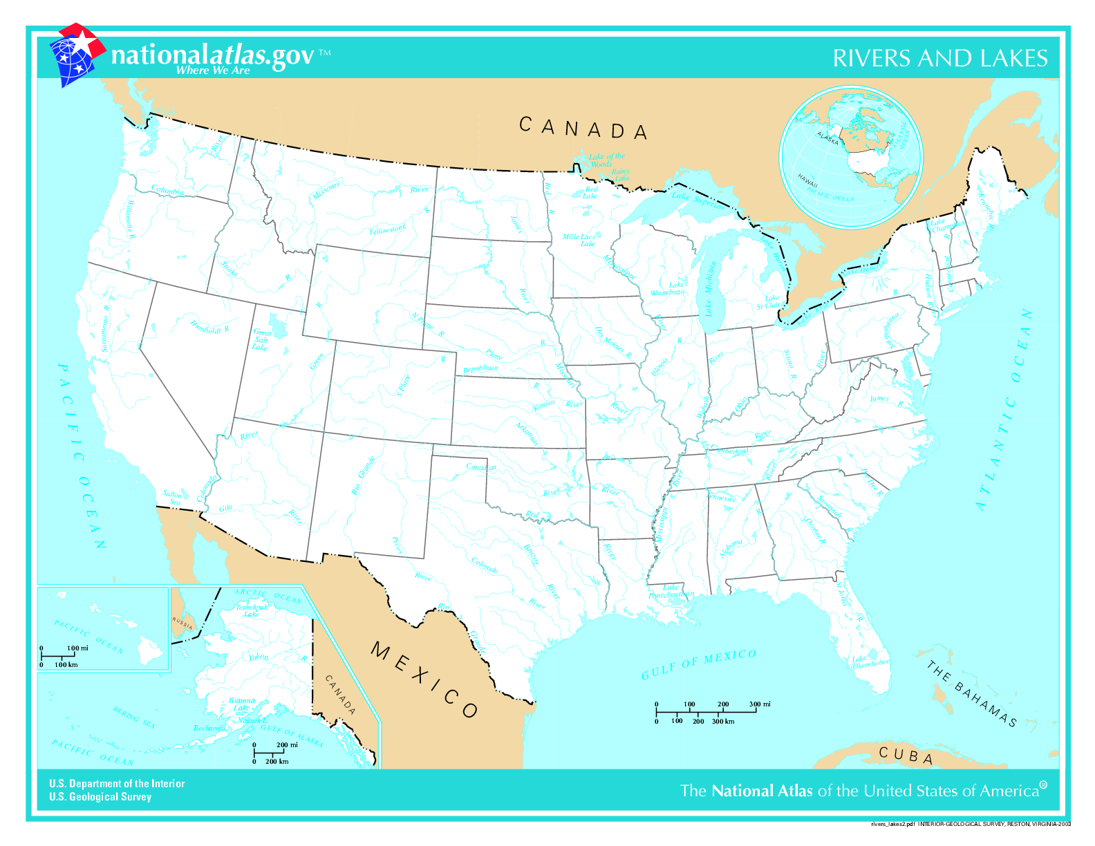
US map - rivers and lakes.png - Duesentrieb
Mississippi River basin.jpg - Avenue

French River (Massachusetts + Connecticut) map.jpg - Daderot
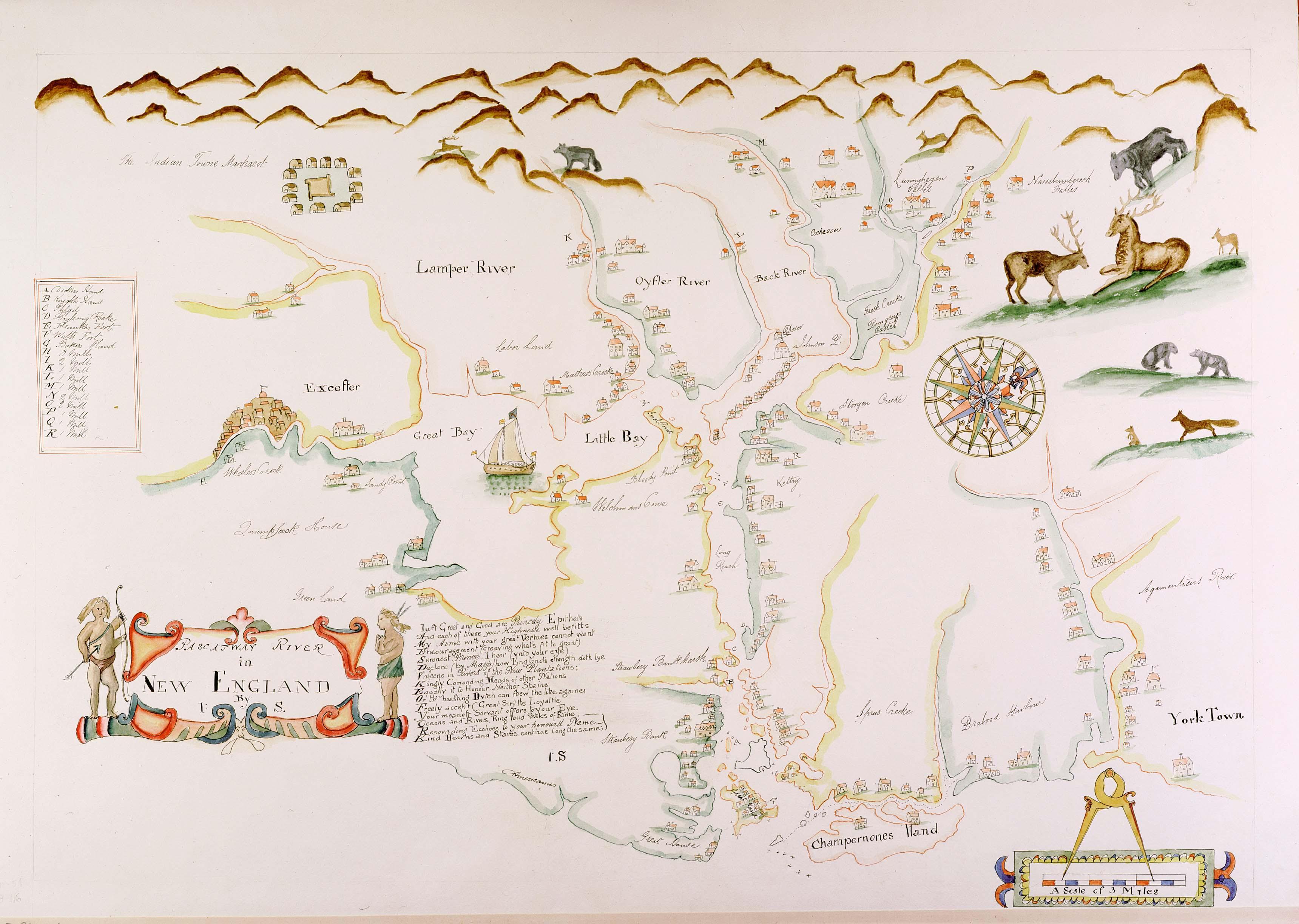
Pascatway River New England.jpg - Justass
Wpdms nasa topo white river south dakota.jpg - File Upload Bot (Magnus Manske)

Arkansasbasincimarron.jpg - Shannon1
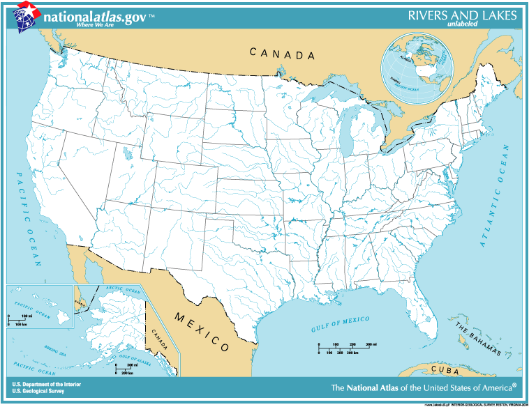
National-atlas-usa-rivers-unlabeled.png - File Upload Bot (Magnus Manske)

Longest Rivers of the US with labels.jpg - Shannon1

Longest Rivers of the US with labels fixed again 2.jpg - Shannon1

Map of Major Rivers in US.png - Luketime~commonswiki

American Heritage Rivers Map.PNG - Dermoid
Refernces to the accompanying map.; Index to maps in Hudson River Valley Atlas. NYPL1691423.tiff - Fæ

The American midland naturalist (1909) (17969100270).jpg - Ruff tuff cream puff

Report of the exploring expedition to the Rocky Mountains in the year 1842, and to Oregon and north California in the years 1843-44 (1845) (14783340742).jpg - Faebot

History of the conspiracy of Pontiac, and the war of the North American tribes against the English colonies after the conquest of Canada (1851) (14759859956).jpg - Fæ
History of transportation in the United States before 1860 (1917) (14757943321).jpg - Faebot

Report of the exploring expedition to the Rocky Mountains in the year 1842, and to Oregon and North California in the years 1843-'44 BHL32560031.jpg - Fæ
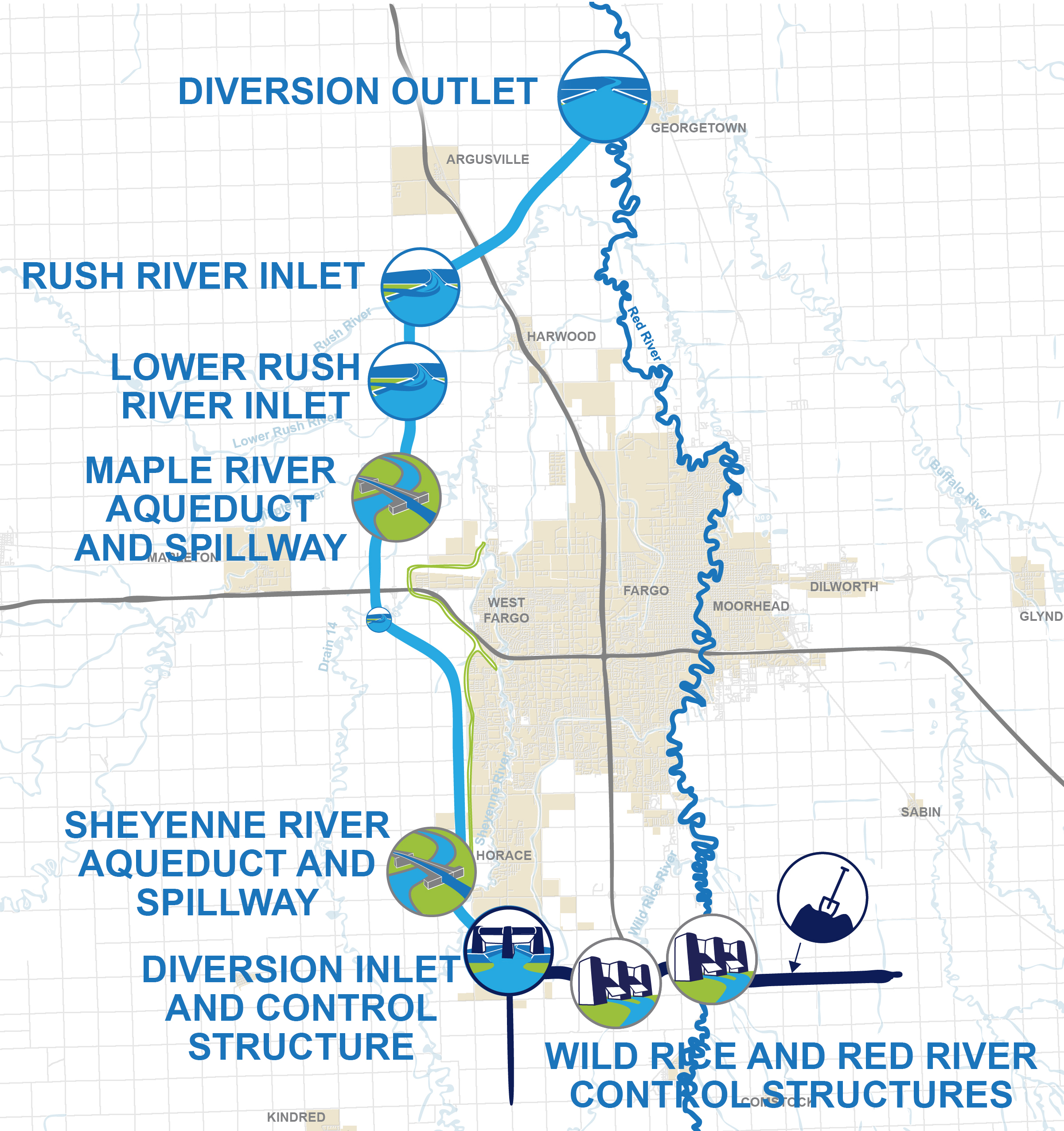
Map of the FM Area Diversion Project.jpg - Tammyjoanderson.taft

1867 Beers Map of Yonkers - Tibbetts Brook 03.jpg - Tdorante10
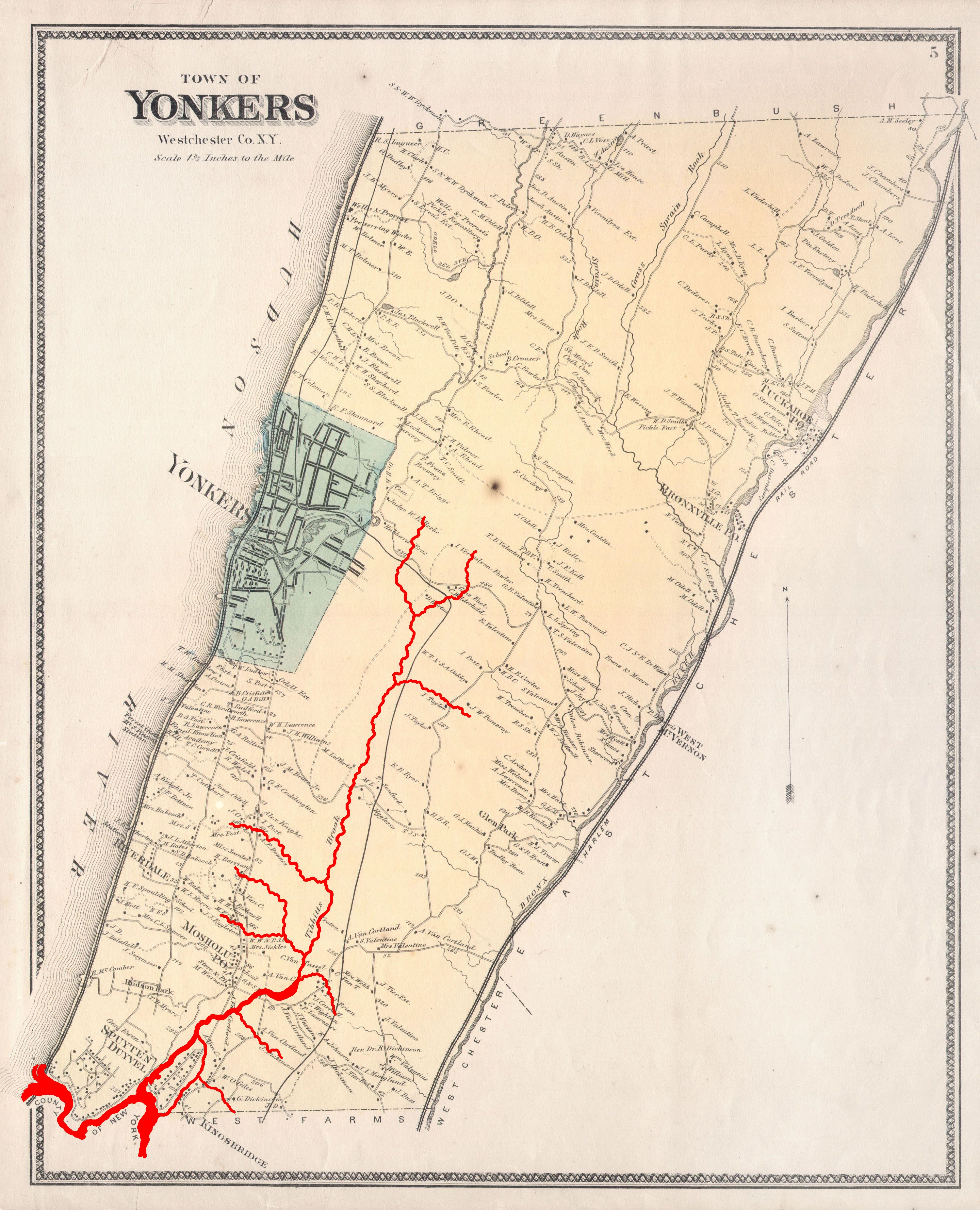
1867 Beers Map of Yonkers - Tibbetts Brook 01.jpg - Tdorante10

1867 Beers Map of Yonkers - Tibbetts Brook 02.jpg - Tdorante10

104 of 'The Earth and its Inhabitants. The European section of the Universal Geography by E. Reclus. Edited by E. G. Ravenstein. Illustrated by ... engravings and maps' (11122721025).jpg - LlywelynII
A map of the sources of the Chaudière, Penobscot, and Kennebec rivers, LOC 74692578.tif - Fæ

1873 Beers Map of Flushing and College Point, Queens, New York - Geographicus - Kissena Creek & Central RR 2A.jpg - Tdorante10
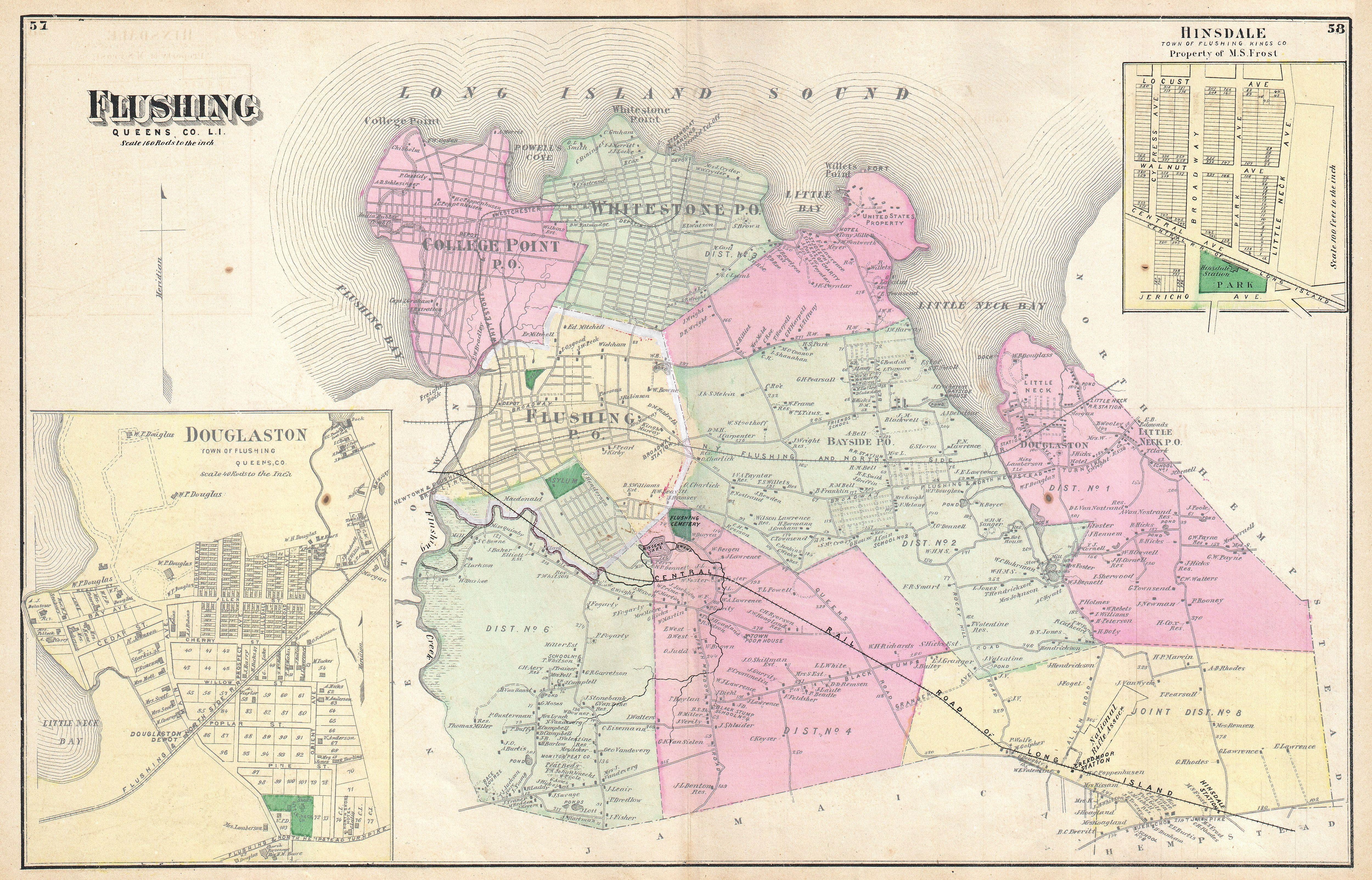
1873 Beers Map of Flushing and College Point, Queens, New York - Geographicus - Kissena Creek & Central RR 1.jpg - Tdorante10

1873 Beers Map of Flushing and College Point, Queens, New York - Geographicus - Kissena Creek & Central RR 2.jpg - Tdorante10

HUC Regions Map - NHDPlusHRStatus.png - Remitamine

Alabama-Coosa Branch of Mobile River System - NARA - 109182421.jpg - US National Archives bot

Alabama-Coosa Branch of Mobile River System - NARA - 109182423.jpg - US National Archives bot

Alabama-Coosa Branch of Mobile River System - NARA - 109182427.jpg - US National Archives bot

Alabama-Coosa Branch of Mobile River System - NARA - 109182429.jpg - US National Archives bot

Maps and Plates from Journal of a Tour into the Territory Northwest of the Allegheny Mountains - DPLA - e24fcb3aad6c08a4b5a770883a1fc4a6 (page 1).jpg - DPLA bot

Inland navigation system.png - Illegitimate Barrister