Wikimedi'Òc
Modes d'emploi

Cet album fait partie des albums
Cet album photos contient les sous-albums suivants :


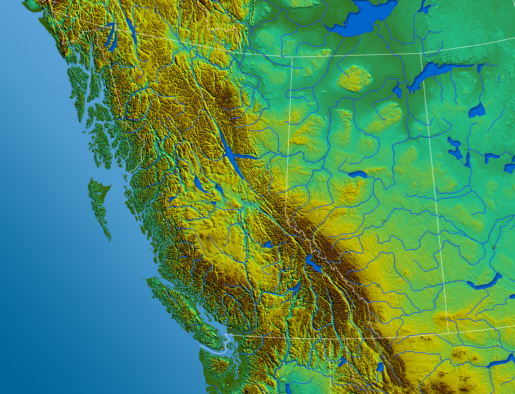
South-West Canada.jpg - Qyd
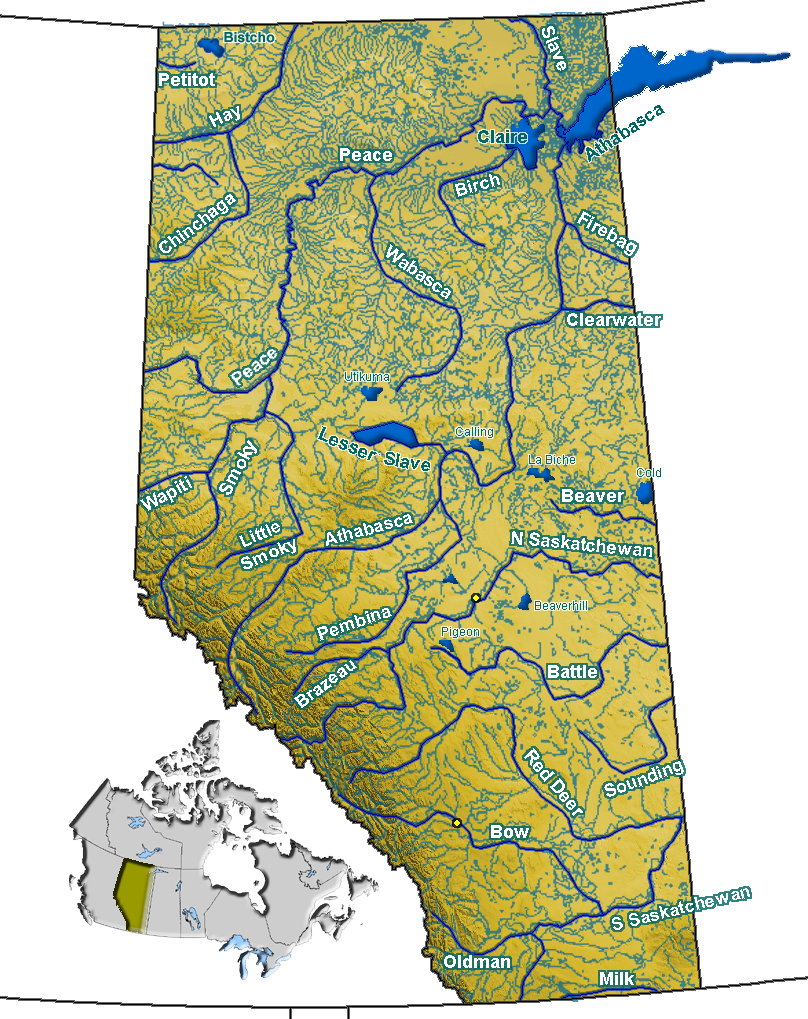
Alberta rivers.png - Qyd

Athabasca Watershed.png - Qyd

Hydrographic Network of West Canada.png - Qyd

Major Rivers in West Canada.png - Qyd

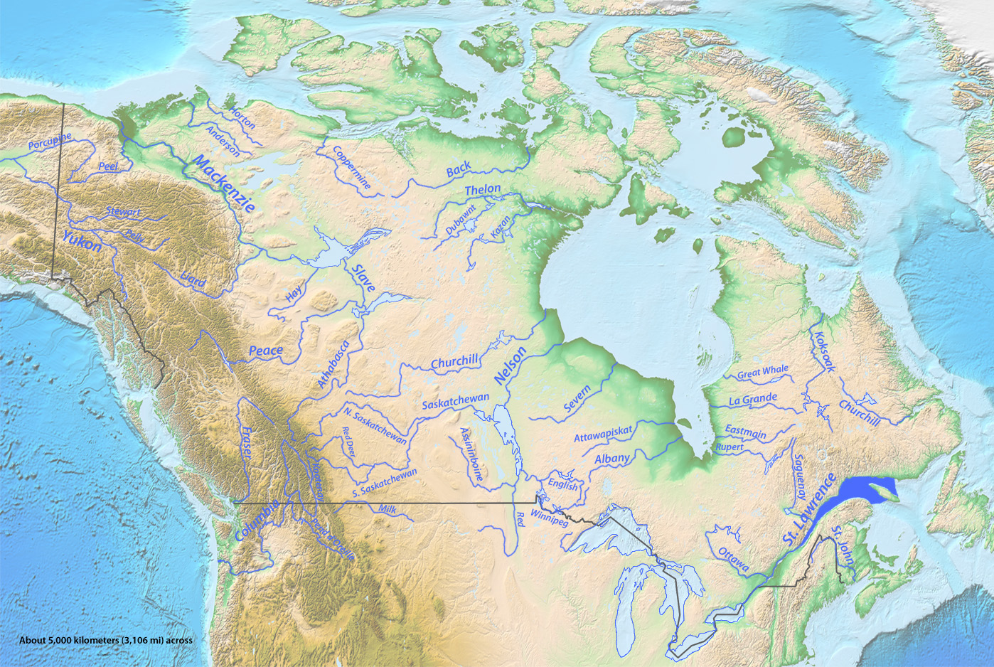
Canada-Drainage.png - Qyd
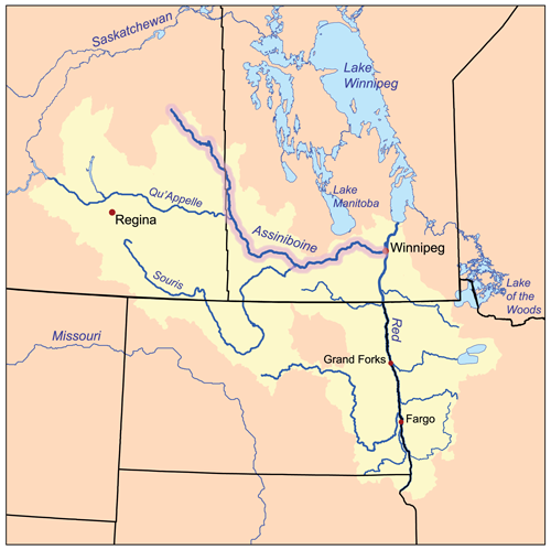
Assiniboinerivermap.png - Kmusser

Quappellerivermap.png - Kmusser

Sourisrivermap.png - Kmusser
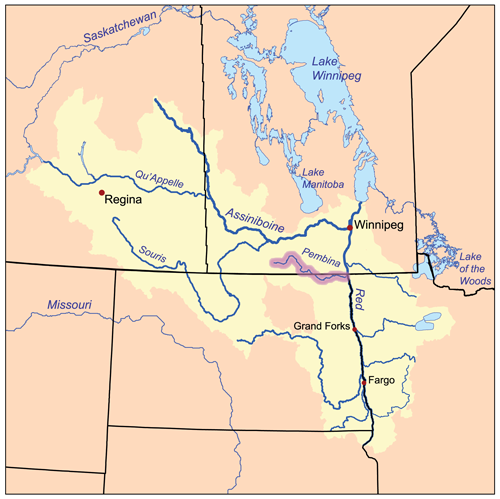
Pembinarivermap.png - Kmusser

Roseaurivermap.png - Kmusser
Wildricerivermap.png - Kmusser
Okanogan River.png - Peteforsyth

Pend Oreille River Map.png - Pfly

Kootenay River map with states and provinces.png - Peteforsyth

Kettle River Map.png - Pfly

Flathead River Map.png - Pfly

St John River Map.png - File Upload Bot (Magnus Manske)

Riv chic map.jpg - Adqproductions

Maple nd rivermap.png - Kmusser

RichelieuValleyMontrealThreeRivers1777.png - Magicpiano
Map of Western British North America (David Thompson 1813-1814).jpg - Geo Swan

Map of the Niagara Frontier, 1869.jpg - Soerfm

Bowrivermap.jpg - Kmusser

Southnahannirivermap.jpg - Shannon1
Pellyrivermap.jpg - Shannon1
Columbia drainage basin blank map.png - Bourrichon

Pend Oreille-Clark Fork dams.jpg - Shannon1
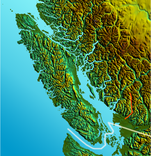
Vancouver Island-reliefPittRiver.png - File Upload Bot (Magnus Manske)

Map of Swan River and Upper Assiniboine River (Peter Fidler 1795).jpg - FlickreviewR

Riviereassiniboinecarte.png - Piotron

Rivieresouriscarte.png - Piotron

Rivierequappellecarte.png - Piotron
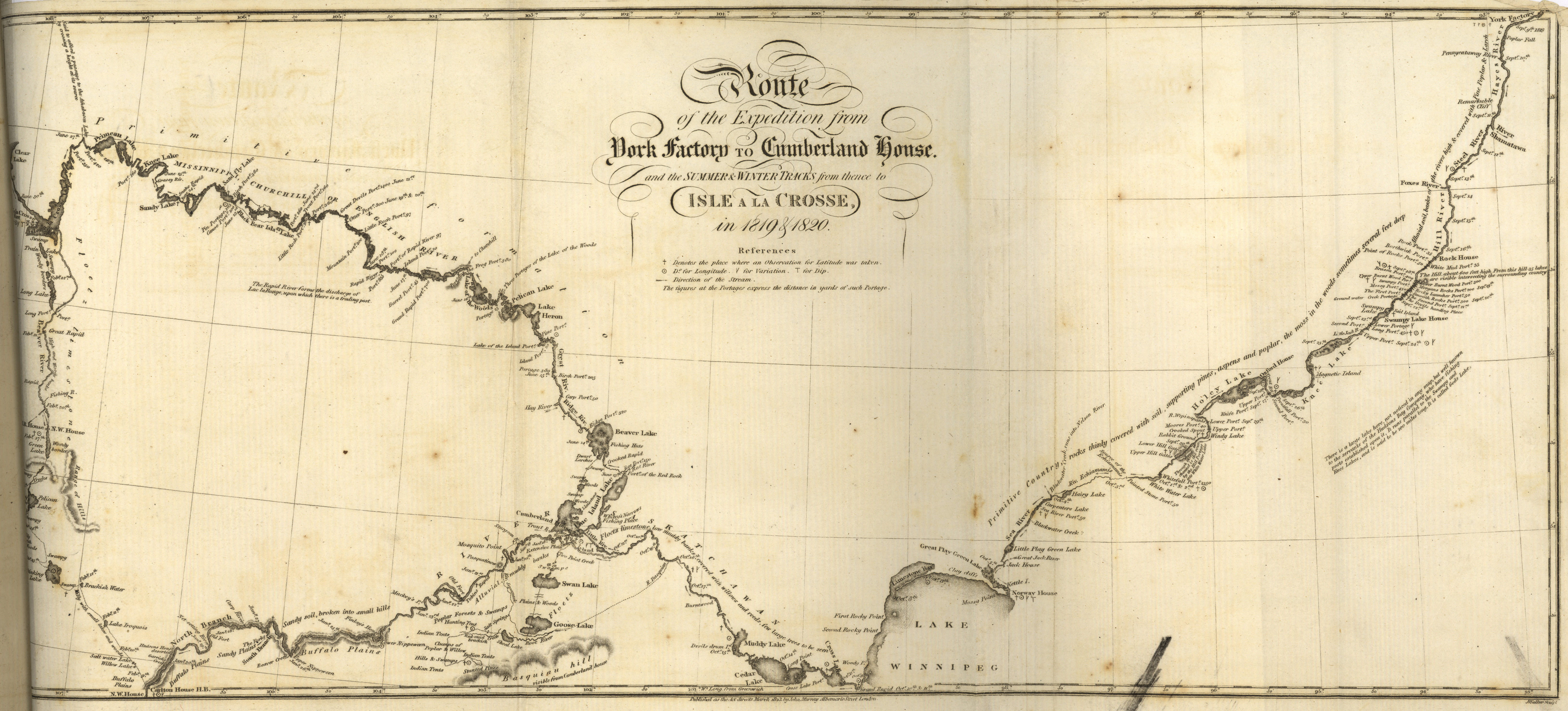
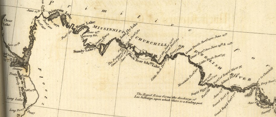
Route of the Expedition from York Factory to Cumberland House and the Summer & Winter Tracks from thence to Isle A La Crosse in 1819 & 1820 (1823).jpg - Jeangagnon

Rivers of New Brunswick map-fr.svg - Sémhur

Rivers of New Brunswick topographic map-fr.svg - Sémhur
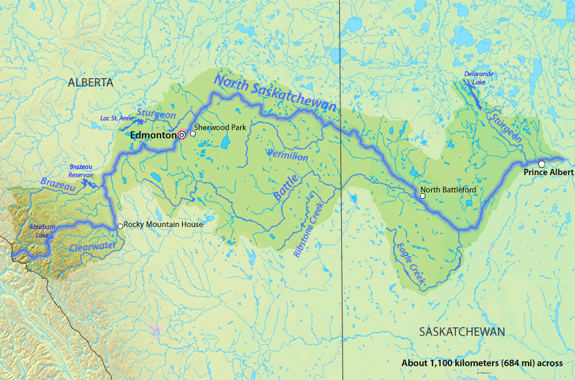
NorthSaskMap.jpg - Shannon1
Longest Rivers of Canada.jpg - Shannon1

Kejimkujik National Park.svg - Bourrichon
Franklin 2 (6).jpg - Kayoty

St John River Map-fr.png - Flappiefh

Columbia basin project.JPG - Grashoofd

Bulletin - United States National Museum (1960) (20478526306).jpg - Fæ

Annual report of Pierre Fortin, esquire, magistrate in command of the expedition for the protection of the fisheries in the Gulf of the St. Lawrence, during the season of 1857 (microform) (1858) (20007635534).jpg - Fæ

Explorations in the far North (microform) - being a report of an expedition under the auspices of the University of Iowa during the years 1892, '93, and '94 (1898) (20002708974).jpg - Ruff tuff cream puff

Explorations in the far North (1898) (20774462695).jpg - Fæ

FMIB 34254 Relative longitudinal and altitudinal positions of the points where collections were made.jpeg - BMacZeroBot

Narrative of the Canadian Red River Exploring Expedition of 1857 - and of the Assinniboine and Saskatchewan Exploring Expedition of 1858 (1860) (14592055049).jpg - SteinsplitterBot

Kennebecasis River map.jpg - Cavarrone

Longest Rivers of Canada.png - Shannon1
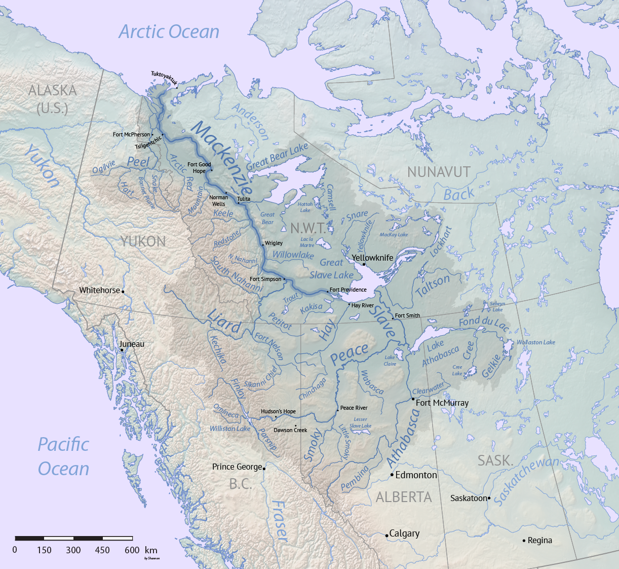
Mackenzie River basin map.png - Shannon1

141 of 'Through the Gold-Fields of Alaska to Bering Straits ... With a map and 33 illustrations (including a portrait)' (11245023125).jpg - Artix Kreiger 2
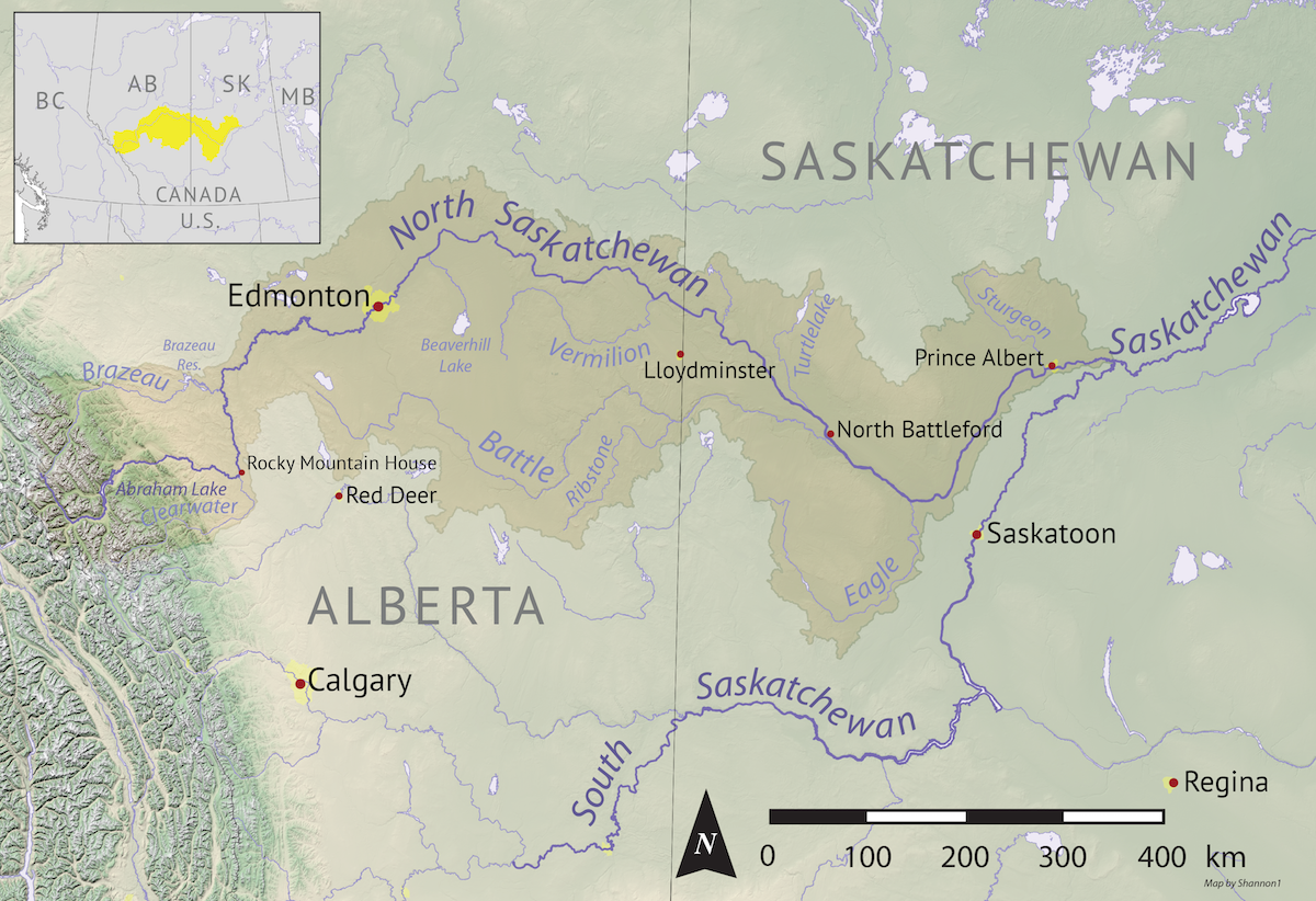
North Saskatchewan basin map.png - Shannon1

South Saskatchewan basin map.png - Shannon1

Saskatchewan basin map.png - Shannon1
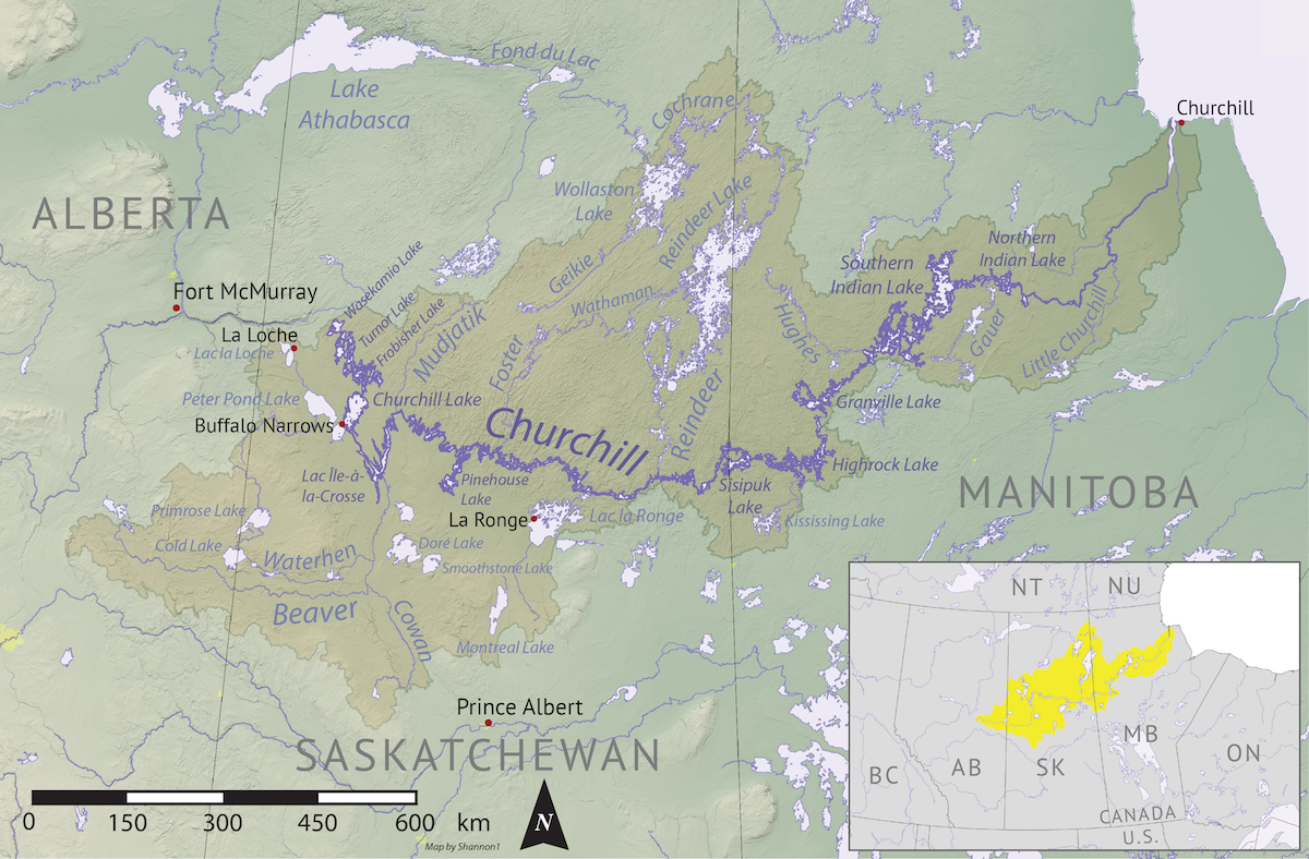
Churchill river hudson basin map.png - Shannon1
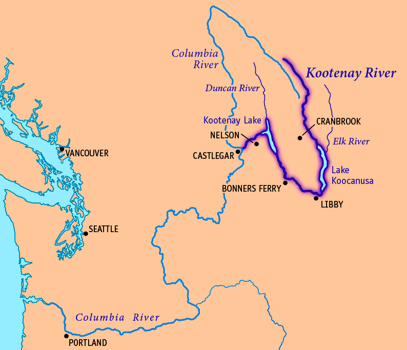
Kootenay River map.png - Thylacinus cynocephalus

Canada drainage map - en.svg - MapGrid

Canada drainage map - fr.svg - MapGrid

Quill Lakes watershed.jpg - Mheberger

Kennebecasis River 1871 race newspaper map.png - B3251