Wikimedi'Òc
Modes d'emploi

Cet album fait partie des albums


Redrivernorthmap.png - Kmusser

Sourisrivermap.png - Kmusser
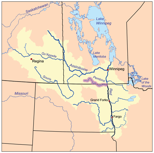
Pembinarivermap.png - Kmusser

Ottertailrivermap.png - Kmusser
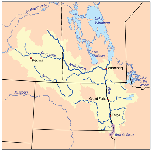
Boisdesiouxrivermap.png - Kmusser
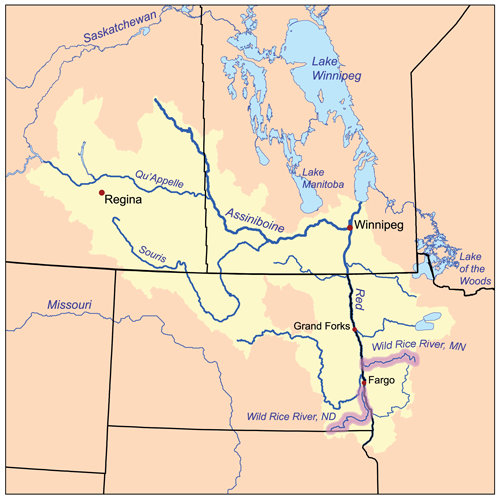
Wildricerivermap.png - Kmusser
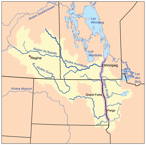
Riviererougecarte.png - Piotron

Rivieresouriscarte.png - Piotron

Report on the Exploration of the Country Between Lake Superior and the Red River Settlement and Between the Latter Place and the Assiniboine and Saskatchewan - South West Sheet (1859) -a.jpg - FlickreviewR

Report on the Exploration of the Country Between Lake Superior and the Red River Settlement and Between the Latter Place and the Assiniboine and Saskatchewan - North West Sheet (1859) -b.jpg - FlickreviewR

Report on the Exploration of the Country Between Lake Superior and the Red River Settlement and Between the Latter Place and the Assiniboine and Saskatchewan - North West Sheet (1859) -d.jpg - FlickreviewR

Colonists on the Red River in North America.png - Geo Swan

Plan Shewing the Proposed Route from Lake Superior to Red River Settlement (1870).jpg - Geo Swan

Bulletin of the U.S. Department of Agriculture (1913-1923.) (20489299292).jpg - Fæ

Bulletin of the U.S. Department of Agriculture (1913-1923.) (20309994550).jpg - Fæ

Map of the Country Embracing the Route of the Expedition of 1823 Commanded by Major S.H. Long.jpg - TimK MSI

Red River Flooding in North Dakota (high res) (4455124807).jpg - A1Cafel

Red River Flooding in North Dakota (4455125023).jpg - A1Cafel

Red River of the North in MN.jpg - Jordax91

Plan d’ une Partie de la Riviere Rouge - North Sheet (1871) (2187411701).jpg - Mindmatrix

Plan d’ une partie de la Riviere Rouge - South Sheet (1871) (2188223382).jpg - Mindmatrix
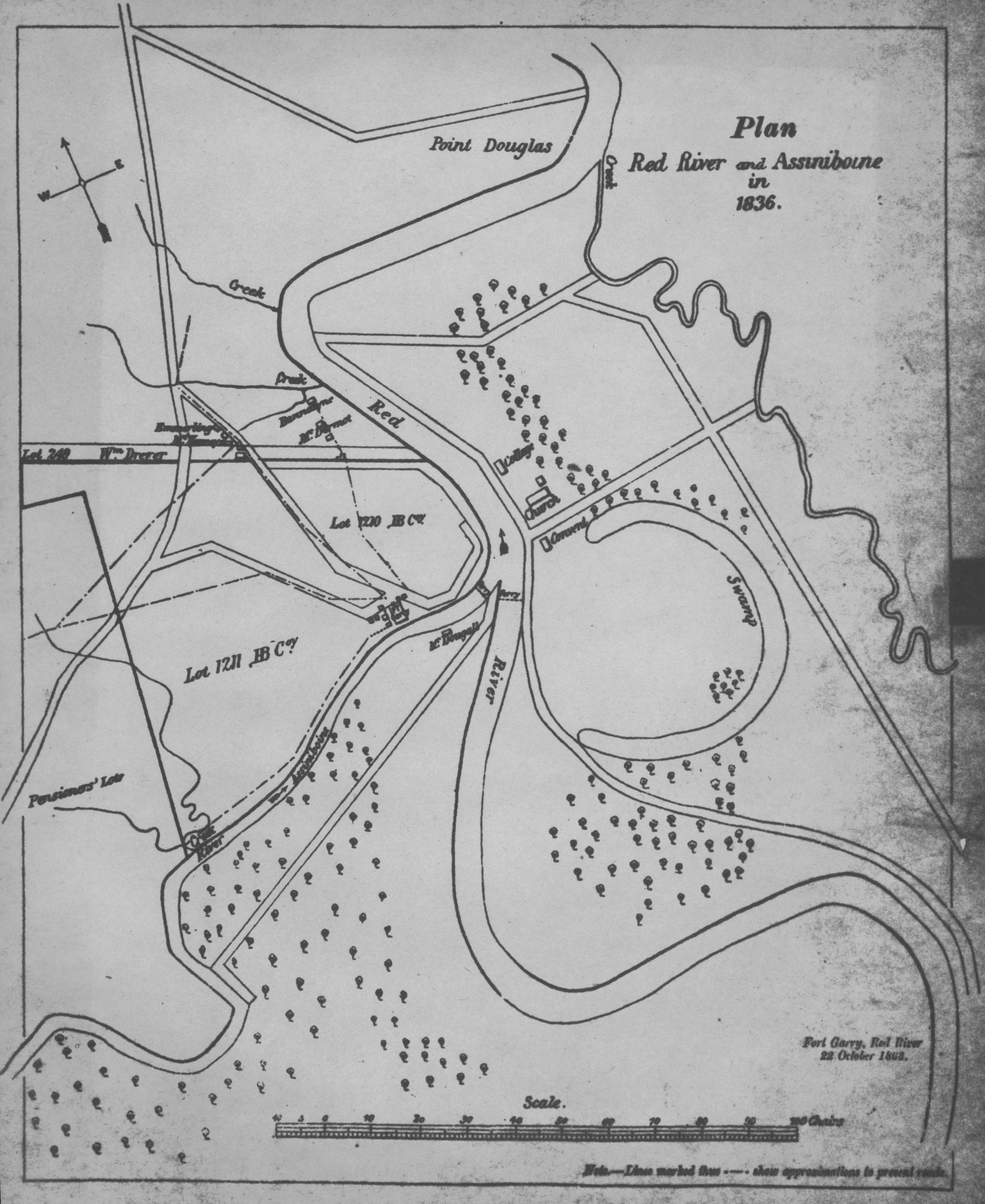
Plan, Red River and Assiniboine in 1836 (1863).jpg - Geo Swan