Wikimedi'Òc
Modes d'emploi

Cet album fait partie des albums
Cet album photos contient les sous-albums suivants :


Sea Islands map.png - HerrAdams
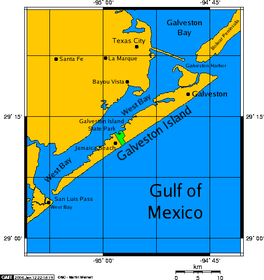
Galveston island 0001.png - PaulVIF
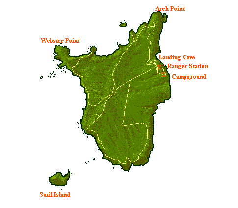
Santa-barbara-island-nps-map.PNG - Telim tor

Santa-rosa-island-nps-map.PNG - Telim tor

Presque Isle State Park Map POL.png - Matthew - first user

Anacapaislandmap.png - PerryPlanet

Rock Island, IL, 1820 (Saukenuk).jpg - Ericaparrott
Photograph of line drawing in possession of Engineering Plans and Services Division, Rock Island Arsenal. MAP OF ROCK ISLAND ARSENAL, 1919, REVISED 1938 - Rock Island Arsenal, HAER ILL,81-ROCIL,3-1.tif - Fæ
Kelly's and Bass Islands showing the harbors of refuge in their vicinity being an extract from the survey of the west end of Lake Erie made under the direction of the Bureau of Topographical LOC 2012593349.tif - Fæ

Kelly's and Bass Islands showing the harbors of refuge in their vicinity being an extract from the survey of the west end of Lake Erie made under the direction of the Bureau of Topographical LOC 2012593349.jpg - Fæ

Pine Island, Lake Livingston, Texas.png - Semicircle2012

Mississippi-Alabama barrier islands.png - Bryanrutherford0

Cat Island map.png - Bryanrutherford0

Largest US Islands.jpg - Winndm31

Sea Islands map.svg - Babbage
Mullet Key chart.pdf - Donald Albury
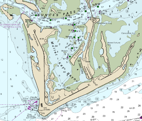
Mullet Key detail.png - Donald Albury
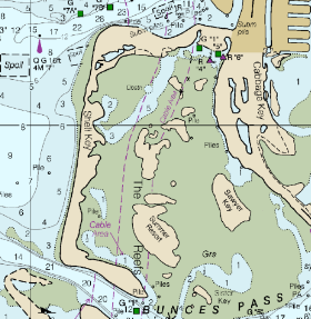
Shell Key detail.png - Donald Albury

Galveston island 0002.png - Mmcfarla