Wikimedi'Òc
Modes d'emploi

Cet album fait partie des albums
Cet album photos contient les sous-albums suivants :


Map of Governor's Island, New York - NARA - 137929600.jpg - US National Archives bot

Map of Governor's Island, New York - NARA - 137929602.jpg - US National Archives bot

Map of Governor Island - NARA - 17369898.jpg - US National Archives bot

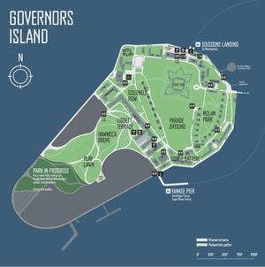
Governors Island.jpg - Pharos

Governor's Island.svg - Inductiveload
Map of Governor's Island.pdf - RandyRostie
PHOTOCOPY OF MAP OF GOVERNORS ISLAND, 1908, DRAWN BY J.M. HILTON - Governors Island, Overview, New York Harbor, New York, New York County, NY HABS NY,31-GOVI,2-14.tif - Fæ
Governors Island, Overview, New York Harbor, New York, New York County, NY HABS NY,31-GOVI,2- (sheet 1 of 1).tif - Fæ
PHOTOCOPY OF MAP OF GOVERNORS ISLAND SHOWING HISTORICAL TROPHY POSITIONS, 1949 - Governors Island, Overview, New York Harbor, New York, New York County, NY HABS NY,31-GOVI,2-15.tif - Fæ
Governors Island, Second Corps Area Headquarters, New York Harbor near Andes Road, New York, New York County, NY HABS NY,31-GOVI,10- (sheet 1 of 2).tif - Fæ
Governors Island, Second Corps Area Headquarters, New York Harbor near Andes Road, New York, New York County, NY HABS NY,31-GOVI,10- (sheet 2 of 2).tif - Fæ

Governors Island, Overview, New York Harbor, New York, New York County, NY HABS NY,31-GOVI,2- (sheet 1 of 1).png - Fæ

Governors Island, Second Corps Area Headquarters, New York Harbor near Andes Road, New York, New York County, NY HABS NY,31-GOVI,10- (sheet 1 of 2).png - Fæ

Governors Island, Second Corps Area Headquarters, New York Harbor near Andes Road, New York, New York County, NY HABS NY,31-GOVI,10- (sheet 2 of 2).png - Fæ

1940 Census Enumeration District Maps - New York - New York County - ED 31-1 - ED 31-2153 - NARA - 5835686 (page 39).jpg - US National Archives bot

1940 Census Enumeration District Maps - New York - New York County - ED 31-1 - ED 31-2153 - NARA - 5835686 (page 40).jpg - US National Archives bot

A Map of Governor Island - NARA - 102280042.jpg - US National Archives bot

Plan of the city of New York - B. Ratzer - btv1b53089813k (2 of 2).jpg - Gzen92Bot

Plan of three island situated in the harbour of New York - btv1b53089714n.jpg - Gzen92Bot
Battery Brooklyn Battery Tunnel Supplementary Drawing Topography & River Bottom Elevations, October 15, 1941 - DPLA - 28a4b03db15ae43e551d090be4f7977e.tiff - DPLA bot