Wikimedi'Òc
Modes d'emploi

Cet album fait partie des albums
Cet album photos contient les sous-albums suivants :


India China transportation - 1942-1943.jpg - W.wolny
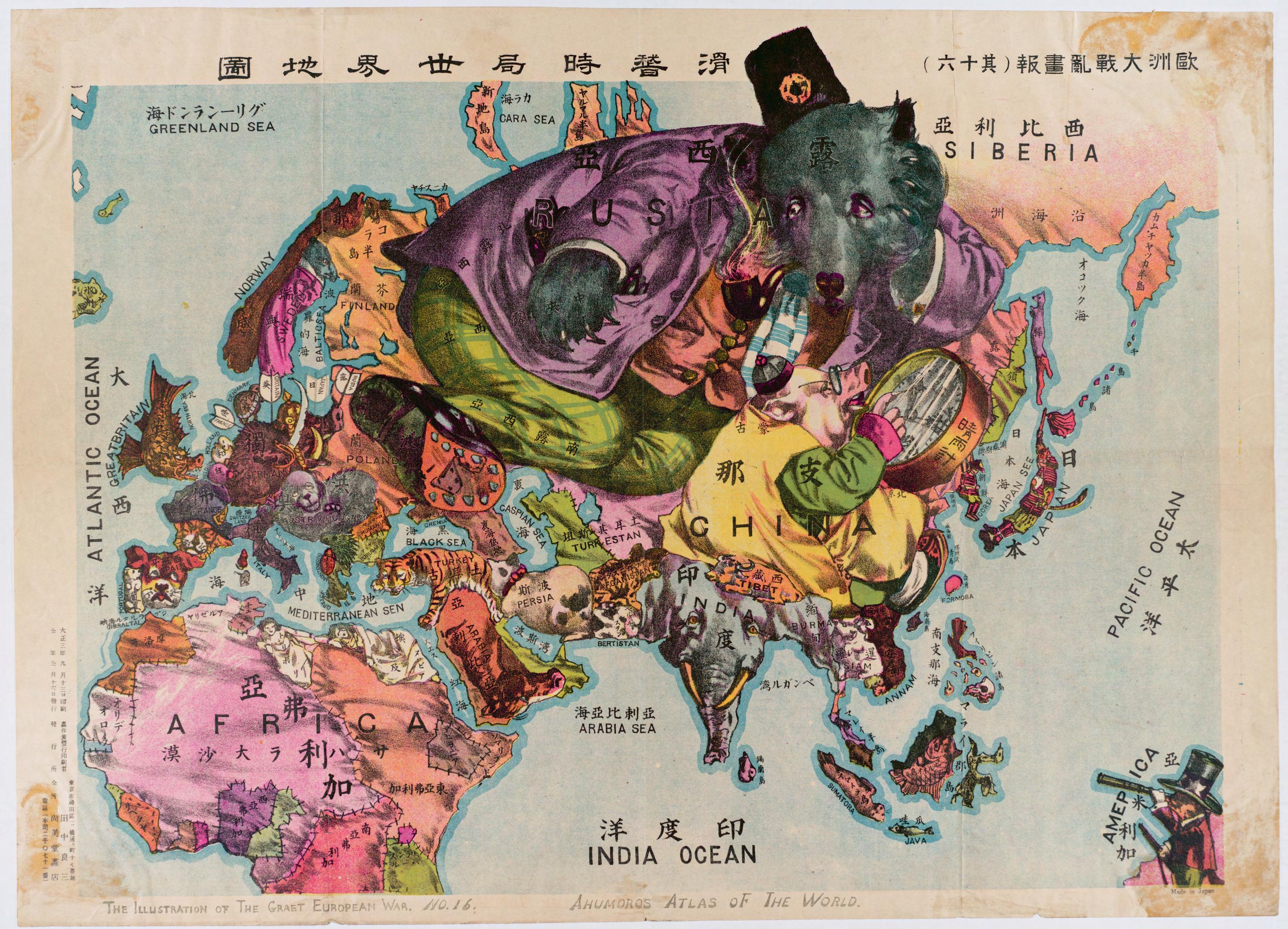
World around 1900.jpg - Olahus

1930 Map of the Republic of China.JPG - 43tthsrxnj

Pieni 2 0791 China.png - 敢為天下先

1943 World War II Japanese Aeronautical Map of Burma ( Myanmar ) - Geographicus - Burma7-wwii-1943.jpg - BotMultichillT
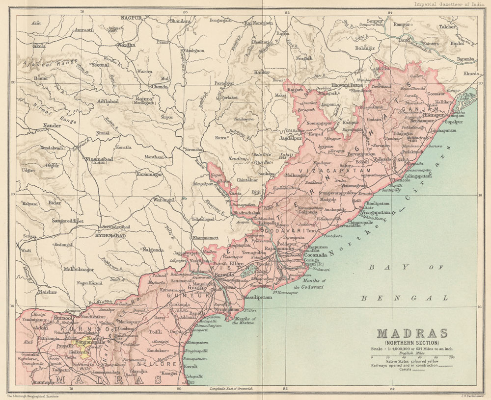
Madras Prov North 1909.jpg - File Upload Bot (Magnus Manske)

1946 Map of British India with areas demanded for separate Pakistan by Muslim League.jpg - AmyNorth

1912 China map from National Geographic.jpg - Scewing

India; Map; 1929 Wellcome L0024831.jpg - Fæ

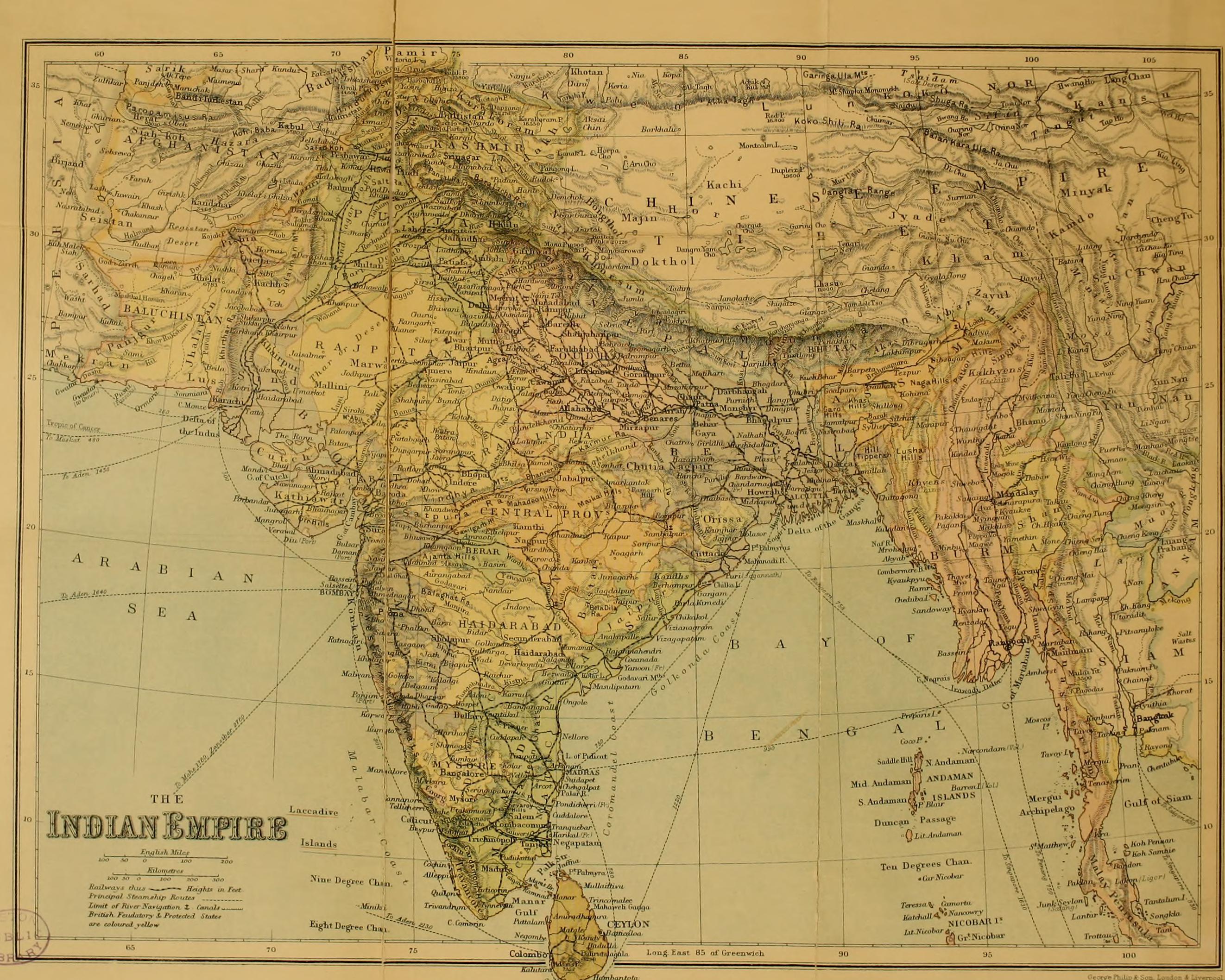
Old India map in german.jpg - Hoa binh
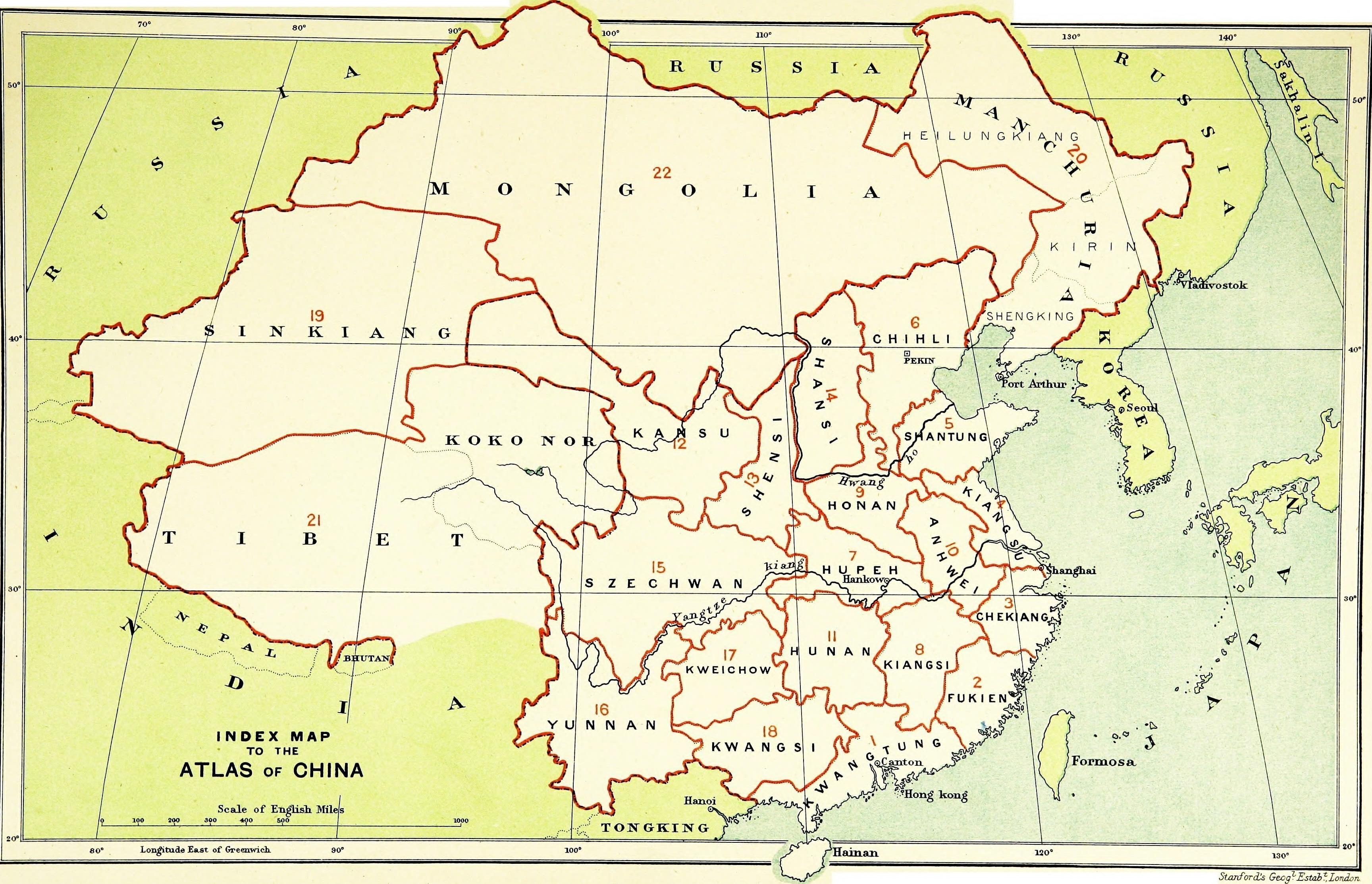
STANFORD(1917) p12 Index map (14783818285).jpg - Metilsteiner
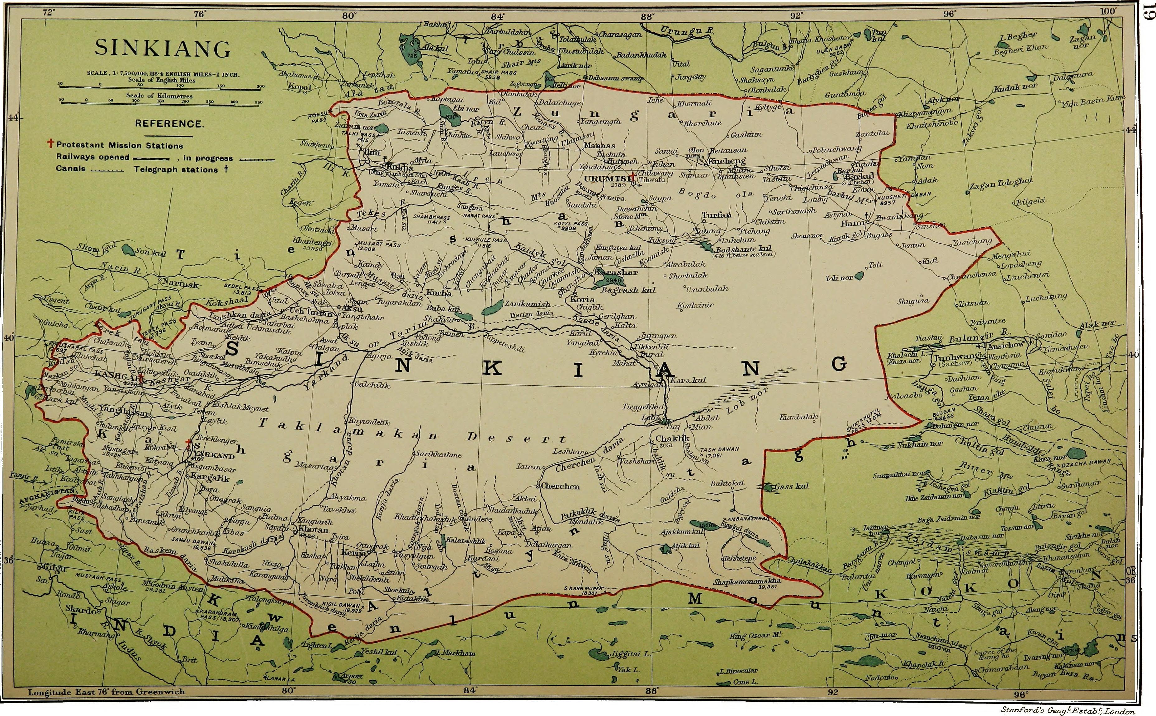
STANFORD(1917) p61 PLATE19. SINKIANG (14597194848).jpg - Metilsteiner

Geological map of India 1911.jpg - Nizil Shah

Provincial Geographies of India Volume 2 0013.jpg - Moondyne

Provincial Geographies of India Volume 2 0168.jpg - Moondyne

Provincial Geographies of India Volume 2 0269.jpg - Moondyne

Medieval and modern times; an introduction to the history of western Europe form the dissolution of the Roman empire to the present time (1919) (14783100375).jpg - Fæ

Indian cotton (1915) (14768919362).jpg - Fæ

Census of India, 1911 (1912) (14591241247).jpg - Fæ
The sportsman's book for India (1904) (14595430477).jpg - Fæ

The rise and expansion of the British dominion in India (1910) (14783922662).jpg - Fæ

The game-birds of India, Burma and Ceylon (1921) (14564854579).jpg - SteinsplitterBot

The game-birds of India, Burma and Ceylon (1921) (14564853358).jpg - SteinsplitterBot

A handbook for travellers in India, Burma, and Ceylon . (1911) (14594749840).jpg - Fæ

The Americana - a universal reference library, comprising the arts and sciences, literature, history, biography, geography, commerce, etc. of the world (1903) (14784570425).jpg - SteinsplitterBot

Reports of the missionary and benevolent boards and committees to the General Assembly of the Presbyterian Church in the United States of America (1913) (14744170156).jpg - Fæ

A short history of England (1904) (14591374397).jpg - Fæ

Coleoptera. Chrysomelidæ (1919) (20475979369).jpg - Fæ
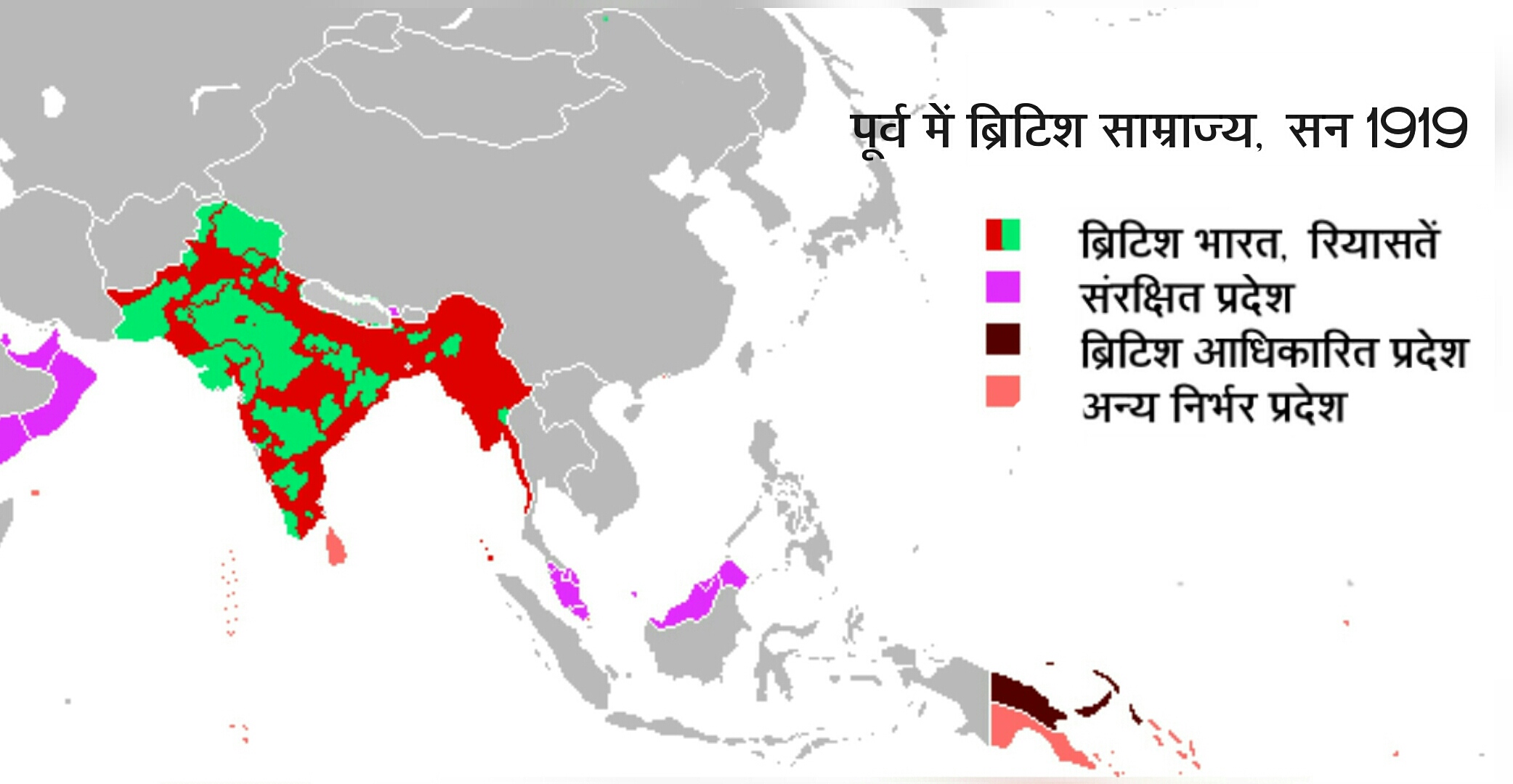
ब्रिटिशकालीन भारत का मानचित्र (british india hindi).jpg - Innocentbunny

1963 China-India Border (30848757436).jpg - Mindmatrix

Map of the Languages and Dialects of the Bârâ or Bodo Group of the Tibeto-Burman Family.jpg - 68Sashanet85

Indian exodus from Burma to Manipur, Bengal, and Assam, January to July 1942.jpg - Fowler&fowler

1903 Routes between Tibet and India by O'Connor.jpg - AmenhotepIII

1914 Survey of India map of Tibet and Adjacent Countries.jpg - Happyseeu

White Paper on Indian States (1950) Map.jpg - Hrishikes

Map of Tibet detail from 1930 Map of the Republic of China (cropped).JPG - Tibet Nation

Map of Tibet detail from China old map 1936 (cropped).jpg - Tibet Nation
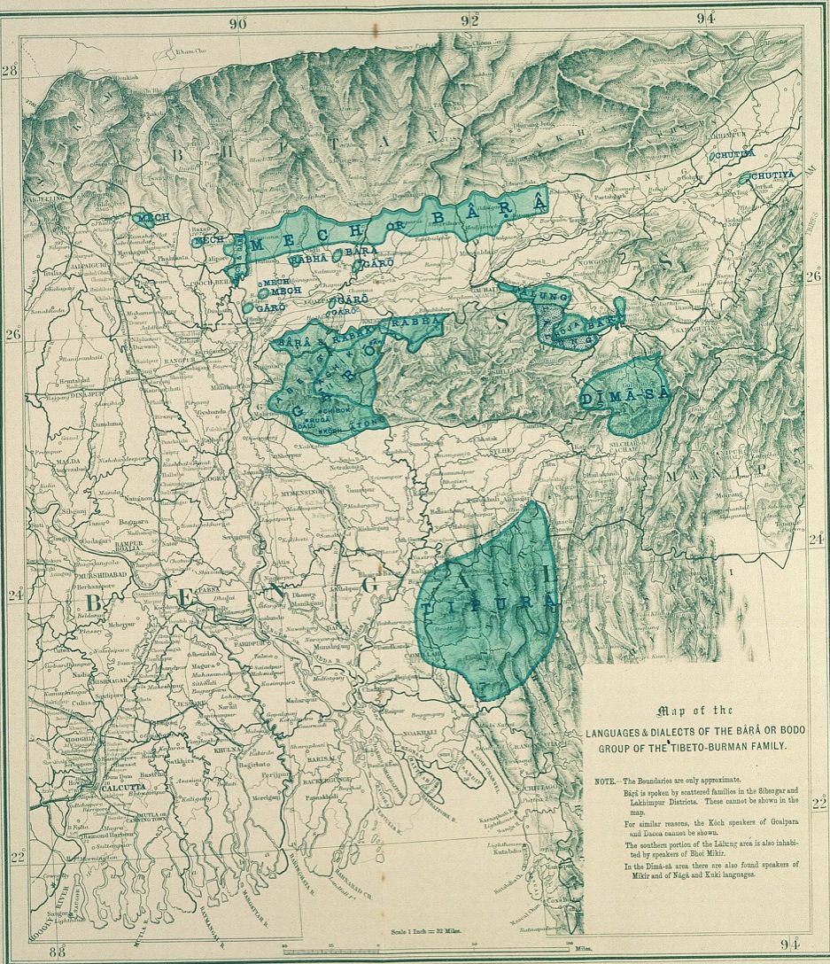
Map of the Languages and Dialects of the Bârâ or Bodo Group of the Tibeto-Burman Family (cropped).jpg - Tibet Nation

Map of Tibet in 1903 from The Americana - a universal reference library, comprising the arts and sciences, literature, history, biography, geography, commerce, etc. of the world (1903) (14576990459) (cropped).jpg - Tibet Nation
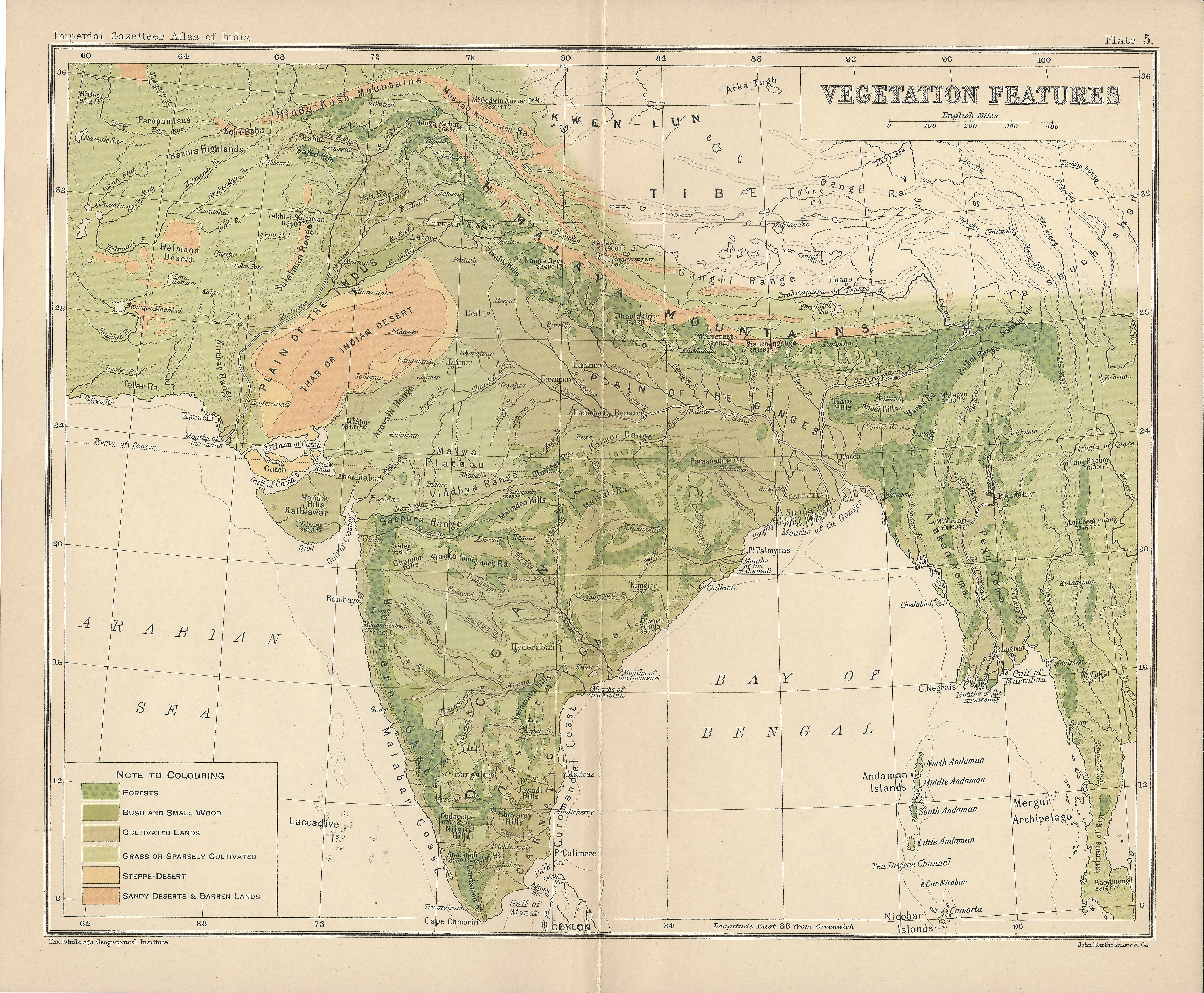
India Vegetation Features IGI 1909 Atlas.jpg - Fowler&fowler

Map of Tibet in 1905, from- 082 china-und-japan (1905) (cropped).png - Tibet Nation

Map of Tibet in 1917, STANFORD(1917) p12 Index map (14783818285) (cropped).jpg - Tibet Nation

Map of Tibet- "TIBET CONFIDENTIAL" "Ethnographic Boundary of Tibet" "Approximate Line of Communist Advance" and "Reportedly occupied by Communists" "11518, CIA, 2-50" February 1950 map- 305945 11518 01.jpg - Smasongarrison

Tilted, 1914 Survey of India map of Tibet and Adjacent Countries (cropped).jpg - Tibet Nation

Map of Tibet- "TIBET CONFIDENTIAL" "Ethnographic Boundary of Tibet" "Approximate Line of Communist Advance" and "Reportedly occupied by Communists" "11518, CIA, 2-50" February 1950 map- 305945 11518 01 (cropped) (cropped).jpg - Koavf

Nouvelle carte de l'Inde pour suivre les opérations militaires dans les possessions anglaises - btv1b530227702.jpg - Gzen92Bot