Wikimedi'Òc
Modes d'emploi

Cet album fait partie des albums
Cet album photos contient les sous-albums suivants :


Bombay Prov north 1909.jpg - QuartierLatin1968
Bengal gazetteer 1907-9.jpg - Furfur

Bengal gazetteer 1907.jpg - AlMare

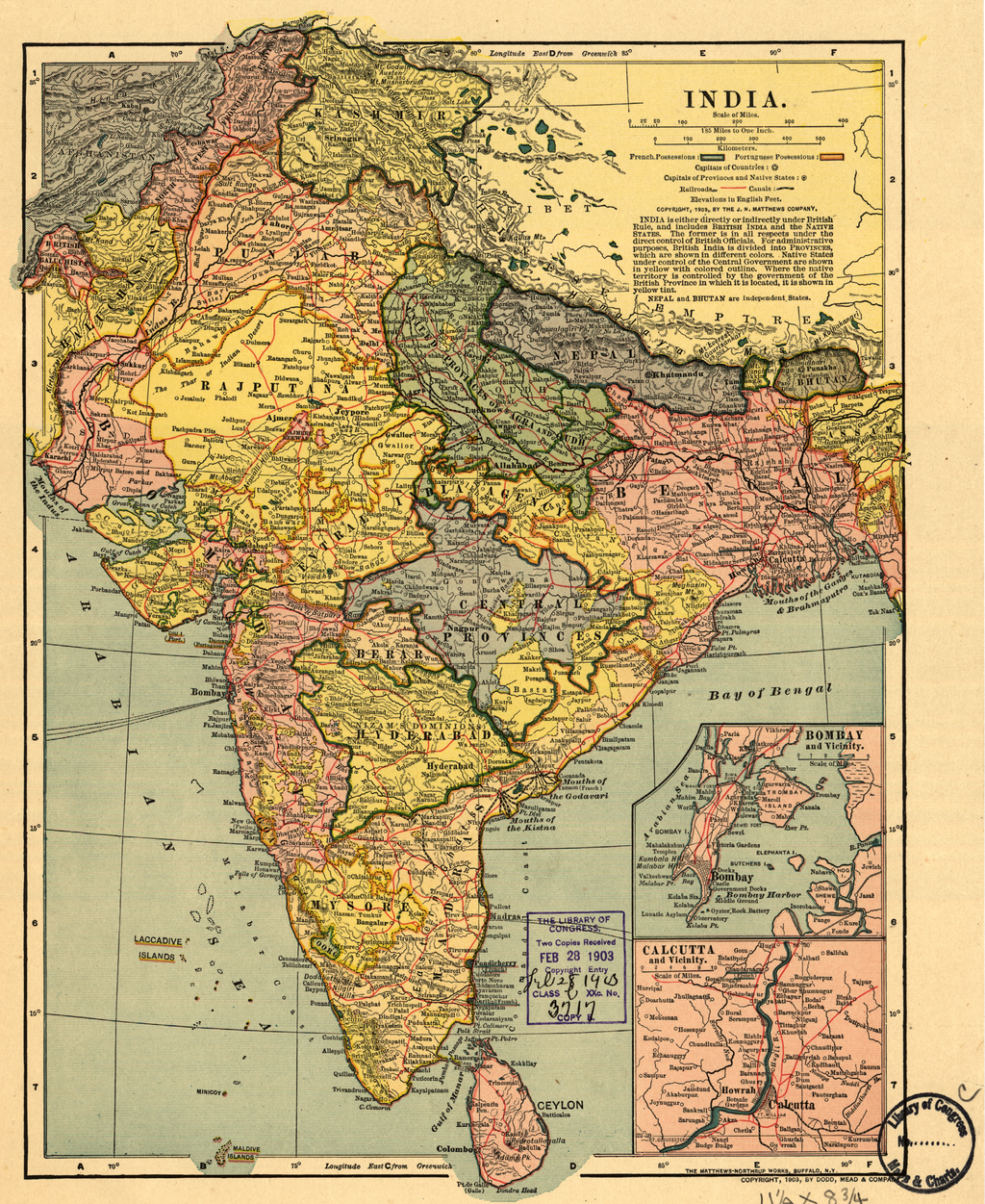
India 1900.jpg - Sasha Krotov

Inde.jpg - ComputerHotline

Central India Agency 1909.jpg - File Upload Bot (Magnus Manske)

Central Provs 1909.jpg - Zenwort
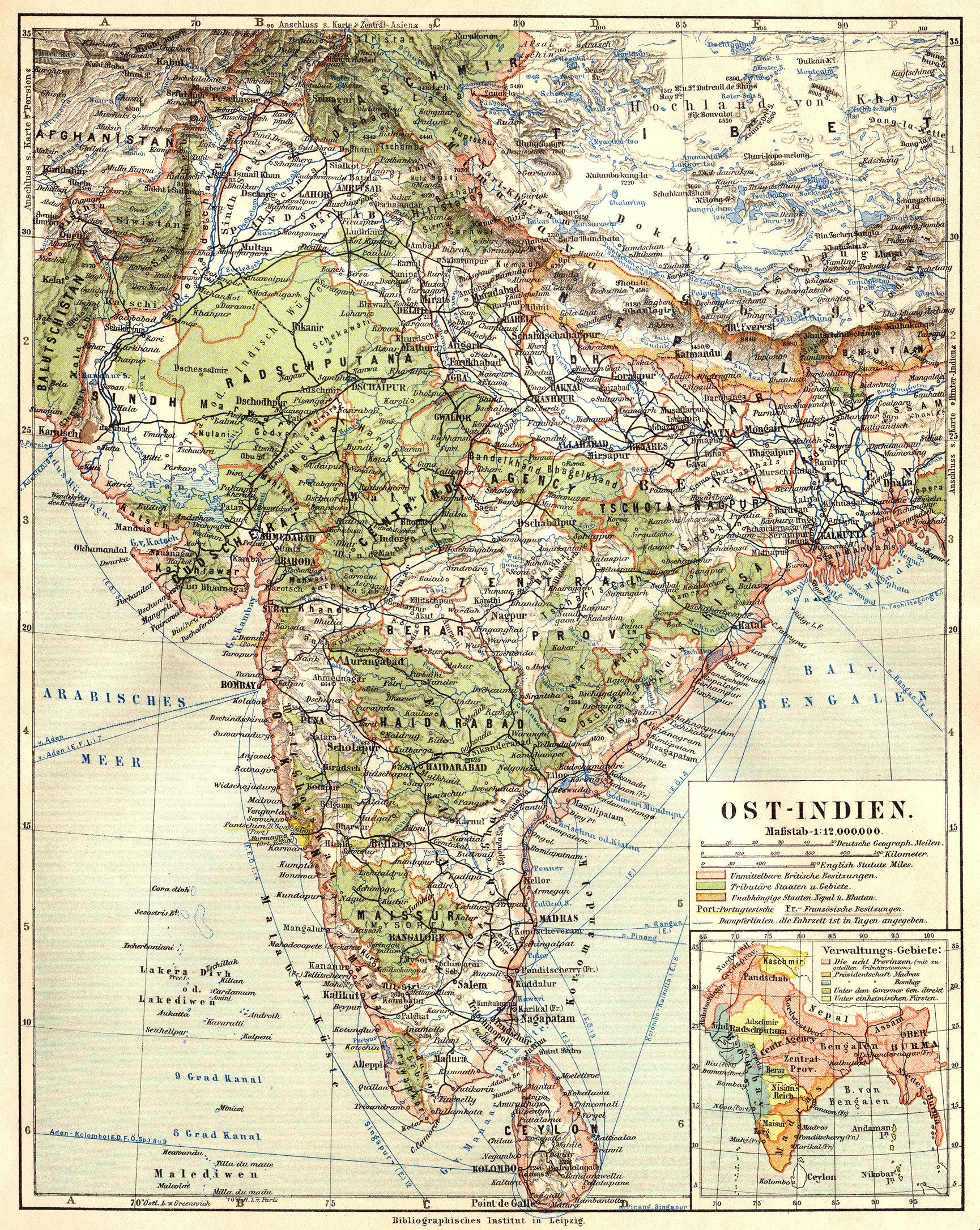
079 ostindien (1905).png - 14nu5
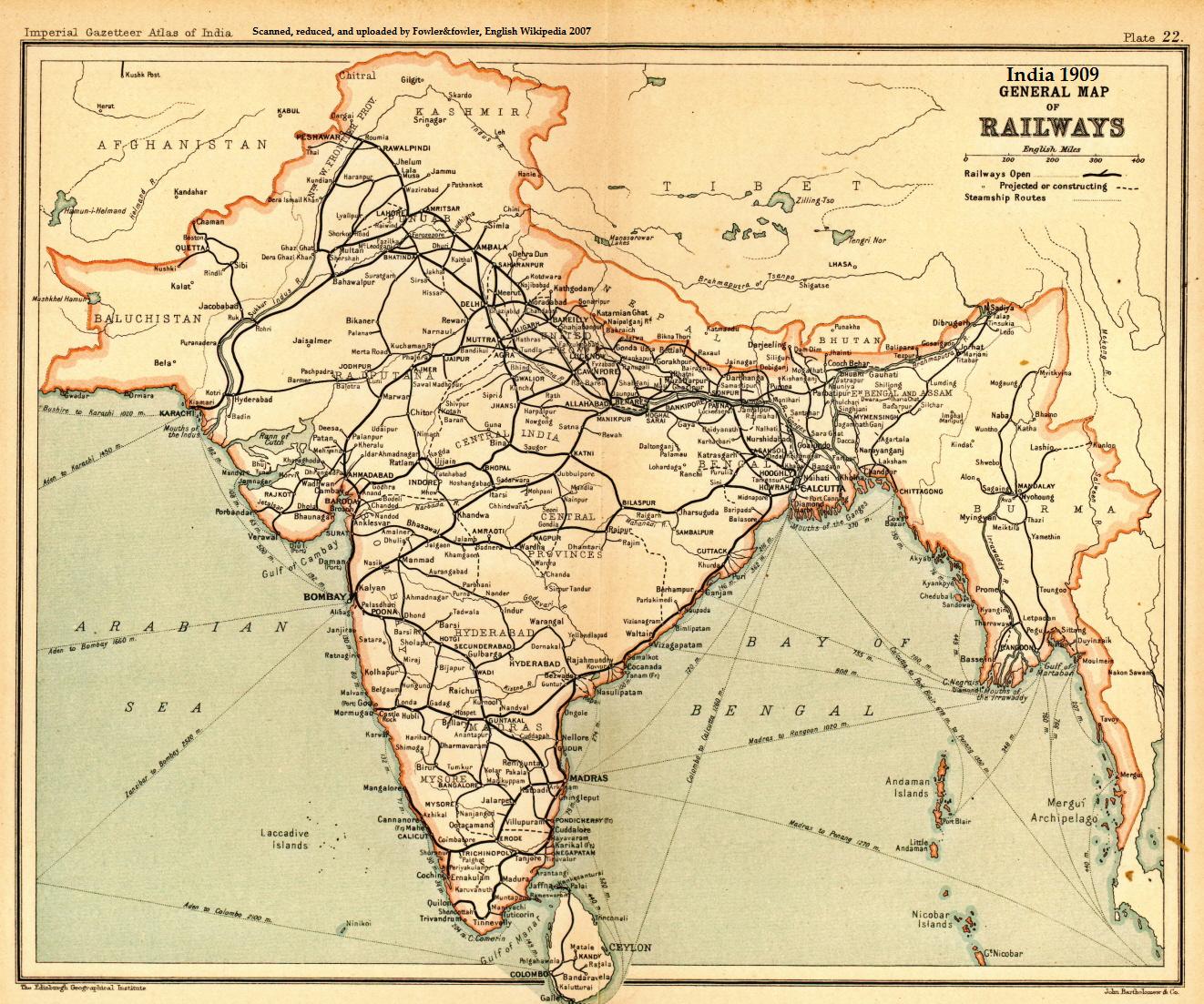
India railways1909a.jpg - File Upload Bot (Magnus Manske)

D203- Alexandre au pays des Sept Rivières -liv2-ch12.png - Vieux têtard
India WDL388.png - Fæ

Jodhpur-map.jpg - Xufanc

Islam, a challenge to faith; studies on the Mohammedan religion and the needs and opportunities of the Mohammedan world from the standpoint of Christian missions (1907) (14778299395).jpg - Fæ

The Americana - a universal reference library, comprising the arts and sciences, literature, history, biography, geography, commerce, etc. of the world (1903) (14804421613).jpg - SteinsplitterBot

NWBritish Indian Empire1909.jpg - Mcapdevila

KB!05 - black-white map of India.png - Enyavar
India. LOC 98687195.tif - Fæ

India. LOC 98687195.jpg - Fæ

EndreiZ11.jpg - 12akd
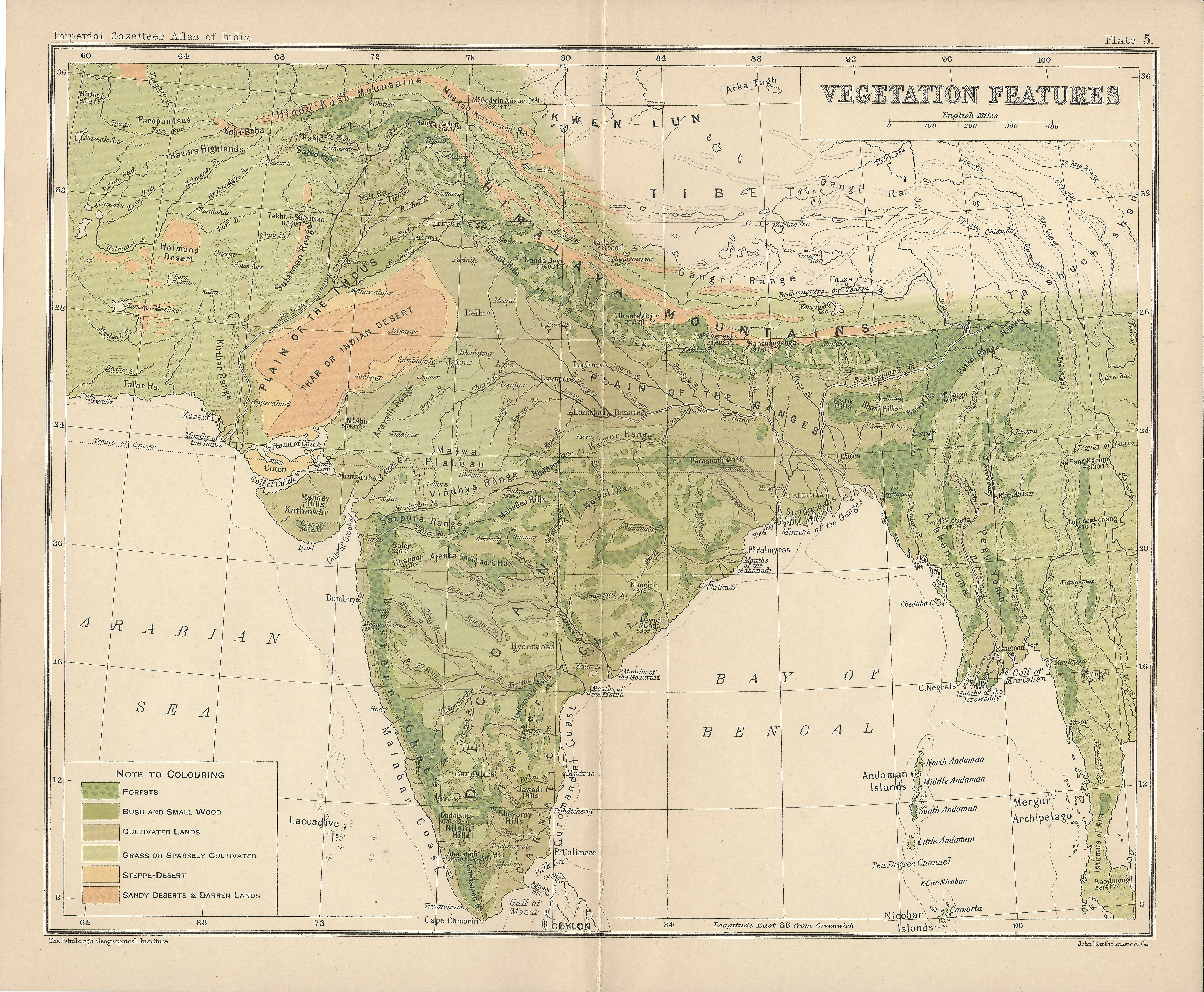
India Vegetation Features IGI 1909 Atlas.jpg - Fowler&fowler
East India Empire Map.jpg - Vinayakavm

Changchenmo-Valley-map-Survey-of-India-1916.jpg - Kautilya3

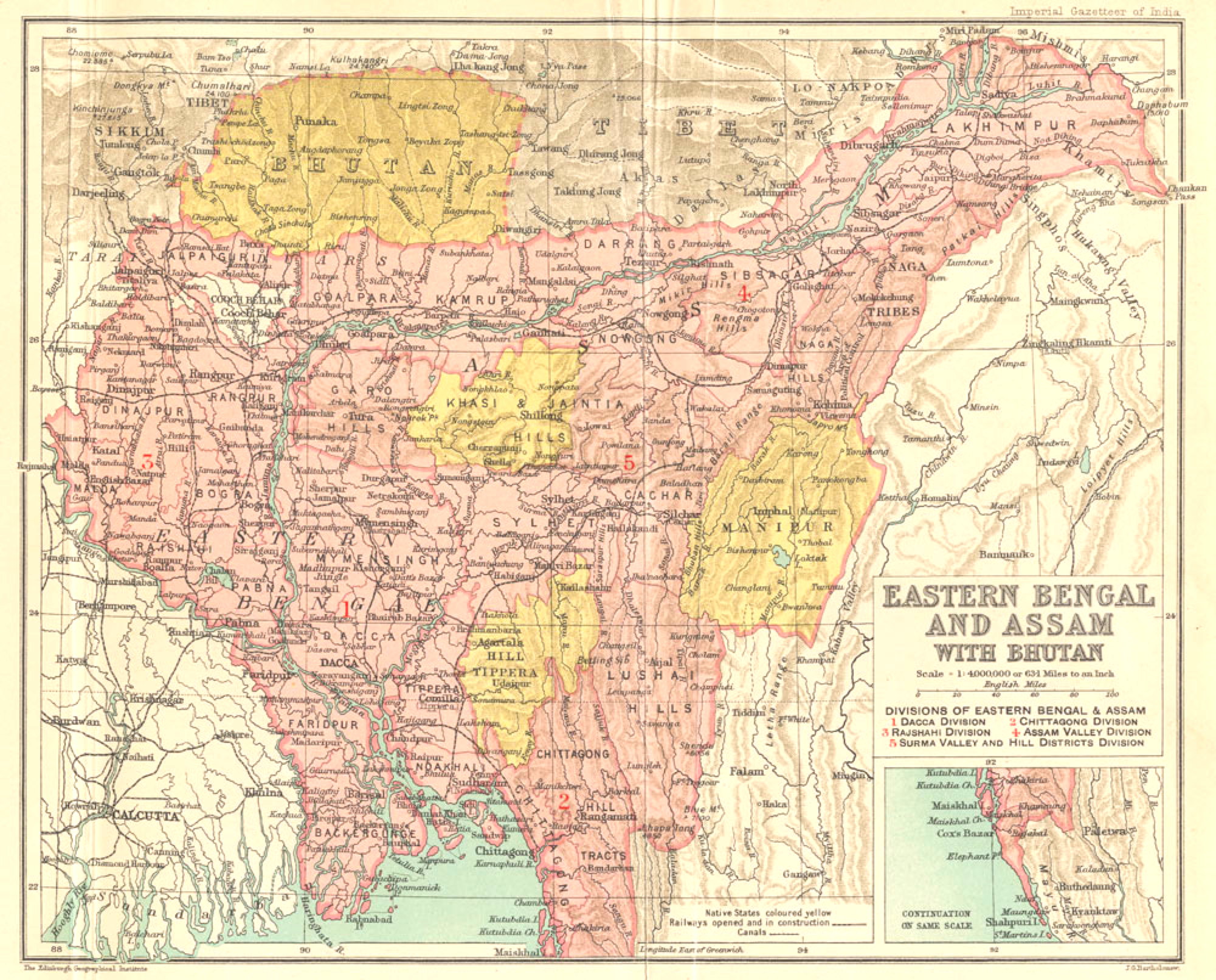
Easter Bengal and Assam with Bhutan.jpg - Rnrctg

Hderabad State 1901.jpg - Jangaonknight

Hyderabad State 1901.jpg - Jangaonknight

Mayurbhanj State 1901.jpg - MaxA-Matrix

Atlas des colonies françaises - 27 planches de cartes, texte explicatif, index alphabétique - dressé par ordre du Ministère des Colonies par Paul Pelet - bpt6k11001831 (080 of 206).jpg - Gzen92Bot

Map of the ruins of Patliputra by L.A. Waddell Published in 1903.jpg - BgIKumar

Map shewing the recruiting districts in Bengal, United Provinces, Central Provinces and Madras.jpg - MaxA-Matrix