×

Striped Butte in Butte Valley.jpg - MSchnitzler2000

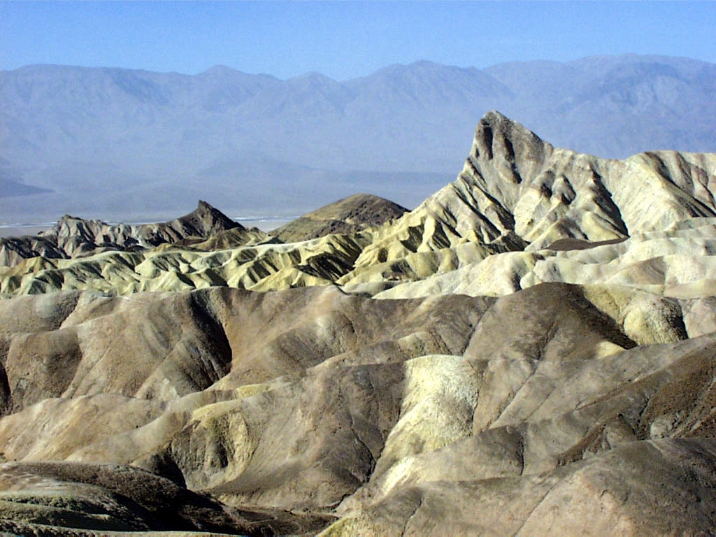
Death Valley Zabriskie Point.jpg - Wikipeder

Rainbow Basin 0024.JPG - JJefferson~commonswiki

Rainbow Basin 0030.JPG - JJefferson~commonswiki

Death Valley,19820817,Zabriskie Point,Red Cathedral.jpg - Roger469

ZabriskiePoint amk.jpg - AngMoKio

Lone Pine Peak.jpg - Flickr upload bot

Santa rosa beach.JPG - Telim tor

Devilgolf.jpg - Tahoenathan

Zabriski Point in Death Valley, CA.jpg - Tahoenathan

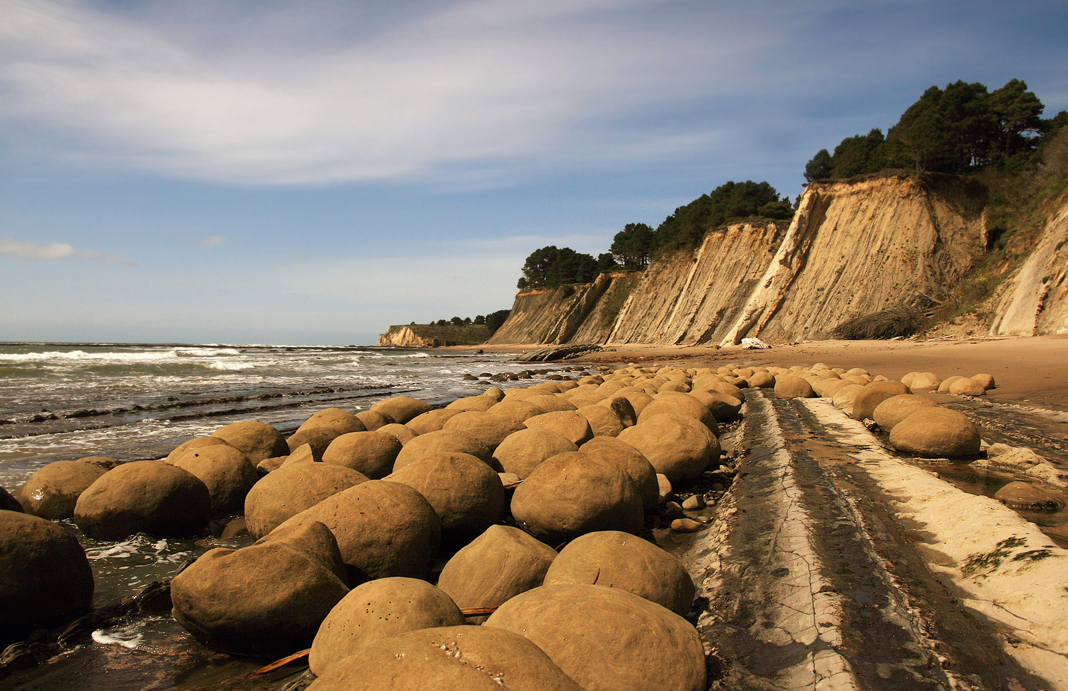
Bowling Balls Beach 2 edit.jpg - JJ Harrison

UShwy101GaviotaRestArea.png - Thewellman

Mt Tom from Swall Meadows.jpg - Dcrjsr

EspadaFormation.jpg - File Upload Bot (Magnus Manske)

LaCumbrePeak.jpg - File Upload Bot (Magnus Manske)

BICYCLING ON ROAD TO MINERAL KING - NARA - 542735.jpg - US National Archives bot

Sanc0164 - Flickr - NOAA Photo Library.jpg - Kobac

Death Valley Zabriskie Point met Manly Beacon 7-10-2012 14-41-39.JPG - Paul Hermans

Fall Canyon - Narrows (3812585164).jpg - File Upload Bot (Magnus Manske)

Aguereberry Point - View South (3811736781).jpg - File Upload Bot (Magnus Manske)

Zabriskie Point, Death Valley (5464224780).jpg - Sebastian Wallroth

"Thats some mountain youre on" (4897101088).jpg - File Upload Bot (Magnus Manske)

Death Valley Zabriskie Pt Facing West.jpg - HGMiller

Sedimentary Rock Layers Zabriskie Point Death Valley USA.jpg - GeoWriter

Zabriskie point death valley.jpg - Fæ

Zabriskie point death valley deserts.jpg - Fæ

Zabriskie Manly Beacon 031013.jpg - Wilson44691

Lake Berryessa turbidites2.jpg - Mikesclark

Zabriskie Point Death Valley December 2013 003.jpg - King of Hearts

Manly Beacon from Zabriskie Point.jpg - Holly Cheng

Zabriskie Point at Sunset Dec 2015 (23470554113).jpg - INeverCry

Death Valley Zabriskie Point 1.jpg - Heike Huslage-Koch

Zabriskie Point kz3.jpg - Kenraiz

NPS devils-postpile-geologic-map.jpg - RKBot

Sunrise at Vasquez Rocks Natural Area (30806496962).jpg - Thesupermat2

Death Valley Zabriskie Point P4230745.jpg - Alexander-93

Death Valley Zabriskie Point P4230746.jpg - Alexander-93

Lake Floodgates - Columbine Lake, Sequoia NP (140442815).jpg - Rodrigo.Argenton

Bat Mountain (Funeral Mountains, Inyo County, California, USA) 1.jpg - Jsj1771

Geological Formations on Trail to Devil's Chair.jpg - Crishazzard

Geology of California - Getting to the Tilted Layers (3354973062).jpg - GeoWriter

Geology of California - IM000544 049 (3354168441).jpg - GeoWriter

Geology of California - IM000544 050 (3354989142).jpg - GeoWriter

Geology of California - Tilted Layers (3354187645).jpg - GeoWriter

Death Valley - The group in Titus Canyon (3262099005).jpg - GeoWriter

Death Valley - 100 1088 (3262869522).jpg - GeoWriter

Rainbow Basin Natural Area - (4579133953).jpg - GeoWriter

Ribbon chert of the Marin Headlands Terrane, exposed at Marshall's Beach, San Francisco.jpg - Callanbentley

Bioherm (Tin Mountain Limestone, Lower Mississippian; Funeral Mountains, Inyo County, California, USA) 2 (45437683135).jpg - Ser Amantio di Nicolao

Big Sur in California.jpg - Chloekwak

Rainbow Basin Natural Area - 50701668776.jpg - Ser Amantio di Nicolao

Rainbow Basin Natural Area - 50702865143.jpg - Ser Amantio di Nicolao

Tilted beds in the surf (31865271604).jpg - Sentinel user

Franciscan melange + radiolarite, Estero Bluffs SP, just N of Cayucos, CA (50757250907).jpg - Orizan
❮
❯


