Wikimedi'Òc
Modes d'emploi

Cet album fait partie des albums
Cet album photos contient les sous-albums suivants :


Bishop tuff.jpg - Hike395

Lembert Dome northwest face.jpg - Stan Shebs
View north across Saratoga Spring ponds.jpg - MSchnitzler2000

Cinder Cone Lassen geologic map-explanation.png - Mav

Pollen core sampling.jpg - Woudloper

Cliffs half moon bay.JPG - Intothewoods29

SespeCA.jpg - FlickreviewR

Inyo Crater Lakes - north crater - erosion on rim.JPG - Mav
Turbidite-4.jpeg - Zimbres
Western development (9).jpg - Lldenke

Archeocyathids.JPG - Citypeek
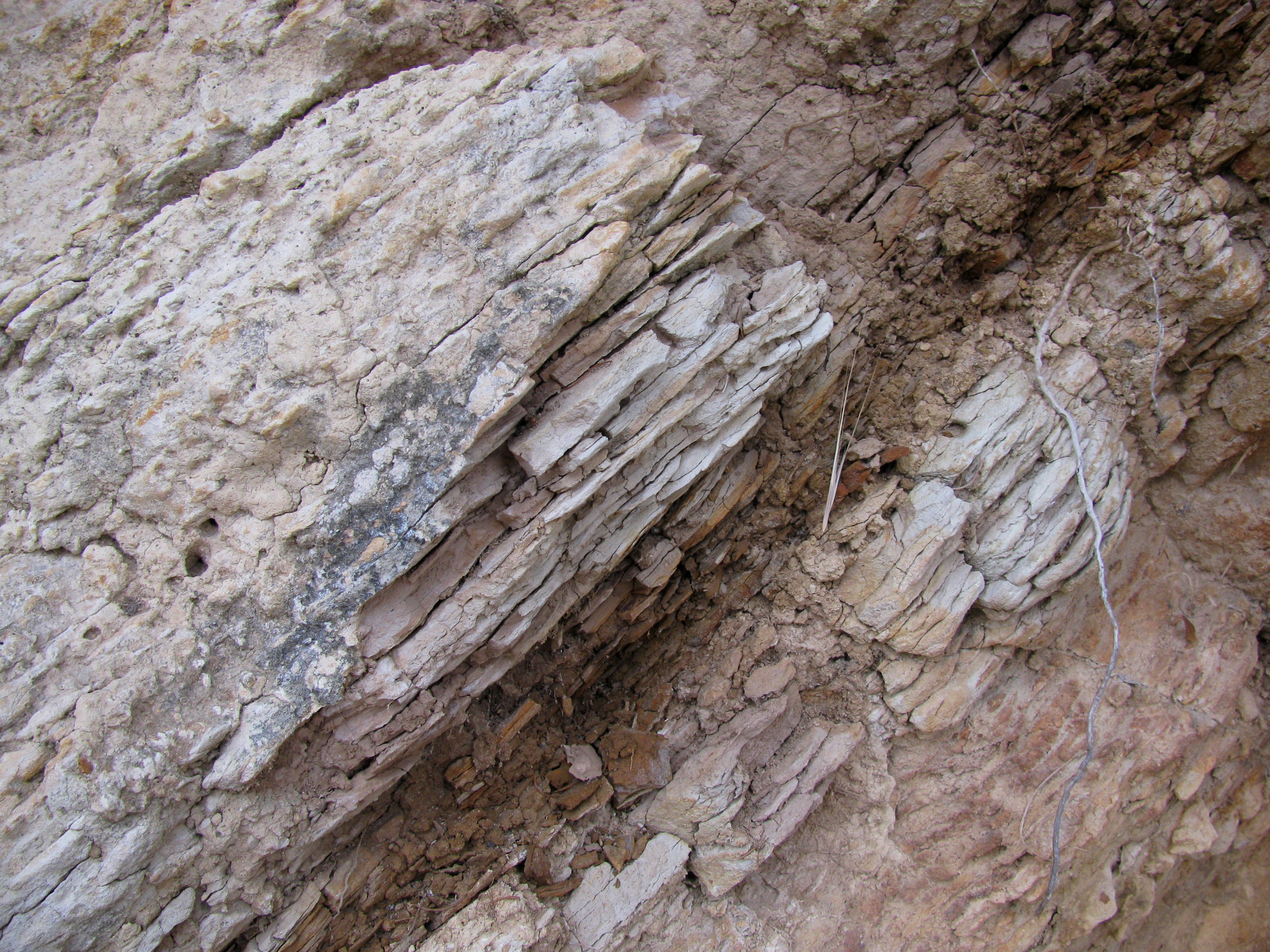
MontereyFm.jpg - File Upload Bot (Magnus Manske)
Explanation Regional Geologic Map of San Andreas and Related Faults in Carrizo Plain, Temblor, Caliente and La Panza Ranges and Vicinity, California.pdf - Rhalden~commonswiki

Bowl spires above Big Pothole Lake.JPG - Dcrjsr
GVS Strat Section.gif - Mikesclark

EurekaCliffsCA.jpg - Ixfd64
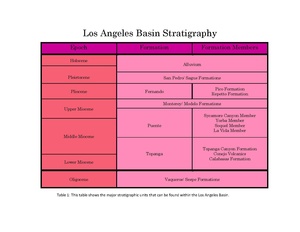
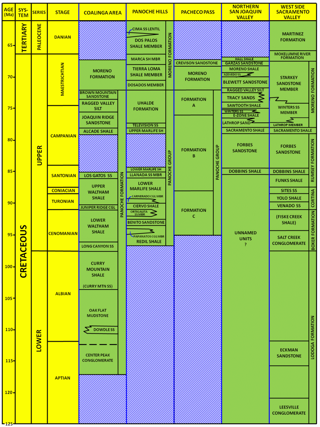
Cenozoic Basin Stratigraphy.pdf - Athrower04

Coast of Point Reyes (TK6).JPG - TheTokl

Convict Canyon, Mount Aggie, and Mount Baldwin from Red Slate Mountain (3928391466).jpg - Hike395
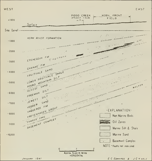
KernFrontOilFieldStructureMap.png - Pi3.124

Bat Mountain , Funeral Mountains, Inyo County, California,.jpg - Tillman

Blue folded metacherts with glaucophane-rich (ashy?) layers.jpg - Callanbentley

Rainbow Basin Natural Area - 50702269007.jpg - Ser Amantio di Nicolao

Alabama Hills National Scenic Area - 50652650756.jpg - Ser Amantio di Nicolao

Price Creek Fm.jpg - Carpenter, Kenneth