Wikimedi'Òc
Modes d'emploi

Cet album fait partie des albums

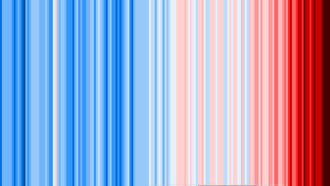


20190704 Warming stripes - HadCRUT.4.6.0.0 - world.png - RCraig09

20190705 Warming stripes - Berkeley Earth (world) - avg above- and below-ice readings.png - RCraig09

20190705 Warming stripes BEHIND line graph - Berkeley Earth (world).png - RCraig09

20190706 Compare warming stripes - Azores (GISTEMP 250 1880-2017) vs World (Berkeley Earth 1850-2018).png - RCraig09

20190707 Compare warming stripes - three reference periods.png - RCraig09

20190707 Compare warming stripes - HadCRUT vs Berkeley Earth - both 1961-1990 ref period.png - RCraig09

20190709 Compare warming stripes - 0.10 vs 0.15 C per color.png - RCraig09

20190711 Comparing warming stripes - GISS, GHCN-v3, HadCRUT4.6.0.0, Berkeley Earth (1961-1990 ref).png - RCraig09

20190725 COMPARE Warming stripes - N vs S hemispheres 1880-2018 (ref 1901-2000).png - RCraig09

20190727 COMPARE warming stripes - Global vs Caribbean 1910-2018 (ref 1910-2000).png - RCraig09

20190907 STACKED global warming stripes (large legends) - derived from Ed Hawkins.png - RCraig09

20190909 STACKED country warming stripes AND global average (1901- ).png - RCraig09

20190912 Stacked warming stripes - atmospheric layers (derived from Ed Hawkins).png - RCraig09

800,000-, 2,000-, 139-year global average temperature.png - RCraig09

2,000- and 139-year global average temperature.png - RCraig09

2017 Global warming attribution - based on NCA4 Fig 3.3.png - RCraig09

1970- Relative income growth by percentiles - US.png - RCraig09

1970- Relative income growth by percentiles - US logarithmic.png - RCraig09

1970- Decline in species populations - Living Planet Index.svg - RCraig09

8000 BCE+ Loss of forest and grassland to grazing and crops.svg - RCraig09

1960- Tax rates of richest versus low income people - US.svg - RCraig09