Wikimedi'Òc
Modes d'emploi

Cet album fait partie des albums
Cet album photos contient les sous-albums suivants :


Map of Europe according to Strabo.jpg - Fphilibert~commonswiki
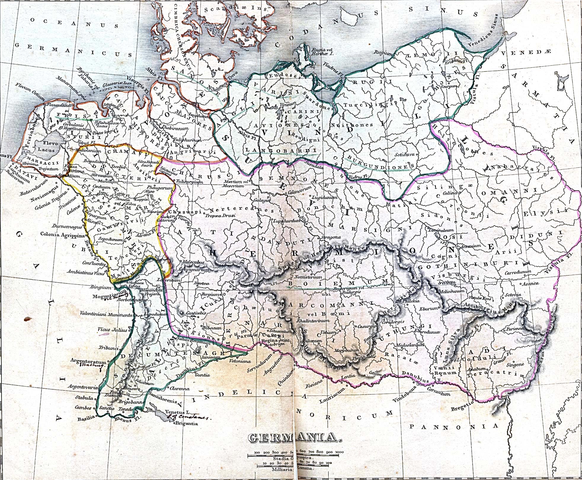
Ancient Germania - New York, Harper and Brothers 1849.jpg - Luestling~commonswiki
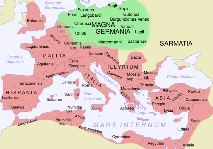
Imperium Romanum Germania.png - Claude Zygiel

Blaeu 1645 - Germaniae veteris typus.jpg - Tm

Celts.svg - KarlUdo

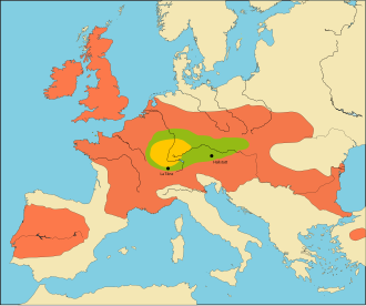
Europa Germanen 50 n Chr.svg - Furfur

Roman Empire 125.png - ArdadN

1832 Delamarche Map of Germany in Roman Times - Geographicus - Germany-d-32.jpg - BotMultichill

1657 Jansson Map of Germany (Germania) - Geographicus - Germaniae-jansson-1657.jpg - BotMultichillT

Germanic dialects ca. AD 1.png - Vlaemink

0009 T. Wandalische Funde aus Waldkarpaten 2-4. Jh. n. Chr. 1. 1. 1.JPG - Silar

025 Rekonstruktionsversuch wandalicher Besiedlung von dem Äußere Karpatensenken und WestbeskidenPR DSC 0147 przeworsk.JPG - Silar

027 Rekonstruktionsversuch wandalicher Trachten von dem Äußere Karpatensenken und Westbeskiden, 2 bis 3 Jh. PR DSC 1316 przeworsk.JPG - Silar

026 Rekonstruktionsversuch wandalicher Trachten von dem Äußere Karpatensenken und Westbeskiden, 2 bis 3 Jh. PR DSC 1315 przeworsk.JPG - Silar

Roman Empire 125 general map.SVG - ArdadN

Roman Empire 125 political map.png - ArdadN

Roman Empire 125 political map.svg - ArdadN

Celtic sword heath showing dragon 50 AD, Cracow, photo by Silar.jpg - Silar

Germanic dialects ca. AD 1 with Arabic color key.jpg - E-960

Europa Germanen 50 n Chr-pt.svg - Renato de Carvalho Ferreira

Roman Empire 125 political map-zh.svg - Vikarna

Roman Empire 125 political map-zh.png - Vikarna

Roman Empire 125 general map-zh.png - Vikarna

Roman Empire 125 general map-zh.svg - Vikarna

Europa Germanen 50 n Chr-gl.svg - MAGHOI

Roman Empire 125 political map-de.svg - Furfur

02023 Elements of the equipment from the so-called ducal tomb, 1st half of the 1st century AD, Szarbia.jpg - Silar

02023 AVCISSA breastpin, elements of the equipment from the so-called ducal tomb.jpg - Silar

Roman Empire 125 (Lugii).png - Blockhaj