Wikimedi'Òc
Modes d'emploi

Cet album fait partie des albums
Cet album photos contient les sous-albums suivants :


Burgundiskt kors, Nordisk familjebok.png - Väsk
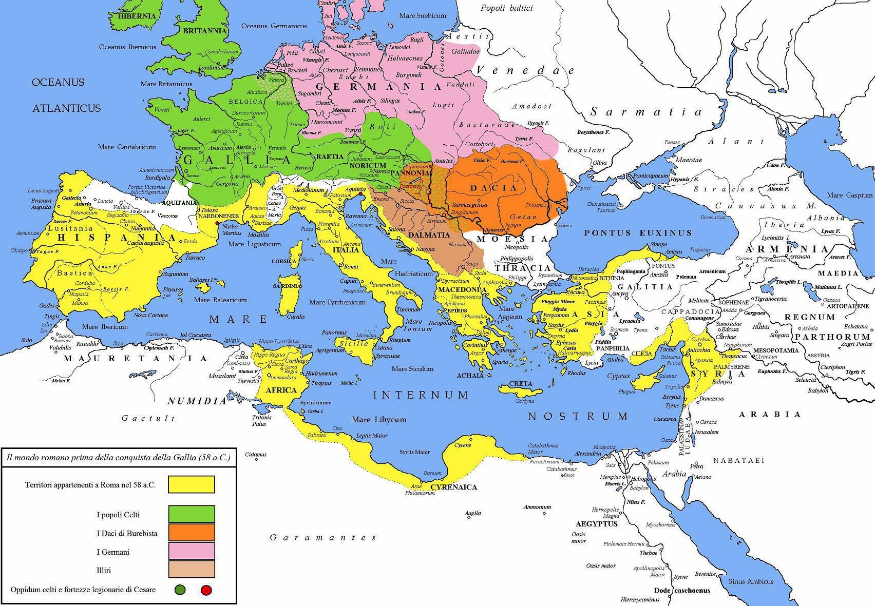
Cesare prima Gallia 58 a.C.jpg - E-960

Germania Teutoburg Ru.jpg - Vissarion

GermanenAD50.png - Ziegelbrenner

Europa Germanen 50 n Chr-fr.svg - Bourrichon

Costantino nord-limes png.PNG - Cristiano64

Bourgondische volksverhuizing.png - Nederlandse Leeuw

Roman Empire 125.png - ArdadN

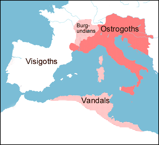
Barbarian invasions from 3rd century.png - Drachentöter78

Burgundian - Virgin and Child - Walters 27560.jpg - File Upload Bot (Kaldari)

Roman Empire 125 general map.SVG - ArdadN

Roman Empire 125 political map.png - ArdadN

Roman Empire 125 political map.svg - ArdadN
1Empire of Theodoric the Great 523.png - GifTagger

Map Gaul divisions 481-it.svg - Ruthven

Roman Empire 460 CE-pt.svg - Renato de Carvalho Ferreira

Evartisseman 2.png - Stardsen

Roman Empire 125 political map-zh.svg - Vikarna

Roman Empire 125 political map-zh.png - Vikarna

Roman Empire 125 general map-zh.png - Vikarna

Roman Empire 125 general map-zh.svg - Vikarna
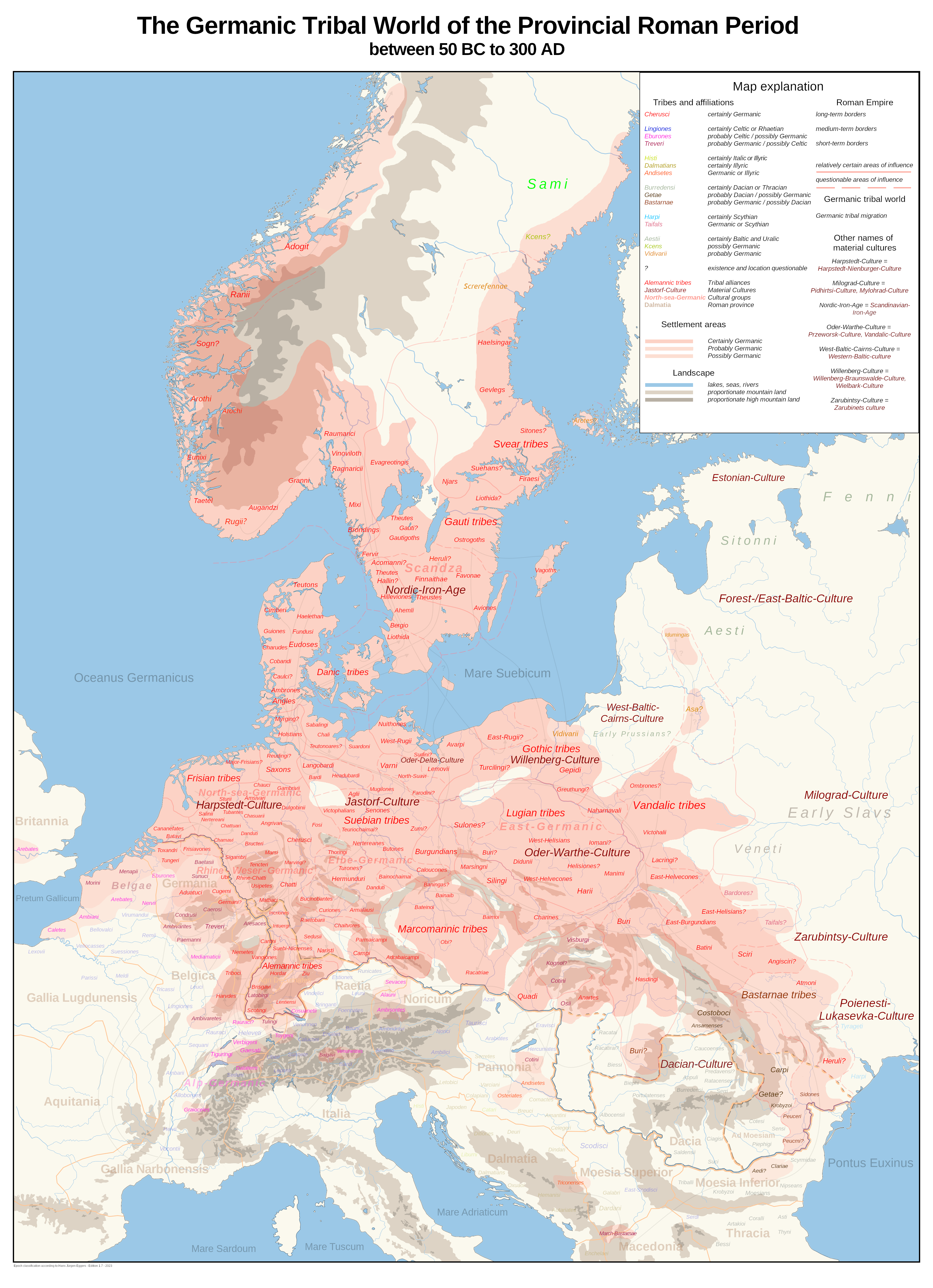
Germanic Tribes in the Roman Imperial Period.png - Arch.-Stud. A.P.

Roman Empire 125 political map-de.svg - Furfur

Coat of arms of the Burgundian State.svg - Felipe Fidelis Tobias

Royaumeburgonde501.png - PhylémonCyclone
Évolution du royaume burgonde.png - PhylémonCyclone

Royaume Burgonde en 499.png - PhylémonCyclone

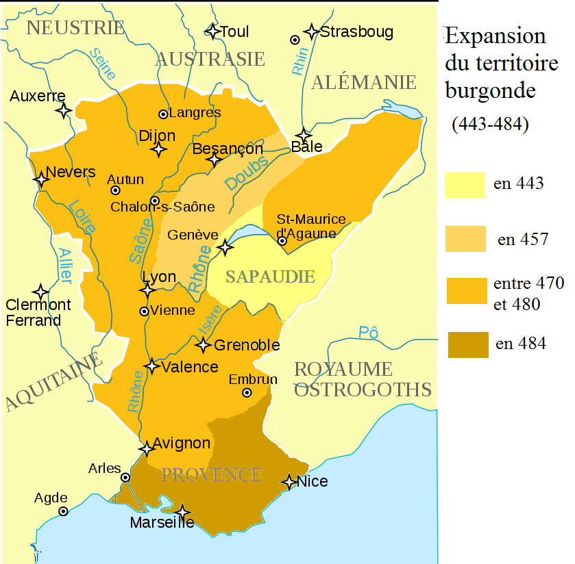
Évolution royaume burgonde 443-485.png - PhylémonCyclone

Burgondes507-509.png - PhylémonCyclone

01645 Blaeu 1645 - Germaniae veteris typus, Suevi, cropped.png - Silar

01870 Germania Rhaetia & Noricum.jpg - Silar

01700 A new map of ancient Germany, Rhætia, Vindelicia, and Noricum, shewing their principal people, tribes, cities, towns, rivers, mountains, Vindili, Vanduli Cropped.jpg - Silar

01718 Poland, Baltic Countries and Germany Map By Christopher Weigel, Germania Ptolemaei, Phinni.png - Silar
01780 A Map of Europe for the Illustration of King Alfred's Anglo-Saxon translation of Orosius. Engraved by J. Bayly , cropped.png - Silar