Wikimedi'Òc
Modes d'emploi

Cet album fait partie des albums


Ronay island.jpg - Rosser1954
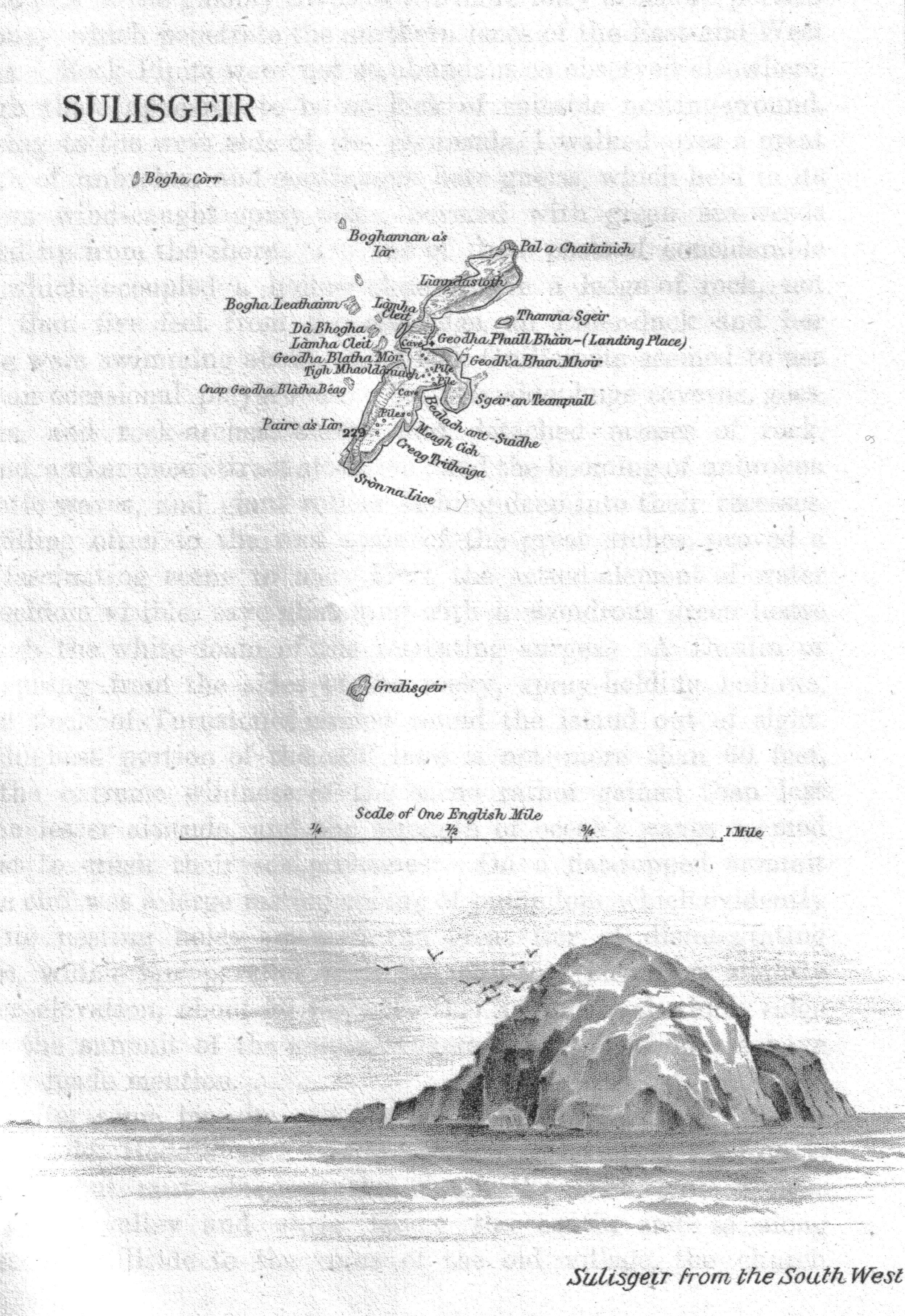
Sula sgeir island.jpg - Rosser1954

St-Kilda-3-maps.png - Philippe Giabbanelli

Shiant isles.jpg - Ratzer
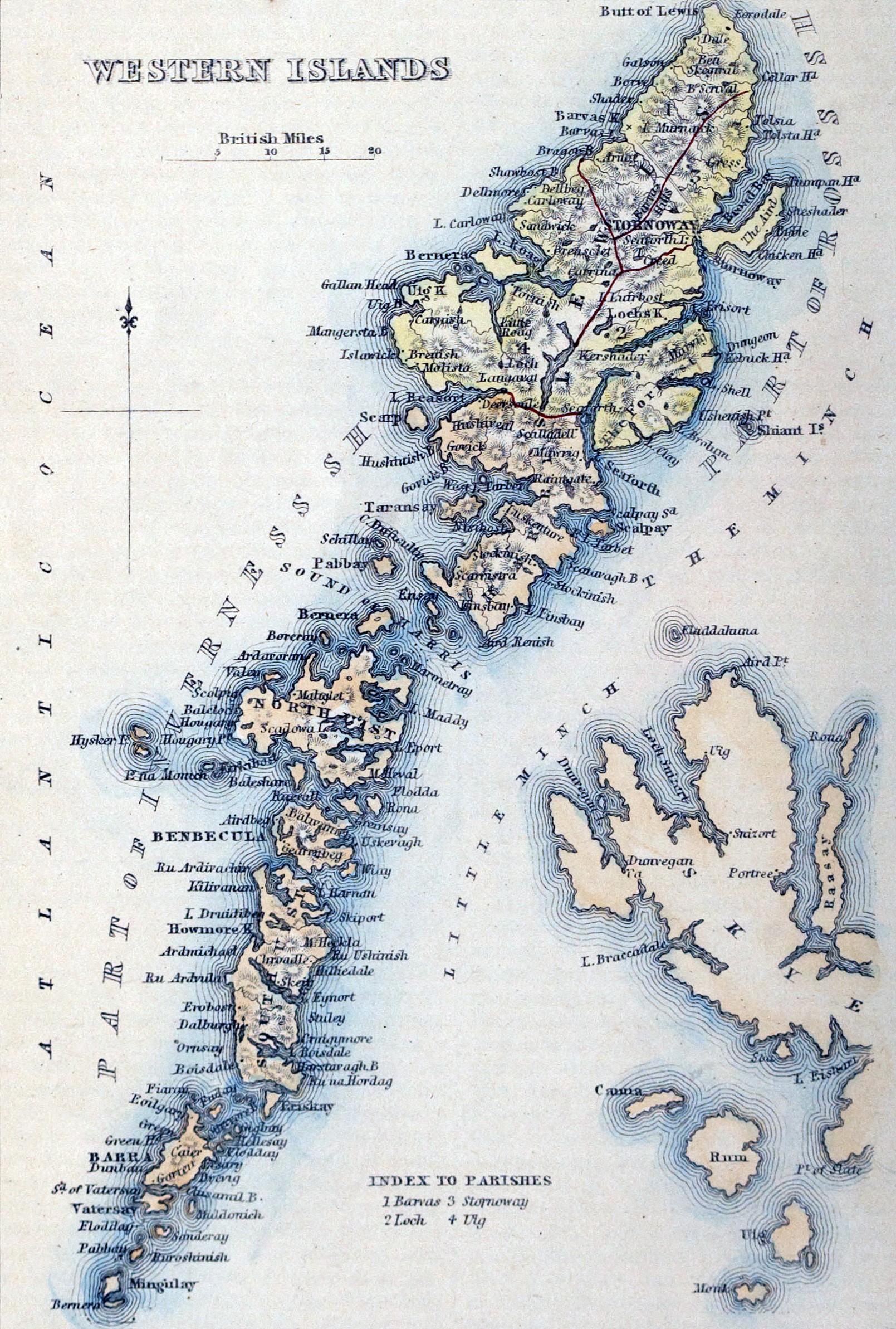
WESTERN ISLANDS.jpg - Elianfoo

Uistus Insula by Blaeu 1665.jpg - Ratzer

"Insulae quaedam minores ex Aebudis quae Mulam et Skiam insulas interjacent = Some of the Smaller Westerne Yles, lying betweene the yles of Mule and Skye - Timoth. Pont auctor. " (22232946936).jpg - Tm

"Vistus Insula, vulgo Viist, cum aliis minoribus ex Aebudarum numero ei ad meridiem adjacentibus - Auct. Timotheo Pont. " (22232907296).jpg - Tm

"Leogus et Haraia insulae ex Aebudarum numero." (21636250514).jpg - Tm

Island of St kildA, J Norman Heathcote, 1900.jpg - NMaia

438 of 'The Earth and its Inhabitants. The European section of the Universal Geography by E. Reclus. Edited by E. G. Ravenstein. Illustrated by ... engravings and maps' (11126686826).jpg - Artix Kreiger 2

471 of 'The Earth and its Inhabitants. The European section of the Universal Geography by E. Reclus. Edited by E. G. Ravenstein. Illustrated by ... engravings and maps' (11127194866).jpg - Artix Kreiger 2

Tabula Leogi et Haraiae ac Skiae vel Skianae insularum - CBT 6604667.jpg - Francesco Serra (BIBCOMTN)

Ordnance Survey Quarter-inch sheet 6 Skye and the Outer Hebrides, published 1936.jpg - Kognos

Admiralty Chart No 2474 Scotland W. Coast Sheet 5 Hebrides Barra Head to Scarpa Island, Published 1865.jpg - Kognos

Ordnance Survey One-Inch Sheet 22 Sollas, Published 1947.jpg - Kognos

Admiralty Chart No 1144 Plans in the Hebrides, Published 1911.jpg - Kognos

Admiralty Chart No 3331 Flannan Isles, Published 1903.jpg - Kognos

Admiralty Chart No 2508 Western Approaches to the Hebrides, Published 1945.jpg - Kognos