Wikimedi'Òc
Modes d'emploi

Cet album fait partie des albums
Cet album photos contient les sous-albums suivants :


Mappa Ebridi est.png - Maksim

Taransay.png - Valencia~commonswiki
ScotlandEileanSiar.png - Harami2000
Outer Hebrides UK blank map.svg - Nilfanion

Eriskay map.svg - Mipmapped

Outer Hebrides UK location map.svg - Nilfanion
Outer Hebrides UK ward map (blank).svg - Nilfanion

Na h-Eileanan an Iar (Scottish Parliament constituency).svg - MGA73bot2

Verlauf der A865.png - Eschenmoser
Map Eoligarry.png - Eschenmoser

Outer Hebrides UK relief location map.jpg - Nilfanion
Outer Hebrides blank.svg - Hogweard

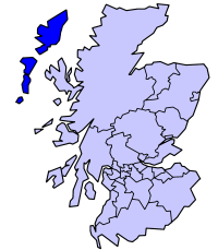
Western Islands Location.png - MGA73bot2
Outer Hebrides UK parish map (blank).svg - Nilfanion

The Quarterly journal of the Geological Society of London (14340781094).jpg - Fæ

Ordnance Survey One-inch Sheet 17 North Uist, Published 1959.jpg - Kognos

Eriskay, Outer Hebrides.jpg - SchroCat

Relevant locations for the SS Politician.jpg - SchroCat

Admiralty Chart No 1144 Plans in the Hebrides, Published 1911, Corrections to 1970.jpg - Kognos