Wikimedi'Òc
Modes d'emploi

Cet album fait partie des albums
Cet album photos contient les sous-albums suivants :


GhatRivers.png - Shyamal

Duke of Clarence route.jpg - Shyamal

Historical fragments of the Mogul empire Fleuron T105584-1.png - Fæ

HyderAliDominions1780.jpg - Armader
Rigobert-Bonne-Atlas-de-toutes-les-parties-connues-du-globe-terrestre MG 9993.tif - Hansmuller

Peutinger India.png - Venu62~commonswiki

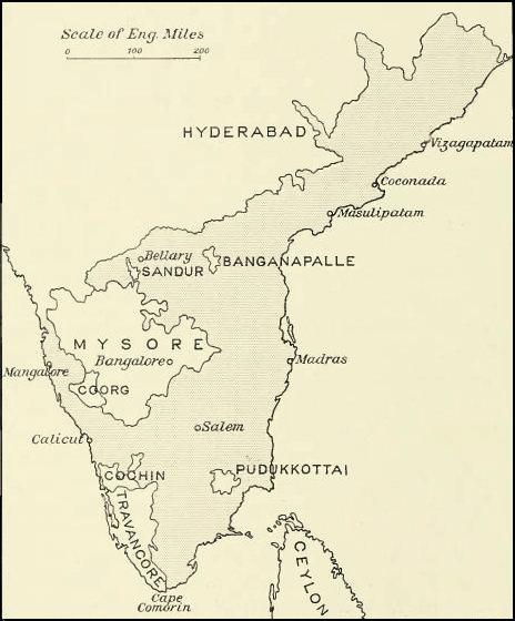
Madras Prov South 1909.jpg - Jungpionier

TabulaPeutingerianaMuziris.jpg - World Imaging
South India Map 1794.jpg - Marcus334
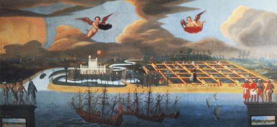
Tranquebar 1600.jpg - Ranveig

Wikipedia OldMysore.jpg - File Upload Bot (Magnus Manske)

SouthIndia1794.jpeg - Magicpiano

Madras Prov 1859.gif - File Upload Bot (Magnus Manske)
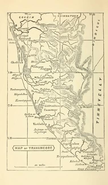
Travancore 1871.JPG - File Upload Bot (Magnus Manske)

Mysore in 1704 Joppen.jpg - Abecedare

Plan de Mahe avec les attaques de Bayanor souverain du lieu.jpg - AYE R
Madras map 1913.jpg - Xufanc

1808 Smith Map of India - Geographicus - India-smith-1808.jpg - BotMultichill

1804 German Edition of the Rennel Map of India - Geographicus - IndiaGerman-rennell-1804.jpg - BotMultichillT
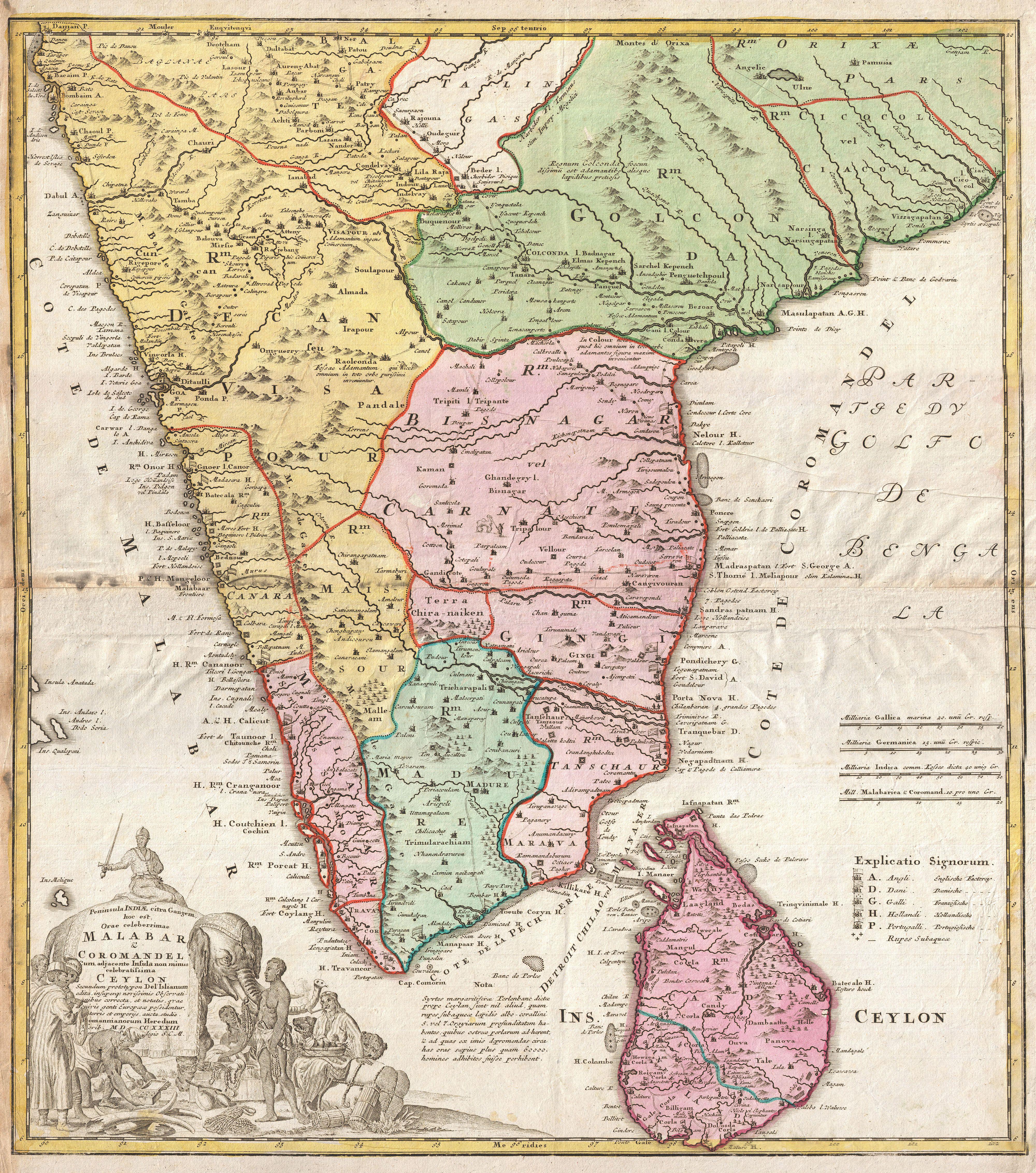
1733 Homann Heirs Map of India - Geographicus - India-homannheirs-1733.jpg - BotMultichillT

1652 Sanson Map of India - Geographicus - India-sanson-1652.jpg - BotMultichillT
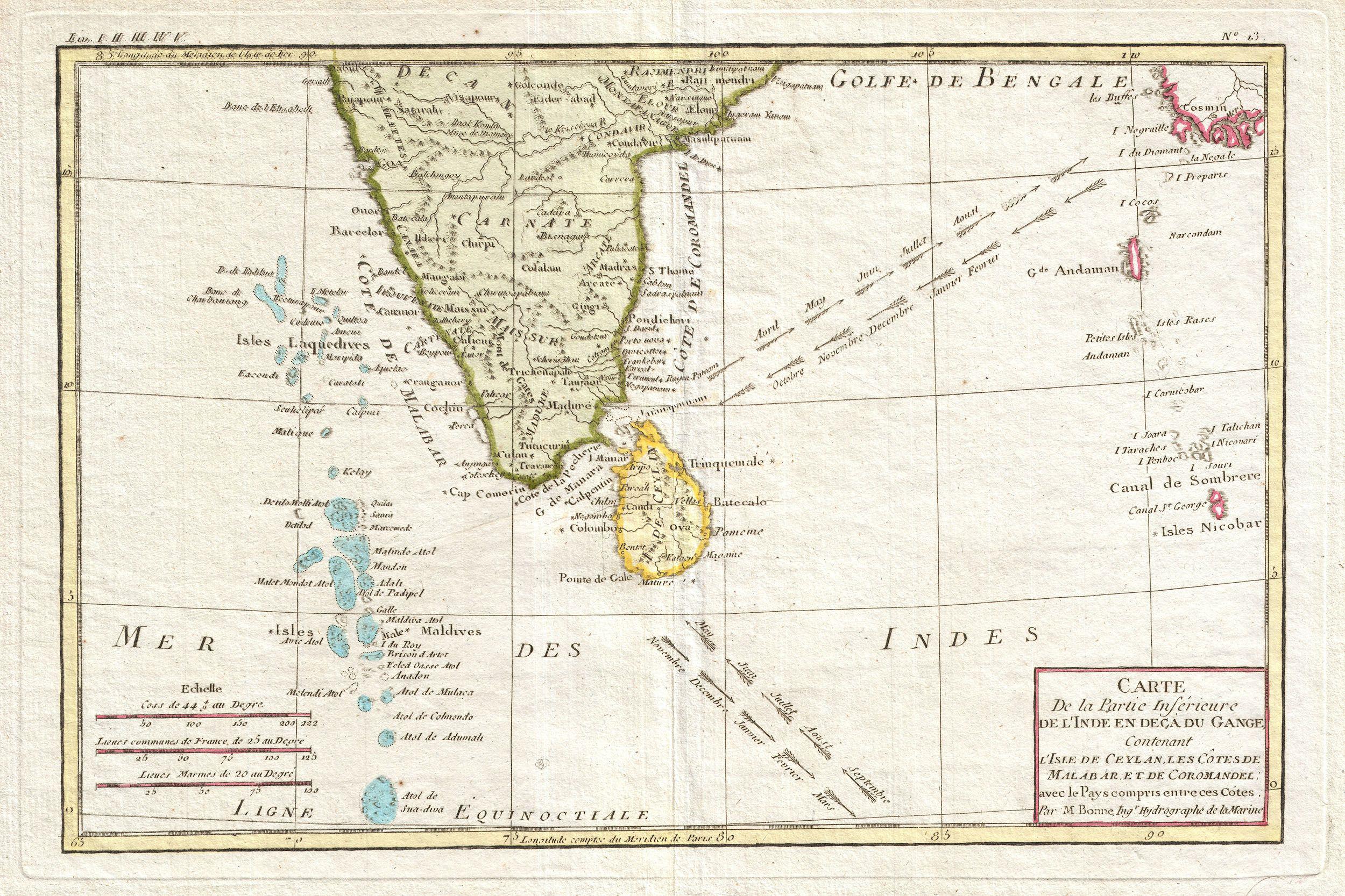
1780 Bonne Map of Southern India, Ceylon, and the Maldives - Geographicus - IndiaSouth-bonne-1780.jpg - BotMultichillT

1800 Faden Rennell Wall Map of India - Geographicus - India-faden-1795.jpg - BotMultichillT

1838 Wyld Wall Map of India (Hindostan or British India) - Geographicus - India-wyld-1838.jpg - BotMultichillT

1780 Raynal and Bonne Map of Southern India - Geographicus - Indes-bonne-1780.jpg - BotMultichillT

1793 Faden Wall Map of India - Geographicus - India-faden-1793.jpg - BotMultichillT

1814 Thomson Map of India - Geographicus - IndiaSouth-t-1814.jpg - BotMultichillT

1775 Mannevillette Map of Southern India and Ceylon or Sri Lanka - Geographicus - CeylonIndia-mannevillette-1775.jpg - BotMultichillT

South India map 1782.jpg - Shyamal

South India Map 1652.jpg - Shyamal

Southern India 1808.jpg - Shyamal

Madras Prov South 1909 Mysore.jpg - Wdwd

Buchanan Journey map.jpg - Shyamal
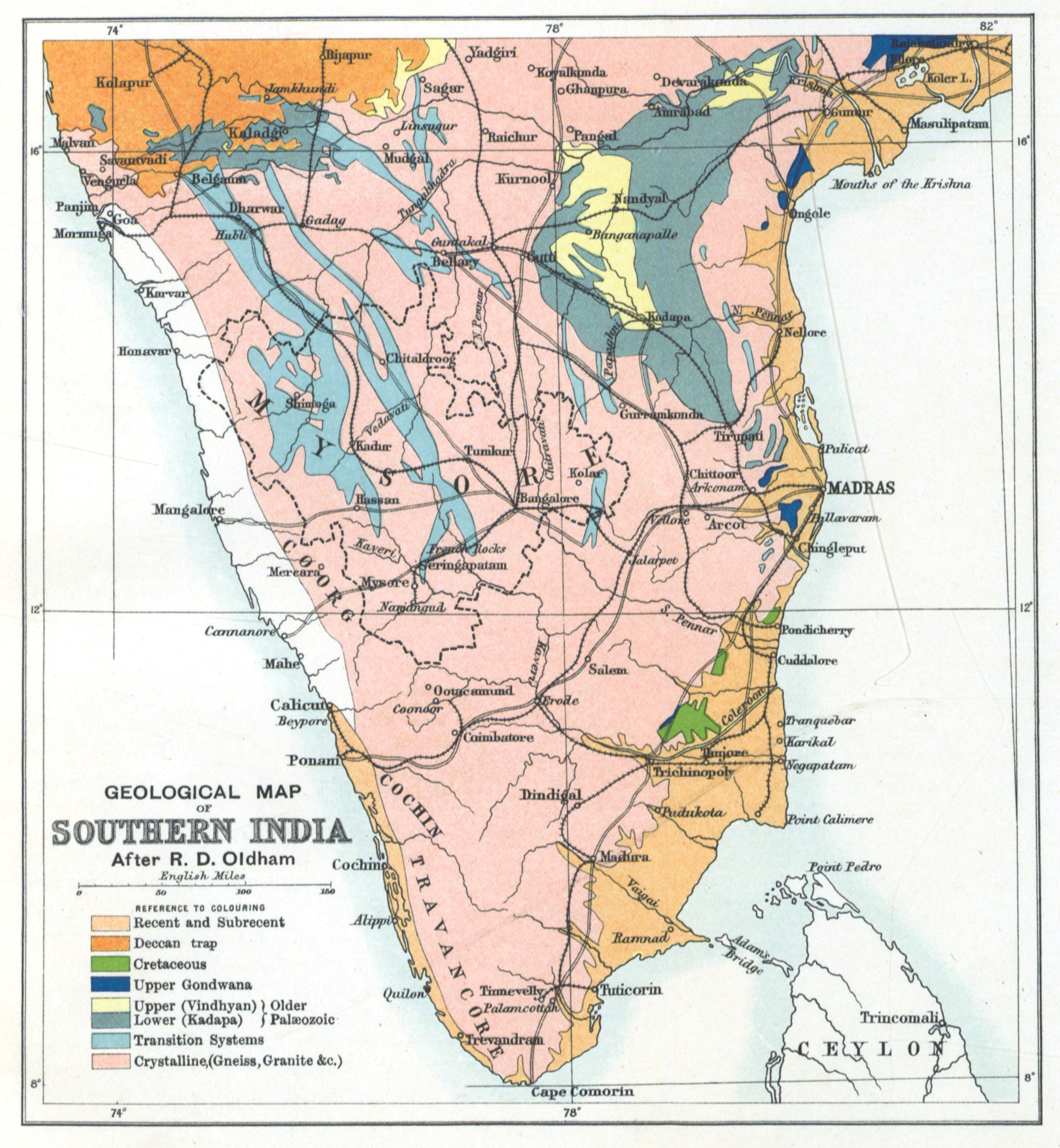
Geology Gazetteer map 1897.jpg - Shyamal

South India map.jpg - Shyamal

Southern Division Map 1843.jpg - Shyamal

History of American missions to the heathen, from their commencement to the present time (1840) (14596037500).jpg - Fæ

History of American missions to the heathen, from their commencement to the present time (1840) (14759720056).jpg - Fæ

Map1880s.jpg - శ్రీధర్ బబు
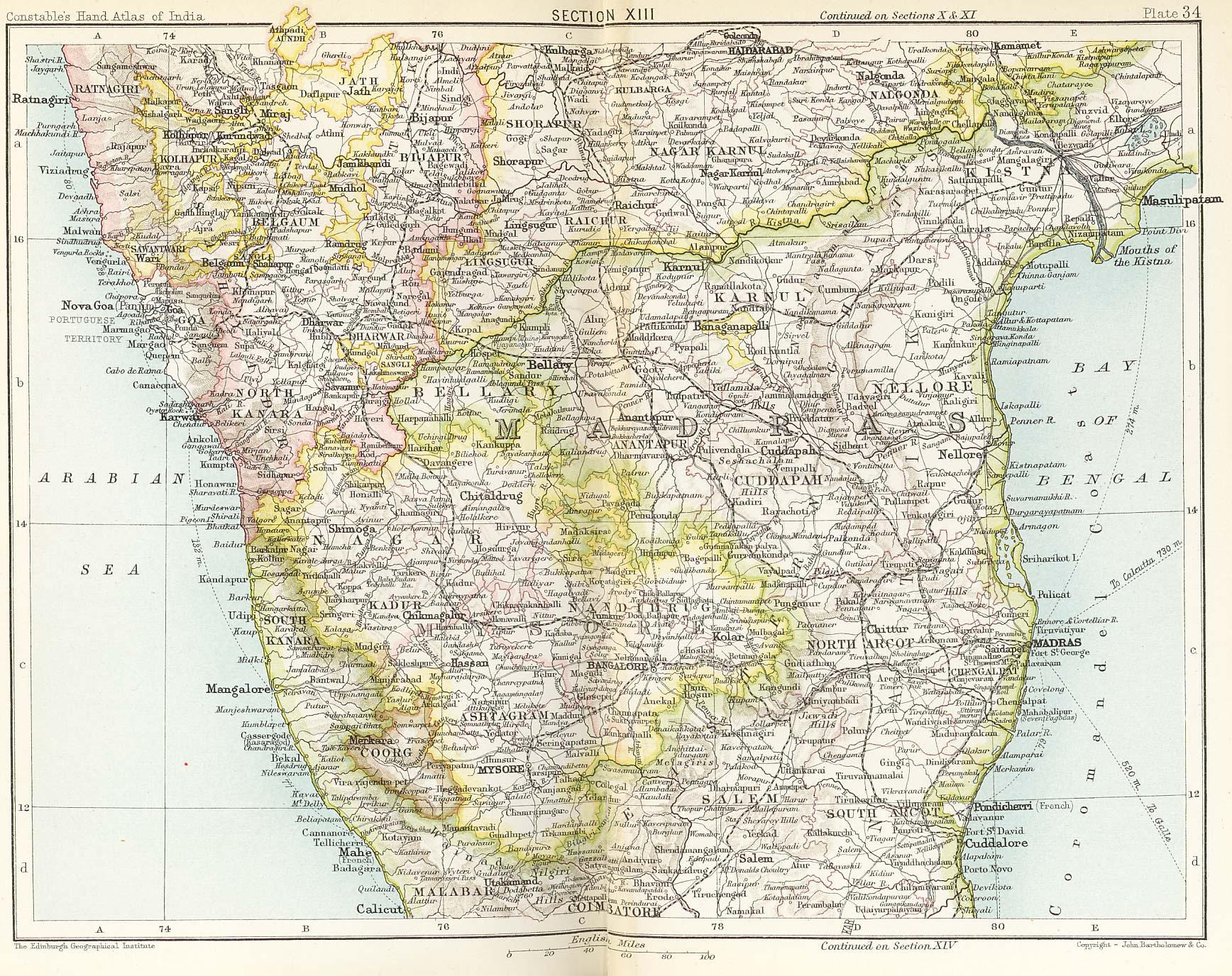
Plate 34. Sect. XIII- Madras, Mysore and Goa maps from Constable 1893 Hand Atlas.jpg - శ్రీధర్ బబు

Plate 35. Sect. XIV- Travancore, Trichinopoli and Ceylon from maps of constabled 1893 hand atlas.jpg - శ్రీధర్ బబు

The peninsula of India, from the Kistnah River to Cape Comorin; exhibiting the partition of the territories of the late Tippoo Sultaun, according to the treaty of 1792, made by the Marquis Cornwallis; and that of 1799, made RMG K1047.jpg - Fæ

936 of 'Géographie générale; physique, politique et économique. ... Avec ... cartes ... gravures, etc' (11112912956).jpg - Artix Kreiger 2

24 of 'Native Life in Travancore' (11162355843).jpg - SteinsplitterBot

16 of '“The Land of Charity-” a descriptive account of Travancore and its people, etc. (With illustrations.)' (11095458733).jpg - Artix Kreiger 2

23 of 'The Earth and its Inhabitants. The European section of the Universal Geography by E. Reclus. Edited by E. G. Ravenstein. Illustrated by ... engravings and maps' (11124973105).jpg - Artix Kreiger 2
1800 Map of Peninsular India-1795.jpg - Shyamal

EB1911India - map (southern part).jpg - Bob Burkhardt

Map of Thekkumkur in 1790.jpg - RajeshUnuppally

Map of South Kerala 1498 AD by Dutch.png - Beao

The Peninsula of India, 1788.jpg - Pratishkhedekar

The Harmsworth atlas and Gazetter 1908 (135850297).jpg - Polona Upload

The Southern countries of India from Madrass to cape Comorin - Surveyed by Col. Kelly... ; Surveyed by Capt. Wersebe - btv1b531195140 (1 of 2).jpg - Gzen92Bot

The Southern countries of India from Madrass to cape Comorin - Surveyed by Col. Kelly... ; Surveyed by Capt. Wersebe - btv1b531195140 (2 of 2).jpg - Gzen92Bot

S India1893.jpg - Baddu676

From "Nova tabula terrarum Cucan, Canara, Malabaria, Madura & Coramandelia, cum parte septroniali insulae Ceylon, in Mari Indico Orientali" by Gerard van Keulen, Amsterdam, c.1704.jpg - Baddu676
Southindia1721.jpg - Baddu676
Hyder's Dominions in 1780.jpg - Mydust

Pope1880MadrasPres2.jpg - MALLUS
Nova tabula terrarum Cucan, Canara, Malabaria, Madura and Coramandelia, cum parte septroniali insulae Ceylon, in Mari Indico Orientali. Edente Hadriano Relando. RMG F0164.tiff - Fæ
Tierra de Persia RMG F1536.tiff - Fæ
60The South Indian Railway.jpg - Wuselig

Andrees allgemeiner Handatlas 1912 (82964449).jpg - Enyavar

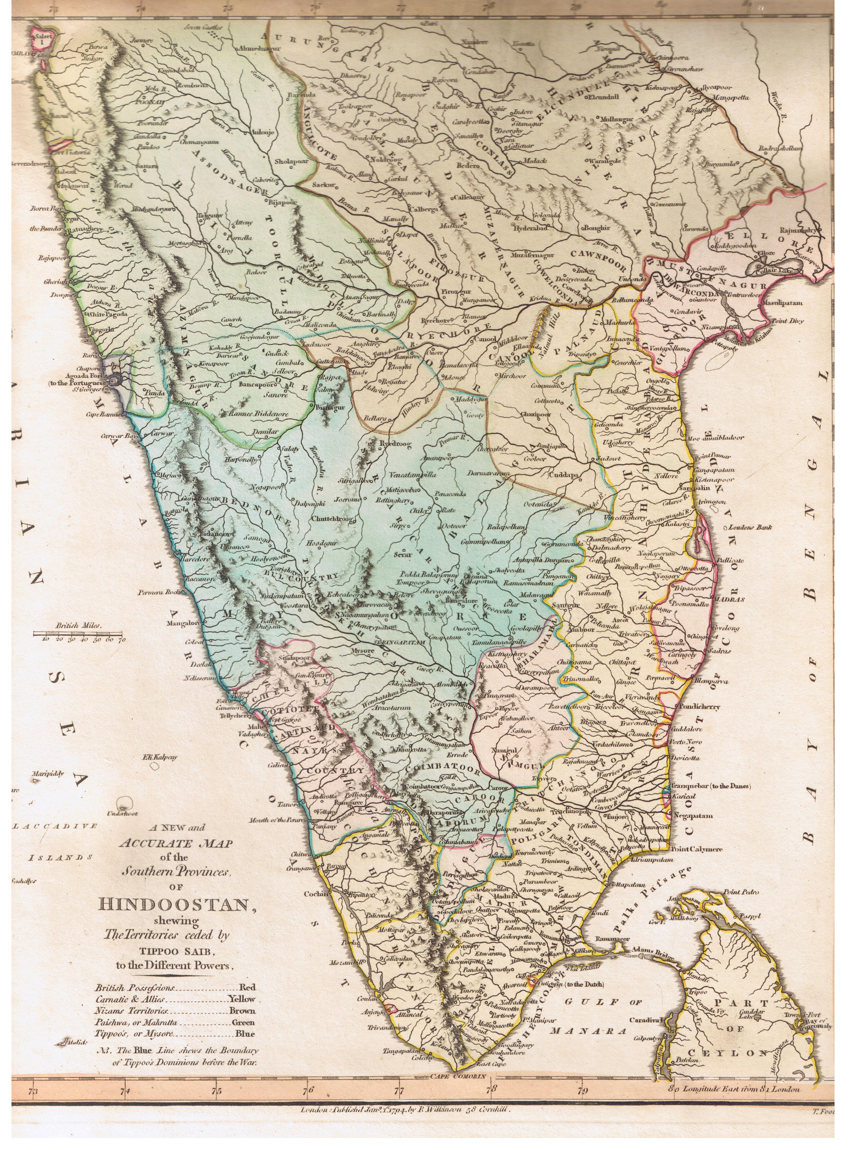
"The Southern Provinces of Hindoostan," by Robert Wilkinson, London South.jpg - Baddu676

"The Southern Provinces of Hindoostan," by Robert Wilkinson, London North.jpg - Baddu676

From a map by John Archer from "Gilbert's Modern Atlas of The Earth with Descriptive Letter-Press by Robert Mudie," Grattan & Gilbert, London, 1840.jpg - Baddu676