Wikimedi'Òc
Modes d'emploi

Cet album fait partie des albums


City Plans Heito.jpg - A-lú-mih
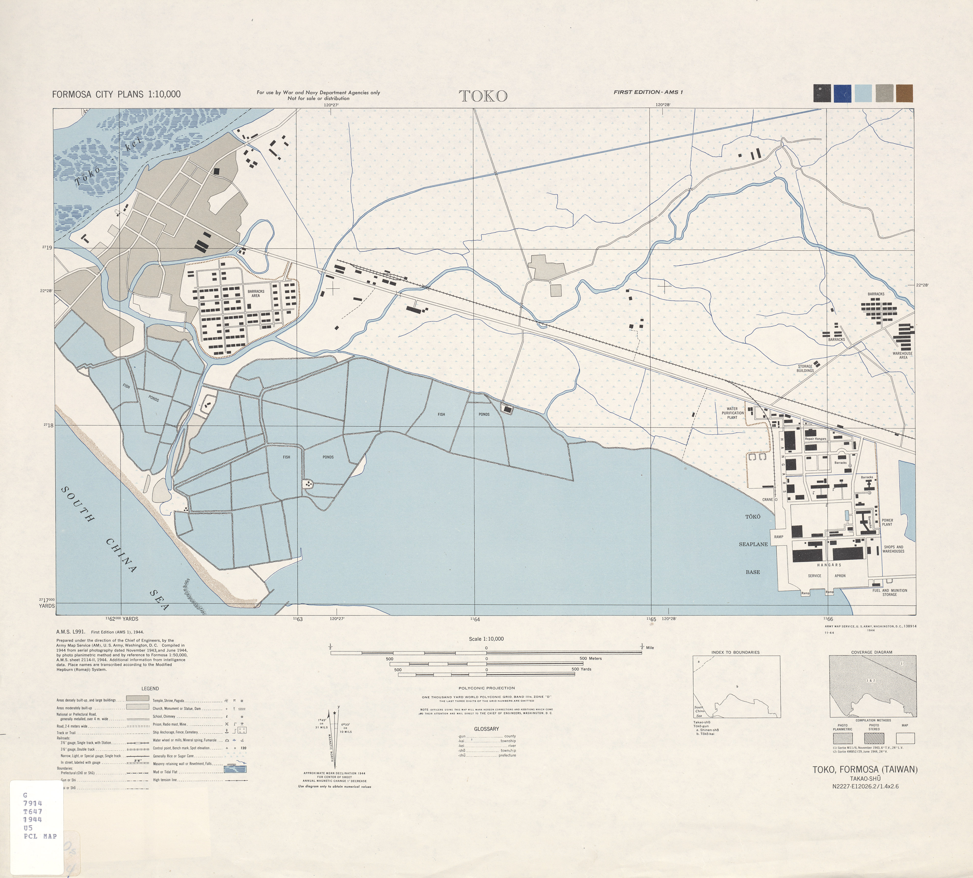
City Plans Toko.jpg - A-lú-mih
Lambay Insel (Karte 1905).jpg - A-lú-mih

Map of the Western Coast of Taiwan, Tayouan and Points South, c. 1636.jpg - Hst0129

Kato 1 10000 1944.jpg - Hst0129

1898日治二萬分之一台灣堡圖(明治版).jpg - Taiwankengo

Formosa Island and the Pescadores Le Gendre Bootang 1870.jpg - Hst0129

Notes of travel in Formosa 1869.jpg - Hst0129

Map line between aborigines and hans.jpg - Hst0129

Map of Hengchun county 1880.jpg - Hst0129

Back front mount Taiwan Hengchun 1879.jpg - Hst0129

Souther part of Taiwan Le Gendre c1873.jpg - Hst0129

Image taken from page 403 of 'The Straits of Malacca, Indo-China, and China; or ten years' travels, adventures, and residence abroad ... Illustrated ... by J. D. Cooper, etc' (11108931063).jpg - Artix Kreiger 2
Shajō no byōchi - chizu ni iwayuru Rōkyōwan nari = Sialiao anchorage - the Liang Kiau Bay of the maps. LOC 2011517762.tif - Fæ

Location map of schools in Takao and Hoko 1927.jpg - Dquai

鵝鑾鼻神社位置圖.jpg - CartoDD897

阿緱街町名區畫.jpg - CartoDD897

新埤庄全圖.jpg - CartoDD897
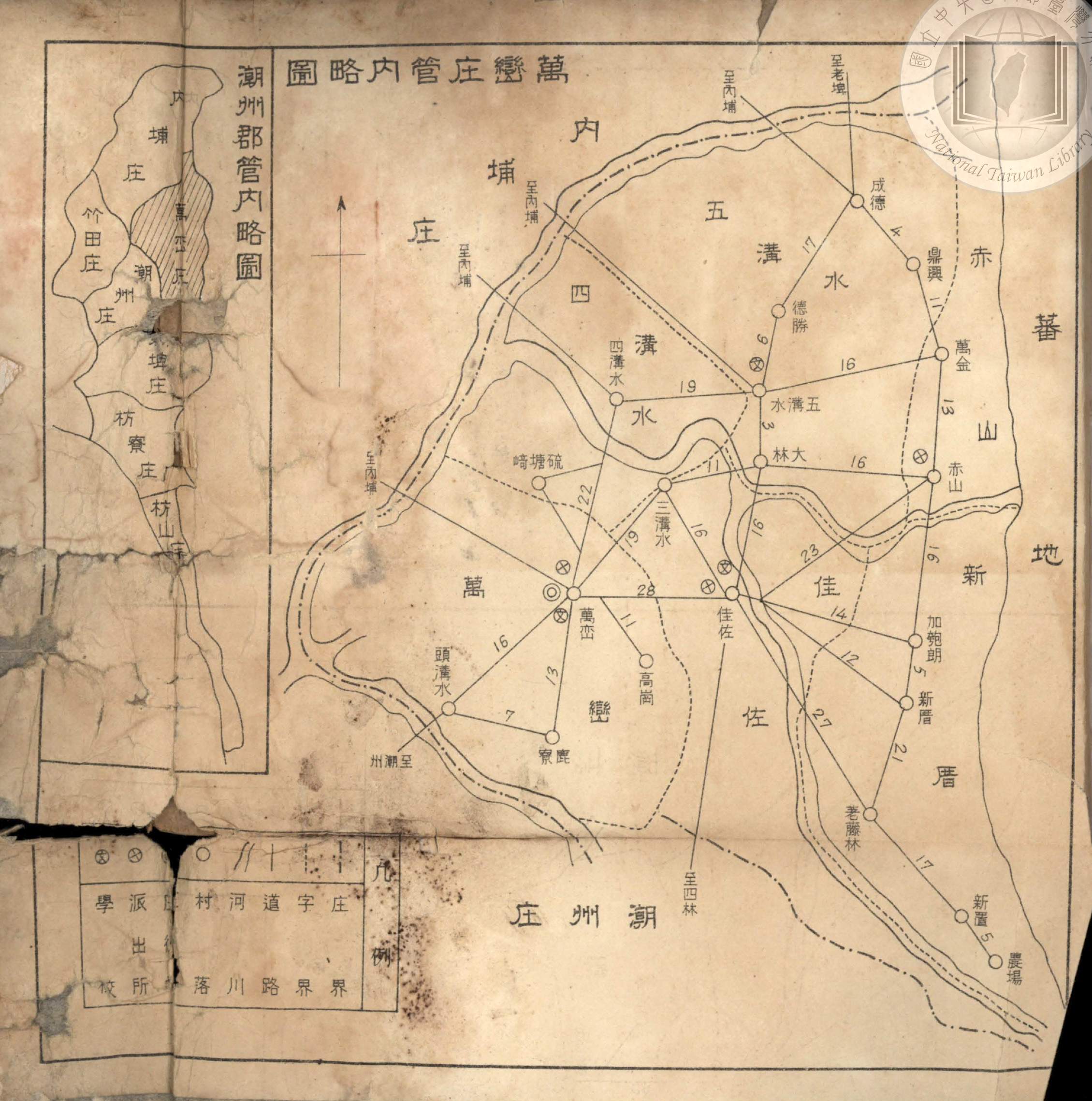
萬巒庄管內略圖.jpg - CartoDD897

屏東市町名與大字圖.jpg - CartoDD897

屏東水道水源地位置平面圖.jpg - CartoDD897

內埔庄管內圖.jpg - CartoDD897

潮州郡鳥瞰圖.jpg - CartoDD897

〈高砂族分布圖〉(複製品)恆春郡部分 (2).jpg - 氏子

〈高砂族分布圖〉(複製品)潮州郡南部部分.jpg - 氏子

東港郡管內圖.jpg - CartoDD897
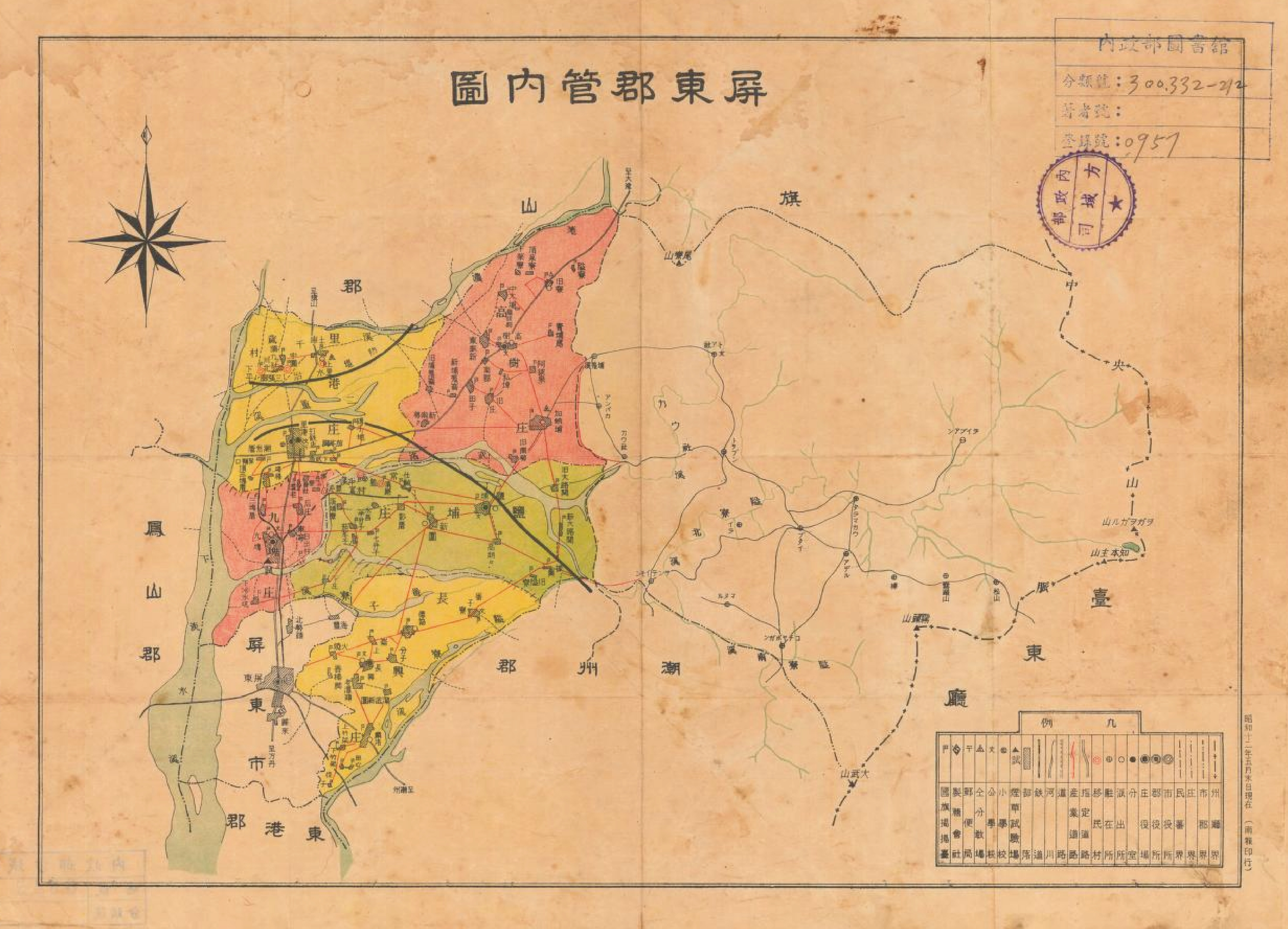
屏東郡管內圖.jpg - CartoDD897

潮州郡管內圖.jpg - CartoDD897