Wikimedi'Òc
Modes d'emploi

Cet album fait partie des albums
Cet album photos contient les sous-albums suivants :


HIND(1863) LABRADOR-EXP. p276 MAP OF THE RIVER MOISIE AND ADJOINING COUNTRY.jpg - Metilsteiner

HIND(1863) LABRADOR-EXP. p544 MAP OF THE PENINSULA OF LABRADOR.jpg - Metilsteiner

IMRAY(1884) p0181 EASTERN SHOALS.jpg - Metilsteiner
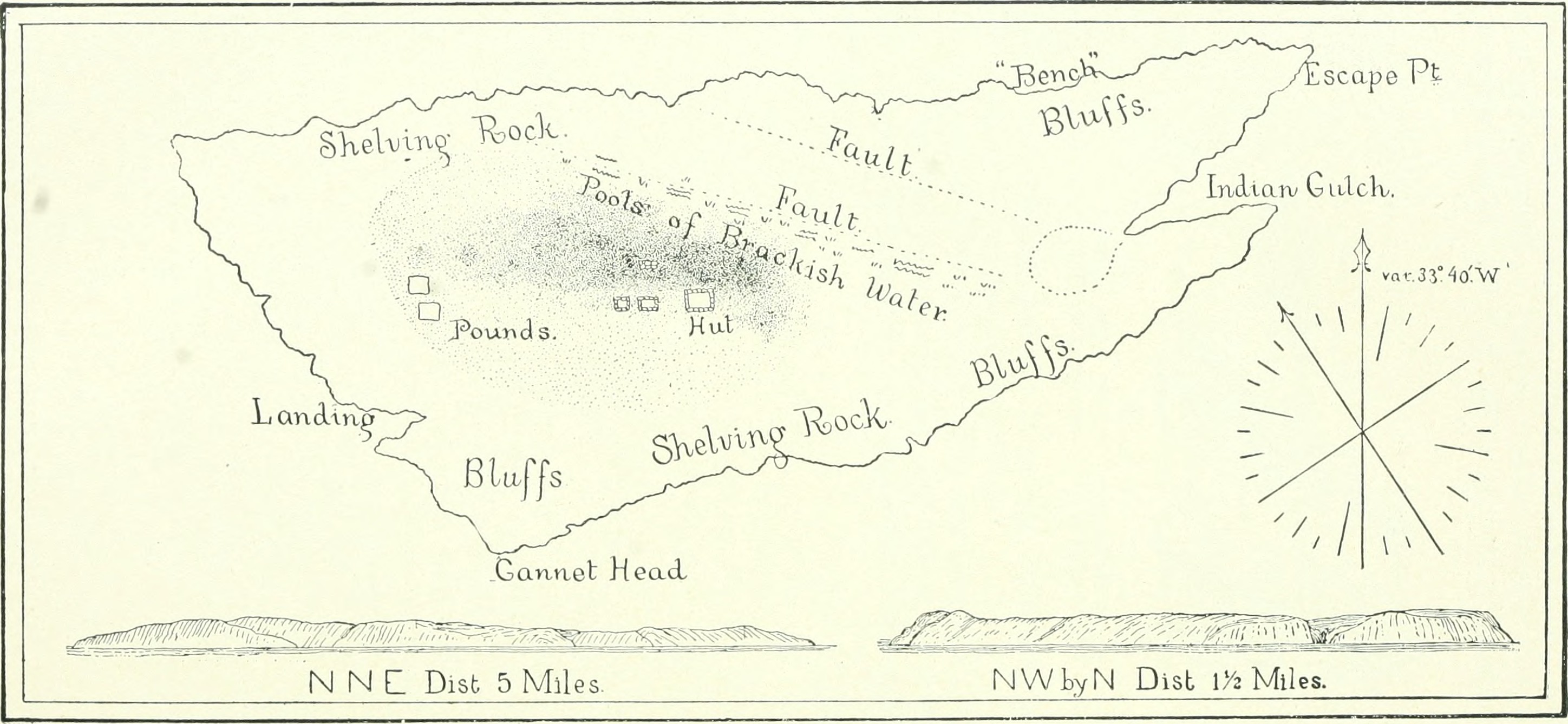
Annual report of the Board of Regents of the Smithsonian Institution (1889) (18248087648).jpg - SteinsplitterBot

IMRAY(1884) p0181 VIRGIN ROCKS.jpg - Metilsteiner

Appleton's annual cyclopedia and register of important events- embracing political, military, an ecclesiastical affairs; public documents; biography, statistics, commerce, finance, literature, (14589771948).jpg - Fæ

Labrador Mining Company 1934 map of territory 20 miles to 1 inch in Labrador Development Company Ltd publicity brochure Port Hope Simpson Tombstone Llewelyn Pritchard.jpg - Llewelynpritchard2

Carte reduite du golphe de St Laurent.jpg - Jeangagnon

NFL in 1912.png - Zorion

The Regions EP Cover.jpg - Thepokemask
Memoires-des-commissaires-du-roi-et-de-ceux-de-sa-majesté-brittanique MG 9386.tif - Hansmuller

Report of the Brown-Harvard Expedition to Nachvak, Labrador, 1900 (1902) (14749598294).jpg - Faebot

Image taken from page 353 of 'A History of Newfoundland from the English, Colonial and foreign records. ... With ... illustrations and numerous maps' (16564199426).jpg - Artix Kreiger 2

Image taken from page 353 of 'A History of Newfoundland from the English, Colonial and foreign records. ... With ... illustrations and numerous maps' (16589527482).jpg - Artix Kreiger 2

330 of 'A History of Newfoundland from the English, Colonial and foreign records. ... With ... illustrations and numerous maps' (11133555003).jpg - Artix Kreiger 2
Newfoundland East Coast Trinity Bay - Deer and St. Jones Harbours (IA McGillLibrary-rbsc map bayfield-019-18899).pdf - Fæ

Map of St John's Newfoundland 1932.jpg - Palaeozoic99