Wikimedi'Òc
Modes d'emploi

Cet album fait partie des albums
Cet album photos contient les sous-albums suivants :


A chart of part of the coast of Labradore from the straights of Bell Isle, to cape Bluff - surveyed by Joseph Gilbert ; engraved by Thomas Jefferys... - btv1b530168069 (1 of 2).jpg - Gzen92Bot

Cooks Karte von Neufundland.jpg - Schaengel89~commonswiki
James Cook NF Belle Isle.jpg - Shipguy

1780 Raynal and Bonne Map of New England and the Maritime Provinces - Geographicus - Canada-bonne-1780.jpg - BotMultichillT

AnnotatedChartOfStJohns1798.jpg - User-duck

Carte du Golphe de St-Laurent et Pays Voisins.png - Jeangagnon

A chart of the sea coast of New Found Land, New Scotland, New England, New York, New Jersey, with Virginia and Maryland (9492652815).jpg - File Upload Bot (Magnus Manske)

A general map of the northern British colonies in America, which comprehends the province of Quebec, the government of Newfoundland, Nova-Scotia, New-England and New-York (9471676933).jpg - File Upload Bot (Magnus Manske)
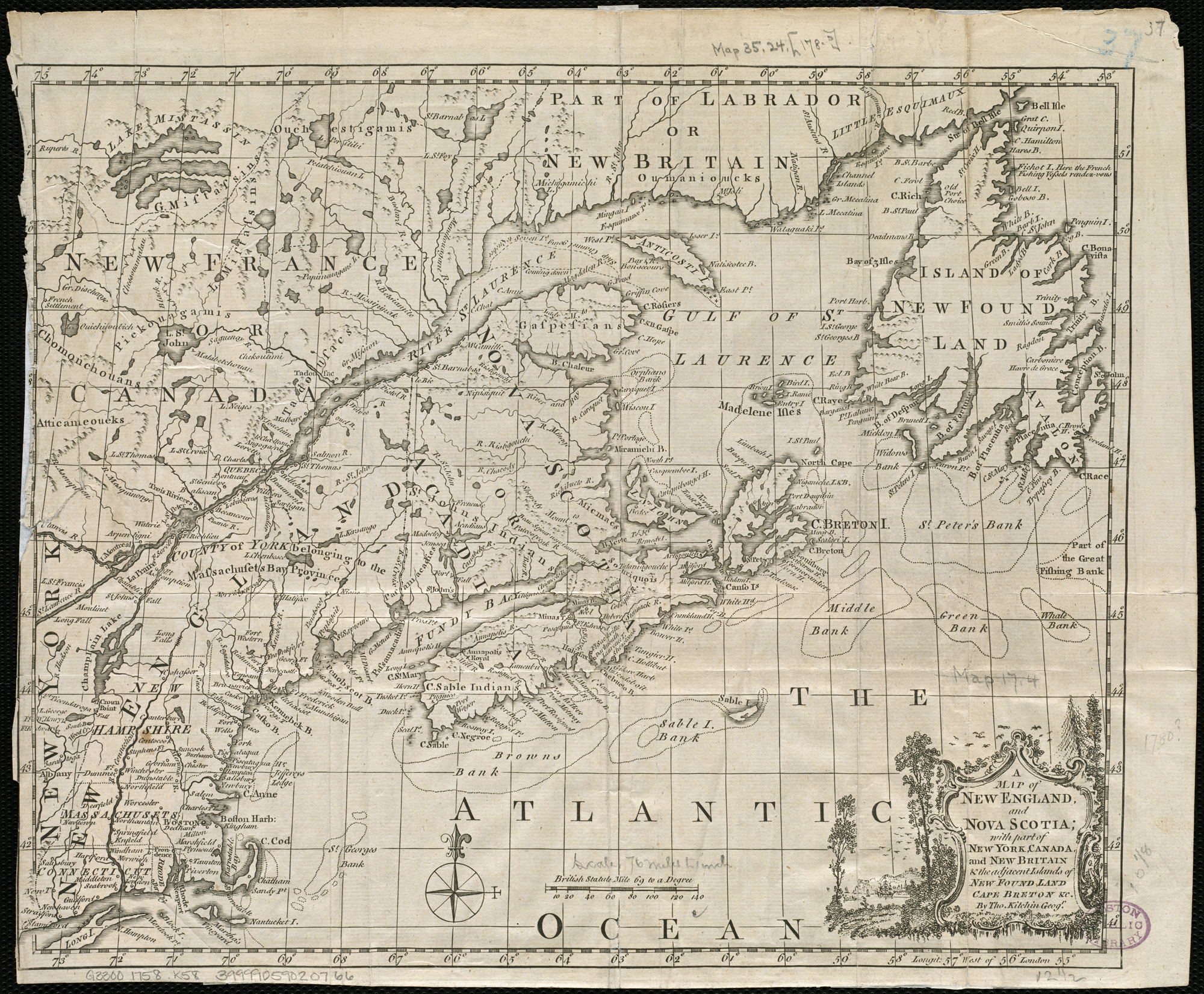
A map of New England, and Nova Scotia, with part of New York, Canada, and New Britain & the adjacent islands of New Found Land, Cape Breton &c. (4231924992).jpg - File Upload Bot (Magnus Manske)

Part of Newfoundland (3046334048).jpg - File Upload Bot (Magnus Manske)
Rigobert-Bonne-Atlas-de-toutes-les-parties-connues-du-globe-terrestre MG 0026.tif - Hansmuller
Memoires-des-commissaires-du-roi-et-de-ceux-de-sa-majesté-brittanique MG 1220.tif - Hansmuller
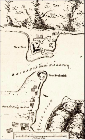
FortFrederickNewfoundland.png - Hantsheroes
A general chart of the Island of Newfoundland with the rocks and soundings, drawn from surveys taken by order of the Right Honourable the Lords Commissioners of the Admiralty. By James Cook and Michael Lane surveyors and RMG F0187.tiff - Fæ

A general chart of the Island of Newfoundland with the rocks and soundings - by James Cook and Michael Lane surveyors and others RMG K1074.jpg - Fæ

226 of 'A History of Newfoundland from the English, Colonial and foreign records. ... With ... illustrations and numerous maps' (11232131933).jpg - Artix Kreiger 2

299 of 'A History of Newfoundland from the English, Colonial and foreign records. ... With ... illustrations and numerous maps' (11232071813).jpg - FlickreviewR 2

347 of 'A History of Newfoundland from the English, Colonial and foreign records. ... With ... illustrations and numerous maps' (11230148995).jpg - FlickreviewR 2

Newfoundland Bank 1787 chart.jpg - Ratzer

A Chart of the gulf of St Laurence - R. Sayer - btv1b53089612c (1 of 2).jpg - Gzen92Bot

A chart of part of the coast of Newfoundland (cape Spear-cape Bonavista) - btv1b5970369m (1 of 2).jpg - Gzen92Bot

A chart of the banks of New Foundland - btv1b59704926 (1 of 2).jpg - Gzen92Bot

A chart of part of the coast of Labradore from Grand Point to Shecatica - surveyed by Michael Lane in 1768 ; engraved by Thomas Jefferys... - btv1b530168425 (1 of 4).jpg - Gzen92Bot

The island of Newfoundland , laid down from surveys taken by order of the right honorable the Lords commissioners of Admiralty, by lieu.t Michael Lane principal surveyor of the said Island 1790. - btv1b5970342z.jpg - Gzen92Bot

A general chart of the island of Newfoundland with the rocks & soundings... - by James cook and Michael Lane surveyors ans others. - btv1b59703315 (1 of 2).jpg - Gzen92Bot

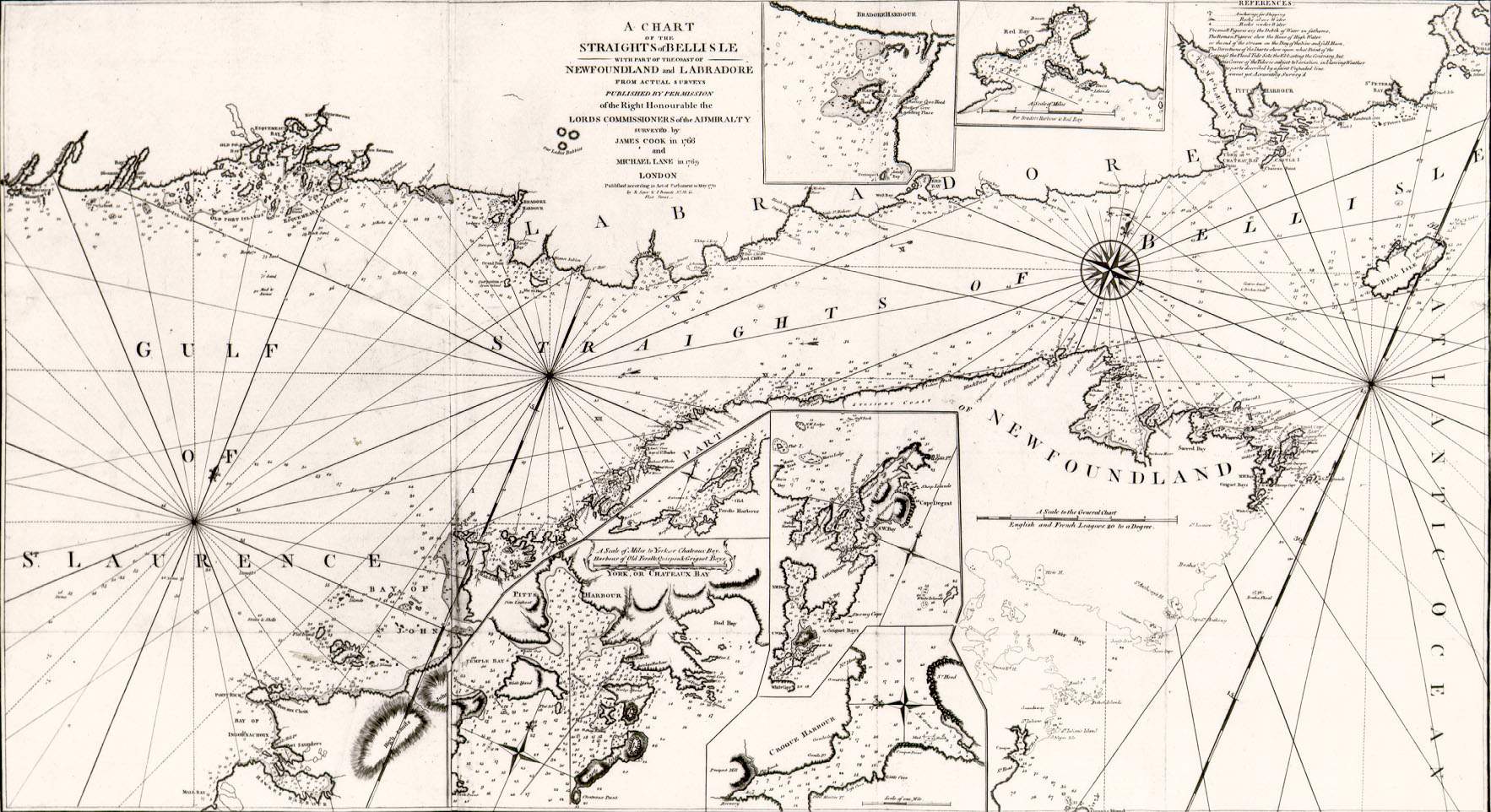
A Chart of the Streights of Belle Isle - R. Sayer - btv1b530897403 (1 of 2).jpg - Gzen92Bot

A Chart of the Streights of Belle Isle - R. Sayer - btv1b530897403 (2 of 2).jpg - Gzen92Bot

A chart of part of the coast of Labradore from Grand Point to Shecatica - surveyed by Michael Lane in 1768 ; engraved by Thomas Jefferys... - btv1b53016798j.jpg - Enyavar

Placentia Harbour, crop of Les principales forteresses, ports etc.jpg - Enyavar