Wikimedi'Òc
Modes d'emploi

Cet album fait partie des albums
Cet album photos contient les sous-albums suivants :


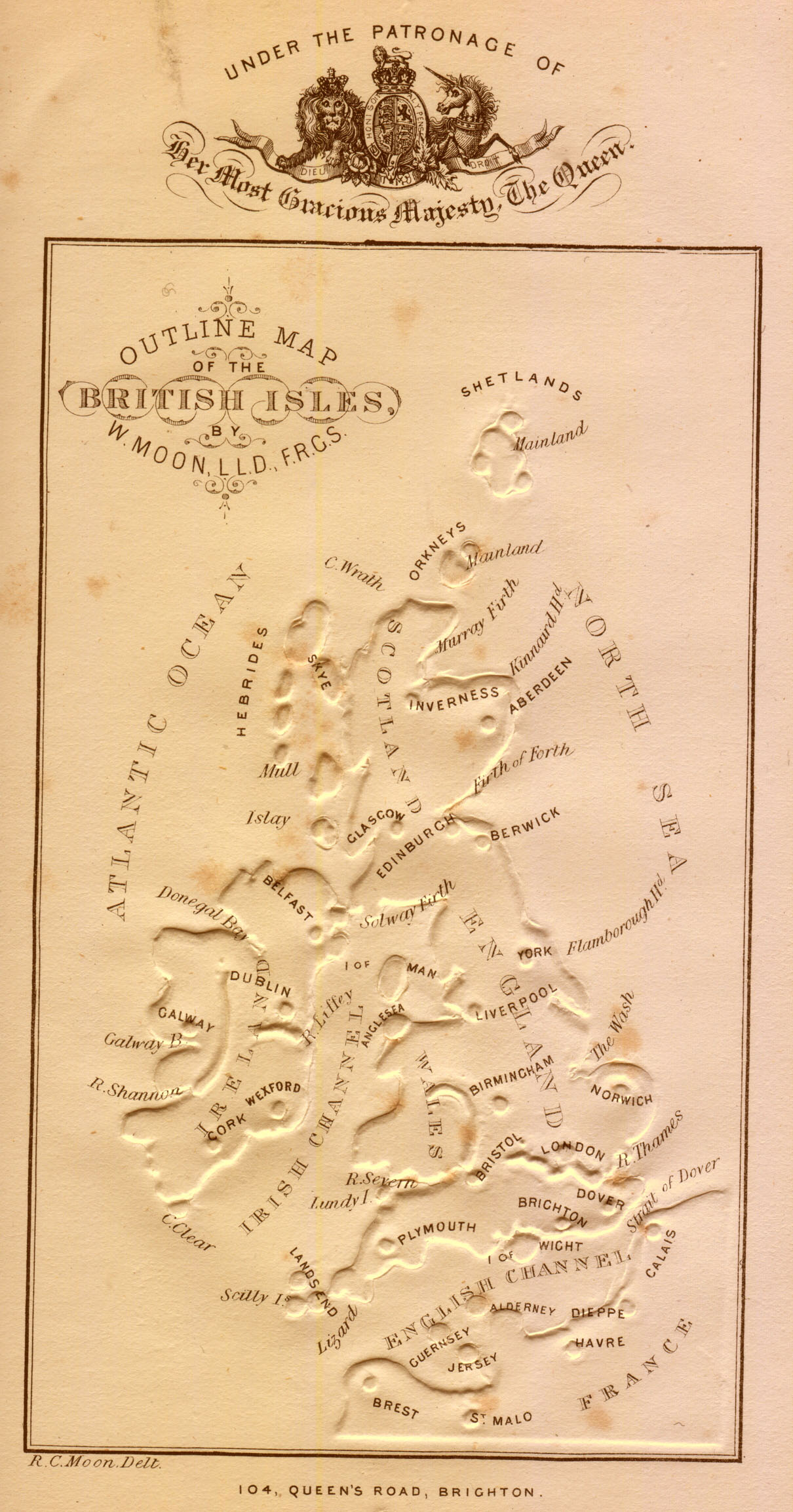
Moon-type-map.jpg - Evertype

Public Schools Historical Atlas - England France Henry I.jpg - Yarl

Public Schools Historical Atlas - England France 1152-1327.jpg - Yarl

Britannienkarte des Matthew Paris.jpg - Alexrk2

1818 Pinkerton Map of Jersey, Guernsey, Scilly and Shetland, British Isles - Geographicus - RemoteBritishIsles-pinkerton-1818.jpg - BotMultichillT

Atlantic map from Pietro Vesconte 1325 atlas.jpg - Walrasiad

Atlantic map from Pietro Vesconte 1321 atlas.jpg - Walrasiad

Ancient-map-of-Britain.jpg - MGA73bot2

Situasjonen i Nord-Europa 1801.jpg - Flickr upload bot

Map of Britain (c.1250) - Matthew Paris, Historia Anglorum, f. 5v.jpg - Jheald

Map of Britain (c.1250) - Matthew Paris, Chronica Maiora part 2, fol iv verso.jpg - Jheald

Roman Roads of Britain - Matthew Paris, Book of Additions (c.1250), f. 187v.jpg - Jheald
Map of Britain (c.1250) - Matthew Paris - STC255189.jpg - Jheald

Map of Britannia Wellcome L0051170.jpg - Fæ

Map of principal Mesolithic sites in Britain. Wellcome M0016326.jpg - Fæ

Annales de la Société royale zoologique et malacologique de Belgique (1908) (18016116618).jpg - Fæ

La face de la terre (Das Antlitz der Erde). Traduit de l'allemand, avec l'autorisation de l'auteur et annotée sous la direction de Emm. de Margerie. Avec une préf. par Marcel Bertrand (1897) (14591613367).jpg - SteinsplitterBot

Maps illustrating cruises of John Paul Jones in British waters (10175546456).jpg - Ww2censor

103 of 'A New Geography on the comparative method. With maps and diagrams' (11107945563).jpg - Kilom691

25 of 'Key Index to the Cyclists' Pocket Road Guides, etc' (11165763963).jpg - FlickreviewR 2
British Empire throughout the world exhibited in one view. LOC 98687124.tif - Fæ

British Empire throughout the world exhibited in one view. LOC 98687124.jpg - Fæ

Admiralty Chart No 2 The British Islands, Published 1913 02.jpg - Kognos
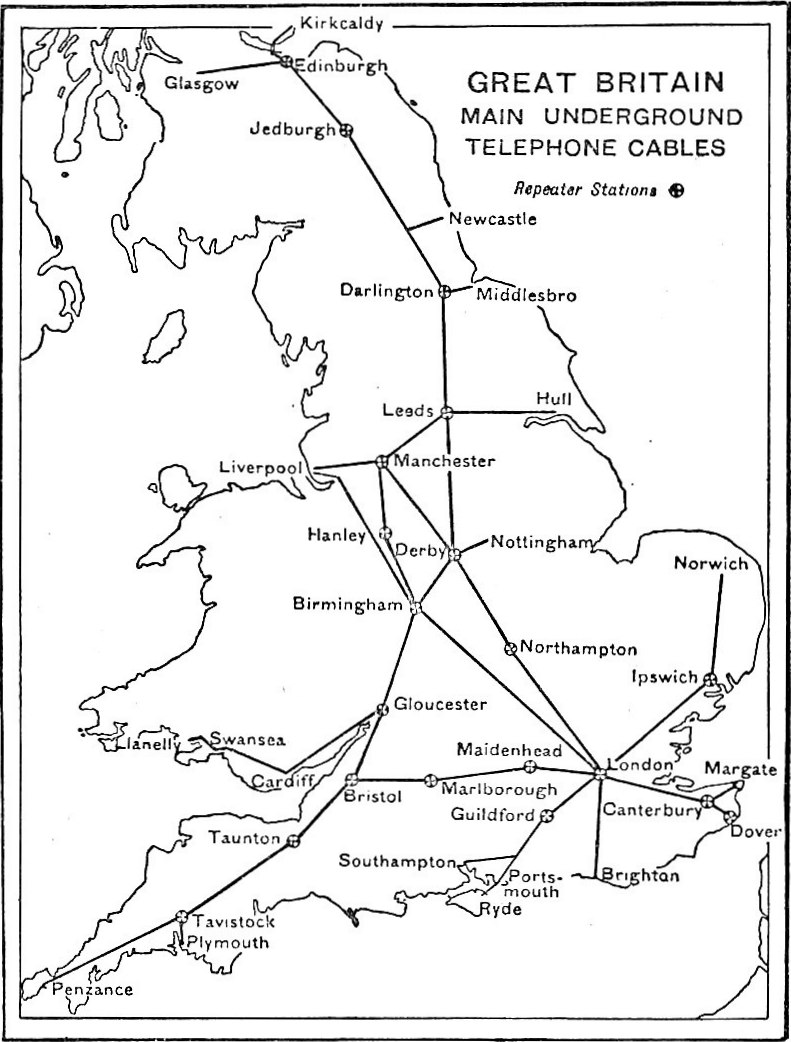
EB1922 Telephone - Great Britain - map of scheme for telephonic communication by means of underground cables and telephone repeaters.jpg - Bob Burkhardt

Ordnance Survey Great Britain Sheet 1, Published 1933.jpg - Kognos

Ordnance Survey Great Britain Sheet 2, Published 1933.jpg - Kognos

Nordenskiöld 1897 Plate 32 Tabula Regionum Septentrionalium 15th Century.jpg - Kognos

Nordenskiöld 1897 Plate 33(1) LOC Image 353.jpg - Kognos