Wikimedi'Òc
Modes d'emploi

Cet album fait partie des albums
Cet album photos contient les sous-albums suivants :


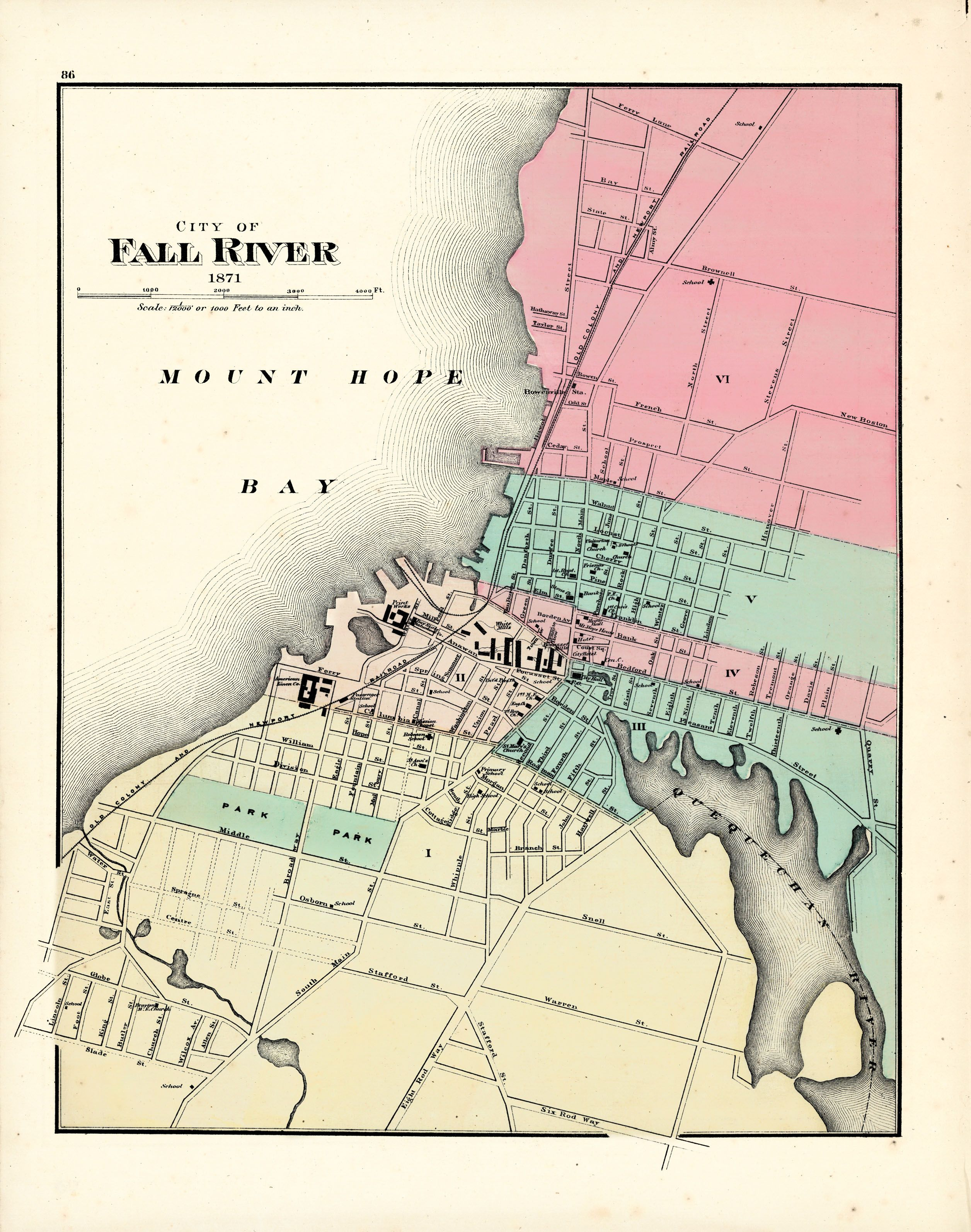
1871 map of Fall River, Massachusetts.png - Pi.1415926535

Fall river 1812.jpg - Marcbela
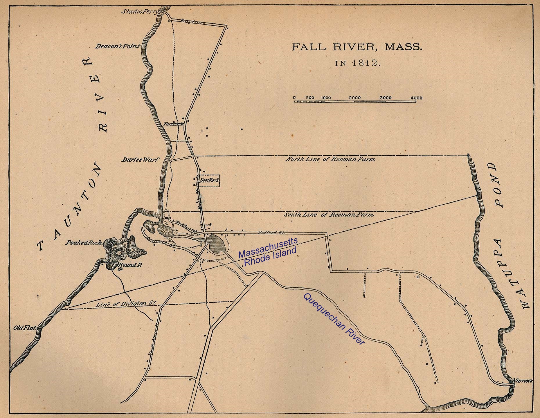
Fall River Map 1812 with text.jpg - Marcbela

American Linen Map 1883.jpg - Marcbela

Wamsutta Woolen and Union Mills 1883 map.jpg - Marcbela

Conanicut Mill map 1883.jpg - Marcbela

Fall River MFG Co - Sanborn Map 1893.jpg - Marcbela

City of Fall River (9472522087).jpg - File Upload Bot (Magnus Manske)

City of Fall River, Mass - 1877 G3764.T2A3 1875B3.jpg - Tm

Map of the Dartmouth and Westport Street Railway, 1900 (14743395326).jpg - Fæ

Report of the Massachusetts state forester to the Reservoir commission of the city of Fall River, with recommendations for the protection and maintenance of the watershed of North Watuppa Pond (1909) (14770614731).jpg - Fæ

Fall River Village ; Map of the town of Fall River, Bristol County, Massachusetts (14775362187).jpg - Ser Amantio di Nicolao
City of Fall River. LOC 2015586099.tif - Fæ

City of Fall River. LOC 2015586099.jpg - Fæ

City of Fall River, Mass. 1877. LOC 75694571.jpg - Fæ
City of Fall River. LOC 2015586100.tif - Fæ

City of Fall River. LOC 2015586100.jpg - Fæ
Books from the Library of Congress (IA reportofmassachu01mass).pdf - Fæ

Fall River Wharf on 1877 bird's eye map.jpg - Pi.1415926535

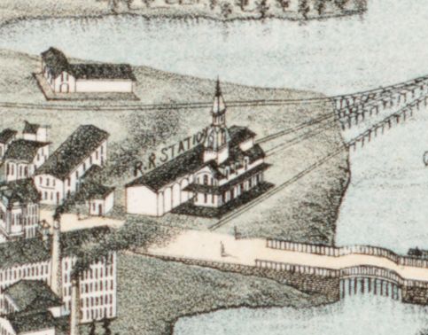
Fall River station on 1877 bird's eye map.jpg - Pi.1415926535
Watuppa station on 1877 bird's eye map.jpg - Pi.1415926535

Ferry Street station on 1877 bird's eye map.jpg - Pi.1415926535