Wikimedi'Òc
Modes d'emploi

Cet album fait partie des albums
Cet album photos contient les sous-albums suivants :


Oregon boundary dispute map.PNG - Roke~commonswiki

1846 Oregon territory.jpg - Lumu

Nisqually Earthquake ShakeMap Oct 13 2003.jpg - Hedwig in Washington

Tacoma Earthquake-APR-29-1965.png - Hedwig in Washington

Vancouver National Historic Reserve ownership map 2003.jpg - Werewombat

Chinook.png - Jeanjung212

York-Factory-Express.png - Pfly

OregonCountry.jpg - Aikonido

Initiative 692 Results.png - Bluerasberry

Map of World War II Japanese American internment camps.png - Ras67

1872 North Cascades Isoseismal Map.png - Mikenorton

Pacific Northwest Military Outposts.jpg - File Upload Bot (Magnus Manske)

Benton County Washington Incorporated and Unincorporated areas.svg - Umbris

Coeur d'Alene Tribe.jpg - Rindere
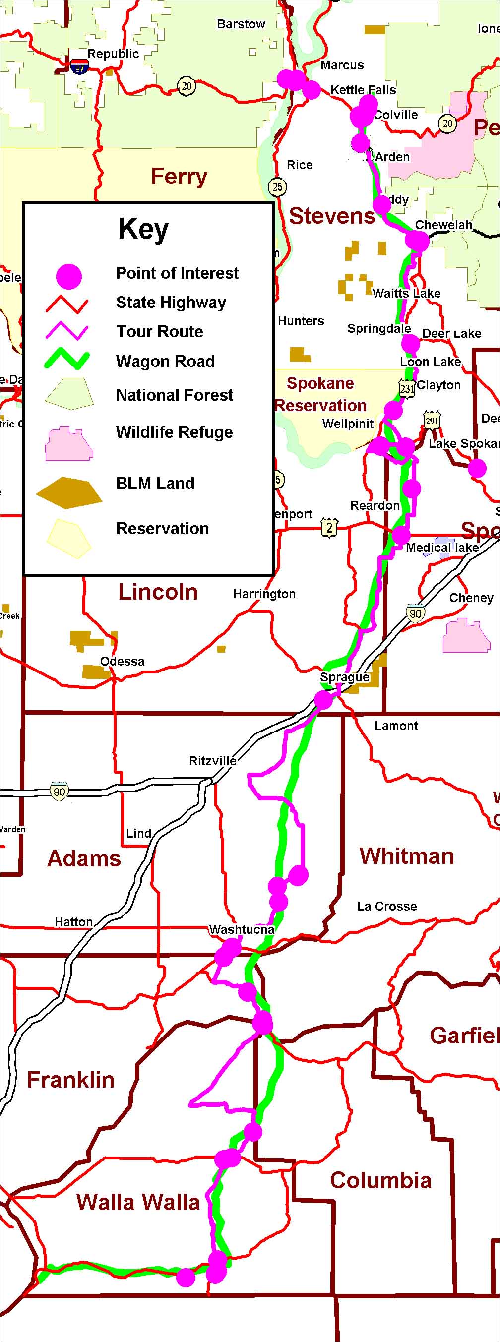
FtWWFtColvRedMap.jpg - Srichart4
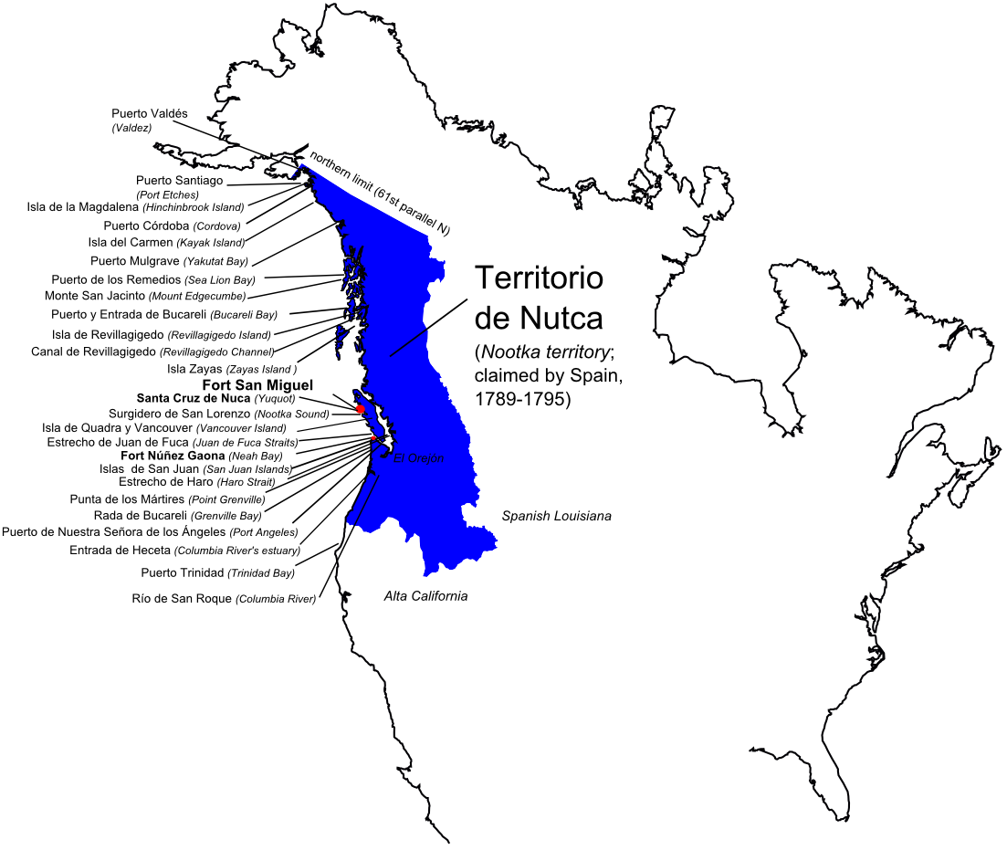
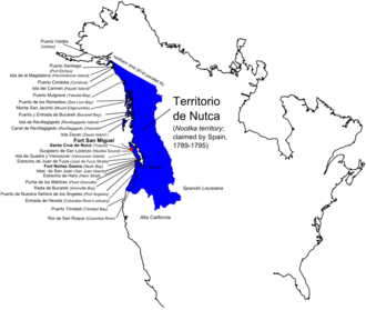
NutcaEN.png - Nagihuin

Fiberwood use in Washington, Oregon, and California, 1970-80 (1973) (19953260223).jpg - Fæ

Cooperative economic insect report (1957) (20698078925).jpg - Fæ

Bonneville Landslide, Bridge of the Gods.jpg - Ron Clausen

Northwest "Indian Wars" - McConnell's Historical maps of the United States LOC 2009581130-38 (cropped).jpg - Ooligan

Map from Indian land cessions in the United States by Charles C. Royce 60.jpg - Jengod

Map from Indian land cessions in the United States by Charles C. Royce 64.jpg - Jengod

Map from Indian land cessions in the United States by Charles C. Royce 68.jpg - Jengod

Black Diamond Historical Museum - immigration map 01.jpg - Jmabel

Suquamish territory.png - PersusjCP