Wikimedi'Òc
Modes d'emploi

Cet album fait partie des albums


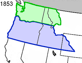


Oregon & Washington Territories 1853.svg - Furfur

1855 Colton Map of Washington and Oregon - Geographicus - WashingtonOregon-colton-1855.jpg - BotMultichillT

1853 Mitchell Map of California, Oregon, Washington, Utah ^ New Mexico - Geographicus - CAORWAUTNM-mitchell-1853.jpg - BotMultichillT

1862 Johnson Map of Washington and Oregon w-Idaho - Geographicus - WAOR-johnson-1862.jpg - BotMultichillT
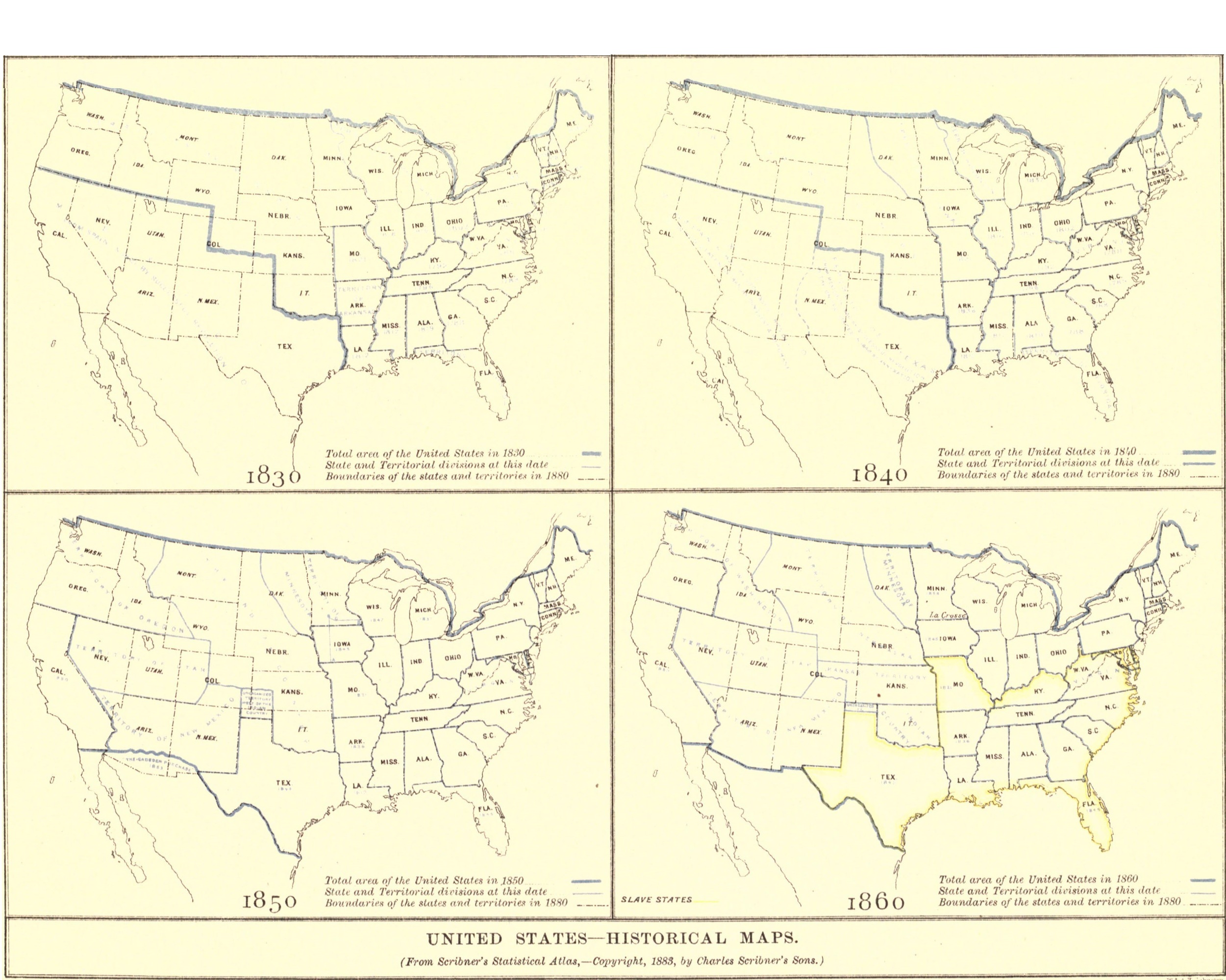
EB9 United States - historical maps (bottom).jpg - Bob Burkhardt

Bird's Eye View of Walla Walla, Washington Territory, 1876 (MAPS 127).jpg - BMacZeroBot

EB9 Oregon - map.jpg - Bob Burkhardt
Life at Puget Sound, with sketches of travel in Washington Territory, British Columbia, Oregon and California, 1865-1881- (IA lifeatpugetsoun00leig).pdf - Fæ

Map of a Part of the Territory of Washington - NARA - 76028713.jpg - US National Archives bot

Map of a part of the Territory of Washington to accompany report of surveyor general - NARA - 139309200.jpg - US National Archives bot

Map of a Part of Washington Territory - NARA - 93193181.jpg - US National Archives bot

Map of an Indian Reservation near the Pacific Ocean in Washington Territory - DPLA - 0ace36d63c6fa7010bbe4380c2337c94.jpg - DPLA bot

Map of Port Angeles, Washington Territory - compiled from a true copy of the U.S. survey thereof on file in the General Land Office, certified February 2nd 1864 by J.M. Edmunds, commissioner (13984191295).jpg - Fæ

Map of Public Surveys in the Territory of Washington to accompany the Report of the Surveyor General - DPLA - 1129ccea8964bc173cdd7280134fc371.jpg - DPLA bot

Map of the Indian Nations and Tribes of the Territory of Washington - NARA - 76028709.jpg - US National Archives bot
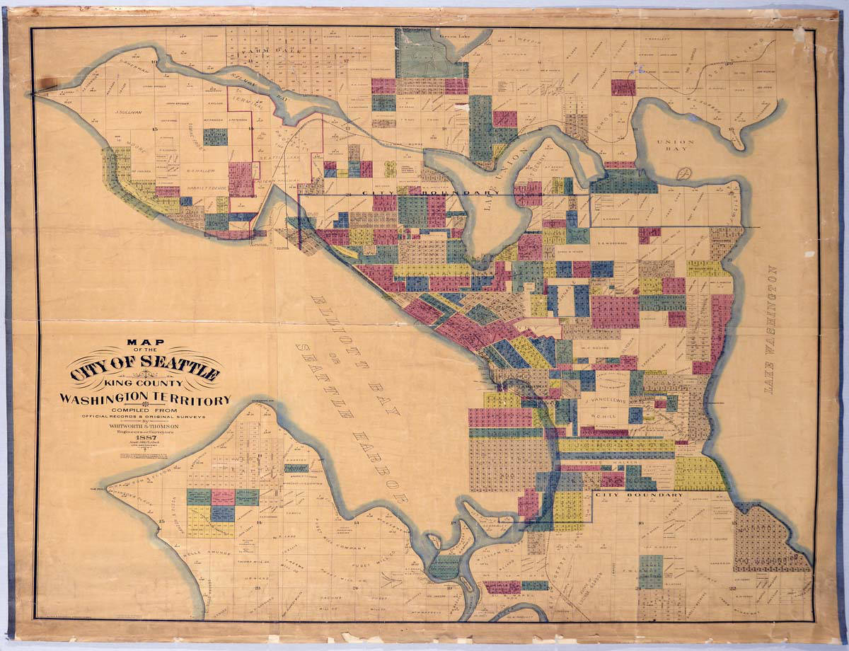
Map of the City of Seattle, King County, Washington Territory, 1887 (MOHAI 13258).jpg - BMacZeroBot

Map of Washington and Oregon territory.jpg - Trebrock

Map of Washington Territory Showing the Indian Tribes - NARA - 76028705.jpg - US National Archives bot

Map of Washington Territory Showing the Indian Tribes - NARA - 76028711.jpg - US National Archives bot

Map State of Washington, USA, main roads with numbers, colored counties with names SVG.svg - Kirill Shrayber

Nisqually and Chehalis Reservations.gif - Innotata

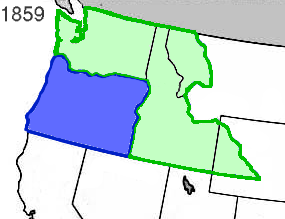
Oregon State & Washington Territory 1859.svg - Furfur

Oregon Territory 1848.svg - Furfur

Oregon State & Washington Territory 1863.svg - Furfur
Wpdms oregon territory 1848.png - Complex01
Wpdms oregon territory 1848.jpg - File Upload Bot (Magnus Manske)
Wpdms oregon washington territories 1853.png - Complex01
Wpdms oregon territory 1859 detail.jpg - File Upload Bot (Magnus Manske)
Wpdms oregon washington territory 1859 b.png - File Upload Bot (Magnus Manske)
Wpdms washington dakota territories 1861.idx.png - Popo le Chien
Wpdms oregon washington territory 1859.png - Complex01
Wpdms washington territory 1863 legend 3.png - Wars
Wpdms washington idaho territories 1863.png - File Upload Bot (Magnus Manske)

1853 Colton Map of Washington and Oregon ( w- Montana, Idaho ) - Geographicus - WAOR-colton-1853.jpg - BotMultichillT

Map of the state of Oregon and Washington territory LOC 2015591073.jpg - Fæ

Map of the Northeast Section of the Department of the Columbia - NARA - 77452262.jpg - US National Archives bot

Map of the Northwest Boundary of the United States - NARA - 77452217.jpg - US National Archives bot