Wikimedi'Òc
Modes d'emploi

Cet album fait partie des albums
Cet album photos contient les sous-albums suivants :


Topography-of-the-China-Sea-and-surrounding-waters.jpg - Sohmen

1935年中國南海各島嶼圖.jpg - Happyseeu
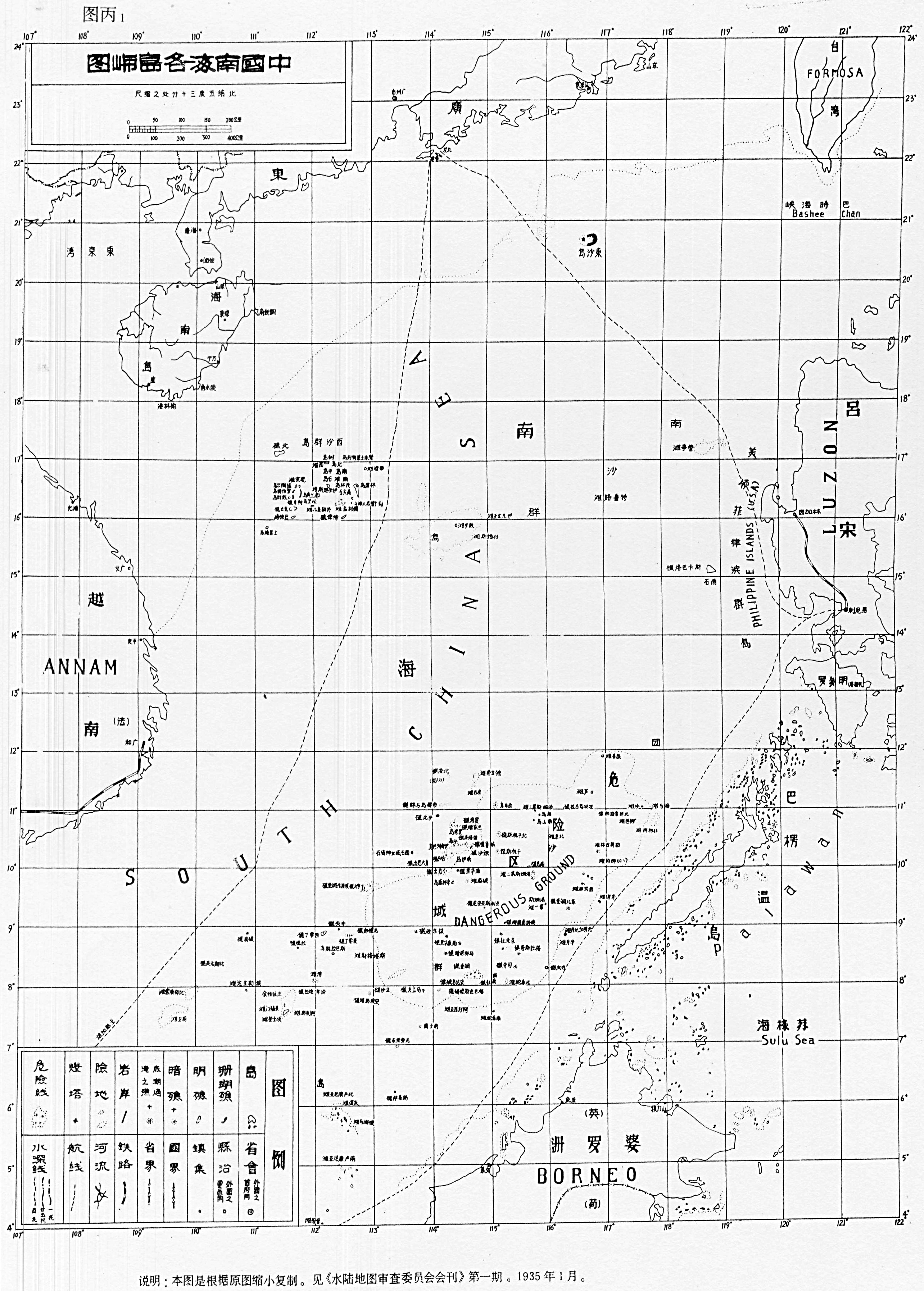
中國南海各島嶼圖.jpg - Micheletb

SouthChinaSea.png - Conscious
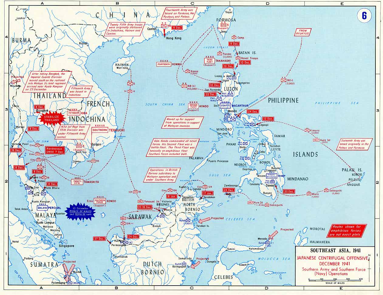
Pacific War - Southeast Asia 1941 - Map.jpg - W.wolny
Bien Dong.png - Tttrung

Locatie Zuid-Chinese Zee.PNG - Chuuuvak

Karta CN SouthChinaSea.PNG - Liverpoolmylove
Schina sea 88.png - Philg88

Lingayengulfmap.png - Kmusser

Nansha huangyan.jpg - Gaoxuewei
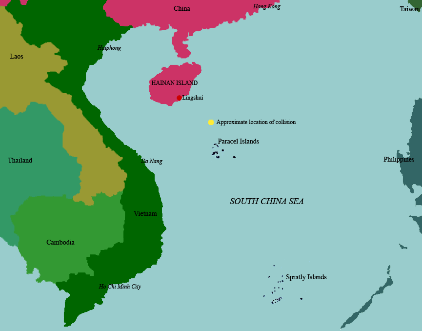
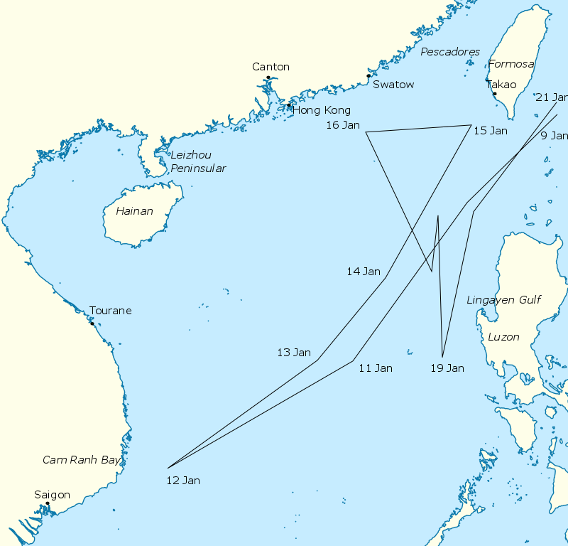
Hainanincidentmap.png - Guinnog

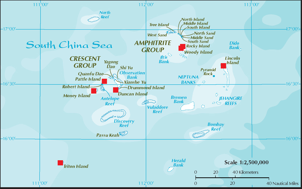
Hoang Sa3.PNG - Benlisquare
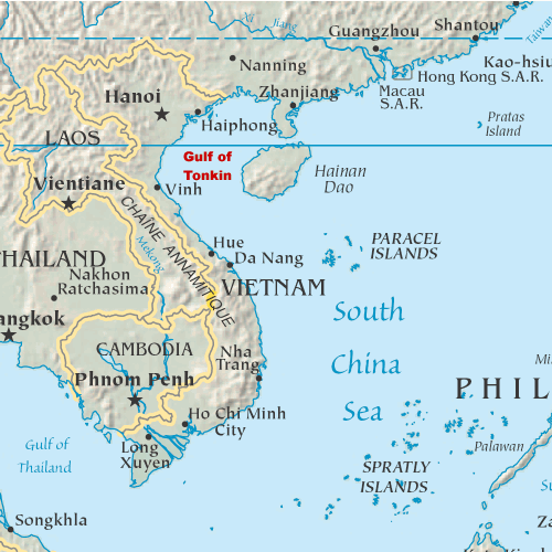
Gulf of Tonkin location.gif - Urdangaray

South China Sea location map.svg - NordNordWest

SouthChinaSea He.png - Itzuvit
9 dotted line.png - Cantons-de-l'Est

Relief Map of South China Sea.png - Nzeemin

9doan.jpg - Cnbhkine

South China Sea map.jpg - Babanwalia

南海诸岛.jpg - File Upload Bot (Magnus Manske)

South China Sea vector.svg - ماني

South China Sea claims 2.png - Kopiersperre

Map of South China Sea.jpg - Chang21liu
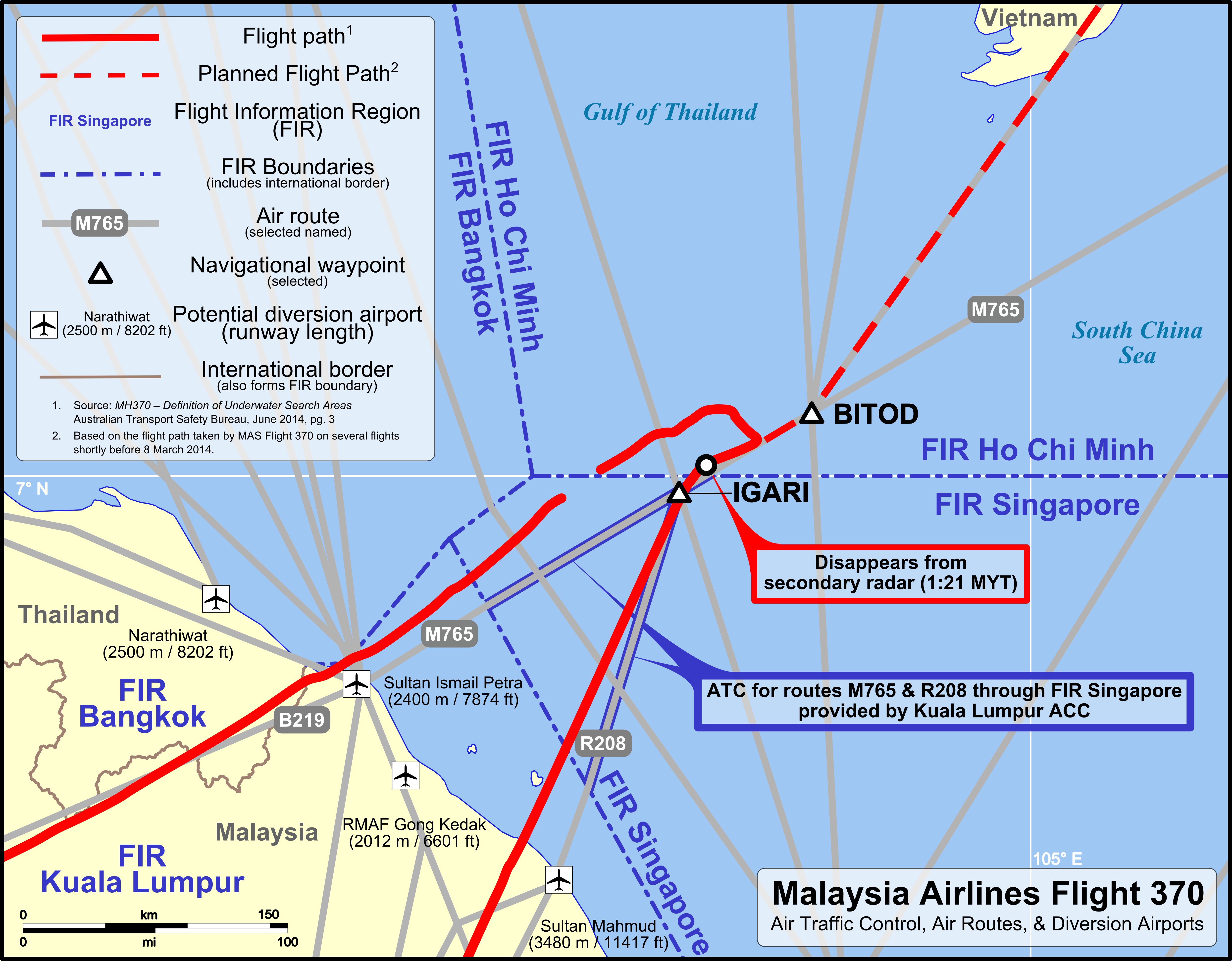
MH370 ATC-Routes map.png - AHeneen

MH370 ATC and air routes map.png - AHeneen

Anambas.png - Trần Nguyễn Minh Huy
North and South Luconia Shoals.jpg - MagentaGreen

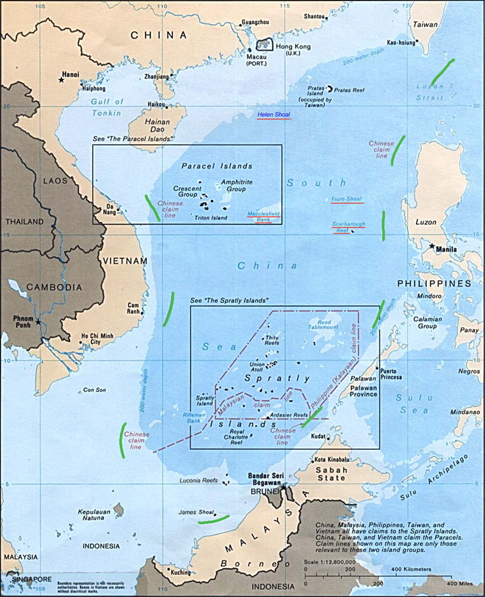
South China Sea claims map.jpg - Daduxing

OpenSeaMap-ChartBundleArea-SouthChineseSea-2016-05.png - Alexej-osm

South China Sea Claims and Boundary Agreements 2012.jpg - Thanto19

South China Sea vector de.svg - Furfur

South China Sea Islands.svg - Micheletb

MH370 ATC and air routes map-en.svg - Goran tek-en

MH370 ATC and air routes map-zh-s.svg - Goran tek-en

Wushi oil field.jpg - Notthebestusername

Nine-Dash-Line-2009-wrong-scale.jpg - Thanto19

MH370 SIO search-en.svg - Goran tek-en

MH370 SIO search-zh-s.svg - Goran tek-en
South China Sea raid.png - Nick-D

Nam Con Son Basin Location.png - WilliamDazet

Yongshu Jiao to Po-Lang Chiao NGA Nautical Chart 93047.jpg - Ratzer

Heng Jiao to Haima Tan (Routh Shoal) (Seahorse Shoal) NGA Nautical Chart 93045.jpg - Pemu

Mantangule Island to Eran Bay (Palawan Passage) NGA Nautical Chart 93046.jpg - Pemu

South China Sea-Vanguard Bank to Spratly Island NGA Nautical Chart 93049.jpg - Pemu

Scarborough Shoal (South China Sea) NGA Nautical Chart 91004.jpg - Wdwdbot

Yongshu Jiao to Yongdeng Ansha (South China Sea) NGA Nautical Chart 93044.jpg - Pemu
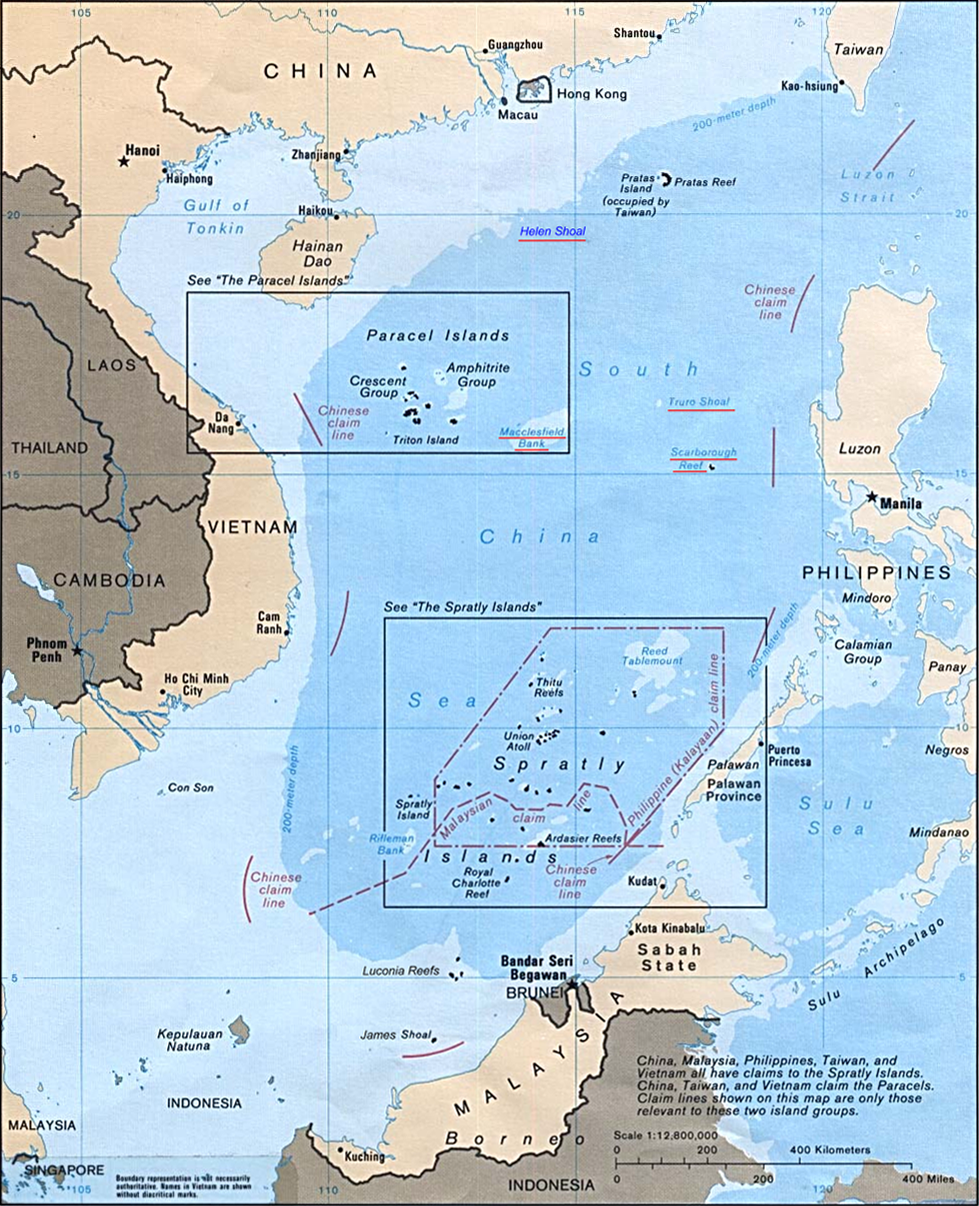
Spratly Islands in the South China Sea Department of State map 2016587286 (2015).pdf - Ratzer

Luconia Shoals Department of State map 2016587286 (2015) (cropped).jpg - Ratzer

Spratly Islands in the South China Sea Department of State map 2016587286 (2015).jpg - Ltn12345

Vanguard Bank cropped from Department of State map 2016587286 (2015).jpg - Pdfpdf
75967 South-China-Sea-1.pdf - Ratzer
75967 South-China-Sea-1 (Paracel Islands cropped).jpg - Ratzer

Monitor areas of the Tsunami warning center of the National Oceanic Administration.png - Theodore Xu
Continental rift model for the spreading of the South China Sea.png - RHaworth

Major crude oil trade flows in the South China Sea (2016) (43582519014).png - MarginalCost

SouthChinaSea-ar.png - Moataz1997

Karta CN SouthChinaSea-zh.png - GnolizX
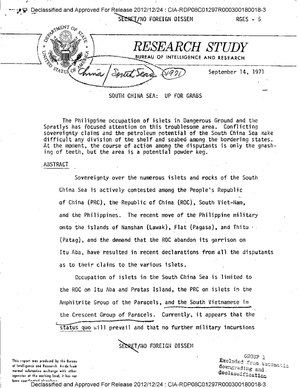
CIA-RDP08C01297R000300180018-3.pdf - Geographyinitiative

Spratly Islands location map.svg - LuciferAhriman

Spratly Islands relief location map.svg - LuciferAhriman

Hainanincidentmap zh.jpg - GnolizX

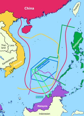
South China Sea Maritime Claims.jpg - Zoozaz1
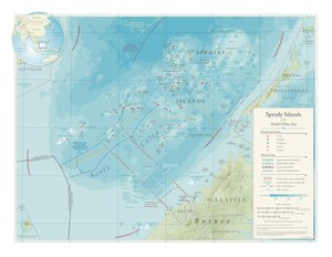
Paracel Spratly Islands.png - Koba-chan

South China Sea in its region (IHO 1953).svg - Aplaice

South China Sea claims map.svg - HueMan1

Map North Natuna Sea.jpg - Chinamoonroll

South China Sea vector Chinese.svg - A11w1ss3nd
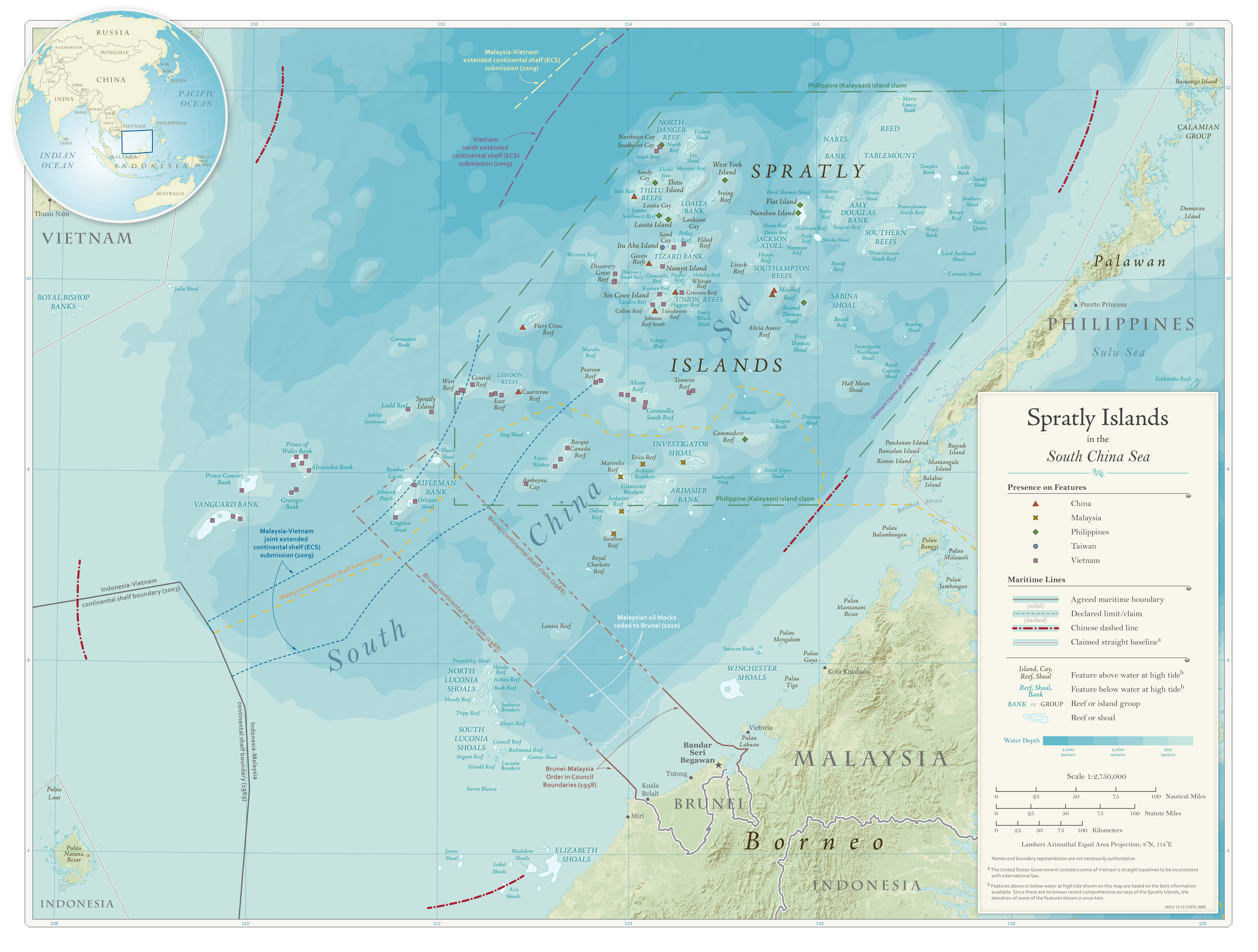
Spratly Islands (US State Department) 2015.jpg - Candivore

Admiralty Chart No 1311 Singapore Strait to Borneo Northern Sheet, Published 1959.jpg - Kognos

Admiralty Chart No 2661b China Sea Northern Portion Eastern Sheet, Published 1967.jpg - Kognos

Vietnamese irredentism and expansionism.png - Daeva Trạc

Gothus teemo range map.svg - Chaotic Enby

Locatie West-Filipijnse Zee.png - RodEmiliano