Wikimedi'Òc
Modes d'emploi


Cet album fait partie des albums
Cet album photos contient les sous-albums suivants :


Position of Union and Confederate armies on the morning of July 1, 1863. LOC 99447126.tif - Fæ

Position of Union and Confederate armies on the morning of July 1, 1863. LOC 99447126.jpg - Fæ

Battle of Cooch's Bridge.jpg - Seanmoir

Philadelphia - Howe Survey - 1777.jpg - PRRfan

HessianMapMudIsland.jpg - Боцман

The Hessians - Operations in Pennsylvania and New Jersey.jpg - Bob Burkhardt

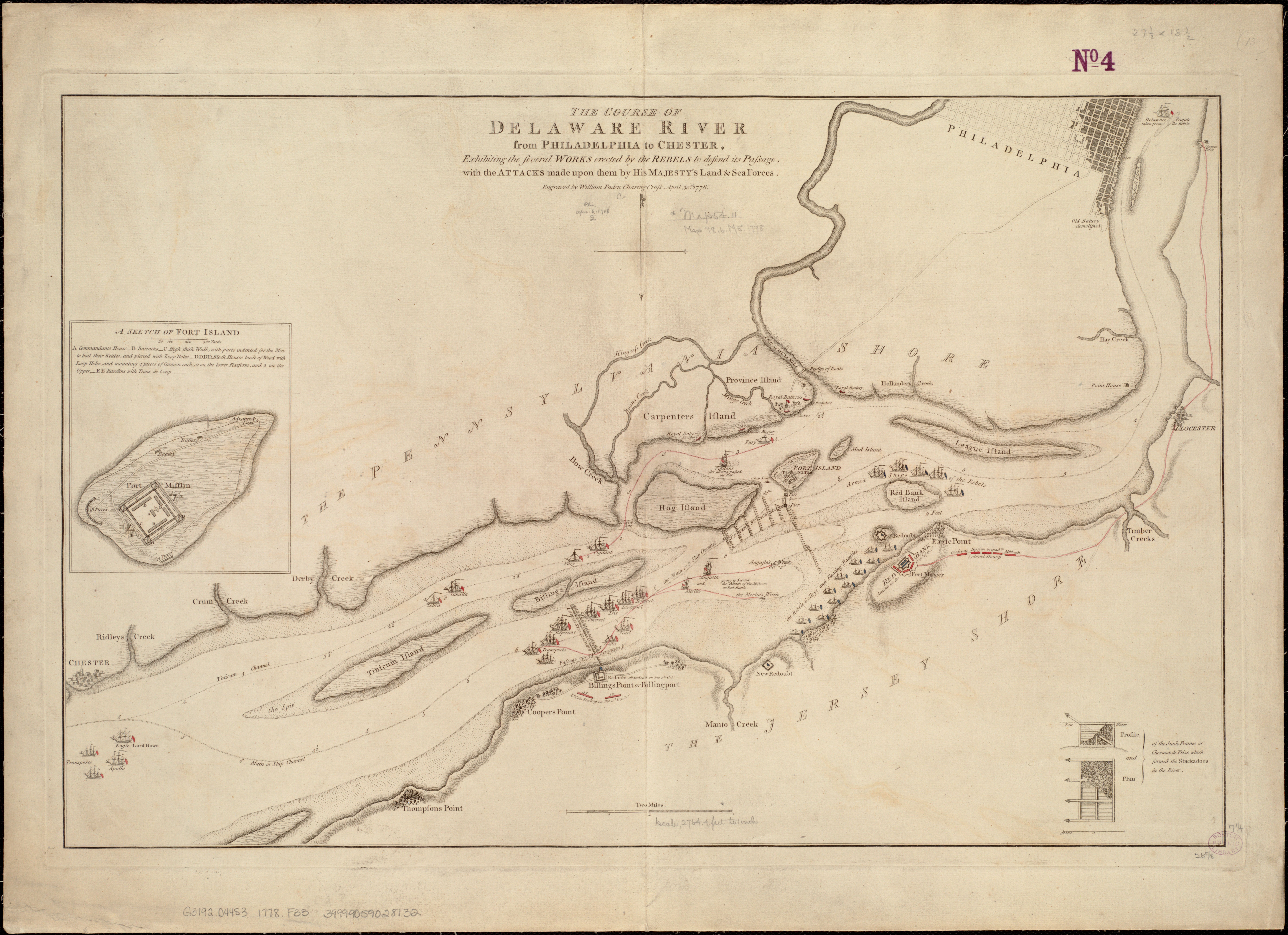
The course of Delaware River from Philadelphia to Chester, exhibiting the several works erected by the rebels to defend its passage, with the attacks made upon them by His Majestys land & sea forces (5120559789).jpg - Tm

Plan of engagement with British ships near Red Bank, New Jersey, October 22 and 23, 1777 (2675457104).jpg - File Upload Bot (Magnus Manske)
A map of the country from Rariton River in East Jersey to Elk Head in Maryland - shewing the several operations of the American and British armies, in 1776 & 1777 - drawn by S. Lewis from surveys made NYPL434075.tiff - SteinsplitterBot
Battle of Monmouth, June 28th, 1778. NYPL434554.tiff - Fæ
A chart of Delaware Bay and River - containing a full and exact description of the shores, creeks, harbours, soundings, shoals, sands, and bearings of the most considerable land marks, from the capes NYPL434492.tiff - Enyavar
A map of the country from Rariton River in East Jersey to Elk Head in Maryland - shewing the several operations of the American and British armies, in 1776 and 1777 - drawn by S. Lewis from surveys NYPL483706.tiff - Zeete
Operations in the Delaware, Oct. and Nov., 1777. NYPL434580.tiff - Fæ
Seat of war in the environs of Philadeliphia - by Thos. Kitchin Senr., hydrographer to His Majesty. NYPL434704.tiff - Sebastian Wallroth
Seat of war in the environs of Philadelphia - by Thos. Kitchin Senr., hydrographer to His Majesty. NYPL483740.tiff - Fæ
Retreat of the Marquis de Lafayette from Barren Hill, May 20th 1778 NYPL434989.tiff - Fæ
Historic American Buildings Survey, Original from Butler Library, Columbia University, See Catalog of Graphic Material -14, PHOTOCOPY OF PLAN, 1777. - Fort Mifflin, Mud Island, HABS PA,51-PHILA,111-1.tif - Fæ
Historic American Buildings Survey, Original from Pennsylvania Historical and Museum Commission, See Catalog of Graphic Material -8, MAP OF FORT MIFFLIN, c.1778. - Fort Mifflin, HABS PA,51-PHILA,111-6.tif - Fæ
Historic American Buildings Survey, John Andre, November 15, 1777, Henry E. Huntington Library, San Marino, California, See Catalog of Graphic Material -44, PHOTOCOPY OF 'MUD HABS PA,51-PHILA,111-3.tif - Fæ
Battle of Bound Brook, troop movements.svg - Oneam
Battle of Short Hills, early troop movements.svg - Oneam
Troop movements in early Philadelphia Campaign, July - September, 1777.svg - Oneam
Battle of Staten Island, 1777.svg - Oneam

Plan of Ft. Mifflin, Philadelphia, PA 1777.jpg - Deadstar

Map of Operations on the Delaware River at Philadelphia, PA Oct-Nov., 1777.jpeg - Deadstar

The American Revolution (1891) (14761713301).jpg - Fæ

The American Revolution (1891) (14762178504).jpg - SteinsplitterBot

Battle of Germantown.Dean.USMA.edu.history.gif - Jmk139494

Germantown Snapshot.jpg - WesternHeritageMapping

A map of the country from Rariton River in East Jersey to Elk Head in Maryland - shewing the several operations of the American and British armies, in 1776 & 1777 (NYPL b15128975-483706).jpg - SteinsplitterBot

British Operations on the Delaware in 1777.png - Ykraps

Иллюстрация к статье «Англо-американские войны» № 3. Военная энциклопедия Сытина (Санкт-Петербург, 1911-1915).jpg - Schekinov Alexey Victorovich

460 of '(Historical Collections of the State of New Jersey ... relating to its history and antiquities, with geographical descriptions of every township in the State. (With illustrations.))' (11231453664).jpg - Artix Kreiger 2

251 of 'Map Modeling in Geography, including the use of sand, clay, putty, paper pulp, plaster of Paris ... Also Chalk Modeling in its adaptation to purposes of illustration. Fully illustrated' (11231095855).jpg - FlickreviewR 2

224 of 'Historical Collections of the State of New Jersey ... relating to its history and antiquities, with geographical descriptions of every township in the State. (With illustrations.)' (11023438656).jpg - Artix Kreiger 2
A survey of the city of Philadelphia and its environs shewing the several works constructed by His Majesty's troops, under the command of Sir William Howe, since their possession of that city 26th. LOC gm71000933.tif - Fæ

A survey of the city of Philadelphia and its environs shewing the several works constructed by His Majesty's troops, under the command of Sir William Howe, since their possession of that city 26th. LOC gm71000933.jpg - Fæ
Carte de l'affaire de Montmouth - ou le G'al Washington commandon l'armée américaine et le G'l Clinton l'armée angloise le 28 juin 1778 LOC 00557055.tif - Fæ

This is not given as an accurate map, but only to afford an idea of the progress of the army from the landing at Elk to the taking of possession of Philadelphia. The brown lines are the supposed LOC gm71000862.jpg - Fæ
Plan of the city of Philadelphia and its environs shewing its defences during the years 1777 & 1778, together with the siege of Mud Island on the River Delaware. LOC gm71002319.tif - Fæ

Plan of the city of Philadelphia and its environs shewing its defences during the years 1777 & 1778, together with the siege of Mud Island on the River Delaware. LOC gm71002319.jpg - Fæ
Plan of part of the River Delaware from Chester to Philadelphia, in which is mark'd the position of His Majs. ships on the 15th. of November 1777. The obstructions to the navigation of the river, laid LOC gm71002218.tif - Fæ

Plan of part of the River Delaware from Chester to Philadelphia, in which is mark'd the position of His Majs. ships on the 15th. of November 1777. The obstructions to the navigation of the river, laid LOC gm71002218.jpg - Fæ
The course of Delaware River from Philadelphia to Chester with the several forts and stackadoes raised by the rebels, and the attacks made by His Majesty's land and sea forces. LOC gm71005478.tif - Fæ
Plan of Fort Mifflin on Mud Island, with the batteries on Province Island. LOC gm71000683.tif - Fæ

Plan of Fort Mifflin on Mud Island, with the batteries on Province Island. LOC gm71000683.jpg - Fæ
A plan of the city of Philadelphia. LOC 74692113.tif - Fæ
Red Banke. LOC gm71002224.tif - Zeete

Red Banke. LOC gm71002224.jpg - Fæ

British camp at Trudruffrin from the 18th. to the 21st. of September 1777, with the attack made by Major General Grey against the rebels near White Horse Tavern on the 20th. of September. LOC gm71000676.jpg - Fæ
A sketch of the navigation from Swan Pt. to the River Elk at the head of Chesapeak Bay. Sketch of the River Elk, at the head of Chesapeak Bay. LOC gm71002217.tif - Fæ

A sketch of the navigation from Swan Pt. to the River Elk at the head of Chesapeak Bay. Sketch of the River Elk, at the head of Chesapeak Bay. LOC gm71002217.jpg - Fæ
A plan of the city and environs of Philadelphia - with the works and encampments of His Majesty's forces under the command of Lieutenant General Sir William Howe, K.B. LOC 74692213.tif - Fæ

A plan of the city and environs of Philadelphia - with the works and encampments of His Majesty's forces under the command of Lieutenant General Sir William Howe, K.B. LOC 74692213.jpg - Fæ

Les marches du corps du Lord Cornwallis de Billinsport jusqu'a Philadelphia au mois de Novembre, 1777. LOC gm71000675.jpg - Fæ

British camp at Trudruffrin from (sic) with the attack made by Major General Grey against the rebels near White Horse Tavern. LOC gm71000677.jpg - Fæ

The course of Delaware River from Philadelphia to Chester, exhibiting the several works erected by the rebels to defend its passage, with the attacks made upon them by His Majesty's land & sea forces. LOC gm71000680.jpg - Fæ

(Philadelphia and vicinity. Military. LOC gm71002316.jpg - Fæ
Draft of roads in New Jersey. LOC gm71005450.tif - Fæ

Draft of roads in New Jersey. LOC gm71005450.jpg - Fæ

Plan of Genl Du Portail. Plan of the position of Valley Forge after Jany. 1778. LOC gm71000935.jpg - Fæ
Zehn Karten und Ansichten den Schlachtfelden des amerikanischen Unabhängigkeitskreiges in den Staaten Pennsylvanien und New York LOC 2003630399-1.tif - Fæ
Zehn Karten und Ansichten den Schlachtfelden des amerikanischen Unabhängigkeitskreiges in den Staaten Pennsylvanien und New York LOC 2003630399-3.tif - Fæ

Zehn Karten und Ansichten den Schlachtfelden des amerikanischen Unabhängigkeitskreiges in den Staaten Pennsylvanien und New York LOC 2003630399-3.jpg - Fæ
Zehn Karten und Ansichten den Schlachtfelden des amerikanischen Unabhängigkeitskreiges in den Staaten Pennsylvanien und New York LOC 2003630399-5.tif - Fæ

Zehn Karten und Ansichten den Schlachtfelden des amerikanischen Unabhängigkeitskreiges in den Staaten Pennsylvanien und New York LOC 2003630399-5.jpg - Fæ
Philadelphia and neighborhood. LOC gm71000682.tif - Fæ

A map of that part of Pensylvania now the principle (sic) seat of war in America, wherein may be seen the situation of Philadelphia, Red Bank, Mud Island, & Germantown. LOC gm71000934.jpg - Fæ

Map1777en.jpg - Etienne2007image

Map1778en.jpg - Etienne2007image
Monmouth1 plainsvg.svg - Factotem

Battle of Monmouth - American vanguard attack.png - Factotem

Battle of Monmouth - American rearguard.png - Factotem

Battle of Monmouth - endgame.png - Factotem

Campaign around Philadelphia (5c0b8840e8ce4ed296e3e98ce61451ae).jpg - BMacZeroBot

File--Portion of Duportail Map- (a5f47b4e108c477da16f7df9ba076784).jpg - BMacZeroBot

Atlas of Battles of the American Revolution, Sheet 8- A Plan of the Provinces of Pensylvania, and East & West New Jersey, whewing the Operations of the Royal Army under the Command of their Excellancies Sir. Wil(...) - NARA - 102279696.jpg - US National Archives bot

Wilhelmshöher Kriegskarten.jpg - Hessisches Landesarchiv

0R9A1957a (29121760047).jpg - Tm

British Revolutionary War map of the Delaware River at Fort Mercer.jpg - Gwillhickers

Philadelphia Map, 1777 Philadelphia Campaign2.jpg - Gwillhickers

Philadelphia, Red Bank, Fort Mifflin2, 1777.jpg - Gwillhickers

Vie de George Washington 1807 (125491526).jpg - Polona Upload

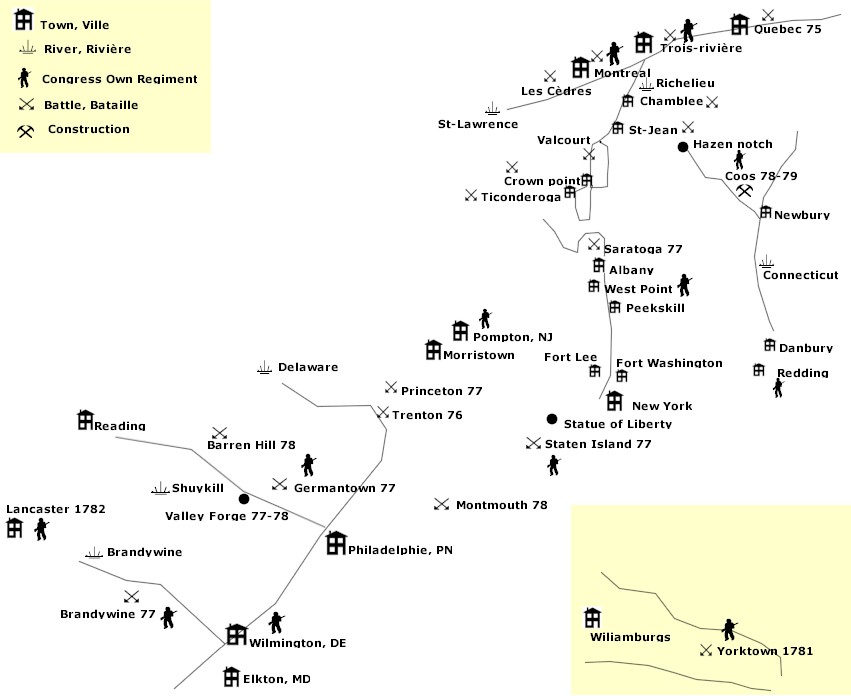
CongressOwnMap.jpg - Imagewikipedia

Barren-hill-map.jpg - Pohick2

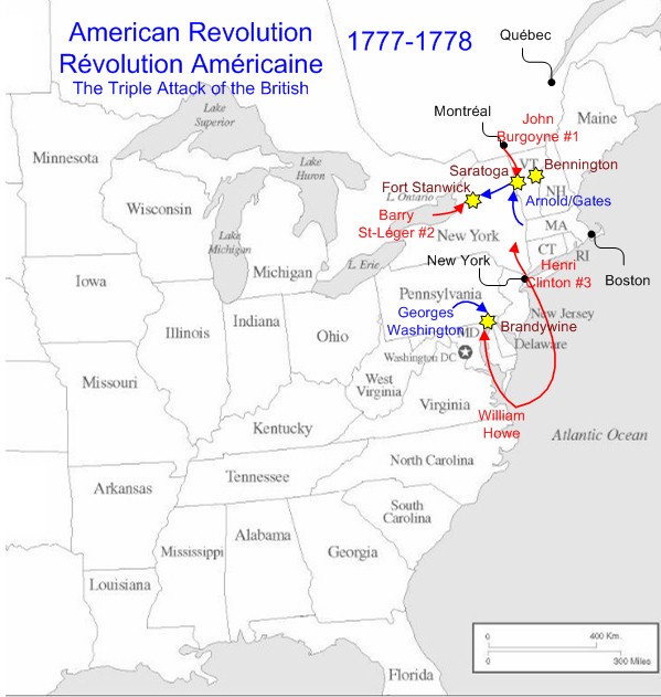
1777-1778.jpg - Imagewikipedia

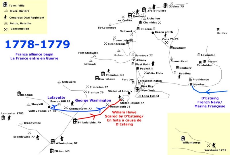
1778-1779.jpg - Imagewikipedia

CoochsBridge1777.jpg - Magicpiano

BattleOfShortHills.jpg - Magicpiano

NorthernNewJersey1777.jpg - Magicpiano