Wikimedi'Òc
Modes d'emploi

Cet album fait partie des albums
Cet album photos contient les sous-albums suivants :


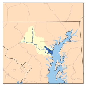


Anacostiamap.png - Kmusser
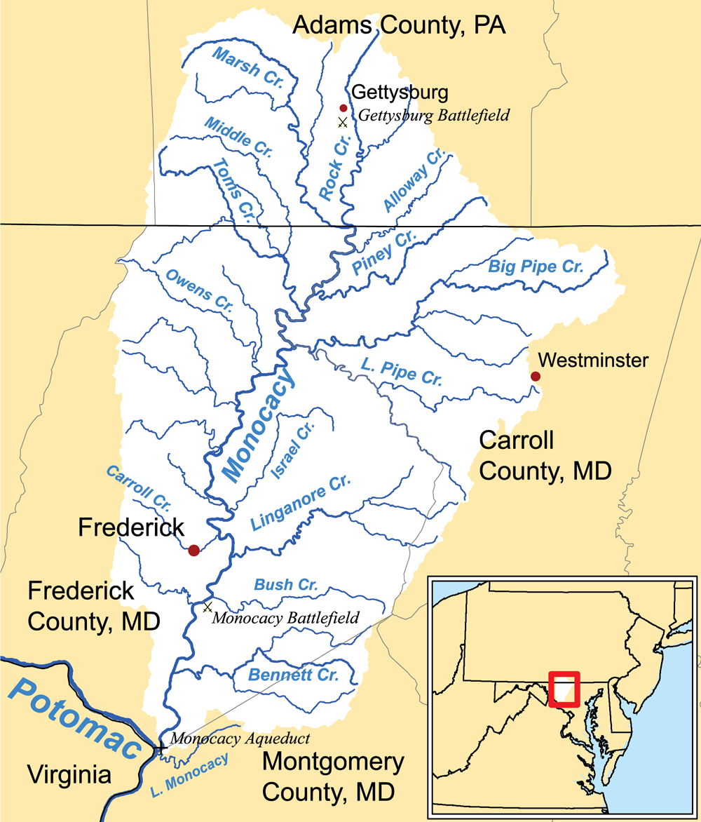
Monocacy.png - Kmusser
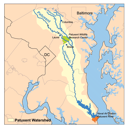
Patuxentrivermap.png - Kmusser
Patapscomap.png - Kmusser

Elkrivermap.png - Kmusser

Sassafrasmap.png - Kmusser

Chestermdmap.png - Kmusser

Choptankmap.png - AMK1211

Pocomokemap.png - Kmusser

Nanticokemap.png - Kmusser
Wicomicomap.png - Kmusser

Monon-CheatRiver.png - Pfly

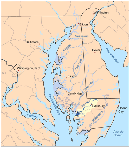
Chesapeakewatershedmap.png - Kmusser

Hongarivermap.png - Kmusser

Tuscarora creek potomac map.png - Kmusser
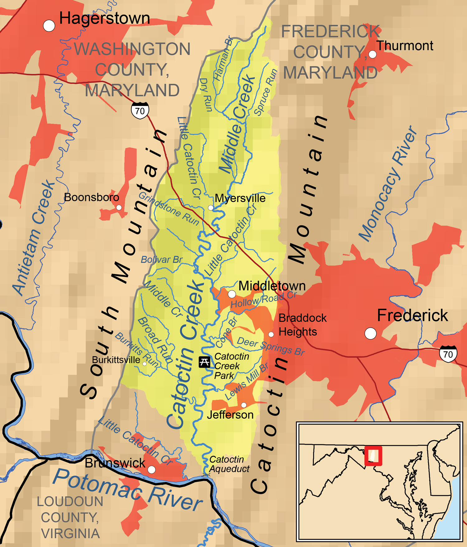
Catoctin md river map.png - Kmusser

A map exhibiting a general view of the roads and inland navigation of Pennsylvania, and part of the adjacent states (5385393632).jpg - File Upload Bot (Magnus Manske)
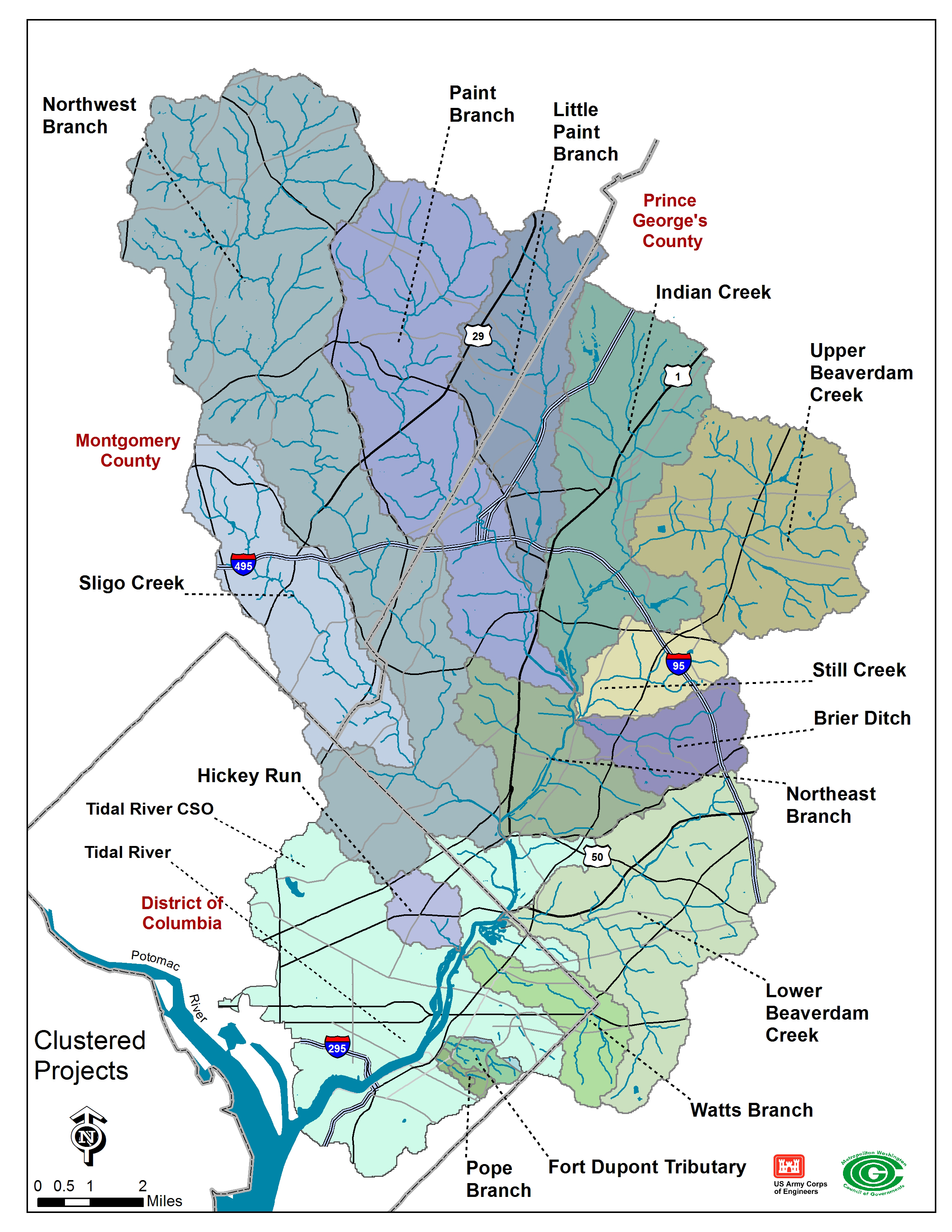
Anacostia River Watershed Map.png - Tcr25
Patapscomap (cropped).png - GreenMeansGo

A sketch of the navigation from Swan Pt. to the River Elk at the head of Chesapeak Bay. Sketch of the River Elk, at the head of Chesapeak Bay. LOC gm71002217.jpg - Fæ

Patuxent River Map.png - Kmusser

Pocomokemap (cropped).png - Ich esse Rosinen.