Wikimedi'Òc
Modes d'emploi

Cet album fait partie des albums
Cet album photos contient les sous-albums suivants :


NorthernIrelandCoutiesNumbered.png - Arz

Northern Ireland - Counties.png - Chumwa

Island of Ireland location map Tyrone.svg - Mabuska

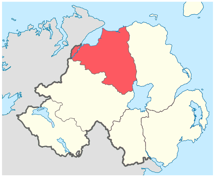
Island of Ireland location map Londonderry.svg - Mabuska

Island of Ireland location map Fermanagh.svg - Mabuska

Island of Ireland location map Antrim.svg - Mabuska

Island of Ireland location map Down.svg - Mabuska

Island of Ireland location map Armagh.svg - Mabuska

Northern Ireland - Counties-HE.png - Ori~

Northern Ireland - Counties mk.png - Bjankuloski06en

County Armagh.png - Mabuska

County Down.png - Mabuska

County Antrim copy.png - Mabuska

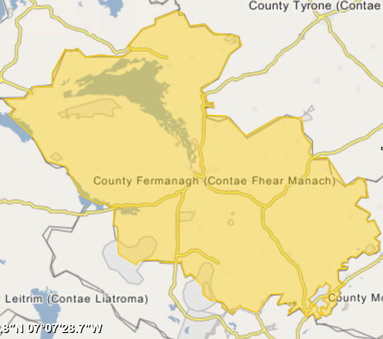
County Fermanagh.png - Mabuska
County Londonderry.png - Mabuska

County Tyrone.png - Mabuska

IveaghOld.png - Mabuska

NIShape blue.png - Kingofthedead

Island of Ireland location map Tyrone with Lake Torrent.png - Rocknrollmancer

Northern Ireland - Counties ru.png - Jim Hokins

Map of Ireland.jpg - Zoozaz1

Location map Northern Ireland County Armagh.png - JohnArmagh

Location map Northern Ireland County Down.png - JohnArmagh

Location map Northern Ireland County Londonderry.png - JohnArmagh
Location map Northern Ireland County Fermanagh.png - JohnArmagh

Location map Northern Ireland County Tyrone.png - JohnArmagh

Map showing the traditional, geographical county of County Tyrone, Northern Ireland.png - RealCounties

Map showing the traditional, geographical county of County Londonderry, Northern Ireland.png - RealCounties

Map showing the traditional, geographical county of County Armagh, Northern Ireland.png - RealCounties

Map showing the traditional, geographical county of County Down, Northern Ireland.png - RealCounties

Map showing the traditional, geographical county of County Antrim, Northern Ireland.png - RealCounties

Map showing the traditional, geographical county of County Fermanagh, Northern Ireland.png - RealCounties