Wikimedi'Òc
Modes d'emploi

Cet album fait partie des albums
Cet album photos contient les sous-albums suivants :


Bergen Passaic 1872.jpg - ChrisRuvolo

Passaic County, NJ municipalities labeled.svg - ChrisRuvolo
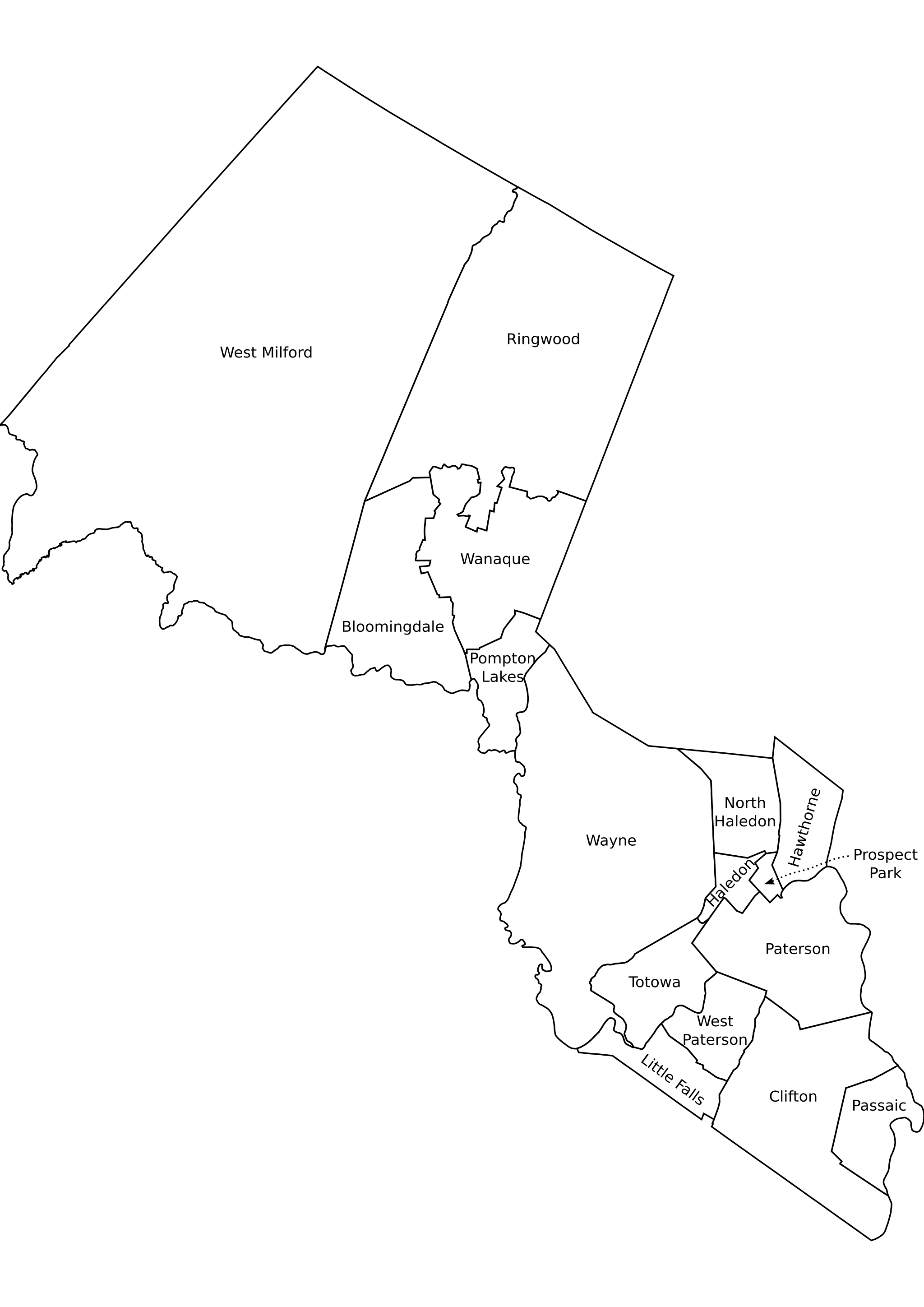
Passaic County, NJ municipalities labeled.png - ChrisRuvolo

Map of New Jersey highlighting Passaic County.svg - Nux

Passaic County New Jersey Incorporated and Unincorporated areas Bloomingdale Highlighted.svg - ArkyBot~commonswiki

Passaic County New Jersey Incorporated and Unincorporated areas Clifton Highlighted.svg - ArkyBot~commonswiki

Passaic County New Jersey Incorporated and Unincorporated areas Haledon Highlighted.svg - ArkyBot~commonswiki

Passaic County New Jersey Incorporated and Unincorporated areas Hawthorne Highlighted.svg - ArkyBot~commonswiki

Passaic County New Jersey Incorporated and Unincorporated areas North Haledon Highlighted.svg - ArkyBot~commonswiki

Passaic County New Jersey Incorporated and Unincorporated areas Passaic Highlighted.svg - ArkyBot~commonswiki

Passaic County New Jersey Incorporated and Unincorporated areas Paterson Highlighted.svg - ArkyBot~commonswiki

Passaic County New Jersey Incorporated and Unincorporated areas Pompton Lakes Highlighted.svg - ArkyBot~commonswiki

Passaic County New Jersey Incorporated and Unincorporated areas Prospect Park Highlighted.svg - ArkyBot~commonswiki

Passaic County New Jersey Incorporated and Unincorporated areas Ringwood Highlighted.svg - ArkyBot~commonswiki

Passaic County New Jersey Incorporated and Unincorporated areas Totowa Highlighted.svg - ArkyBot~commonswiki

Passaic County New Jersey Incorporated and Unincorporated areas Wanaque Highlighted.svg - ArkyBot~commonswiki

Passaic County New Jersey Incorporated and Unincorporated areas West Milford Highlighted.svg - ArkyBot~commonswiki

Passaic County New Jersey Incorporated and Unincorporated areas West Paterson Highlighted.svg - ArkyBot~commonswiki

Great Notch station map.PNG - Mitchazenia

AcquackanonkTownshipNewJersey1872.JPG - Uzma Gamal

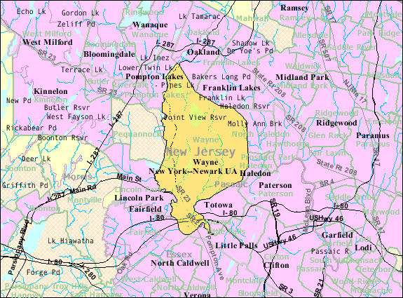
Location map of Passaic County, New Jersey.svg - Omnedon
Township of West Milford (Township) NYPL1602559.tiff - Fæ
The Business Representation of Paterson and Passaic County. Patrons of this Atlas. NYPL1602560.tiff - Fæ
The Business Representation of Paterson and Passaic County. Patrons of this Atlas. (cont.); Too Late for Classification. NYPL1602561.tiff - Fæ
Table of Distances from one Village to another, in Passaic County, N.J. NYPL1602527.tiff - Fæ
Table of Contents. NYPL1602552.tiff - Fæ

Great Falls-S. U. M. Historic District, Oliver Street, Paterson, Passaic County, NJ HAER NJ,16-PAT,15- (sheet 4 of 5).png - Fæ

Census Bureau map of Bloomingdale, New Jersey.png - GifTagger

Census Bureau map of Haledon, New Jersey.png - GifTagger

Census Bureau map of Hawthorne, New Jersey.png - GifTagger

Census Bureau map of Little Falls, New Jersey.png - GifTagger

Census Bureau map of North Haledon, New Jersey.png - GifTagger

Census Bureau map of Pompton Lakes, New Jersey.png - GifTagger

Census Bureau map of Prospect Park, New Jersey.png - GifTagger

Census Bureau map of Ringwood, New Jersey.png - GifTagger

Census Bureau map of Totowa, New Jersey.png - GifTagger

Census Bureau map of Wanaque, New Jersey.png - GifTagger
Census Bureau map of Wayne, New Jersey.png - GifTagger

Census Bureau map of West Milford, New Jersey.png - GifTagger

Census Bureau map of West Paterson, New Jersey.png - GifTagger

Map of the counties of Bergen and Passaic, New Jersey - from actual surveys LOC 2011588009.jpg - Fæ

Passaic County racial and ethnic map 2010.svg - Iniți

Passaic County most spoken language at home map 2015.svg - Iniți
PassaicRiverNorthBend.png - Lithium6ion