Wikimedi'Òc
Modes d'emploi

Cet album fait partie des albums
Cet album photos contient les sous-albums suivants :


Camp Mills 1897 1-62,500 - PCL Map Collection - txu-pclmaps-topo-ny-camp mills-1897.jpg - DaxServer

Easthampton 1903 1-62,500 - PCL Map Collection - txu-pclmaps-topo-ny-easthampton-1903.jpg - DaxServer

Islip 1902 1-125,000 - PCL Map Collection - txu-pclmaps-topo-ny-islip-1902.jpg - DaxServer
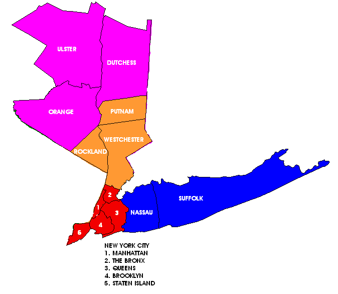
Long Island counties, Long Island, New York.png - Duffman~commonswiki
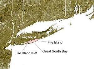
Fire Island-NY-USA-Location Map.jpg - Fg68at

Fire Island-NY-USA-Location Map of Fire Island National Seashore.gif - Fg68at

Fire Island-NY-USA-Location Map-01.gif - Fg68at

Longisland.png - Nikater

Outer Lands.png - Pharos
Ctpanhandle.png - Kmusser

Longisland1.png - Nikater

Map of Long Island NY.png - Tzign~commonswiki
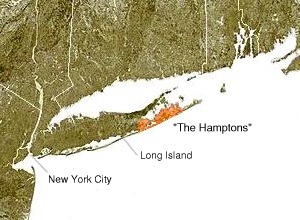
The Hamptons.jpg - Kordas
New york long island.jpg - Nicke L
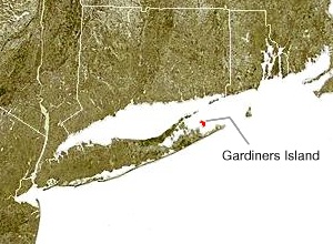
Wpdms ev26188 gardiners island.jpg - Nikater
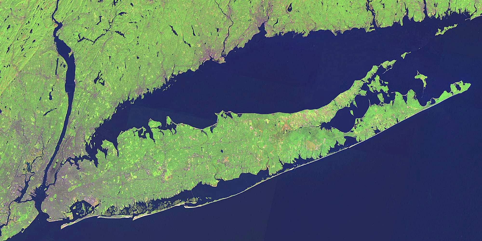
Long Island Landsat Mosaic.jpg - Urdangaray

Location of Peconic County.svg - NuclearVacuum

Long Island Mercator projection 2.png - File Upload Bot (Magnus Manske)

Long Island Mercator projection 1.png - Kelly

Long Island statehood map.svg - NuclearVacuum

Wpdms ev26188 blockislandsound.jpg - SreeBot

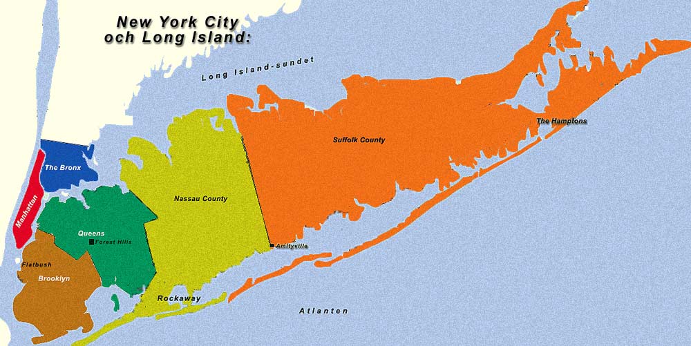
New York City and the Long Island.jpg - Intelligentlove
Wpdms ev26188 great south bay.jpg - SreeBot
Long Island US map.gif - File Upload Bot (Magnus Manske)

Long Island-Congressional District 1(pre-2012).svg - IsadoraofIbiza

New York—Congressional District 1.svg - IsadoraofIbiza

Long Island—Congressional Districts 2012.svg - IsadoraofIbiza
Blank Map of Long Island.svg - IsadoraofIbiza

New York—Congressional District 4.svg - IsadoraofIbiza

New York—Congressional District 2.svg - IsadoraofIbiza

New York—Congressional District 3.svg - IsadoraofIbiza

New York—Congressional District 5.svg - IsadoraofIbiza

Long Island—Congressional Districts 2012—In Suffolk County.svg - IsadoraofIbiza

Map of the Boroughs of New York City and the counties of Long Island.png - Chumwa
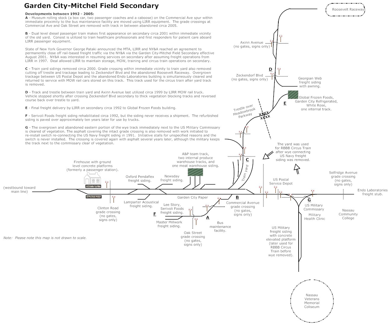
Garden City Mitchel Field Secondary Final.jpg - Thebatsignal
Long Island 1686.jpg - Sarnold17
Wpdms ev26188 fire island.jpg - Arthunter

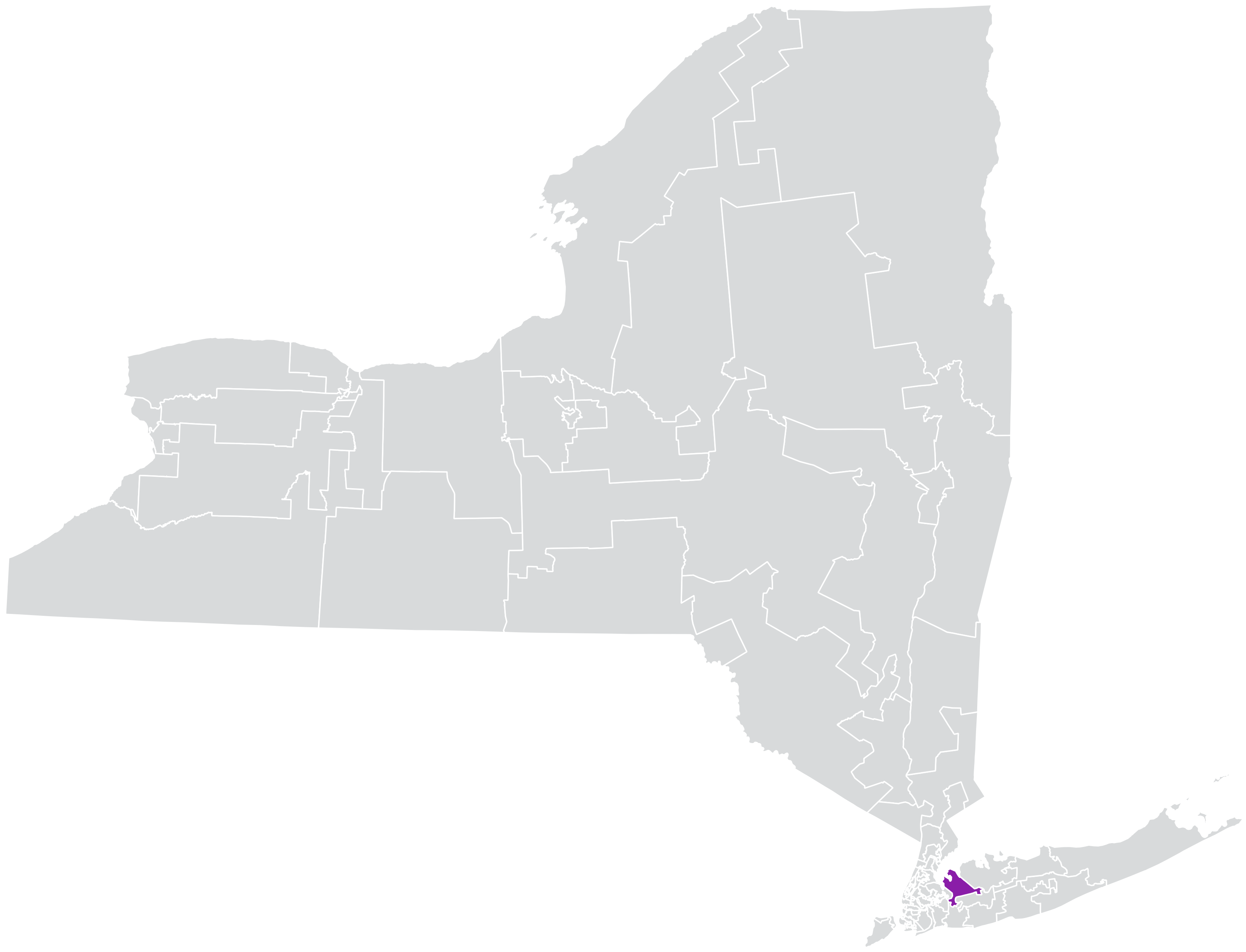
Long Island location map.svg - Ergo Sum

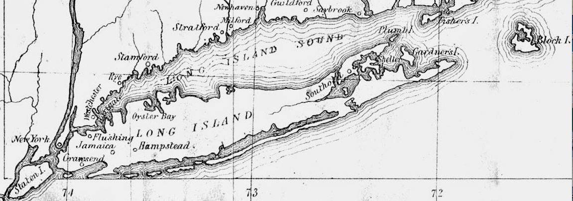
Tourists Map of Long Island Sound, 1868.jpg - Fæ

T4-li.jpg - Sanjayshivesh
DownState.png - OgreBot

Location map Long Island.png - L9A8M

LIFortMap01.png - RobDuch

Fire Island-NY-USA-Location Map-01.svg - Opencooper

Untitled - Advertising (NBY 3280).jpg - Fæ

Map of the Art Village Situated at Shinnecock Hills.jpg - WomenArtistUpdates

Fishers Island Map.jpg - Innotata

Long Island Sound - NARA - 12007681.jpg - US National Archives bot

New York State Senate District 2 (2012).png - Blizzardwind

New York State Senate District 3 (2012).png - Blizzardwind

New York State Senate District 4 (2012).png - Blizzardwind

New York State Senate District 5 (2012).png - Blizzardwind
New York State Senate District 7 (2012).png - Blizzardwind

New York State Senate District 8 (2012).png - Blizzardwind

New York State Senate District 9 (2012).png - Blizzardwind
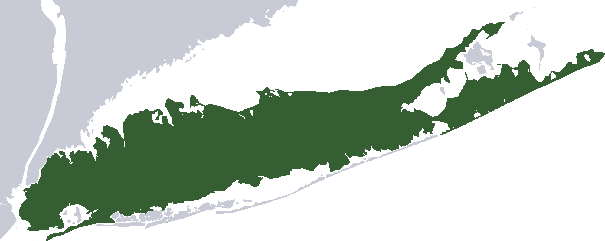
Green Map of Long Island 2000px.png - Matrek

Map of Long Island topography.jpg - SpanishSnake
Map of the southern part of Gardiners Island, also showing Cartwright Island.pdf - Geo Swan

Southern tip of Gardiners Island, Cartwright Shoals, Cartwright Island USGS.jpg - Geo Swan
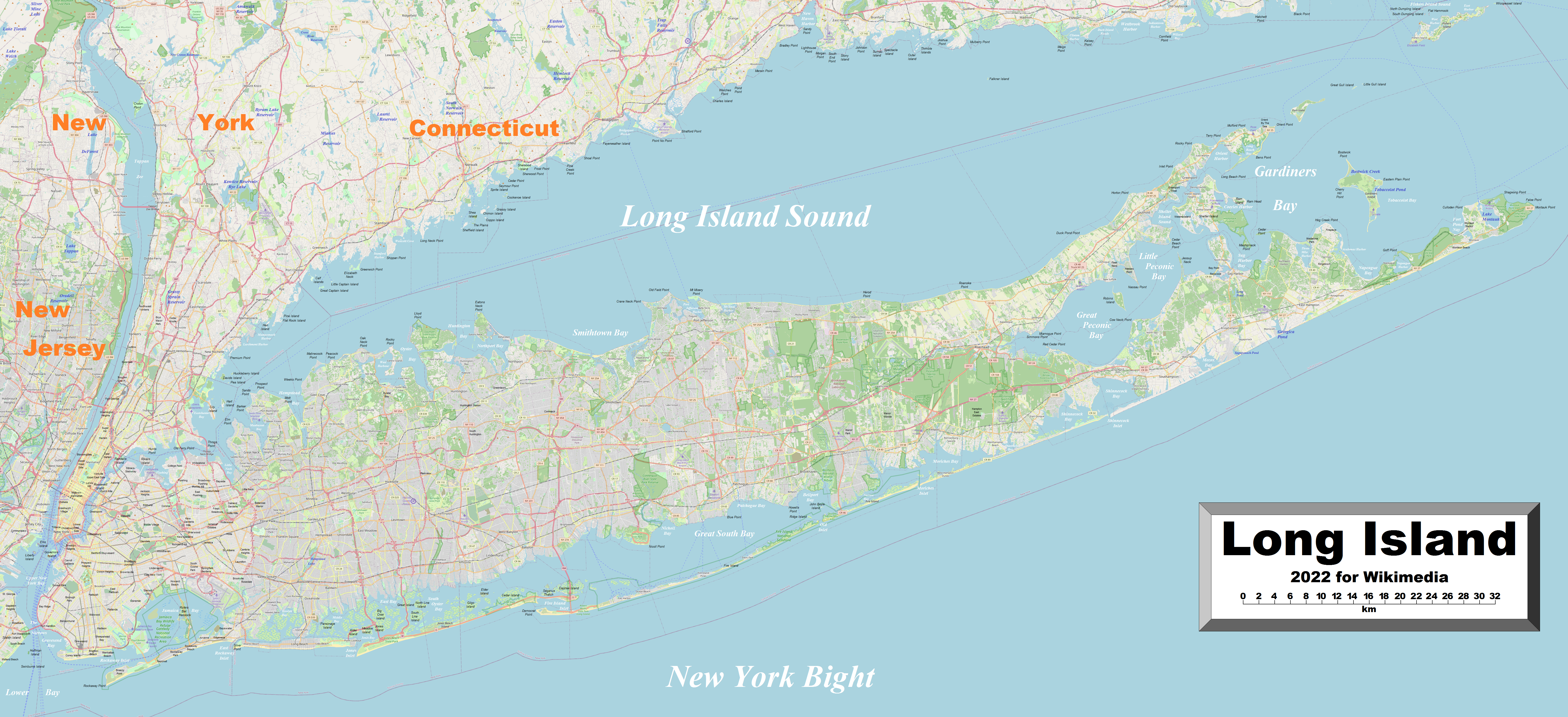
LongIsland2022OSM.png - Kelisi

Long Island Flag Map.png - Xenonts
Long Island Counties.gif - Pharos

2012 NY-03 election results.svg - Incognito melon

2022 New York's 2nd Congressional District election map by precinct.svg - Democratic2034!

New York's 2nd congressional district (since 2025).svg - Twotwofourtysix

New York's 1st congressional district (since 2025).svg - Twotwofourtysix

New York's 3rd congressional district (since 2025).svg - Twotwofourtysix

2024 NY-02 election results.svg - Incognito melon

USA New York Tri State NYC area.svg - Hmdwgf

Annual report (1912) (18243367809).jpg - Fæ