Wikimedi'Òc
Modes d'emploi

Cet album fait partie des albums


1878 Manhattan Beach Railway.jpg - SPUI~commonswiki

LIRR map.svg - Train2104

LIRR schematic.svg - ComplexRational

LIRR map 1876.svg - NE2

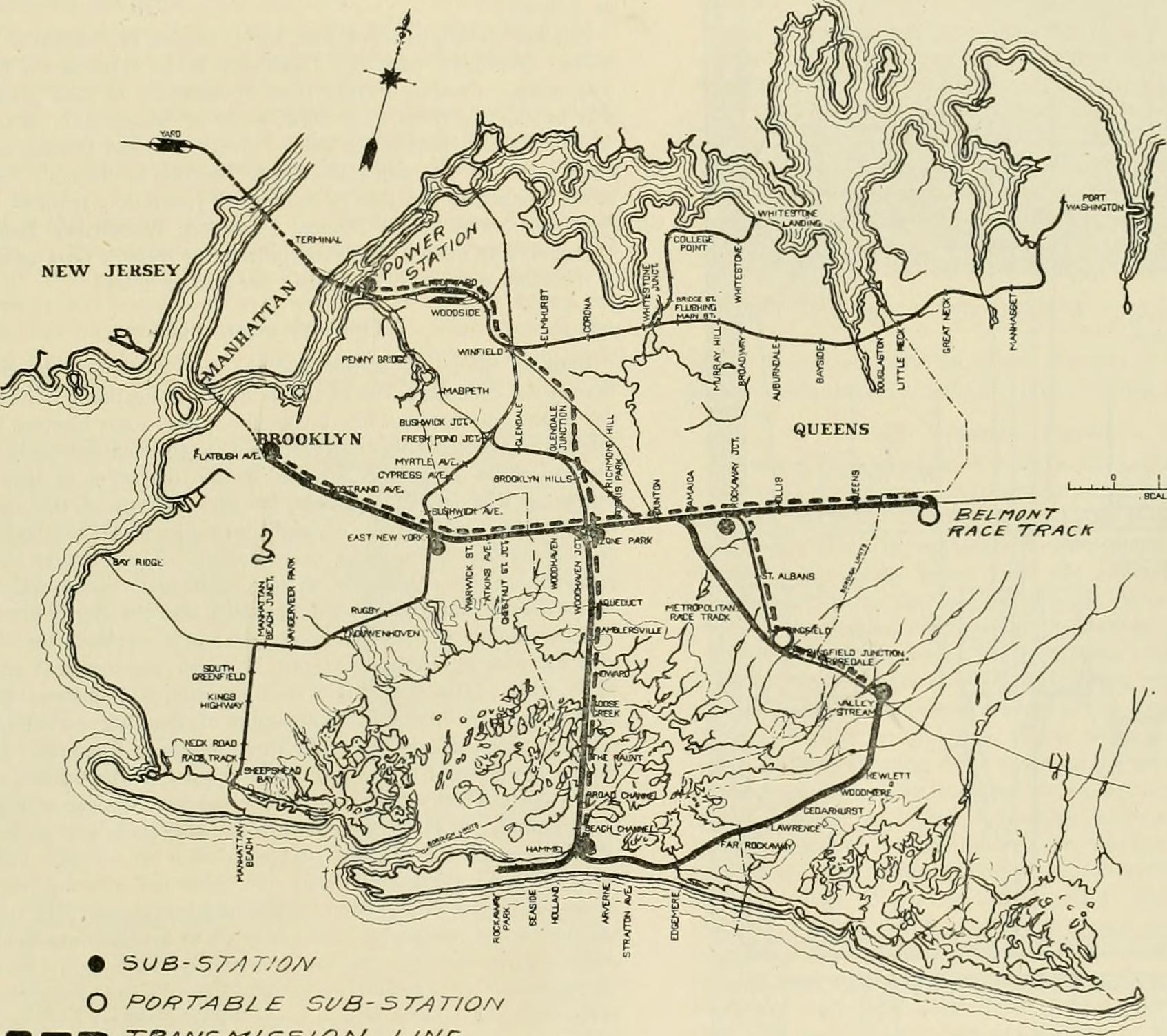
Rockaway Branches.jpg - NE2

FNS front.jpg - NE2

FNS back.jpg - NE2

FNS map only.jpg - NE2

Jamaica stations 1873.jpg - NE2

LIRR 1891 Morris Park station.jpg - NE2
LIRR 1891 Clarenceville station.jpg - NE2
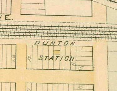
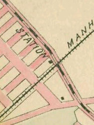
LIRR 1891 Dunton station.jpg - NE2

LIRR 1891 Morris Park facility.jpg - NE2

LIRR 1891 Richmond Hill station.jpg - NE2
LIRR 1891 Union Course station.jpg - NE2
LIRR 1891 City Line station.jpg - NE2

LIRR 1891 Woodhaven Junction station.jpg - NE2
LIRR 1891 Ozone Park station.jpg - NE2

LIRR 1891 Maple Grove station.jpg - NE2
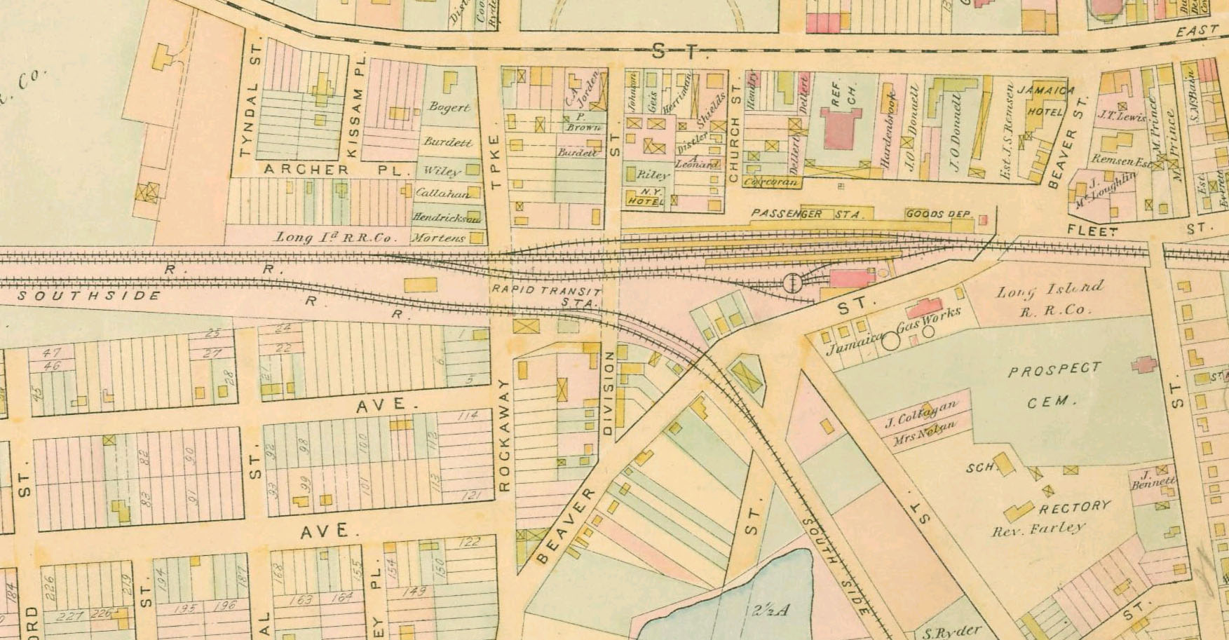
LIRR 1891 Jamaica station.jpg - NE2

LIRR 1873 East New York station.jpg - NE2

LIRR 1891 Long Island City.jpg - NE2

LIRR 1891 Winfield station.jpg - SteinsplitterBot

LIRR 1891 Woodside station.jpg - NE2
LIRR 1891 Newtown station.jpg - NE2

LIRR 1891 Laurel Hill station.jpg - NE2

LIRR 1891 Corona station.jpg - NE2
LIRR 1891 Cypress Avenue station.jpg - NE2
LIRR 1891 Fresh Pond Junction.jpg - NE2

LIRR 1891 Fresh Pond station.jpg - NE2

LIRR 1891 Creedmoor station.jpg - NE2

LIRR 1891 Queens Village station.jpg - NE2

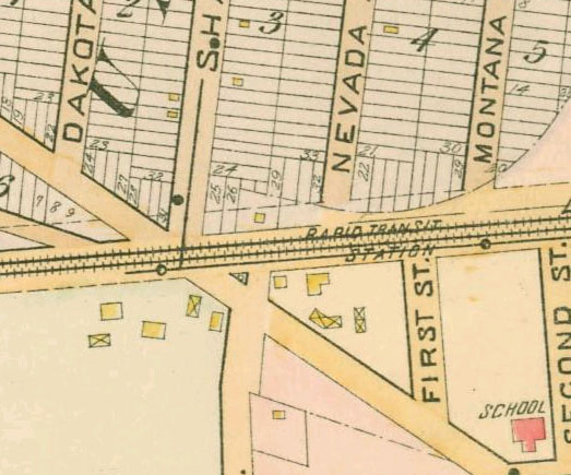
LIRR 1891 Hollis station.jpg - NE2

LIRR 1891 Bridge Street station.jpg - NE2

LIRR 1891 Flushing.jpg - NE2

LIRR 1891 Flushing Main Street station.jpg - NE2
LIRR 1891 Murray Hill station.jpg - NE2

LIRR 1909 Rockaway Junction station.jpg - NE2

LIRR 1909 Hollis station.jpg - NE2
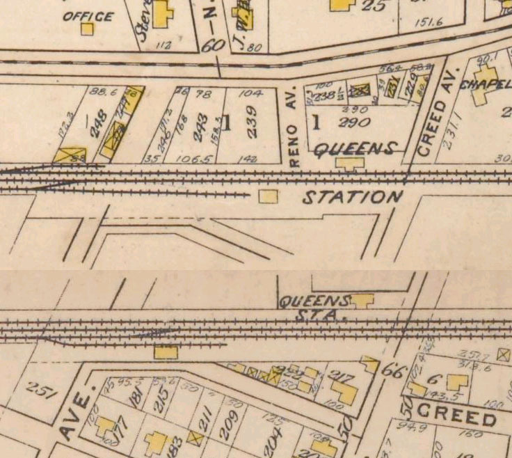
LIRR 1909 Queens station.jpg - NE2
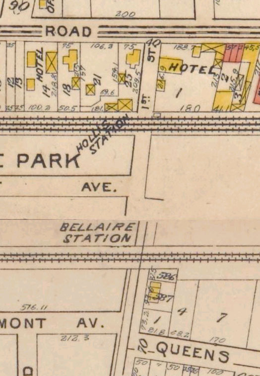
LIRR 1909 Bellaire station.jpg - NE2

LIRR CTZ.svg - Pi.1415926535

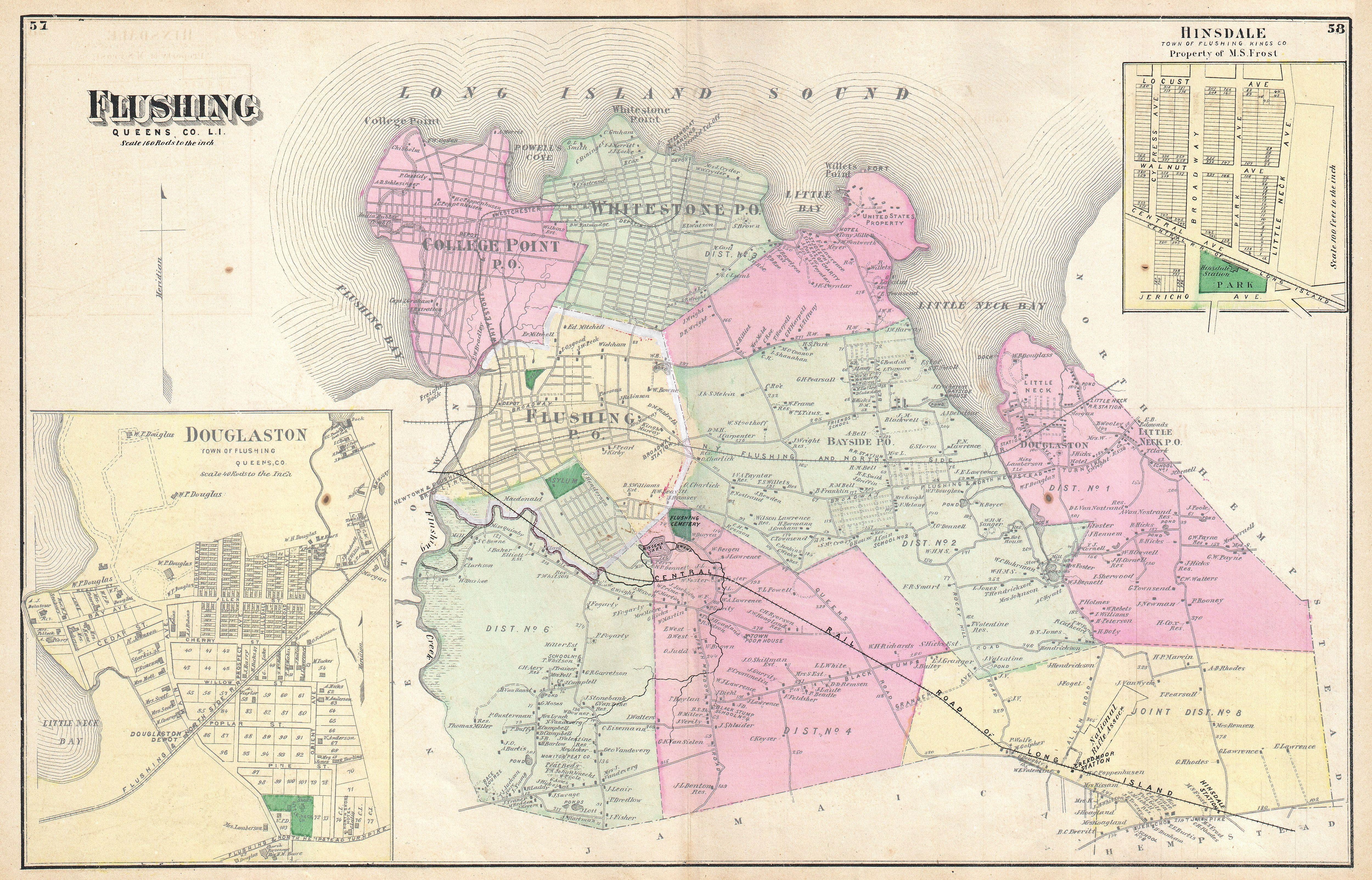
1873 Beers Map of the Flushing Railroad, Long Island, Queens, New York - Geographicus - FlushingRailroad-beers-1873.jpg - BotMultichill

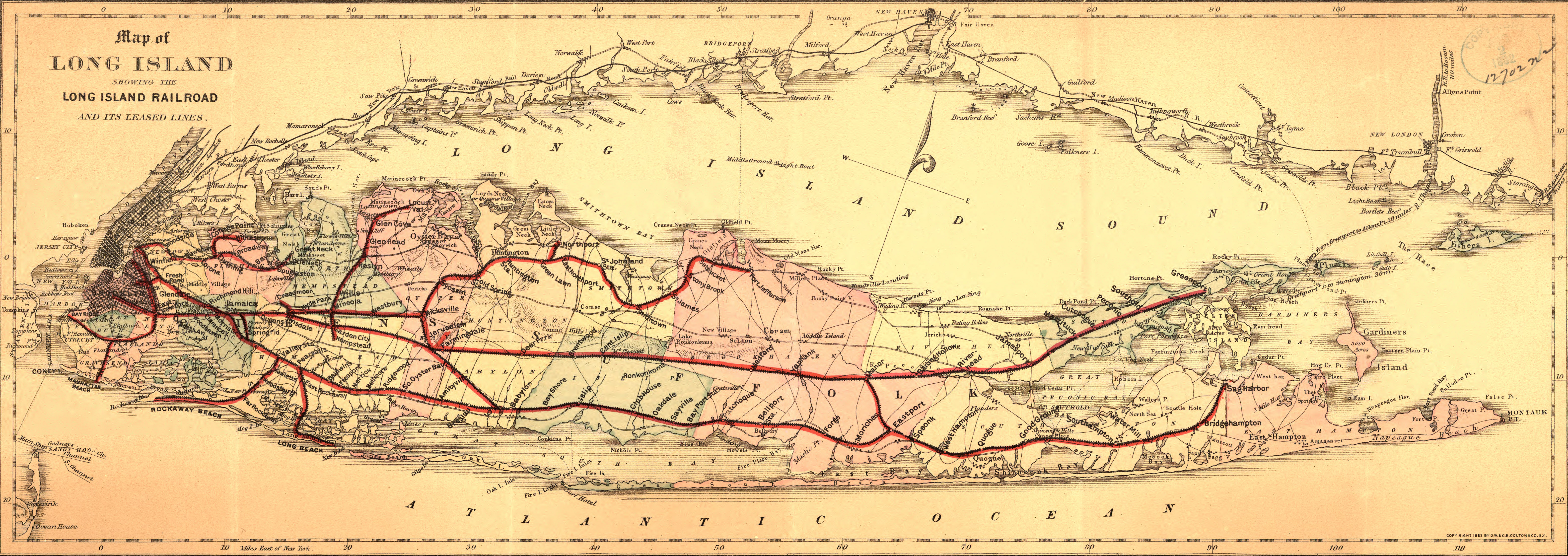
1891 Long Island Railroad Real Estate Map of Long Island - Geographicus - LongIsland-railroadmap-1891.jpg - BotMultichillT

Atlantic Branch Map.PNG - Pi.1415926535
1882 map of Long Island Railroad.jpg - BurtAlert

Atlantic Branch Map.svg - Pi.1415926535
Flushing and North Side Railroad, with its leased branches (contd.).) NYPL1527261.tiff - Fæ
Plate 35- Bounded by Johnson Ave., Rockaway Tpke., Beaver St., Prospect St., South St., Canal St., Douglass St., Larch St., Theodore St., Dewey Ave., Merrick Rd., (Jamaica Ter.), Cumberland NYPL1516369.tiff - Fæ
Plate 37- Bounded by Atlantic Avenue, Cummings Street, Hollis Avenue, (South Hollis Hills) South Street, Farmers Avenue, ... Central Avenue, Merrick Plank Road, ... Dean Island, ... South NYPL1516373.tiff - Fæ
The Flushing and North Side Railroad, with its leased branches. NYPL1527260.tiff - Fæ
Queens, Vol. 1, Double Page Plate No. 34; Part of Ward 5; Farrockaway; (Map bounded by The Strand; Cornell Ave., Clinton Ave., Mott Ave; Including Central Ave., Bay Ave., Fulton Ave., NYPL1693877.tiff - Fæ

East Side Access.svg - Egmason
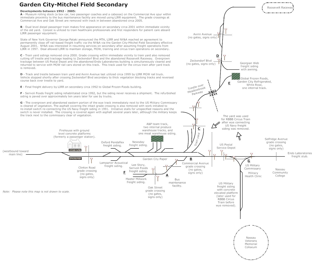
Garden City Mitchel Field Secondary Final.jpg - Thebatsignal

General guide to the exhibition halls of the American Museum of Natural History (1911) (14595245600).jpg - Fæ
The street railway review (1891) (14757425094).jpg - Fæ

Appletons' illustrated hand-book of American travel. A full and reliable guide to the United States and the British provinces. With careful maps of all parts of the country, and pictures of famous (14592216748).jpg - SteinsplitterBot

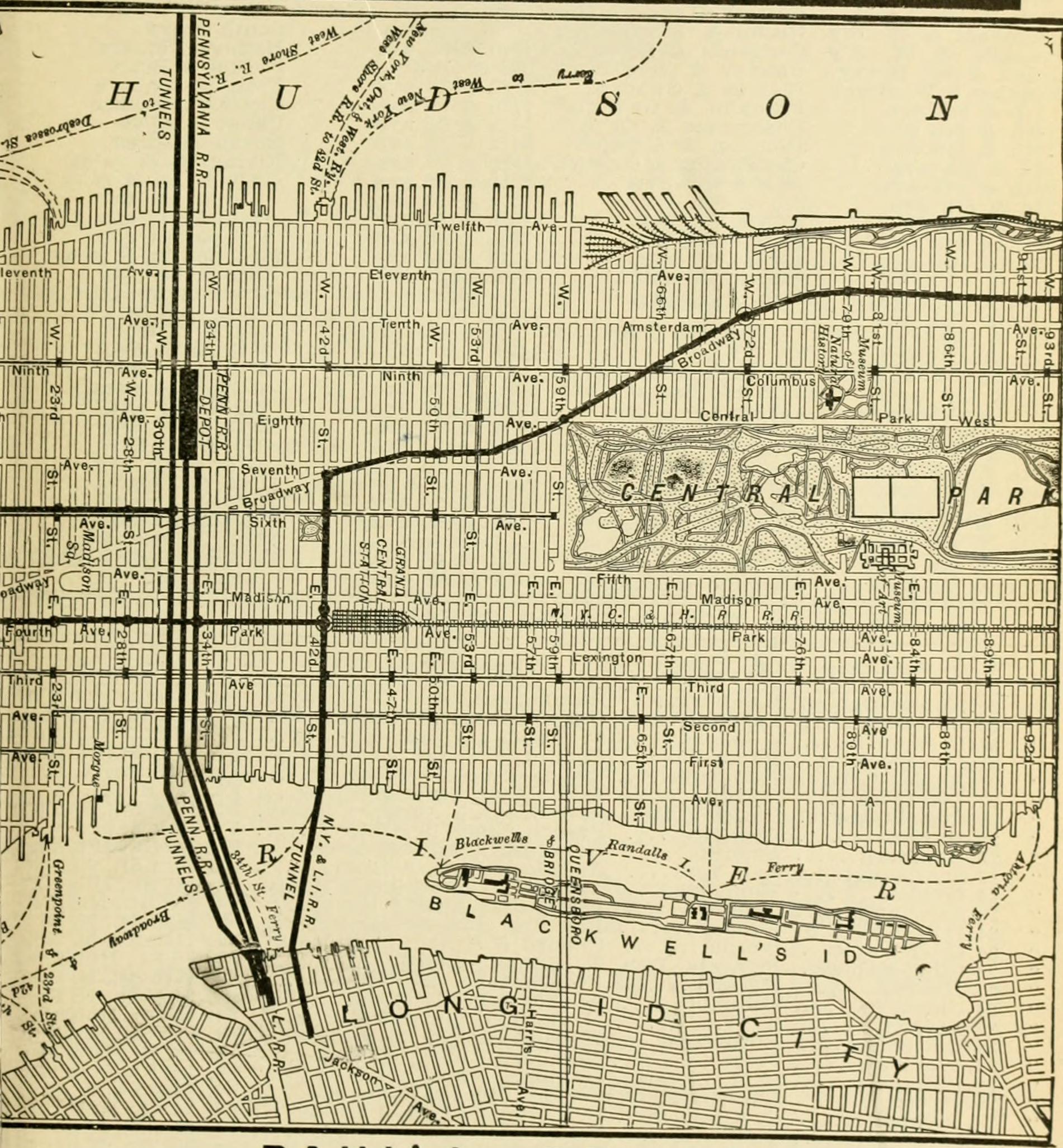
The New York improvement and tunnel extension of the Pennsylvania railroad. Issued October, 1910 (1910) (14573132588).jpg - Fæ

Daily attractions in New York. Advance information of art exhibitions, lectures, concerts, churches, theatres, railroads, Pullman accommodations, points of interest, where to dine, etc. (1906) (14755160801).jpg - Fæ

Daily attractions in New York. Advance information of art exhibitions, lectures, concerts, churches, theatres, railroads, Pullman accommodations, points of interest, where to dine, etc. (1906) (14778146273).jpg - Fæ
Daily attractions in New York. Advance information of art exhibitions, lectures, concerts, churches, theatres, railroads, Pullman accommodations, points of interest, where to dine, etc. (1906) (14758024062).jpg - Fæ

Daily attractions in New York. Advance information of art exhibitions, lectures, concerts, churches, theatres, railroads, Pullman accommodations, points of interest, where to dine, etc. (1906) (14755089431).jpg - SteinsplitterBot

Daily attractions in New York. Advance information of art exhibitions, lectures, concerts, churches, theatres, railroads, Pullman accommodations, points of interest, where to dine, etc. (1906) (14758045692).jpg - Fæ

Daily attractions in New York. Advance information of art exhibitions, lectures, concerts, churches, theatres, railroads, Pullman accommodations, points of interest, where to dine, etc. (1906) (14757960362).jpg - Fæ

The Street railway journal (1903) (14758305321).jpg - Fæ
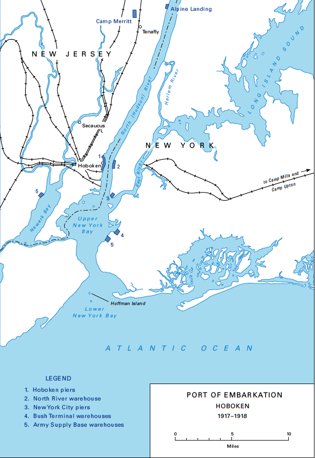
Port of Embarkation Hoboken (1917-1918).png - FastilyClone

NYAR map.svg - Train2104
Map showing the route & connections of the Central Rail Road Extension Company of Long Island. LOC 98688614.tif - Fæ

Map showing the route & connections of the Central Rail Road Extension Company of Long Island. LOC 98688614.jpg - Fæ
Sanborn Fire Insurance Map from Jamaica, Queens County, New York. LOC sanborn06010 001-5.tif - Fæ

Sanborn Fire Insurance Map from Jamaica, Queens County, New York. LOC sanborn06010 001-5.jpg - Fæ
Sanborn Fire Insurance Map from Jamaica, Queens County, New York. LOC sanborn06010 003-11.tif - Fæ

Sanborn Fire Insurance Map from Jamaica, Queens County, New York. LOC sanborn06010 003-11.jpg - Fæ

1873 Beers Map of Flushing and College Point, Queens, New York - Geographicus - Kissena Creek & Central RR 2A.jpg - Tdorante10
1873 Beers Map of Flushing and College Point, Queens, New York - Geographicus - Kissena Creek & Central RR 1.jpg - Tdorante10

1873 Beers Map of Flushing and College Point, Queens, New York - Geographicus - Kissena Creek & Central RR 2.jpg - Tdorante10
Sanborn Fire Insurance Map from Jamaica, Queens County, New York. LOC sanborn06010 002-9.tif - Fæ

1950 Census Enumeration District Maps - New York (NY) - Queens County - Queens - ED 41-1 to 2176 - NARA - 24519584 (page 8).jpg - US National Archives bot
The Transportation system - New York City - Brooklyn and Manhattan(GN03662).jpg - Htsa

LIRR Diesel Regions Map.jpg - Kew Gardens 613

GCM Opening - 52649084066.jpg - Ɱ

Long Island Rail Road Diagram.svg - Loganbutler3

New York City Commuter Railroads Diagram.svg - Loganbutler3