Wikimedi'Òc
Modes d'emploi

Cet album fait partie des albums
Cet album photos contient les sous-albums suivants :


Political maps of India in the years 1765 and 1805, published in the 'Imperial Gazetteer of India' (Vol. XXVI, Atlas; 1931 revised edition; plate no. 28).jpg - MaplesyrupSushi

Political maps of India in the years 1837 and 1857, published in the 'Imperial Gazetteer of India' (Vol. XXVI, Atlas; 1931 revised edition; plate no. 29).jpg - MaplesyrupSushi

India 1804 map.jpg - Kensplanet

Map BEIC 1837-1857.jpg - Amenhtp
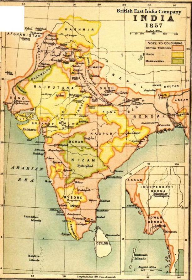
Map BEIC 1857.jpg - Amenhtp

Map BEIC 1837.jpg - Amenhtp
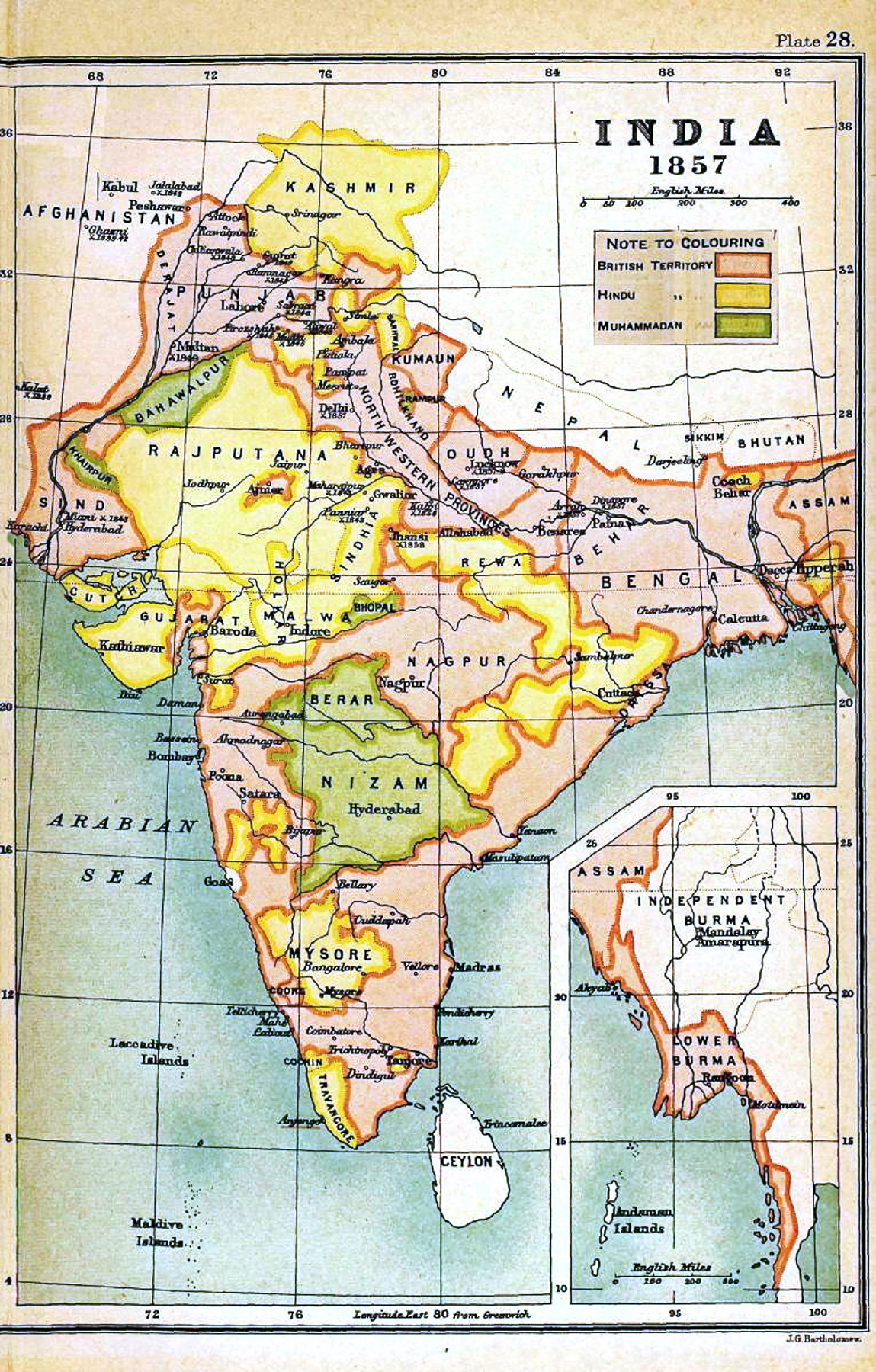
IGI1908India1857b.jpg - OgreBot

IGI1908India1837a.jpg - MALLUS

Joppen1907India1805a-21.jpg - Trotting cove

India - Division de la peninsula indiana en 1858.png - Nicolas Eynaud

Map of India 1823.jpg - Ikhtiyaar

A short history of England and the British Empire (1915) (14744310886).jpg - Fæ

Essentials in English history (from the earliest records to the present day) (1905) (14781710011).jpg - Fæ

A shorter history of England and greater Britain (1920) (14596316339).jpg - Fæ

462 of 'Cassell's Illustrated Universal History' (11154470095).jpg - Artix Kreiger 2

Retreat of Col Monson 1804.jpg - Pratishkhedekar
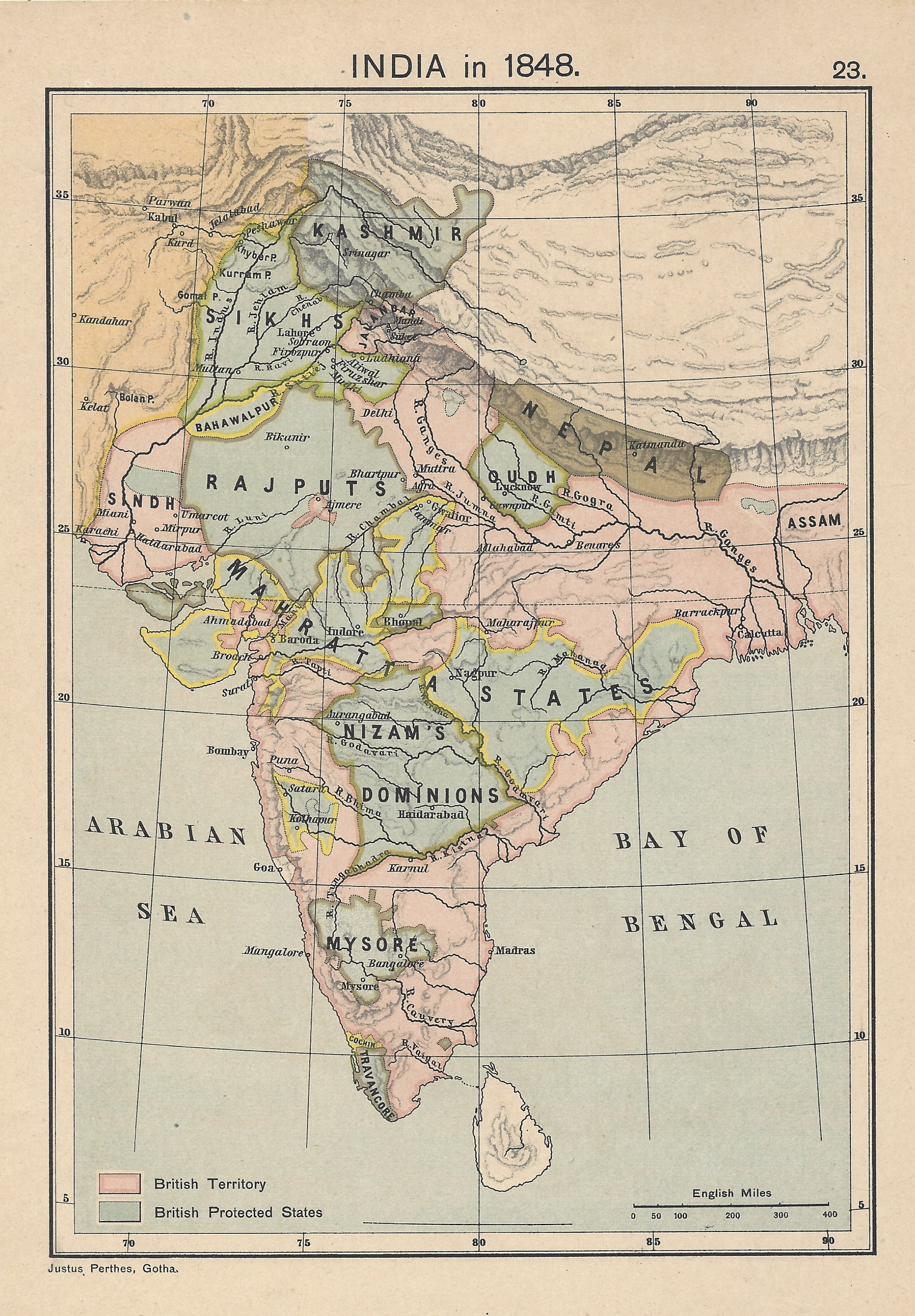
India in 1848 Joppen.jpg - Fowler&fowler
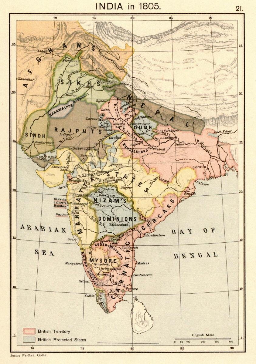
Joppen1907India1805a.jpg - Beao

Cropped image of Map of India 1823.jpg - Raju Babu

Historical atlas of modern Europe 1903 (135895484).jpg - Polona Upload

Joppen1907India1805aDarjeelingNepal.jpg - Fowler&fowler

India in 1805.png - Fayninja

India in 1845 (Johnston).jpg - Enyavar

Inland Customs Line India.png - Blackknight12

British India-es.svg - Rowanwindwhistler
British India.png - Kmusser