Wikimedi'Òc
Modes d'emploi

Cet album fait partie des albums
Cet album photos contient les sous-albums suivants :


Circassia in 1773.png - Karapolk

The Crimean Khanate at its maximum extent (1525).png - DamiKarv

Northern Caucasus regions map.png - OgreBot

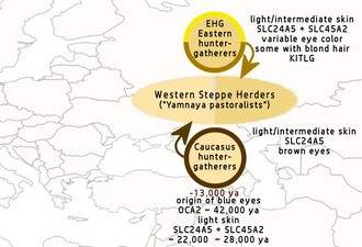
Yamnaya pastoralists, main genetic ancestry.png - पाटलिपुत्र

Caucasus and Crimea.png - Iktsokh

Relief location map of Eastern Europe.jpg - Iktsokh

University Ranking in Eastern Europe.jpg - Maps.interlude

Carpathians-satellite.jpg - Qorilla
Eastern-Europe-small.png - Ivanko~commonswiki
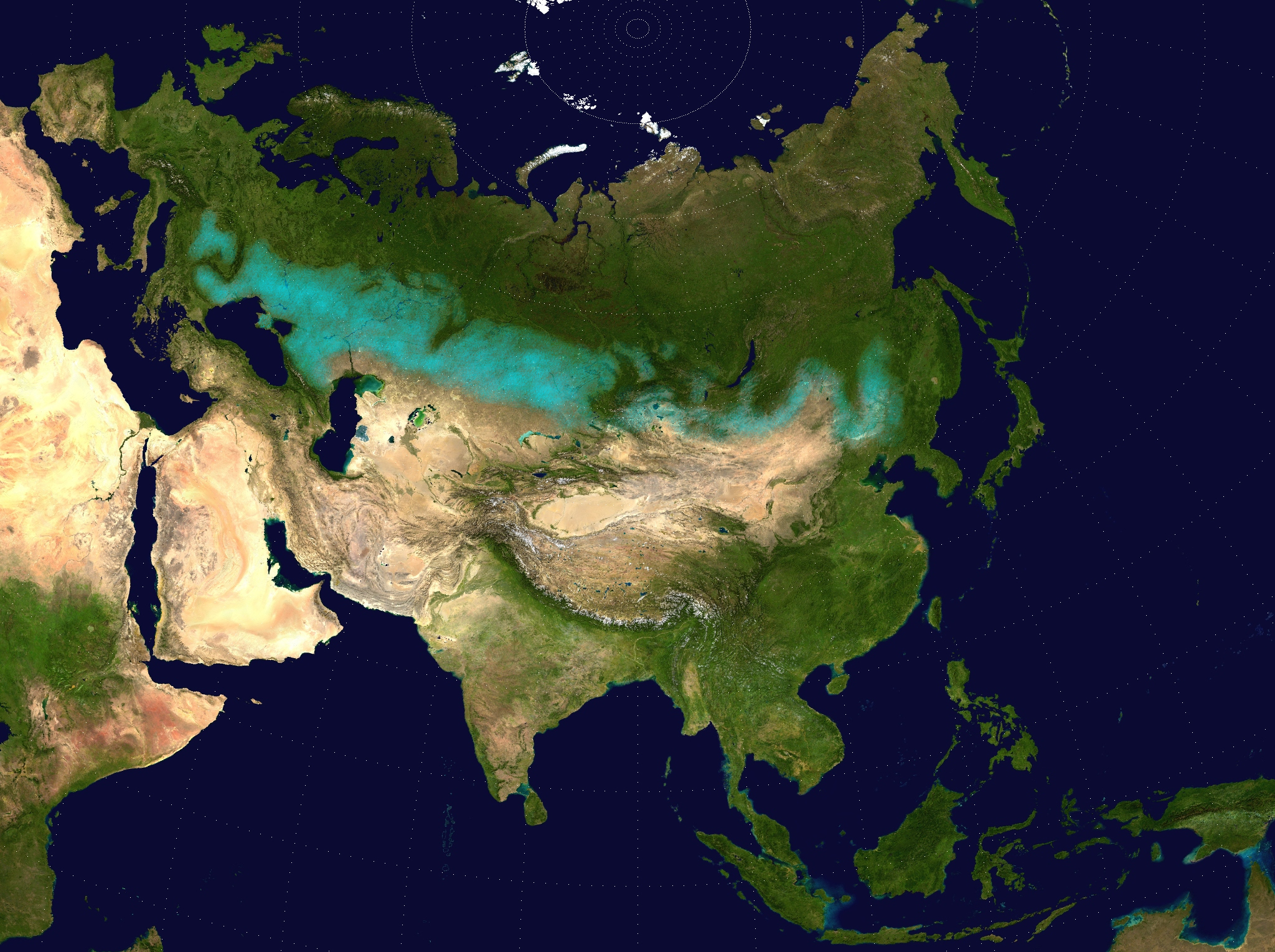
TransAsia m.png - Рагин1987
Rautaesirippu.jpg - Рагин1987

EasternEurope1.png - Koyos

Pontic Caspian climate.png - Dbachmann

Chasaren.jpg - Julieta39
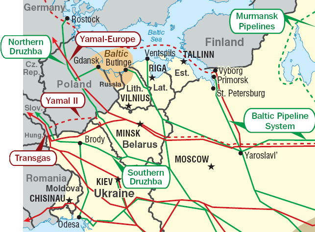
Pipelines in Eastern Europe.png - Ras67
Central and Eastern Europe Map.png - Minestrone
KazachstanEasternEurope.PNG - SieBot

Landen in Oost-Europa.PNG - SieBot

Map East Europe.svg - Iktsokh

Östeuropa.png - Рагин1987

Borders of Polish states and Polish–Lithuanian Commonwealth (union state of the Crown of the Kingdom of Poland and Grand Duchy of Lithuania).png - Mélomène

Eastern-Europe-extended-map.svg - Iktsokh

Eastern-Europe-map.svg - Antissimo
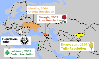
Color Revolutions Map.png - Thereppy

Eastern-Europe-Time-Almanac.png - Deadstar

Regiões do Leste Europeu.png - Pedro Aguiar
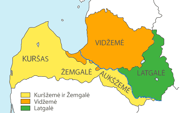
Latvian regions and latvians-(LT).png - Arz
Latvia-hist-regions-(blank).png - Arz
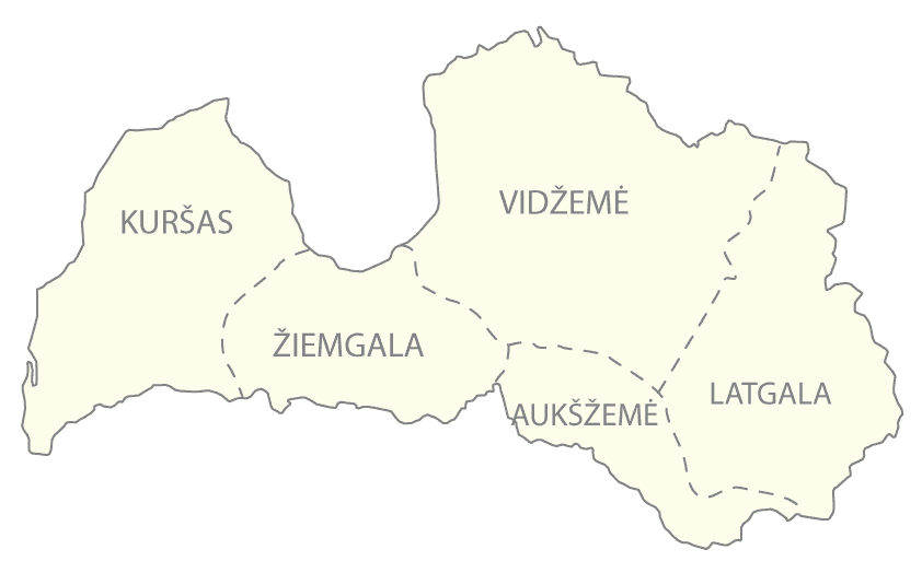
Latvia-hist-regions-(LT).png - Arz

ApproxPositionsWWI-1919.png - Hohum

E-euro.png - S19991002

Eastern Europe(UNGEGN EE Members).png - Iktsokh

Europe (UN divisions Eastern, East Central and Southeastern Europe).PNG - Olahus

Postgeorgia.JPG - Powerofrussia

IE5500BPeo.png - ThomasPusch

EEurope MW Herbarium.jpg - Alexey Seregin
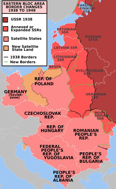
EasternBloc.png - Mosedschurte

Eastern Europe Map.jpg - Maphobbyist
Eurasian steppe belt.jpg - Clivius

Източна Европа.PNG - Targovishtenec bg
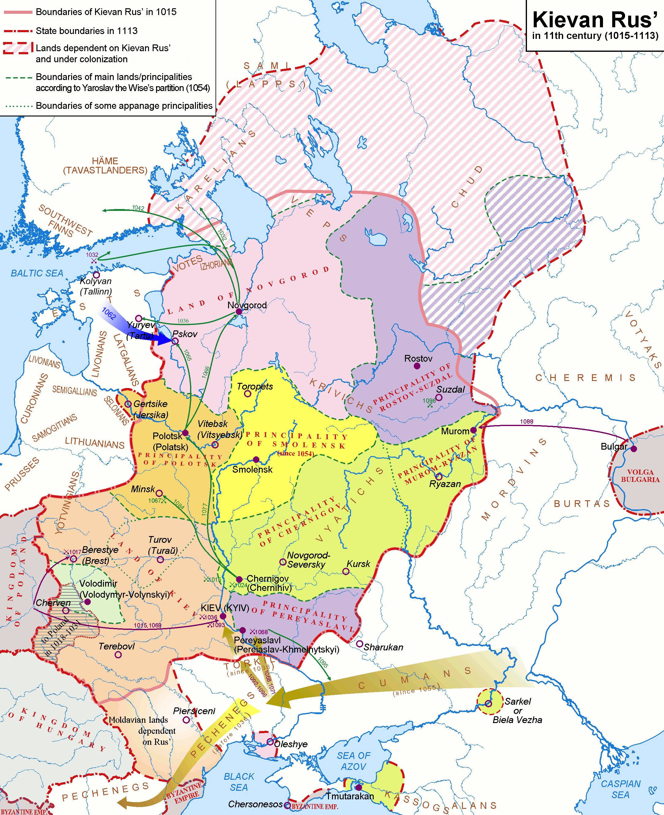
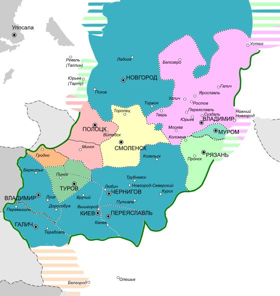
Kievan-rus-1015-1113-(en).png - Nihil scimus

LocationEasternEurope.PNG - Akigka

Cucuteni-Trypillya culture.jpg - Manyuha

RailBaltica.jpg - Vkem~commonswiki

Eeurope rel84.jpg - File Upload Bot (Magnus Manske)

Vyrez ua md zlte.jpg - GWPCEE

Political map of Eastern Europe mk.svg - MacedonianBoy

Political map of Eastern Europe according UN mk.svg - MacedonianBoy

Eastern Europe by U.S. Army Map Service Index Map.jpg - ShinePhantom

UNGA Presidents from Eastern Europe.png - Forthrunner

Xavras Wyżryn Map.PNG - Рагин1987
Eastern-Europe-Democratic.png - Honymand

Eastern Europe (Robinson projection).png - Serg!o
New Byuzantia.png - Iktsokh

Ida-Euroopa.png - Рагин1987

Location-Europe-UNsubregions-Slovensky.png - File Upload Bot (Magnus Manske)

Flag-map of the Eastern European countries.svg - SpinnerLaserz

Ost-Europa.png - Balou46
CAI maerkte D.jpg - Рагин1987

4 countries BY-LT-PL-RU.svg - SiBr4

4 countries BY-PL-RU-UA.svg - SiBr4

4 countries BY-LV-LT-RU.svg - SiBr4

EasternBloc BorderChange38-48-hu.svg - Iktsokh

Języki i etnolekty słowiańskie.png - ThatBPengineer

Ukraine topo big-1.png - UWCTransferBot

EurEstAlphabets.jpg - Spiridon Ion Cepleanu

Geopolitics South Russia2.png - Scu ba

Prorussian 2008 2014.png - Rausch

Russian recognition of european post-sovietic territories early 2014.svg - Iktsokh

Old Great Bulgaria map..gif - Ivonti10

Onoguria(2).jpg - Ivonti10

Gaelic genepool in Eastern Europe.png - Chief Inspector of Irish Iron Age

A general map of Eastern Europe.svg - Pitsarotta

Eastern-Europe-map-UN.png - Knyaz-1988

South Russia geopolitics 2015.jpg - Trecătorul răcit

The World book - organized knowledge in story and picture (1918) (14577562410).jpg - Fæ

Color revolutions.svg - Eshko Timiou

Расселение вольсков-влахов.jpg - Oium
Eastern Europe green map.png - Paasikivi
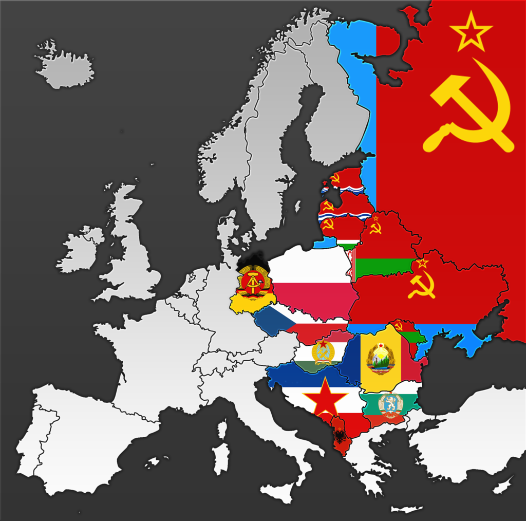
Eastern block flags.png - Crossswords
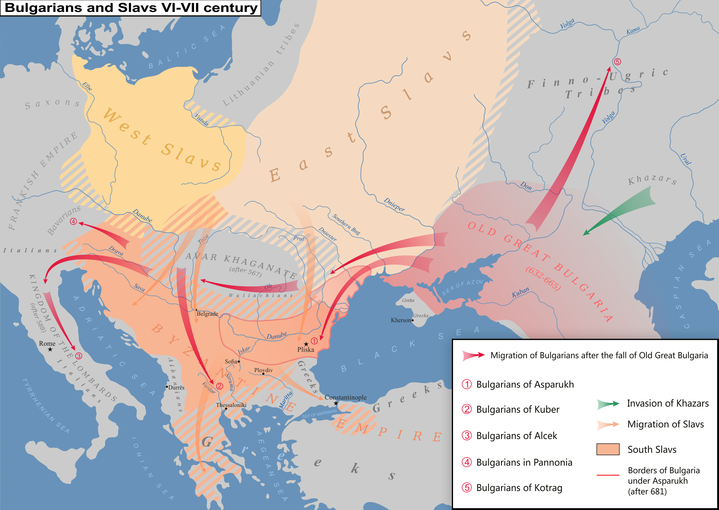
More complete map of Eastern Europe peoples VI-VII cent.png - Julieta39
Indo-European 18.jpg - Kindattu2004
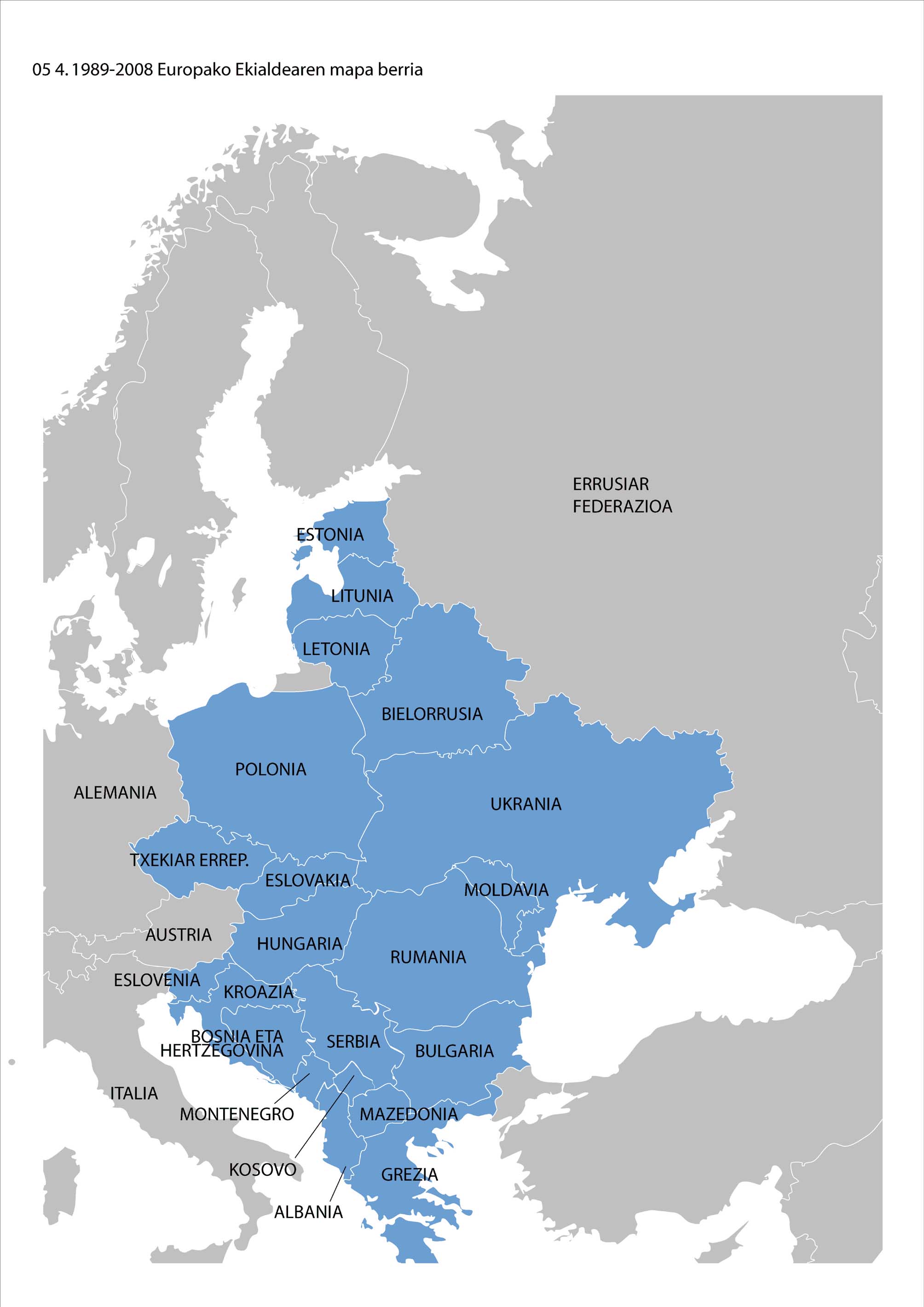
1989-2008 Ekialdeko Europaren mapa berria.jpg - AnttonUgarte

Historical map of Rus', 862.gif - Михаил Семёнов

Koppen-Geiger Map Eastern Europe future.svg - NVergopolan

Centra kaj Orienta Eŭropo, mapo.png - Iktsokh

Mittelmeer-Lander nach dem 4. Kreuzzuge (1204).jpg - Kun Kipcsak
Eastern Europe.png - Danloud
European ussr.jpg - Yami-Yami6
Blank map Eastern Europe with borders1.png - Рагин1987
Blank map Eastern Europe with borders1 (fixed).png - Рагин1987

نقشه بلاروس.jpg - Amir.Vector

AAA Defenses of the Union of Soviet Socialist Republics (USSR) in Europe - DPLA - 34cf0d9ff0d9bad43fd36b1200bf9aa0.jpg - DPLA bot

Eastern Europe (orthographic projection).svg - Рагин1987
Bucharest Nine map.png - Super Dromaeosaurus

WV Eastern Europe.svg - Iktsokh
Ольговичи.png - Maximalist

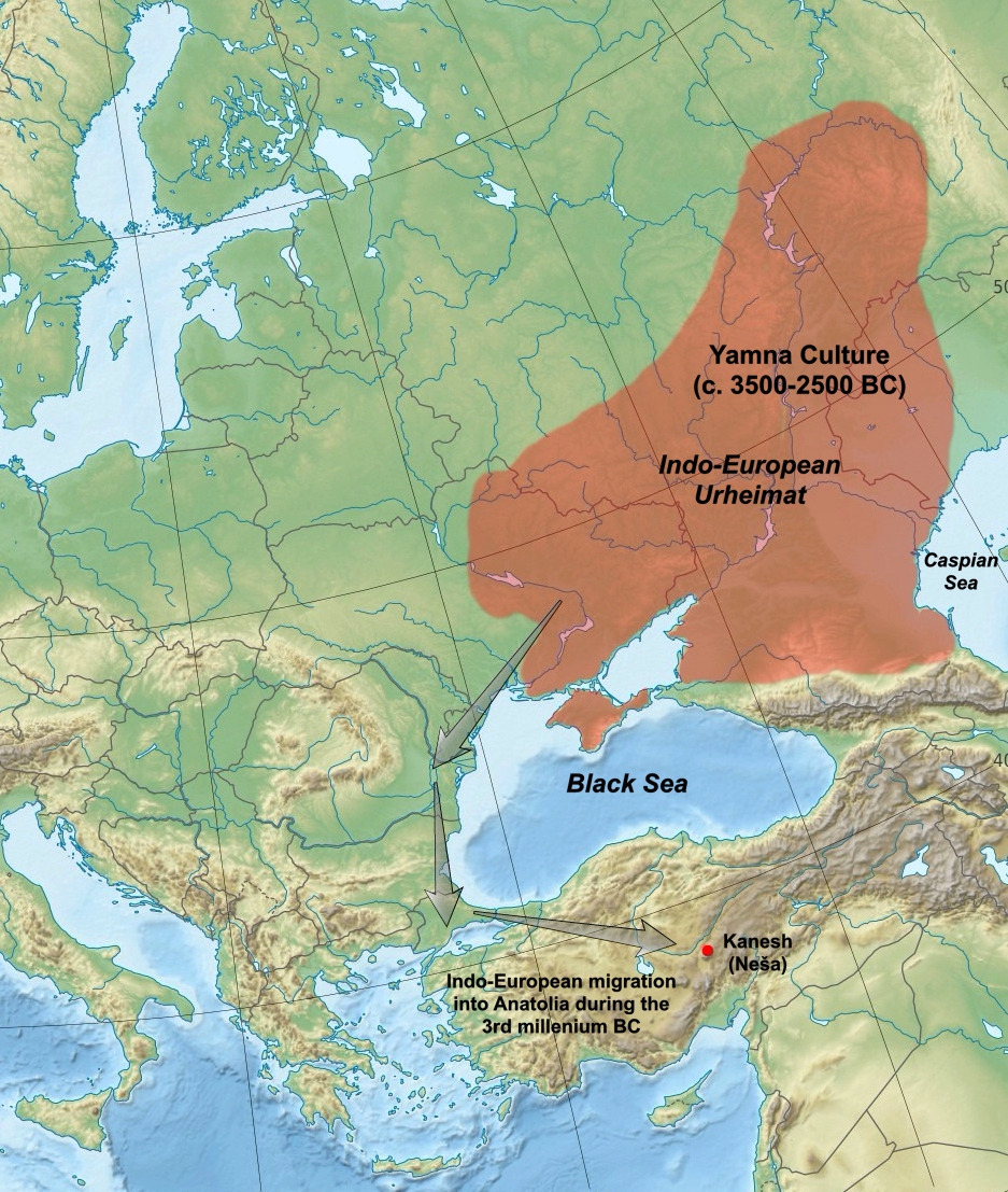
Yamnaya culture.jpg - Krakkos

Map of Community for Democracy and Rights of Nations2.png - Scu ba

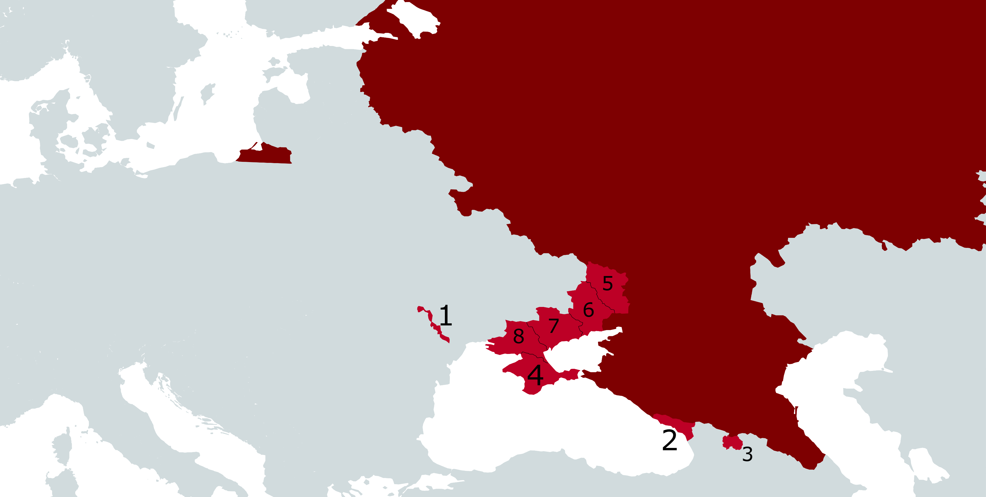
Russian-occupied territories.svg - Iktsokh

Kievan-rus-1015-1113-(hu).svg - Sepultura

PAT - Eastern Europe.gif - Babelia

Eastern Europe regions.png - Sbb1413

Eastern Europe regions.svg - Sbb1413

Eastern Europe Wikivoyage map.png - SelfieCity
Russian-occupied territories in map.jpg - Iktsokh

Soviet Caucasus (1 May 1918).png - DaniCBP
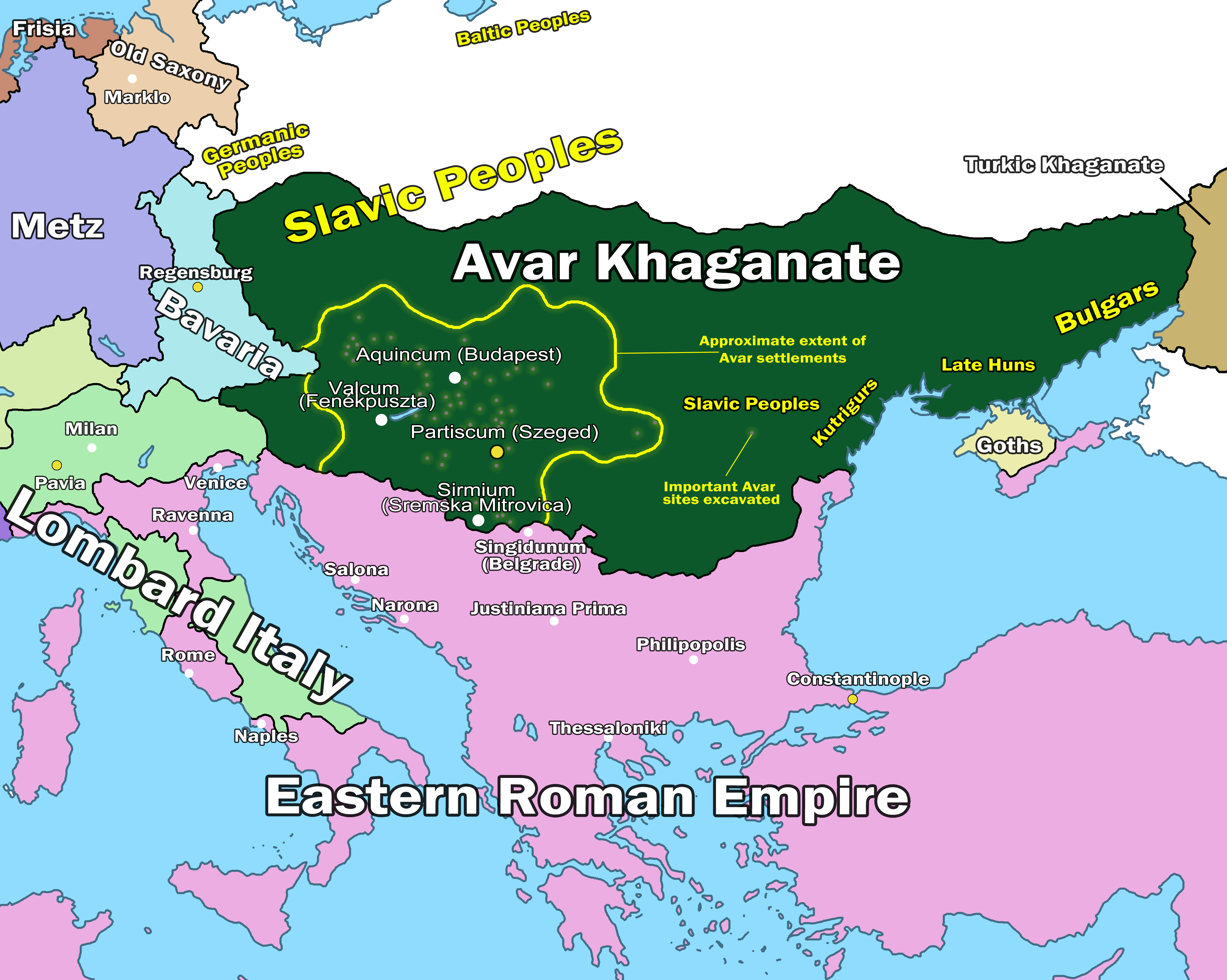
Avar Khaganate Map 602.png - Devlet Geray
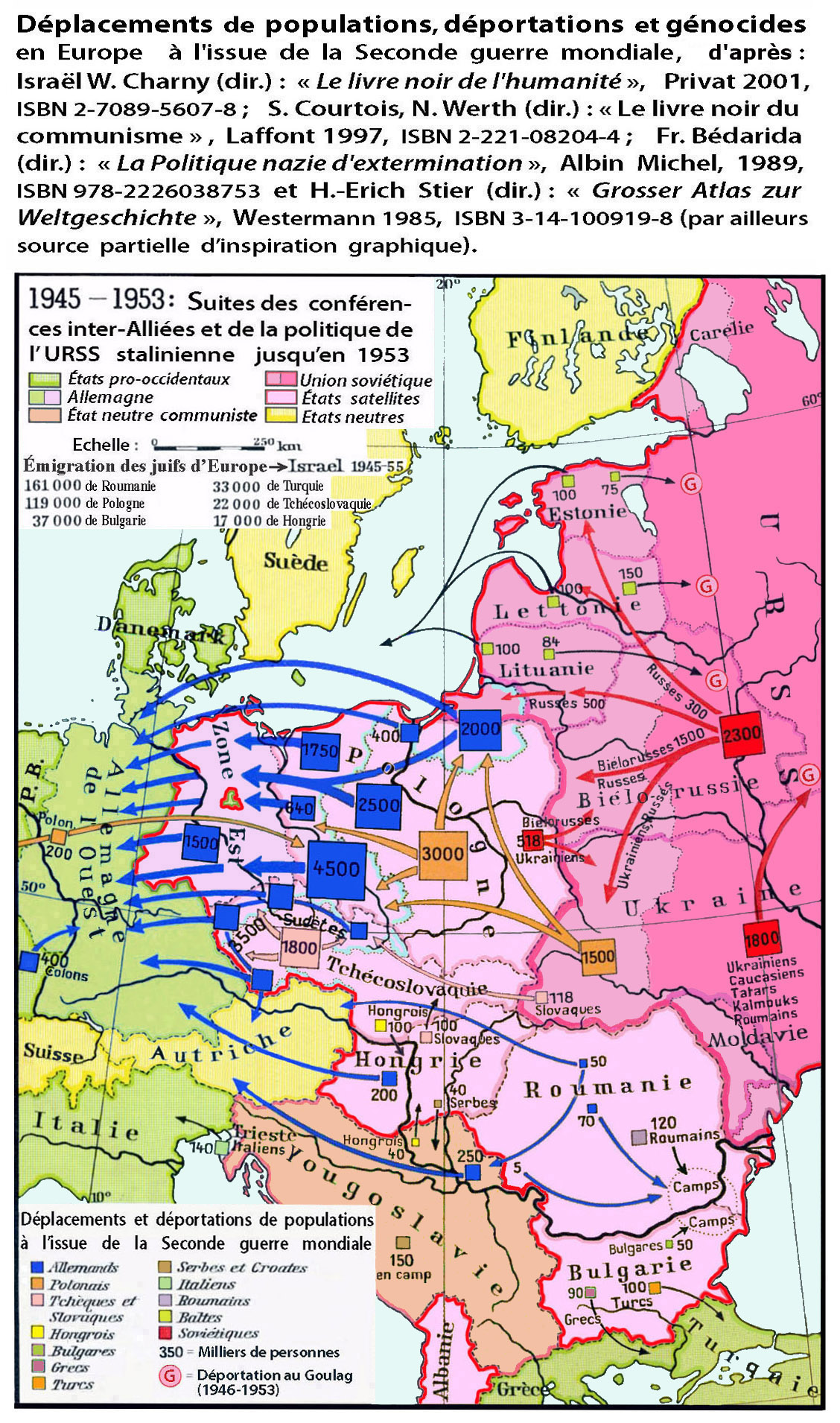
Deplac.Eur.C-O. 1945-1953.jpg - Qualimac

Europe Eastern Bloc flag map.svg - OwcaGierka

East Central Europe De Facto and Treaty Boundaries Sept 1944 through Feb 1947 - DPLA - d09b85b6f71cc1b36335f61809dc506d.jpg - DPLA bot

Eastern Europe (Serbian).png - Ђидо

Экспансия России в Европе.jpg - Ориенталист

NATO East Flank.svg - Accipiter Gentilis Q.

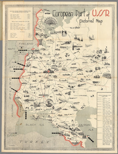
European Part of Soviet Union location map.png - Iktsokh
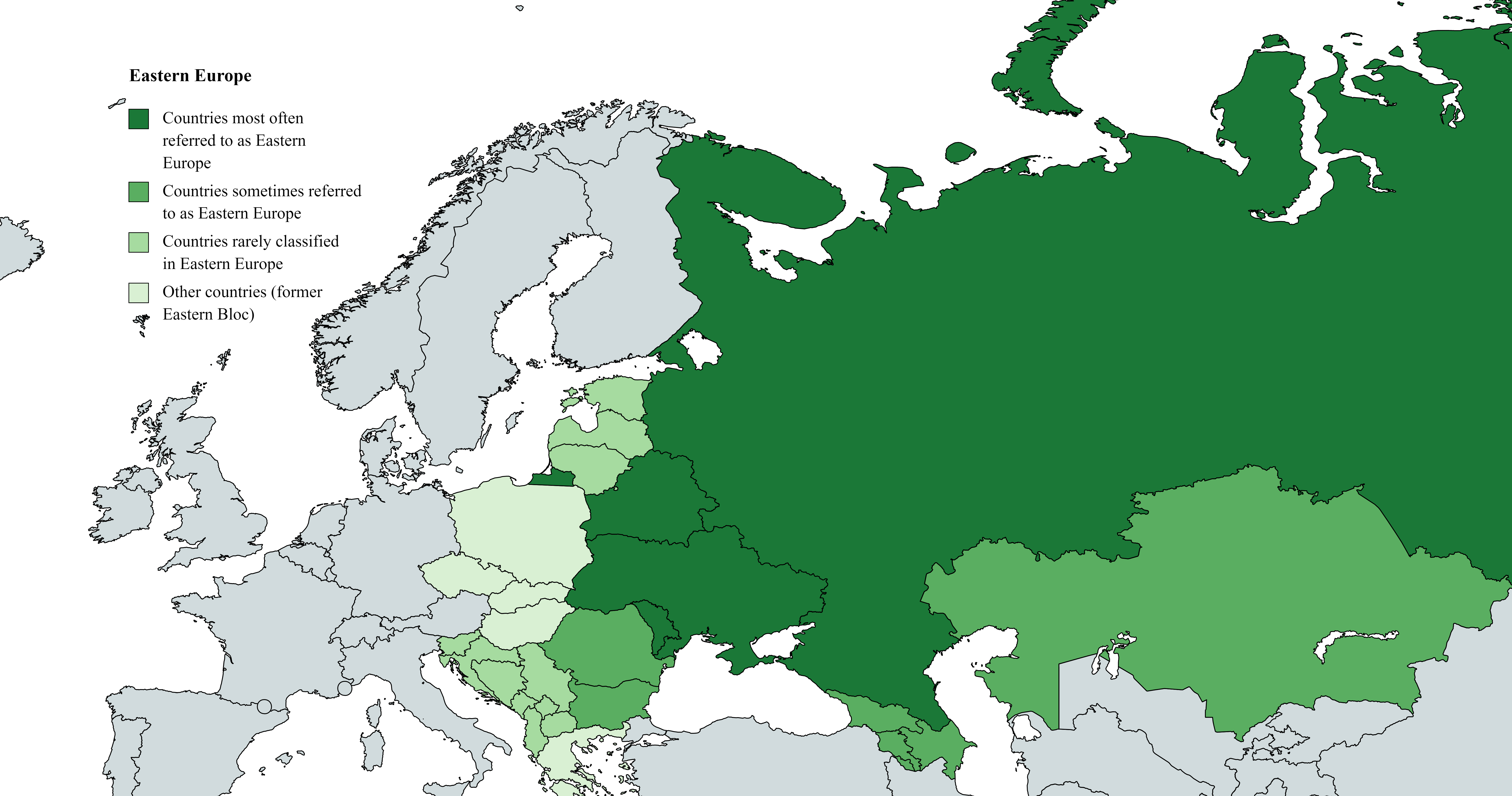
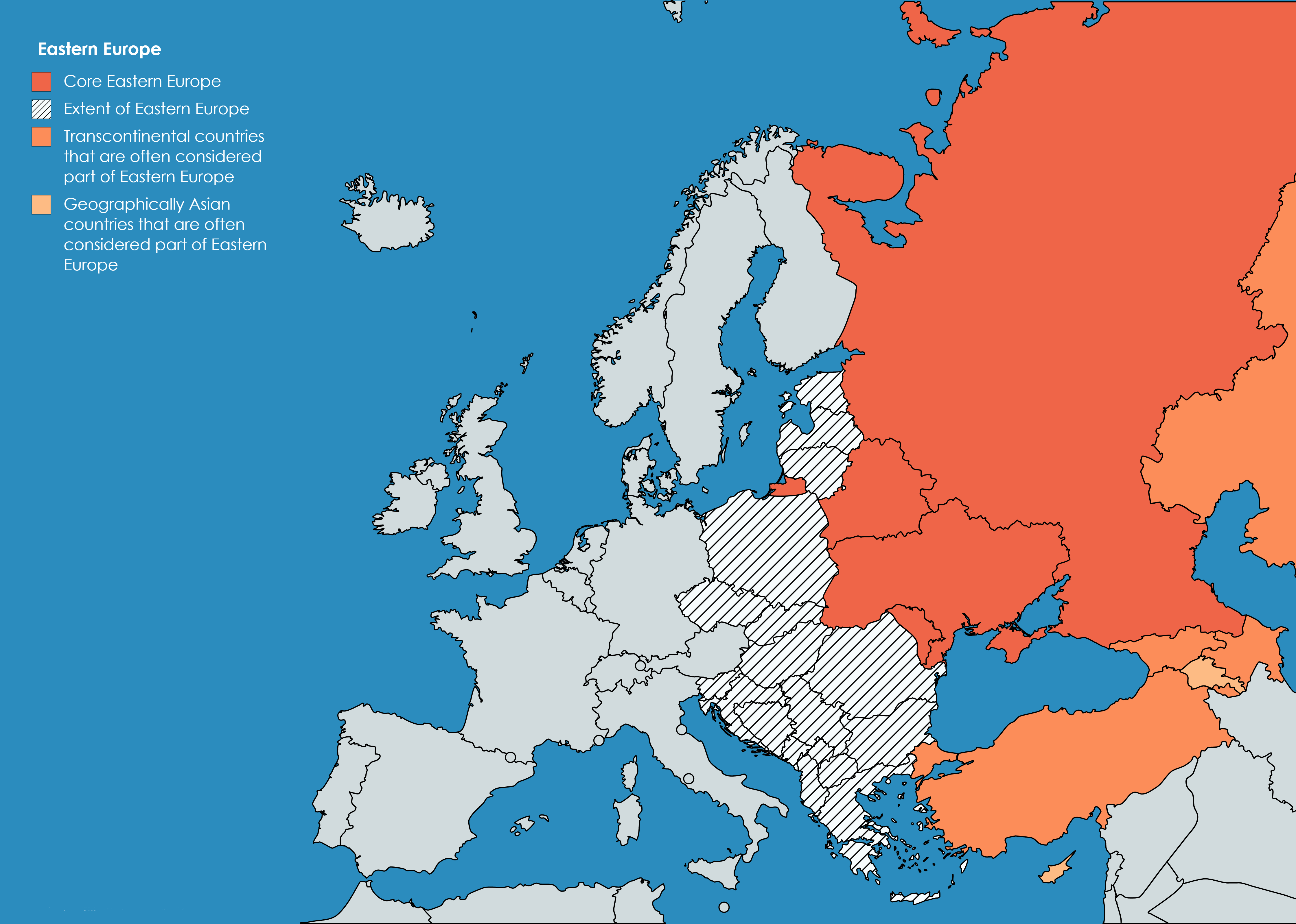
Eastern Europe (definitions).png - Iktsokh

Eastern Europe - DPLA - 491d9956f8055dc8c61f64e698a6b8bf.jpg - DPLA bot

Eastern Europe - DPLA - 09d230e4d55e91ce393606695ba0bc6f.jpg - DPLA bot

Ethnic Groups in Eastern Europe - DPLA - 758bc322f394cfdee3f42285d691c1f7.jpg - DPLA bot

Eastern Europe - DPLA - 7f393f4415ccd952d4affbd5e942f296.jpg - DPLA bot

Eastern Europe - DPLA - ddf7405649aebc7ca926200064b93550.jpg - DPLA bot

Eastern Europe - DPLA - 08e9b2c6b2bf1d6e0ad0ef247e13fb42.jpg - DPLA bot

Russian-occupied territories (extended).svg - Iktsokh

Europe in "Xavras Wyżryn" novel (EN).png - Iktsokh

Rostov-Suzdal 1015-1113 (en).png - Nederlandse Leeuw

Өз атымен қол қойылған барлық елдер толығымен немесе ішінара Шығыс Еуропаға сілтеме жасай алады..jpg - KaaİZER

Олардың атымен қол қойылған барлық елдер толығымен немесе ішінара Шығыс Еуропаға тиесілі болуы мүмкін..jpg - KaaİZER

Topographical map of the Carpathian Ruthenia region.svg - Amitchell125

Carpathian Rus' (1920-1938).svg - Amitchell125

Karta 1. UVOZ i IZVOZ sveukupne energije u Istočnoj Europi.png - Lucija1923

Istočna Europa.png - Darija procen

Russian occupied territories in map.svg - OttavianoLolnoob

Europa occidentale - orientale.png - Iktsokh

Russian-occupied territories in map.webp - Viceskeeni
Blank map of Europe (SFR).png - Iktsokh

Post-Soviet European countries.png - Iktsokh

ApproxPositionsWWI-1919 hu.png - Sepultura

EasternEurope.png - Scooter20

Eastern Europe broader definition.svg - Andrej-airliner

Eastern Europe narrow definition.svg - Andrej-airliner

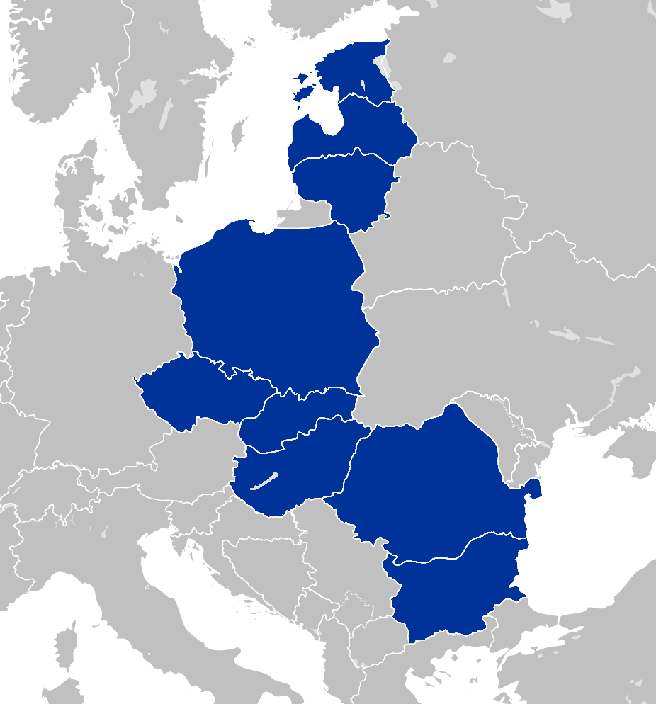
Central and Eastern Europe countries.svg - Andrej-airliner

Eastern Europe narrow definition 2.svg - Andrej-airliner

Eastern Europe broader definition 2.svg - Andrej-airliner

Central and Eastern Europe countries 2.svg - Andrej-airliner

Central and Eastern European Countries according to OECD.svg - Andrej-airliner

Central and Eastern Europe narrow and broader definition.svg - Andrej-airliner

Eastern Europe narrow and broader definition.svg - Andrej-airliner

Map of the Russian Near Abroad.svg - Iktsokh