Wikimedi'Òc
Modes d'emploi

Cet album fait partie des albums
Cet album photos contient les sous-albums suivants :


Pagans Hill, facing west.jpg - Crkev

Dorset pl from ac.jpg - Angusmclellan

Dartmoor a.jpg - Wigulf~commonswiki

Dartmoor b.jpg - Wigulf~commonswiki

PingoDepression.jpg - Solipsist~commonswiki

North York Moors.jpg - Hohum

Devon countryside, July 2006.jpg - Alex1011

Harbour.JPG - Strider52

Tarkatrail.jpg - Strider52

M66.JPG - Strider52

ViewFulking.jpg - Curtis3250692~commonswiki
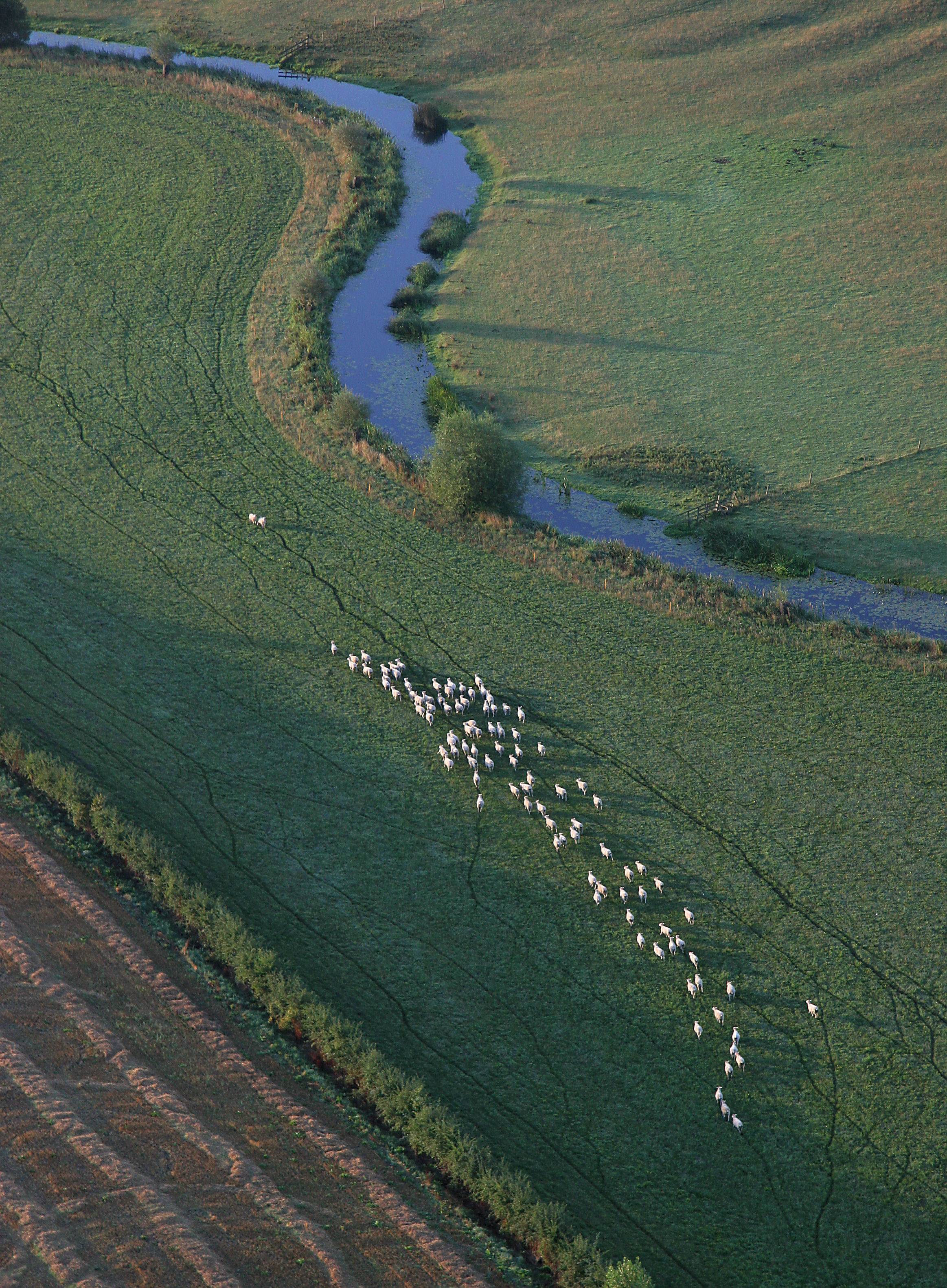
Sheep herd.jpg - Chin tin tin

Hills of England.jpg - Finavon
Portpatrick start of southern upland way.JPG - Miles away

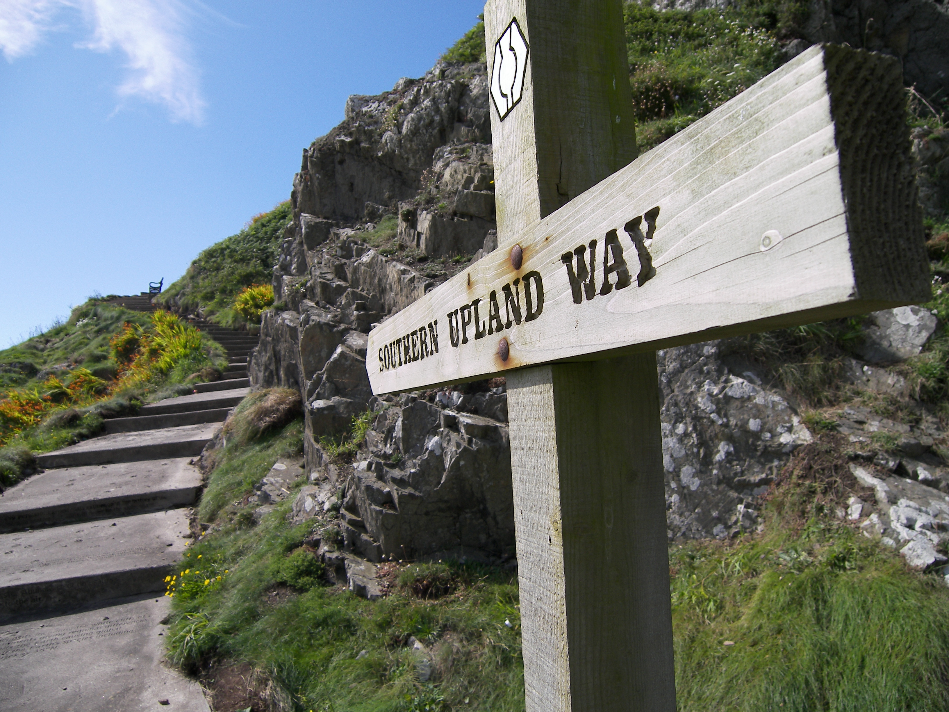
Waymarker at Southern Upland Way.JPG - Miles away
Landscape-England-IvinghoeBeacon-2006-12-20-1.jpg - Paulzarucki
IrlamMoss.jpg - Malleus Fatuarum

PeatWorkingsIrlam.jpg - Malleus Fatuarum

View of Thakeham Oct 2007.JPG - Nuttycow

View of thakeham from the churchyard 2.jpg - Nuttycow

South Downs View.jpg - Leoboudv

South downs.jpg - File Upload Bot (Magnus Manske)
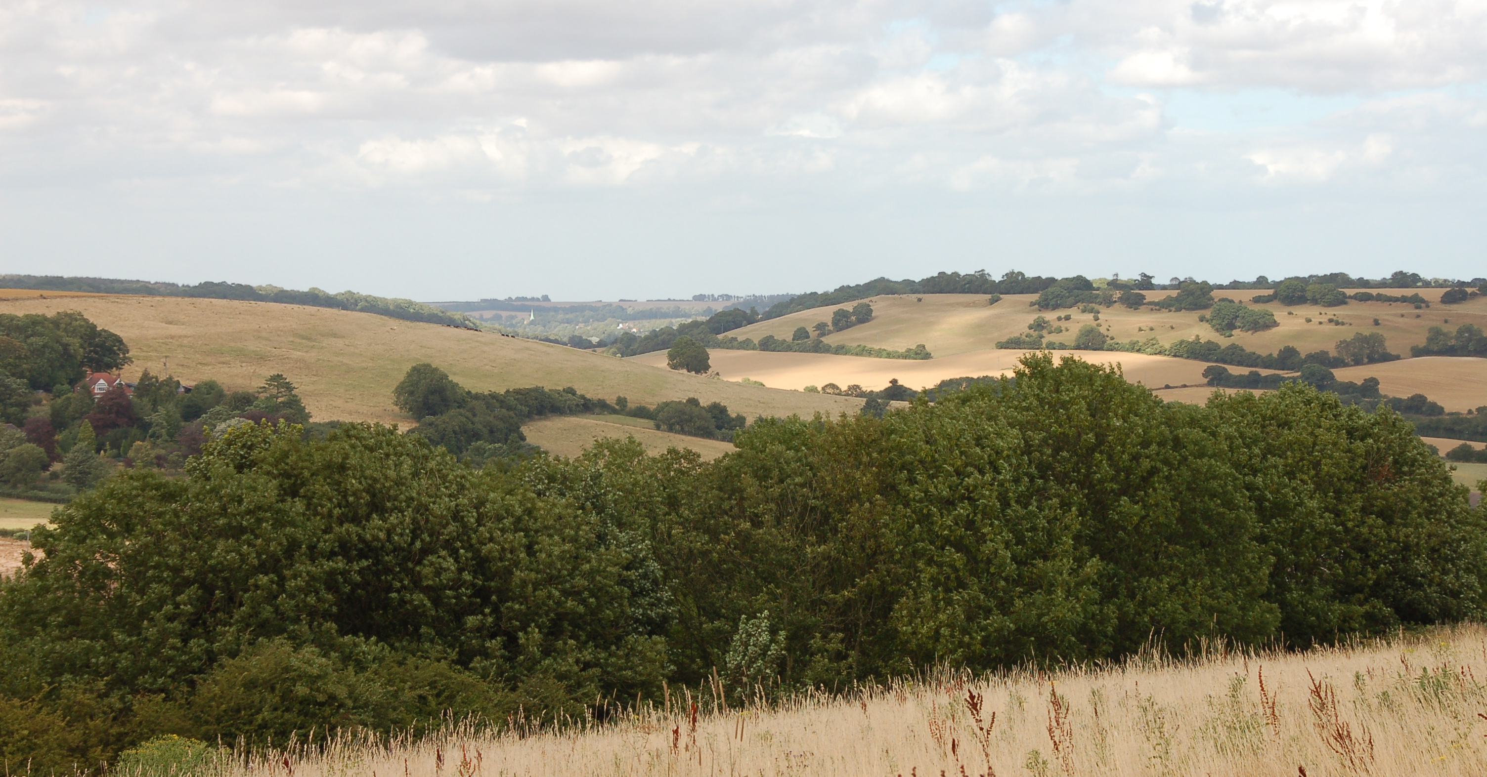
Elham Valley 2.JPG - File Upload Bot (Magnus Manske)
Boulmer - geograph.org.uk - 16958.jpg - GeographBot

A windy Day on Brean Down. - geograph.org.uk - 70640.jpg - GeographBot

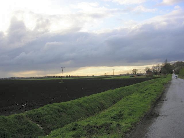
Freshly Ploughed Field - geograph.org.uk - 34960.jpg - GeographBot

Government Property - geograph.org.uk - 55921.jpg - GeographBot

From Rampside towards Piel - geograph.org.uk - 72130.jpg - GeographBot

Viewpoint - geograph.org.uk - 46443.jpg - GeographBot

Tigh-A-Cladach - geograph.org.uk - 51905.jpg - GeographBot

Viewpoint - not ^ - geograph.org.uk - 56224.jpg - GeographBot

Croftland at Borrowston - geograph.org.uk - 105948.jpg - GeographBot

Glacial deposits - geograph.org.uk - 150909.jpg - GeographBot

View north from Offa's Dyke path, below Highbury Farm - geograph.org.uk - 167340.jpg - GeographBot

Castle Views - geograph.org.uk - 192408.jpg - GeographBot

View from Hag Hill towards Sway Tower - geograph.org.uk - 181838.jpg - GeographBot

Viewpoint on Dinas Oleu - geograph.org.uk - 185767.jpg - GeographBot

Out to sea from Portmeirion - geograph.org.uk - 245027.jpg - GeographBot

View from Roadside of Kintocher - geograph.org.uk - 246576.jpg - GeographBot

View of Blargie Craig from Spey Bridge - geograph.org.uk - 247636.jpg - GeographBot

Lane near Tyndrain - geograph.org.uk - 243200.jpg - File Upload Bot (Magnus Manske)

Rich Pasture beside Afon Dyfi - geograph.org.uk - 240492.jpg - File Upload Bot (Magnus Manske)

Clifftop Viewers - geograph.org.uk - 255309.jpg - GeographBot

View from near Dunrobin Castle - geograph.org.uk - 253626.jpg - GeographBot

Upper Clough Foot, Cragg Vale - geograph.org.uk - 266164.jpg - GeographBot

View NW from ridge east of Ben A Chlachair - geograph.org.uk - 262322.jpg - GeographBot

View of Cromarty - geograph.org.uk - 260317.jpg - GeographBot

Hedgerow and fields - geograph.org.uk - 289309.jpg - GeographBot

The view that they came to admire - geograph.org.uk - 283148.jpg - GeographBot

Frozen Pile of Stones on Lovely Seat. - geograph.org.uk - 299519.jpg - GeographBot

Stout Bay from Stout Point - geograph.org.uk - 294980.jpg - GeographBot

View from Sgurr Choinnich Mor East - geograph.org.uk - 301760.jpg - GeographBot

Havengore Creek - geograph.org.uk - 310371.jpg - GeographBot

Havengore Creek 2 - geograph.org.uk - 310374.jpg - GeographBot

Coleby Low Fields - geograph.org.uk - 330637.jpg - GeographBot

View from Wraik Hill - geograph.org.uk - 340153.jpg - GeographBot

View from Crathes Castle - geograph.org.uk - 359931.jpg - GeographBot

View from Orton - geograph.org.uk - 370896.jpg - GeographBot

Viewing Area - geograph.org.uk - 373037.jpg - GeographBot
View from Riley Lane, Kirkburton - geograph.org.uk - 395423.jpg - GeographBot

View - geograph.org.uk - 415246.jpg - GeographBot

View of Longwood from Quarmby Cliff - geograph.org.uk - 410795.jpg - GeographBot

View across the entrance to Wick Bay - geograph.org.uk - 479183.jpg - GeographBot

Easterly view from Hill o'Many Stanes - geograph.org.uk - 481004.jpg - GeographBot

The inside of the Sea Bank - geograph.org.uk - 502033.jpg - Geograph Update Bot

Ghost rider in the mist.jpg - FlickreviewR

Towards Port Charlotte - geograph.org.uk - 700166.jpg - GeographBot

View of Moor Hey, Fixby - geograph.org.uk - 703208.jpg - GeographBot

View of Old Lindley - geograph.org.uk - 701672.jpg - GeographBot

Clifton Suspension Bridge from the river bank - geograph.org.uk - 768470.jpg - GeographBot

Near Standish Hall - geograph.org.uk - 1246572.jpg - GeographBot

Stafford's Wood - geograph.org.uk - 1430850.jpg - GeographBot

Walkie-talkie from London Bridge.jpg - Fæ

Near Cerne Abbas (18417647749).jpg - Moheen

Near Cerne Abbas (18239208839).jpg - Moheen

To the ends of the world (15717703904).jpg - Moheen

Lines (16341900432).jpg - Moheen

Lake Placid (16145154600).jpg - Moheen

Or In Colour...? (19725547104).jpg - Wilfredor

Secret Window (16853597419).jpg - Wilfredor

Crab Quay (26059679030).jpg - INeverCry

Dean Gate (3708140562).jpg - INeverCry

Crosland Edge (5143891704).jpg - INeverCry

Curving path on the edge of llkley Moor (4974937646).jpg - INeverCry

Sunset over St michaels - panoramio.jpg - Panoramio upload bot

Cwmafan Landscape - panoramio.jpg - Panoramio upload bot

-Group of 11 Early Stereograph Views of British Landscapes- MET DP73089.jpg - Pharos

-Group of 11 Early Stereograph Views of British Landscapes- MET DP73093.jpg - Pharos

-Group of 11 Early Stereograph Views of British Landscapes- MET DP73095.jpg - Pharos

Dorset pl from ac (retouched).jpg - MagentaGreen

United Kingdom Still (8443275307).jpg - Thesupermat2

Stonewalls and rocky fields around Todmorden and Hebden bridge.jpg - Mzales11

The Hoad Monument.jpg - The Strawberry Thief

IERLAND SCHOTLAND 2004 209 (5977835416).jpg - Rudolphous

Sunset at Dorset beach.jpg - MehmoodMathour

GOC Hexton 097 Galley Hill (24491263832).jpg - Matlin

The Roaches and Hen Cloud.jpg - Alex Bishton

Moor pond (6869117058).jpg - JrandWP

Moorland view (35703770806).jpg - Ltn12345

View towards Penrith from the site of Hartside Cafe, Alston, UK.jpg - Benjamin Shaw

The Maxey Cut.jpg - Caputterz

The Folly River.jpg - Caputterz