Wikimedi'Òc
Modes d'emploi

Cet album fait partie des albums
Cet album photos contient les sous-albums suivants :


Nearing the summit of Schiehallion - geograph.org.uk - 598608.jpg - GeographBot

Stormy skies (48948604803).jpg - Юрий Д.К.

Loch Achne01.jpg - Fingalo

2001-ScotlandHighlands-TheQuirang2.jpg - Liftarn
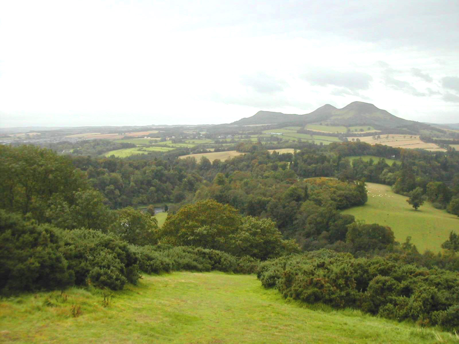
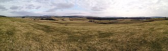
EildonScottsView.jpg - Patrick.charpiat
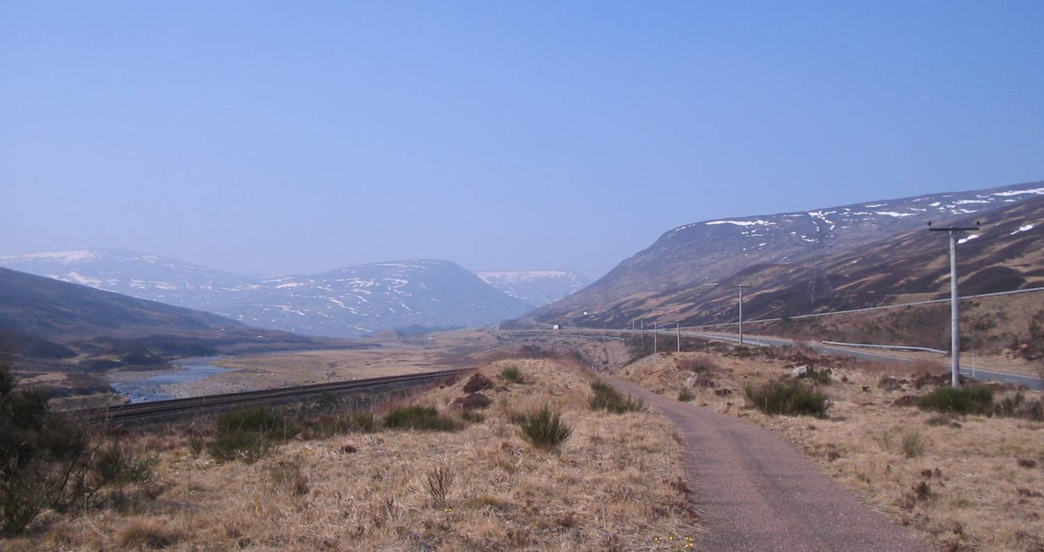
Drumochter March2007.jpg - JBellis~commonswiki
Beinn Eighe Sail Mhor.jpg - Ikiwaner

Beinn Eighe Ruadh-stac Mor.jpg - Ikiwaner

Beinn Eighe Coire Dubh Mor.jpg - Ikiwaner
Glen Finglas.JPG - Mutt Lunker

IsleOfSky.jpg - Markus.gaisbauer

SunsetInInverness.jpg - Markus.gaisbauer
Callander-Cracks.JPG - Moeng

StubbleFieldNearAllerton-BlackIsle(SylviaDuckworth)Nov2007.jpg - Euchiasmus
Beinn Eighe.jpg - Ikiwaner

Dunadd Fort - view.jpg - Otter

Kinlochleven.JPG - Rmaclean3
Peaks of Mamores.JPG - Rmaclean3

Bennachie from the North.jpg - Tommfuller~commonswiki

Alternative Coastal Route.jpg - W. L. Tarbert
Parallel Roads.JPG - RichardCrowest

Garry Beach, Lewis in Scotland.jpg - File Upload Bot (Magnus Manske)

Castle stalker and loch laich.jpg - Gil.cavalcanti
View down to Brann, Dunkeld by Roger Fenton.jpg - Yann
View down to Brann, Dunkeld by Roger Fenton.tif - Hannibal

Küste in Schottland 20091017.jpg - Ds1508

Durisdeer Hills from A702.jpg - Scothill

Lowther Hills from Scaw'd Law.jpg - Scothill

Bruce's Stone, Loch Trool Muldonnoch and 1307 Battle Location from Eschoncan.jpg - Scothill

Lochs Enoch, Arron and Neldricken, the Dungeon Hills and the Rhinns of Kells from Merrick.jpg - Scothill
Silver Flowe from Dungeon Hill.jpg - Scothill

View over Lochs Arron, Neldricken and Valley to Minnigaff Hills.jpg - Scothill

Scree above Hartfell Spa.jpg - Scothill

Scree run above Hartfell Spa.jpg - Scothill

Covenanter Monument to John Hunter Devil's Beef Tub.JPG - Scothill

Earthwork by Druidhill Burn with Lowther hills in distance.jpg - Scothill

Lowther Hills from Cairnkinna.jpg - Scothill

Scaur hills from Woodend Craig.jpg - Scothill

Cross on the top of Dodd Hill Carsphairn hills.jpg - Scothill

Trig point and Cairn on Cairnkinna.jpg - Scothill

Carrot Hill - geograph.org.uk - 14139.jpg - GeographBot

Distant North Sea from the top of Carrot Hill - geograph.org.uk - 14142.jpg - GeographBot

Dundee from the summit of Carrot Hill - geograph.org.uk - 14149.jpg - GeographBot

Dunnet Head - geograph.org.uk - 14727.jpg - GeographBot

Gleneagles from Eastbow Hill - geograph.org.uk - 24825.jpg - GeographBot

Neil Gunn Memorial Viewpoint - geograph.org.uk - 28799.jpg - GeographBot

The View from Cairn O'Mount - geograph.org.uk - 16811.jpg - GeographBot

View North from RAF Kilchiaran - geograph.org.uk - 15157.jpg - GeographBot

Arthur's Seat to the South - geograph.org.uk - 43655.jpg - GeographBot

Drumbrae - geograph.org.uk - 49335.jpg - GeographBot

Hoy Sound - geograph.org.uk - 33961.jpg - GeographBot

Kippen Muir Viewpoint - geograph.org.uk - 36764.jpg - GeographBot

King Seat view. - geograph.org.uk - 44230.jpg - GeographBot

Kingseat View East - geograph.org.uk - 44240.jpg - GeographBot

Raasay from viewpoint above the Aros Experience - geograph.org.uk - 33161.jpg - GeographBot

Killin and the Tarmachan Mountains - geograph.org.uk - 74718.jpg - GeographBot

Looking down Starthardle - geograph.org.uk - 79915.jpg - GeographBot

Scott's View - geograph.org.uk - 36860.jpg - GeographBot

Outskirts of Duloch housing estate, Masterton. - geograph.org.uk - 52592.jpg - GeographBot

Peaceful Road, Appin - geograph.org.uk - 53707.jpg - GeographBot

Scenic view - geograph.org.uk - 46345.jpg - GeographBot
View over valley of River Earn above Comrie from Monument near The Milton, Comrie - geograph.org.uk - 37138.jpg - GeographBot

Viewpoint on footpath near Aonach Mor gondola - geograph.org.uk - 31365.jpg - GeographBot

Waternish from viewpoint above Scuddaborg - geograph.org.uk - 33169.jpg - GeographBot

The Far North and beyond - geograph.org.uk - 43782.jpg - GeographBot

Torridon Viewpoint - geograph.org.uk - 48074.jpg - GeographBot

View looking East - geograph.org.uk - 46343.jpg - GeographBot

Vale of Strathmore from Tullybaccart - geograph.org.uk - 57856.jpg - GeographBot

View across the Solway Firth - geograph.org.uk - 79815.jpg - Geograph Update Bot

View from Beinn Leabhainn - geograph.org.uk - 74715.jpg - GeographBot

Looking towards woodland near Port Ann, Argyll. - geograph.org.uk - 88334.jpg - GeographBot

Kippen Muir Viewpoint - geograph.org.uk - 95408.jpg - GeographBot

Looking into Glen Lyon - geograph.org.uk - 103095.jpg - GeographBot

Viewpoint - geograph.org.uk - 80651.jpg - GeographBot

Viewpoint and picnic site at Kilmaha - geograph.org.uk - 101522.jpg - GeographBot

Occult Skys (1946191338).jpg - File Upload Bot (Magnus Manske)

Looking SE down Loch Duich from Carr Brae - geograph.org.uk - 124463.jpg - GeographBot

View point - geograph.org.uk - 127878.jpg - GeographBot

Cairn overlooking Loch Tulla and Glen Orchy hills - geograph.org.uk - 143702.jpg - GeographBot

Coastal woodland, Dunglas - geograph.org.uk - 148585.jpg - GeographBot

Viewpoint at Junction of paths - geograph.org.uk - 132730.jpg - GeographBot

Devil's Beef Tub, near Moffat - geograph.org.uk - 156141.jpg - GeographBot

Looking towards Moffat from Beattock Hill - geograph.org.uk - 141627.jpg - GeographBot

Seat at Viewpoint above Altandhu overlooking Summer Isles - geograph.org.uk - 149268.jpg - GeographBot
Flood tide on the Sound of Luing - geograph.org.uk - 168925.jpg - GeographBot

Fields, Woodland and Track to Dunes - geograph.org.uk - 110767.jpg - GeographBot

Suidhe viewpoint - geograph.org.uk - 142439.jpg - GeographBot

New Glen Fruin Road, Viewpoint - geograph.org.uk - 160754.jpg - GeographBot

View from topograph - geograph.org.uk - 158871.jpg - GeographBot

Viewpoint on Cardie Hill - geograph.org.uk - 151391.jpg - GeographBot

Woodland above Loch Melfort - geograph.org.uk - 153585.jpg - GeographBot

View from the "Haylie Brae" - geograph.org.uk - 112465.jpg - GeographBot

Allanaquoich Views - geograph.org.uk - 197728.jpg - GeographBot

The wee seat - geograph.org.uk - 176895.jpg - GeographBot

Viewpoint a short walk from Dog Falls - geograph.org.uk - 170061.jpg - GeographBot

Evening View of the Eildons from near Wallace Monument. - geograph.org.uk - 200177.jpg - GeographBot

View to Dervaig - geograph.org.uk - 180814.jpg - GeographBot

Whistlefield Viewpoint - geograph.org.uk - 180790.jpg - GeographBot

Bench and view indicator - geograph.org.uk - 211305.jpg - GeographBot

New fence - geograph.org.uk - 202973.jpg - GeographBot

Beinn na h-Aire - geograph.org.uk - 229344.jpg - GeographBot

Callander Crags - geograph.org.uk - 218351.jpg - GeographBot

After the shower - geograph.org.uk - 243314.jpg - GeographBot

Bettyhill viewpoint - geograph.org.uk - 243312.jpg - GeographBot

Victoria's viewpoint - geograph.org.uk - 200080.jpg - GeographBot

View Indicator, Bin of Cullen - geograph.org.uk - 204981.jpg - GeographBot

Viewpoint on Torr a'Chronain - geograph.org.uk - 200775.jpg - GeographBot

Count the ridges - geograph.org.uk - 241614.jpg - GeographBot

Road on the raised beach - geograph.org.uk - 212459.jpg - GeographBot

Viewpoint in Glen Finglas - geograph.org.uk - 219942.jpg - GeographBot

Marker post, Queens View by Braehead. - geograph.org.uk - 246933.jpg - GeographBot

Queens View lookout - geograph.org.uk - 246920.jpg - GeographBot

Tappoch viewpoint - geograph.org.uk - 249503.jpg - GeographBot

Tappoch viewpoint looking east. - geograph.org.uk - 249583.jpg - GeographBot

Camas Cuil an t-Saimh.jpg - MGA73bot2

Dodgy bridge in a farm track - geograph.org.uk - 1725021.jpg - File Upload Bot (Magnus Manske)

Tigh-Na-Sleubhaich.jpg - Flickr upload bot

Ballater from Craigendarroch in Summer - geograph.org.uk - 256487.jpg - GeographBot

Buntait from Corrimony - geograph.org.uk - 250631.jpg - GeographBot

Burn o' Vat Viewpoint - geograph.org.uk - 251450.jpg - GeographBot

Looking NNE from NR6209. - geograph.org.uk - 255575.jpg - GeographBot

Struie Hill viewpoint - geograph.org.uk - 253526.jpg - GeographBot

Struie Viewpoint - geograph.org.uk - 253534.jpg - GeographBot

View from Cairn O'Mount viewpoint - geograph.org.uk - 253509.jpg - GeographBot

View from NR6109. - geograph.org.uk - 255513.jpg - GeographBot

Viewpoint. - geograph.org.uk - 255366.jpg - GeographBot

Viewpoint over the Clunie, Braemar - geograph.org.uk - 260557.jpg - GeographBot

Garbh Rubha - geograph.org.uk - 299255.jpg - GeographBot

Garbh Rubha - geograph.org.uk - 299264.jpg - GeographBot

Milton at Christmas 2006 - geograph.org.uk - 326770.jpg - GeographBot

Viewing platform - geograph.org.uk - 320706.jpg - GeographBot

Torridon Viewpoint - geograph.org.uk - 331347.jpg - GeographBot

Kinlochleven from north side of Loch Leven - geograph.org.uk - 348376.jpg - GeographBot

East Lothian - view from Pencraig - geograph.org.uk - 363735.jpg - GeographBot

Picnic Area by the A77 - geograph.org.uk - 365326.jpg - GeographBot

Brown Carrick Hill Viewpoint - geograph.org.uk - 372671.jpg - GeographBot

Non view indicator - geograph.org.uk - 377741.jpg - GeographBot

Suidhe Viewpoint - geograph.org.uk - 384602.jpg - GeographBot

View back to Dingwall and the Cromarty Firth - geograph.org.uk - 385996.jpg - GeographBot

West Feal - geograph.org.uk - 391641.jpg - GeographBot

Ben Cruachan - geograph.org.uk - 467000.jpg - GeographBot

'The Cottage' - geograph.org.uk - 479775.jpg - GeographBot

Horses by St John's Point - geograph.org.uk - 479725.jpg - GeographBot

Maligoe - geograph.org.uk - 479700.jpg - GeographBot

Indicator board - geograph.org.uk - 486866.jpg - GeographBot

The Mill Cottage - geograph.org.uk - 483898.jpg - GeographBot

The red loop - geograph.org.uk - 484247.jpg - GeographBot

Lochs Craggie and Loyal from high point on road - geograph.org.uk - 492113.jpg - GeographBot

Staffin - geograph.org.uk - 499740.jpg - GeographBot

The Marble Road - geograph.org.uk - 494733.jpg - GeographBot

The recently extended track and Grouse Moor, with Cairngorms in the distance - geograph.org.uk - 498881.jpg - GeographBot

Looking North from the summit of Beinn Talaidh - geograph.org.uk - 503279.jpg - GeographBot

Scrape Burn Valley - geograph.org.uk - 505068.jpg - GeographBot

The Many Lochs - geograph.org.uk - 505465.jpg - GeographBot

The McMoab - geograph.org.uk - 507274.jpg - GeographBot

The old coffin route passes Dubh Loch Beag - geograph.org.uk - 504238.jpg - GeographBot

The old path to Loch Choire - geograph.org.uk - 505004.jpg - GeographBot

The road through Gleann Beag - geograph.org.uk - 503551.jpg - GeographBot

Crawford and surrounding area - geograph.org.uk - 512203.jpg - GeographBot

New viewing gallery at the Lairig Eilde Bridge - geograph.org.uk - 516162.jpg - GeographBot

River Tweed, Peebles - geograph.org.uk - 515484.jpg - GeographBot

The Clyde at Crawford - geograph.org.uk - 515668.jpg - GeographBot

The Luggie - geograph.org.uk - 519298.jpg - GeographBot

Culag Viewpoint - geograph.org.uk - 523667.jpg - GeographBot

Farm path Scourie - geograph.org.uk - 521640.jpg - GeographBot

Glenbuck pre Open Cast, showing A70, old Glenbuck Station and woods around Glenbuck loch - geograph.org.uk - 521565.jpg - GeographBot

Kintyre from Gigha - geograph.org.uk - 529391.jpg - GeographBot

On the bridge over the Allt Charnan - geograph.org.uk - 526333.jpg - GeographBot

Strathaven from Low Kype Road near Sandford - geograph.org.uk - 521573.jpg - GeographBot

The Milnholm Cross - geograph.org.uk - 522270.jpg - GeographBot

The Northern Slopes of Ark Hill - geograph.org.uk - 521282.jpg - GeographBot

Carn Bhad Choillidh from Carn Macsna - geograph.org.uk - 538134.jpg - GeographBot

Durcha viewpoint - geograph.org.uk - 532035.jpg - GeographBot

Looking across the River Clyde - geograph.org.uk - 532892.jpg - GeographBot

Looking towards Broughton - geograph.org.uk - 531000.jpg - GeographBot

Looking up at Castle Hill - geograph.org.uk - 542379.jpg - GeographBot

Stanhope in Tweeddale - geograph.org.uk - 546543.jpg - GeographBot

Heather on pathway above Grey Mare's Tail - geograph.org.uk - 552067.jpg - GeographBot

Kintyre Way Saddell, view to Carradale Point beyond tree tops.. - geograph.org.uk - 559146.jpg - GeographBot
Kintyre Way looking to Saddell Bay - geograph.org.uk - 559143.jpg - GeographBot

Kintyre Way views. - geograph.org.uk - 559142.jpg - GeographBot

Looking towards Staffin - geograph.org.uk - 559613.jpg - GeographBot

Summit of Great Cumbrae - geograph.org.uk - 552812.jpg - GeographBot

B842 view - geograph.org.uk - 563859.jpg - GeographBot

Black Andrew Wood - geograph.org.uk - 569392.jpg - GeographBot

Looking over the Devil's Beef Tub - geograph.org.uk - 564015.jpg - GeographBot

Mountbenger - moorland and forestry - geograph.org.uk - 569255.jpg - GeographBot

Near the Borders - geograph.org.uk - 563614.jpg - GeographBot

Nether Horsburgh Farm - geograph.org.uk - 569227.jpg - GeographBot

The B7016 towards Broughton - geograph.org.uk - 564009.jpg - GeographBot

Borders Countryside - geograph.org.uk - 573031.jpg - GeographBot

Lauder Common - geograph.org.uk - 577995.jpg - GeographBot

Laudervale, from Scarce Law - geograph.org.uk - 578070.jpg - GeographBot

Looking towards Trabrown from Scarce Law - geograph.org.uk - 578061.jpg - GeographBot

Looking up the Harry Burn Valley - geograph.org.uk - 578042.jpg - GeographBot

Sheep at Thornielaw - geograph.org.uk - 576856.jpg - GeographBot

The Boondreigh Water - geograph.org.uk - 576944.jpg - GeographBot

The valley of the Leader Water - geograph.org.uk - 576844.jpg - GeographBot

Achahoish looking to Loch Caolsport - geograph.org.uk - 584891.jpg - GeographBot

After the Fire - geograph.org.uk - 586293.jpg - GeographBot

Califer Viewpoint - geograph.org.uk - 586939.jpg - GeographBot

Loch Fyne viewpoint - geograph.org.uk - 584877.jpg - GeographBot

Looking towards Findhorn from Califer Viewpoint - geograph.org.uk - 586953.jpg - GeographBot

Fields at Meadowhead - geograph.org.uk - 597004.jpg - GeographBot

Heading for Ben Nevis - geograph.org.uk - 598346.jpg - GeographBot

Looking East from Dunlachlan House - geograph.org.uk - 594382.jpg - GeographBot

Early Morning - geograph.org.uk - 606096.jpg - GeographBot

Knockie viewpoint Glen Tanar - geograph.org.uk - 600703.jpg - GeographBot

A1 viewpoint looking north - geograph.org.uk - 613414.jpg - GeographBot

Crossbrae - geograph.org.uk - 618792.jpg - GeographBot

Forglen Estate - geograph.org.uk - 618791.jpg - GeographBot
Plock of Kyle - geograph.org.uk - 610713.jpg - GeographBot

Remains Of Fence Loch Skerrow Halt - geograph.org.uk - 615830.jpg - GeographBot

Tobha Mor from Howmore. - geograph.org.uk - 612427.jpg - GeographBot

Cul Mor over Ledmor River and Elphin - geograph.org.uk - 628173.jpg - GeographBot
Distant Mountain - geograph.org.uk - 629575.jpg - GeographBot

Looking from Raasay to Skye - geograph.org.uk - 628699.jpg - GeographBot

Looking to the north of Raasay - geograph.org.uk - 628693.jpg - GeographBot

Oxen Craig Viewpoint and View to NW - geograph.org.uk - 625673.jpg - GeographBot

Reflections at Queens View - geograph.org.uk - 627213.jpg - GeographBot

Reflections at Queens view - geograph.org.uk - 627216.jpg - GeographBot

Suilven and Canisp over Cam Loch - geograph.org.uk - 628172.jpg - GeographBot

Sunset over Inch Kenneth - geograph.org.uk - 626410.jpg - GeographBot

Don't fall down - geograph.org.uk - 632191.jpg - GeographBot

Rubh' Ardalanish - geograph.org.uk - 633109.jpg - GeographBot

The anchorage at Rubh Ardalanish - geograph.org.uk - 632233.jpg - GeographBot

Tullochroisk - geograph.org.uk - 630061.jpg - GeographBot

Beinn Dorain - geograph.org.uk - 641036.jpg - GeographBot

Dalmahoy Hill - geograph.org.uk - 649244.jpg - GeographBot

Keppoch and Ben Nevis - geograph.org.uk - 643593.jpg - GeographBot

Frosty field and woodland at Lamancha - geograph.org.uk - 656065.jpg - GeographBot

In The Distance - geograph.org.uk - 657027.jpg - GeographBot

Landscape of Finavon and the further Mountains in Angus - geograph.org.uk - 650899.jpg - GeographBot

Landscape view of Dalbog, near Edzell - geograph.org.uk - 650638.jpg - GeographBot

Looking across Tweeddale - geograph.org.uk - 655929.jpg - GeographBot

Looking towards Braedownie from Jock's Road Path - geograph.org.uk - 650876.jpg - GeographBot

South Leckaway Farm, Forfar - geograph.org.uk - 654529.jpg - GeographBot

The village of Bolton, East Lothian - geograph.org.uk - 659887.jpg - GeographBot

Tweeddale in winter - geograph.org.uk - 655849.jpg - GeographBot

Tyne Valley between Hailes Castle and East Linton - geograph.org.uk - 657976.jpg - GeographBot

Down through the Glen - geograph.org.uk - 662513.jpg - GeographBot

Finavon Hill Road, Angus - geograph.org.uk - 661119.jpg - GeographBot

Lower Diabaig - geograph.org.uk - 665802.jpg - GeographBot

Askomil hill looking to Campbeltown harbour - geograph.org.uk - 672009.jpg - GeographBot
Askomill Hill view - geograph.org.uk - 672002.jpg - GeographBot

Askomill Hill view - geograph.org.uk - 672006.jpg - GeographBot

Ballygroggan - geograph.org.uk - 671952.jpg - GeographBot

Newton of Ardtoe from Meal a Ghob Sheilich - geograph.org.uk - 679106.jpg - GeographBot

Rodshill towards Fyvie - geograph.org.uk - 672651.jpg - GeographBot

Rodshill towards Monkshill-Darnabo - geograph.org.uk - 672658.jpg - GeographBot
Beyond Gala - geograph.org.uk - 702501.jpg - GeographBot

Bealach na Ba - geograph.org.uk - 712084.jpg - GeographBot

Arthur's Seat - geograph.org.uk - 739579.jpg - GeographBot

Power Lines through Kirkinch Wood - geograph.org.uk - 733930.jpg - GeographBot

A stream cutting through the fields - geograph.org.uk - 748876.jpg - GeographBot

Across the Bay - geograph.org.uk - 749058.jpg - GeographBot

Lauder, Berwickshire - geograph.org.uk - 745488.jpg - GeographBot

A view of the Southern Uplands - geograph.org.uk - 763065.jpg - GeographBot

Bridge over Tweed near St. Boswells - geograph.org.uk - 763027.jpg - GeographBot

Above Fort William - geograph.org.uk - 837134.jpg - GeographBot

A view towards Haughhead from the Strathkelvin Railway Path - geograph.org.uk - 1012300.jpg - GeographBot

Old Road - geograph.org.uk - 1017443.jpg - GeographBot

A view towards the Garbh Allt - geograph.org.uk - 1038719.jpg - GeographBot

A Typical View on the north side of Balgavies Loch - geograph.org.uk - 1098069.jpg - GeographBot

A View northwards over Montrose Basin and into Hillside Village - geograph.org.uk - 1106562.jpg - GeographBot

A view towards Ladycross Wood and Black Wood - geograph.org.uk - 1105967.jpg - GeographBot

Aonach Mor Viewpoint - geograph.org.uk - 1101254.jpg - GeographBot

A View of Inverkeilor - geograph.org.uk - 1184717.jpg - GeographBot

"Alien Scene" - geograph.org.uk - 1253243.jpg - GeographBot

The Abhainn Chuaig - geograph.org.uk - 1380200.jpg - GeographBot

Sheep grazing on Colonsay coastal meadow - geograph.org.uk - 1416454.jpg - GeographBot

Bog land from level crossing - geograph.org.uk - 1441583.jpg - GeographBot

At The Bennan Hill Viewpoint - geograph.org.uk - 1458940.jpg - GeographBot

Fishing On The Water Of Girvan - geograph.org.uk - 1470633.jpg - GeographBot

Allt Lair entering Loch Gharbhrain - geograph.org.uk - 1493711.jpg - GeographBot

The dam at Loganlea Reservoir from Turnhouse Hill - geograph.org.uk - 1574634.jpg - GeographBot

Clouds over Scotland.jpg - Flickr upload bot

Scottish scenery.jpg - Flickr upload bot

Scotland, argyll, isle of mull, loch na keal 37, westview at derryguaig.JPG - Dirk Elsthout

River Earn (Uisge Eireann).jpg - Flickr upload bot

Loch Torridon, Scotland.jpg - Ritchyblack

Maol Chean-dearg 23-June-2011.JPG - Hobbitmorley

Panorama South from Chattan Clan monument at Craig Dhu, Laggan, Scotland.jpg - Chiswick Chap

View from Almagill Hill looking south to the Solway Firth and the Lake District beyond.jpg - Scothill
See in Knoydart.JPG - Mehlauge

Boat (5790750143).jpg - File Upload Bot (Magnus Manske)
Sandbank View (3661088982).jpg - File Upload Bot (Magnus Manske)
Scotland (2647763746).jpg - File Upload Bot (Magnus Manske)

SettlementLochOlabhat Geograph-2928636-by-Richard-Law.jpg - Jmv

SettlementLochOlabhat Geograph-2928641-by-Richard-Law.jpg - Jmv

Scotland view (5933906808).jpg - File Upload Bot (Magnus Manske)

Scotland landscape (5836413407).jpg - File Upload Bot (Magnus Manske)

Scotland in blue (5835383304).jpg - File Upload Bot (Magnus Manske)

Beautiful landscape in black and white, Scotland (5831890202).jpg - File Upload Bot (Magnus Manske)

Low clouds over the mountains, Scotland (5817535580).jpg - File Upload Bot (Magnus Manske)

Scotland view (5788916227).jpg - File Upload Bot (Magnus Manske)

Scotland, Skye, Old man of Storr (5735762649).jpg - File Upload Bot (Magnus Manske)

Scotland lake view (5727546228).jpg - File Upload Bot (Magnus Manske)

Scotland, the lake and the mountians (5712830064).jpg - File Upload Bot (Magnus Manske)

Clouds over the mountains, Scotland (5700257876).jpg - File Upload Bot (Magnus Manske)

Scottish countryside (1).jpg - Fæ

Scottish countryside field.jpg - Fæ

Scottish countryside forrest.jpg - Fæ

Scottish countryside yellow green grass.jpg - Fæ

Scottish country.jpg - Fæ

Scottish countryside green hill.jpg - Fæ

Scottish countryside in the morning.jpg - Fæ

Ben Wyvis from Cromarty Firth, Black Isle, Ross-Shire, Scotland..jpg - Alancru

Traprain view northwards.JPG - Kim Traynor
Flanders Moss 2009.jpg - Leoboudv

Solway Firth (3330483175).jpg - Russavia

Bus in a moorland landscape (geograph 3457180).jpg - File Upload Bot (Magnus Manske)

Road&mountain@Scotland.jpg - Tuvalkin

Scotland Landscape DSC 047320140816111152.jpg - Viswaprabha

Suidhe Viewpoint 2.jpg - Guillaume.R-B.

Fairy Glen Skye.jpg - Guillaume.R-B.
Quiraing Isle of Skye.jpg - Guillaume.R-B.

Scotland-uk.jpg - Hansmoser~commonswiki

Quiraing, Isle of Skye, Scotland - Diliff.jpg - Diliff

Glamaig from Rubha nam Brathairean, Isle of Skye.jpg - Colin

Balcary Bay Auchincairn - panoramio.jpg - Panoramio upload bot

The Lochan, Dunoon, Scotland LOC 3450344440.jpg - Fæ

The Brightest Spot - panoramio.jpg - Panoramio upload bot

Callander banner Crags.JPG - AlasdairW

Loch eil-1.jpg - Ronaldcameron

Three Sisters Scotland.jpg - EOSfoto

Jasper van der Meij 2014 (Unsplash).jpg - Fæ

Ross and Cromarty Wikivoyage Banner.jpg - Wauteurz

Scottish Highlands Mountains.jpg - Hikideas

EildonScottsView (cropped).jpg - Удивленный1

Dornoch Firth 058 B9176.jpg - Yandirjr-WIKI
Loch Torridon, Scotland P-SCO Banner.jpg - Cactus.man

Sandend Bay (43982021961).jpg - Christian Ferrer

Sandend Beach (29044124057).jpg - Christian Ferrer

Field of barely (43934871412).jpg - Christian Ferrer

Scotland 2018-037 (43983395581).jpg - Christian Ferrer

Sunset over Sandend Bay (43264842364).jpg - Christian Ferrer

Eilean Donan Castle, Schottland.jpg - GuidoLesszinsky

A small loch in the saddle between Beinn an Dothaidh and Beinn Dorain, Scotland 01.jpg - Podzemnik

Winter in Trossachs, Scotland.jpg - Podzemnik

Rain over Beinn Eich, Luss Hills, Scotland.jpg - Podzemnik
A peat bog below the top of Doune Hill, Luss Hills, Scotland.jpg - Podzemnik
View north from Ben Lawers, Scotland.jpg - Podzemnik

View of Blackrock Cottage.jpg - Andrewmckie
Captain Horatio Ross - River Landscape, Scotland - 1997.44.b - Cleveland Museum of Art.tif - Madreiling
Captain Horatio Ross - River Landscape, Scotland - 1997.44.a - Cleveland Museum of Art.tif - Madreiling
Captain Horatio Ross - River Landscape, Scotland - 1997.44 - Cleveland Museum of Art.tif - Madreiling

Scotland-24 (14950971262).jpg - B2Belgium

View north from Ben Lawers, Scotland (cropped) P-SCO Panorama.jpg - Cactus.man

Inverkeithing, Fife, Scotland.jpg - Arcaist
Glen-Coe-Pano-(1).jpg - JavierOlivares

Garrow Scotland.jpeg - Seasider53

Back to Town - Flickr - Neillwphoto.jpg - Red panda bot

20210306 HP20Pro IMG 155746.jpg - WikipediaRLN
20210306 HP20Pro IMG 154935.jpg - WikipediaRLN

River Orchy landscape 20211022.jpg - Domob

River Orchy panorama 20211022.jpg - Domob
Kilchurn Castle distant 20211022.jpg - Domob

Glencoe Lochan reflections 1 20211022.jpg - Domob

Glencoe Lochan reflections 3 20211022.jpg - Domob

Hydro Dam Picture.jpg - Doddsjames

A boundary fence looking towards Bennan Hill - geograph.org.uk - 3366931.jpg - GeographBot

Landscape with Ben Nevis in Scotland.jpg - TheGoldTiger

Glen Coe, Scottish Hightlands.jpg - JavierOlivares
Old man of storr en écosse sur l'ile de skye.jpg - Clementp1986

Road to Braemar, Scotland (48723218958).jpg - Юрий Д.К.

Suilven.jpg - Devidave

Burnswark Hill aerial view from the east.jpg - Trimontium Museum

Glencoe (43438255120).jpg - Юрий Д.К.

Talla Reservoir, Scottish Borders (34005742760).jpg - Юрий Д.К.

Talla Reservoir (43673431304).jpg - Юрий Д.К.

Fort Augustus - Old Military Road (43435875015).jpg - Юрий Д.К.

Morone Birkwood Nature Reserve (48728351476).jpg - Юрий Д.К.

Scottish Borders Sunset (50315038348) (cropped).jpg - Юрий Д.К.

Scottish Borders Sunset (50315038348).jpg - Юрий Д.К.

Talla Reservoir (49624413767).jpg - Юрий Д.К.

Talla Reservoir (52369971276).jpg - Юрий Д.К.

Looking towards Fannich (Explored 23-03-24) - Flickr - jkiscycling.jpg - Red panda bot