Wikimedi'Òc
Modes d'emploi

Cet album fait partie des albums


The former chapel at Brook Street - geograph.org.uk - 21839.jpg - GeographBot

Track Junction in St Leonard Forest. Part of the High Weald Landscape Trail - geograph.org.uk - 27077.jpg - GeographBot

Benenden Village, church and cricket field - geograph.org.uk - 77897.jpg - GeographBot

Kent orchard just outside Cranbrook - geograph.org.uk - 77902.jpg - GeographBot

View towards south on day after hay cutting - geograph.org.uk - 39082.jpg - GeographBot

High Weald Landscape Trail - geograph.org.uk - 244472.jpg - GeographBot

Bluebells in Woodland - geograph.org.uk - 1877806.jpg - File Upload Bot (Magnus Manske)

Bluebell Wood - geograph.org.uk - 1877787.jpg - File Upload Bot (Magnus Manske)

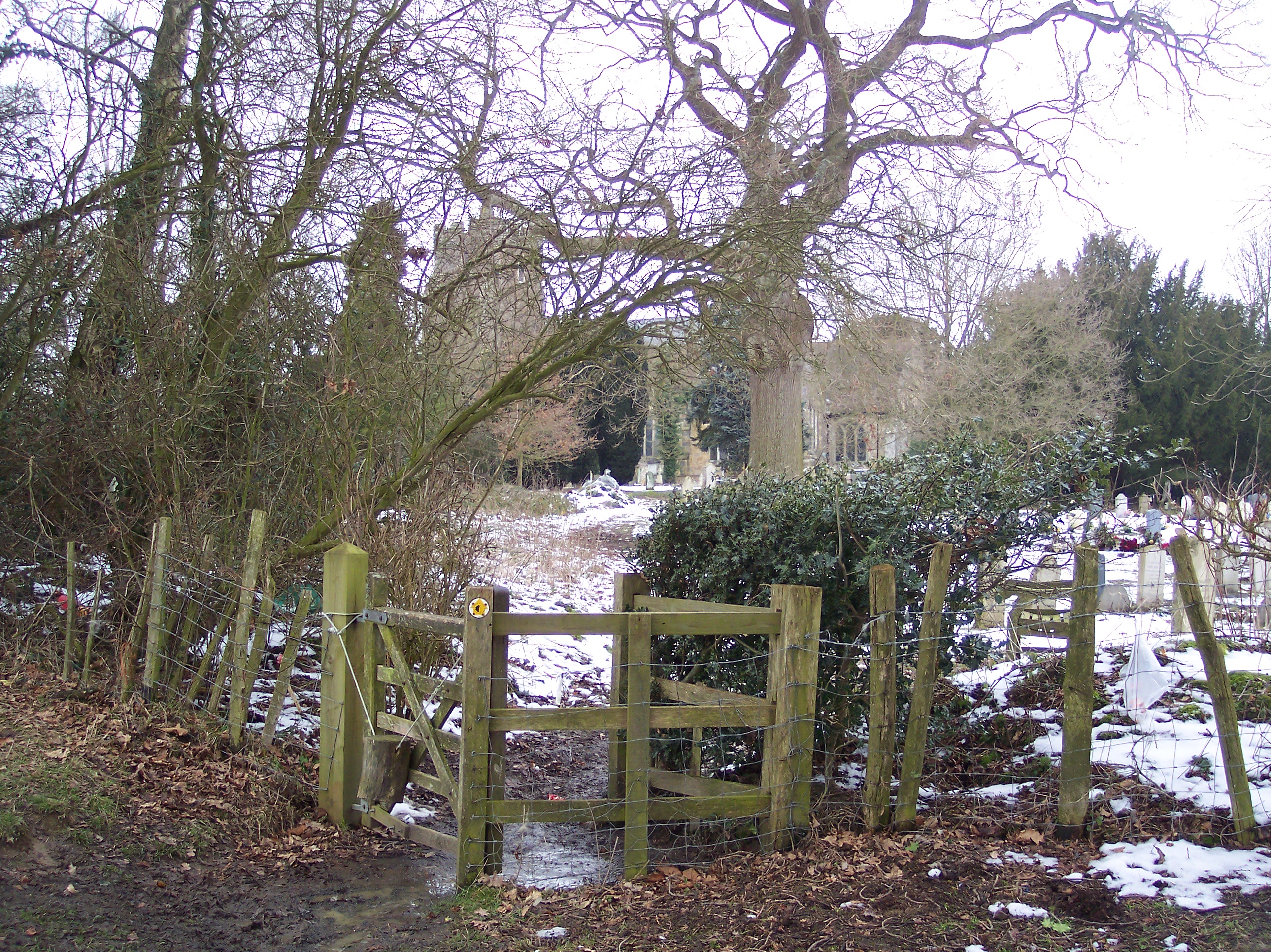
Great Maytham Hall - geograph.org.uk - 1711104.jpg - File Upload Bot (Magnus Manske)

High Weald Landscape Trail, Mill Wood - geograph.org.uk - 335351.jpg - GeographBot

Unnamed Pond , Decoypond Wood - geograph.org.uk - 335360.jpg - GeographBot

Walking Away - geograph.org.uk - 335372.jpg - GeographBot

Woodland Boundary, Alder Shaw - geograph.org.uk - 335369.jpg - GeographBot
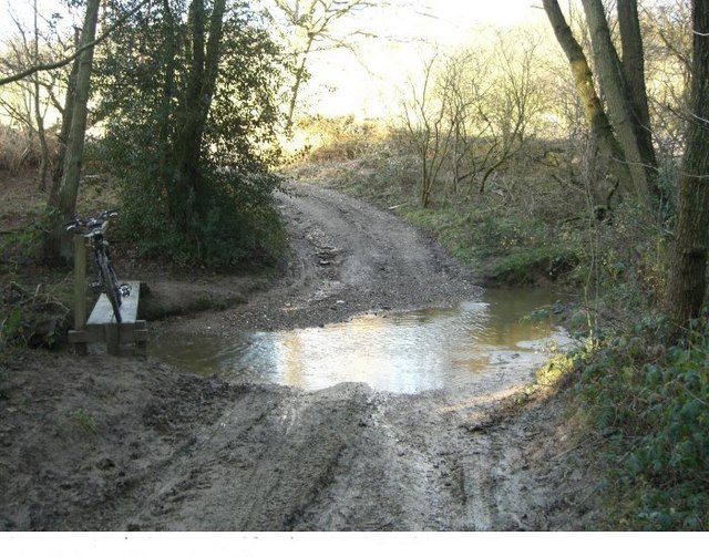
Tattleton's ford - geograph.org.uk - 374604.jpg - GeographBot

Barn, Black Barn Farm - geograph.org.uk - 399964.jpg - GeographBot

Footpath to Wittersham Road - geograph.org.uk - 400200.jpg - GeographBot

Stile on High Weald Landscape Trail - geograph.org.uk - 409632.jpg - GeographBot

Turf Plain - geograph.org.uk - 406228.jpg - GeographBot

Turf Plain Lodge - geograph.org.uk - 406243.jpg - GeographBot

Wet Level - geograph.org.uk - 400068.jpg - GeographBot

Dumbourne - geograph.org.uk - 410220.jpg - GeographBot

WW2 roadblock at Carterslodge Lane - geograph.org.uk - 420126.jpg - GeographBot

Chaffinch 5 - geograph.org.uk - 625046.jpg - GeographBot

Neylands Farm Cottages, Grinstead Lane - geograph.org.uk - 625038.jpg - GeographBot

High Weald Footbridge - geograph.org.uk - 731629.jpg - GeographBot

High Weald Landscape Trail - geograph.org.uk - 731691.jpg - GeographBot

High Weald Pond - geograph.org.uk - 731261.jpg - GeographBot

Maypole Lane - geograph.org.uk - 731614.jpg - GeographBot

Stile Near Triggs Farm - geograph.org.uk - 731666.jpg - GeographBot

Footpath, River's Wood - geograph.org.uk - 856212.jpg - GeographBot

Footpath Joins Copyhold Lane - geograph.org.uk - 858135.jpg - GeographBot

Across the Field to Slaugham - geograph.org.uk - 895637.jpg - GeographBot

Tenacity tree - geograph.org.uk - 1069288.jpg - GeographBot

Ornamental gates on the High Weald Landscape Trail - geograph.org.uk - 1133065.jpg - GeographBot

Bridleway running north to meet the High Weald Landscape Trail - geograph.org.uk - 1235945.jpg - GeographBot

Gorse along side the High Weald Landscape Trail - geograph.org.uk - 1236896.jpg - GeographBot

Ladybird on Mountain bike near Carter's Lodge - geograph.org.uk - 1239153.jpg - GeographBot

Part ploughed pasture - geograph.org.uk - 1239883.jpg - GeographBot

Reflections in small pond beside the High Weald Landscape Trail - geograph.org.uk - 1236914.jpg - GeographBot

Stew Pond next to the High Weald Landscape Trail - geograph.org.uk - 1236866.jpg - GeographBot

Field south of the High Weald Landscape Trail - geograph.org.uk - 1288284.jpg - GeographBot

Gorse by the High Weald Landscape Trail - geograph.org.uk - 1288345.jpg - GeographBot

High Weald Landscape Trail, St Leonards Forest - geograph.org.uk - 1288425.jpg - GeographBot

High Weald Landscape Trail, St Leonards Forest - geograph.org.uk - 1288457.jpg - GeographBot

High Weald Landscape Trail (2) - geograph.org.uk - 1288309.jpg - GeographBot

High Weald Landscape Trail - geograph.org.uk - 1288291.jpg - GeographBot

Looking south along the High Weald Landscape Trail, St Leonards Forest - geograph.org.uk - 1288492.jpg - GeographBot
Muddy field south of the High Weald Landscape Trail - geograph.org.uk - 1288298.jpg - GeographBot

Stile by The High Weald Landscape Trail - geograph.org.uk - 1288269.jpg - GeographBot

Stile on the High Weald Landscape Trail, St Leonards Forest - geograph.org.uk - 1288388.jpg - GeographBot

Track crosses the High Weald Landscape Trail - geograph.org.uk - 1288332.jpg - GeographBot

Trees north of the High Weald Landscape Trail - geograph.org.uk - 1288305.jpg - GeographBot

Trees south of the High Weald Landscape Trail - geograph.org.uk - 1288324.jpg - GeographBot

Waymark, High Weald Landscape Trail, St Leonards Forest (2) - geograph.org.uk - 1288473.jpg - GeographBot

Waymark, High Weald Landscape Trail, St Leonards Forest - geograph.org.uk - 1288439.jpg - GeographBot

Waymark, High Weald Landscape Trail, St Leonards Forest - geograph.org.uk - 1288468.jpg - GeographBot

Waymark and Stile, High Weald Landscape Trail - geograph.org.uk - 1288276.jpg - GeographBot

Waymarker for the High Weald Landscape Trail - geograph.org.uk - 1288353.jpg - GeographBot

High Weald Landscape Trail leaves Hawkenbury Rd - geograph.org.uk - 1299783.jpg - GeographBot

The High Weald Landscape Trail meets The Tunbridge Wells Circular Path, High Wood - geograph.org.uk - 1299866.jpg - GeographBot

An unofficial path through High Wood - geograph.org.uk - 1300789.jpg - GeographBot

End of paved section of The Tunbridge Wells Circular Walk and High Weald Landscape Trail, Little Bayhall - geograph.org.uk - 1301053.jpg - GeographBot

Fallow field north of The Tunbridge Wells Circular Walk - geograph.org.uk - 1300938.jpg - GeographBot

Fallow field north of The Tunbridge Wells Circular Walk - geograph.org.uk - 1300975.jpg - GeographBot

Field - woodland boundary from The Tunbridge Wells Circular Walk and High Weald Landscape Trail - geograph.org.uk - 1301594.jpg - GeographBot

Flowering hedgerows by The Tunbridge Wells Circular Path and High Weald Landscape Trail which are combined at this point. - geograph.org.uk - 1300800.jpg - GeographBot

Flowering hedges along the sides of The Tunbridge Wells Circular Walk and High Weald Landscape Trail - geograph.org.uk - 1300886.jpg - GeographBot

Footpath junction , High Wood - geograph.org.uk - 1300767.jpg - GeographBot

Footpath signposted off The Tunbridge Wells Circular Path and High Weald Landscape Trail on the edge of High Wood - geograph.org.uk - 1300796.jpg - GeographBot

Mind your head^ The Tunbridge Wells Circular Walk and High Weald Landscape Trail pass through Cooper's Rough - geograph.org.uk - 1301624.jpg - GeographBot

The Tunbridge Wells Circular Path and High Weald Landscape Trail heads east through High Wood - geograph.org.uk - 1300792.jpg - GeographBot

The Tunbridge Wells Circular Walk and High Weald Landscape Trail approaching Little Bayhall Farm - geograph.org.uk - 1301003.jpg - GeographBot

The Tunbridge Wells Circular Walk and High Weald Landscape Trail entering a woodland near Pembury - geograph.org.uk - 1301610.jpg - GeographBot

The Tunbridge Wells Circular Walk and High Weald Landscape Trail heading to Little Bayhall Farm - geograph.org.uk - 1300987.jpg - GeographBot

The Tunbridge Wells Circular Walk and High Weald Landscape Trail heading towards Pembury - geograph.org.uk - 1301598.jpg - GeographBot

The Tunbridge Wells Circular Walk and High Weald Landscape Trail pass through a small woodland heading towards Pembury - geograph.org.uk - 1301587.jpg - GeographBot

The view SE from the junction of the track to Dodhurst and The Tunbridge Wells Circular Walk and High Weald Landscape Trail - geograph.org.uk - 1300950.jpg - GeographBot

Track off The Tunbridge Wells Circular Walk and High Weald Landscape Trail to Mouseden Farm. - geograph.org.uk - 1300890.jpg - GeographBot

View east from The Tunbridge Wells Circular Walk and High Weald Landscape Trail across the Upper Teise valley. - geograph.org.uk - 1301605.jpg - GeographBot

Waymarker for The Tunbridge Wells Circular Walk and High Weald Landscape Trail - geograph.org.uk - 1301061.jpg - GeographBot

Footbridge over Furnace Pond - geograph.org.uk - 1357079.jpg - GeographBot

High Weald Landscape Trail towards Brenchley - geograph.org.uk - 1357077.jpg - GeographBot

Hononton Cottage - geograph.org.uk - 1357083.jpg - GeographBot

Waterfall on Furnace Pond - geograph.org.uk - 1357064.jpg - GeographBot

Cuckfield Church spire from the High Weald Landscape Trail - geograph.org.uk - 1366185.jpg - GeographBot

High Weald Landscape Trail entering Walks Wood - geograph.org.uk - 1365971.jpg - GeographBot

High Weald Landscape Trail entering the eastern edge of New England Wood - geograph.org.uk - 1367572.jpg - GeographBot

High Weald Landscape Trail enters a woodland west of Matfield - geograph.org.uk - 1360465.jpg - GeographBot

High Weald Landscape Trail joins the Romford Rd - geograph.org.uk - 1360590.jpg - GeographBot

High Weald Landscape Trail leaves Bramble Reed Lane - geograph.org.uk - 1360561.jpg - GeographBot

High Weald Landscape Trail through the woods - geograph.org.uk - 1360573.jpg - GeographBot

Looking east on the High Weald Landscape Trail towards bridge under the A 23 at Bolney - geograph.org.uk - 1364482.jpg - GeographBot

Orchard by the High Weald Landscape Trail - geograph.org.uk - 1361103.jpg - GeographBot

Soft fruit by the High Weald Landscape Trail, Matfield (2) - geograph.org.uk - 1361180.jpg - GeographBot

Soft fruit by the High Weald Landscape Trail, Matfield (3) - geograph.org.uk - 1361181.jpg - GeographBot

Soft fruit by the High Weald Landscape Trail, Matfield - geograph.org.uk - 1361176.jpg - GeographBot

Soft fruit by the High Weald Landscape Trail, Matfield - geograph.org.uk - 1361184.jpg - GeographBot

Stile on the High Weald Landscape Trail - geograph.org.uk - 1361172.jpg - GeographBot

Stile on the High Weald Landscape Trail near Matfield - geograph.org.uk - 1360448.jpg - GeographBot

The High Weald Landscape Trail joins Bramble Reed Lane - geograph.org.uk - 1360555.jpg - GeographBot

The High Weald Landscape Trail near Petteridge - geograph.org.uk - 1361102.jpg - GeographBot

The High weald Landscape Trail enters the woods east of Bramble Reed Lane - geograph.org.uk - 1360548.jpg - GeographBot

This footpath runs parallel with the A23 at Bolney - geograph.org.uk - 1368876.jpg - GeographBot

Farmland on High Weald Walk - geograph.org.uk - 1409250.jpg - GeographBot

Footbridge over the A21, near Hastings Road - geograph.org.uk - 1409216.jpg - GeographBot

Footpath junction in Snipe Wood - geograph.org.uk - 1409159.jpg - GeographBot

Footpath junction is Snipe Wood - geograph.org.uk - 1409130.jpg - GeographBot

Footpath junction on edge of Snipe Wood - geograph.org.uk - 1409142.jpg - GeographBot

Footpath on High Woods Lane - geograph.org.uk - 1409287.jpg - GeographBot

High Weald Landscape Trail in Snipe Wood - geograph.org.uk - 1409138.jpg - GeographBot

High Weald Path junction in Snipe Wood - geograph.org.uk - 1409150.jpg - GeographBot

High Weald Paths in Snipes Wood - geograph.org.uk - 1409145.jpg - GeographBot

High Weald Paths on Woodlands - geograph.org.uk - 1409162.jpg - GeographBot

High Weald Walks heading to Pembury - geograph.org.uk - 1409181.jpg - GeographBot

High Weald Walks near the A21 - geograph.org.uk - 1409192.jpg - GeographBot

High Weald Walks past playing field near Pembury - geograph.org.uk - 1409188.jpg - GeographBot

High Weald Walks to Hastings Road, Pembury - geograph.org.uk - 1409211.jpg - GeographBot
Long Distance Paths in Snipe Wood - geograph.org.uk - 1409124.jpg - GeographBot

Stile on High Wealds Walks, Romford - geograph.org.uk - 1409177.jpg - GeographBot

The High Weald Walks head through farm fields towards Pembury - geograph.org.uk - 1409260.jpg - GeographBot

The High Weald Walks head toward Little Bayhall Farm - geograph.org.uk - 1409269.jpg - GeographBot

Footpath junction on High Weald Walks - geograph.org.uk - 1410223.jpg - GeographBot

A muddy high Weald Landscape Trail - geograph.org.uk - 1437443.jpg - GeographBot

Footbridge on High Weald Landscape Trail - geograph.org.uk - 1436162.jpg - GeographBot

Footpath from Brenchley Church - geograph.org.uk - 1436149.jpg - GeographBot

High Weald Landscape Trail descending from Pickeridge Farm - geograph.org.uk - 1438763.jpg - GeographBot

High Weald Landscape Trail in Boundary Wood - geograph.org.uk - 1437335.jpg - GeographBot

High Weald Landscape Trail near Pickeridge Farm - geograph.org.uk - 1438742.jpg - GeographBot

High Weald Landscape Trail towards Brenchley - geograph.org.uk - 1436157.jpg - GeographBot

Old Orchard in Southfield Farm - geograph.org.uk - 1436165.jpg - GeographBot

Permissive path in Brenchley - geograph.org.uk - 1436160.jpg - GeographBot

Southfield Farm - geograph.org.uk - 1436166.jpg - GeographBot

Steps on a footpath near Petteridge - geograph.org.uk - 1436170.jpg - GeographBot

The Black Path - geograph.org.uk - 1436171.jpg - GeographBot

Tibbs Court Lane - geograph.org.uk - 1436168.jpg - GeographBot

Building by the High Weald Landscape Trail - geograph.org.uk - 1459808.jpg - GeographBot

Building by the High Weald Landscape Trail - geograph.org.uk - 1459861.jpg - GeographBot

Footbridge on the High Weald Landscape Trail - geograph.org.uk - 1459798.jpg - GeographBot

Gate on the High Weald Landscape Trail - geograph.org.uk - 1459870.jpg - GeographBot

High Weald Landscape Trail near Southfield Farm - geograph.org.uk - 1459755.jpg - GeographBot

High Weald Landscape Trail near Southfield Farm - geograph.org.uk - 1459760.jpg - GeographBot

High Weald Landscape Trail near Southfield Farm - geograph.org.uk - 1459782.jpg - GeographBot

Kissing gate on the High Weald Landscape Trail - geograph.org.uk - 1459728.jpg - GeographBot

Permissive Path off the High Weald Landscape Trail - geograph.org.uk - 1459850.jpg - GeographBot

Woodland off High Weald Landscape Trail - geograph.org.uk - 1459878.jpg - GeographBot

High Weald Landscape Trail north of Staplefield - geograph.org.uk - 1469601.jpg - GeographBot

Footpath waymarker and High Weald Landscape Trail post - geograph.org.uk - 1471777.jpg - GeographBot

High Weald Landscape Trail passing through River's Wood - geograph.org.uk - 1471780.jpg - GeographBot

High Weald Landscape Trail through Pratt's Wood - geograph.org.uk - 1470829.jpg - GeographBot

Benenden School Playing fields - geograph.org.uk - 1499297.jpg - GeographBot

Cloth Hall Oast House - geograph.org.uk - 1499217.jpg - GeographBot

Crabtree Farmhouse - geograph.org.uk - 1499268.jpg - GeographBot

Farm road from Little Coursehorne to Crabtree Farm - geograph.org.uk - 1499264.jpg - GeographBot

Footbridge in Dibley Shaw - geograph.org.uk - 1499284.jpg - GeographBot

Footbridge in Hagues Gill - geograph.org.uk - 1499237.jpg - GeographBot

Footbridge on High Weald Landscape Trail - geograph.org.uk - 1499258.jpg - GeographBot

Footpath junction on the High Weald Landscape Trail - geograph.org.uk - 1499307.jpg - GeographBot

Hagues Gill - geograph.org.uk - 1499253.jpg - GeographBot

High Weald Landscape Trail in Dibley Shaw - geograph.org.uk - 1499281.jpg - GeographBot

Kissing Gate on High Weald Landscape Trail - geograph.org.uk - 1499193.jpg - GeographBot

Kissing Gate on High Weald Landscape Trail - geograph.org.uk - 1499232.jpg - GeographBot

Kissing Gate on High Weald Landscape Trail - geograph.org.uk - 1499293.jpg - GeographBot

New Kissing Gate and Gate on High Weald Landscape Trail - geograph.org.uk - 1499209.jpg - GeographBot

Old Cloth Hall - geograph.org.uk - 1499225.jpg - GeographBot

Paddocks Farm - geograph.org.uk - 1499202.jpg - GeographBot

Stile on High Weald Landscape Trail - geograph.org.uk - 1499201.jpg - GeographBot

The High Weald Landscape Trail heads to Cranbrook - geograph.org.uk - 1499255.jpg - GeographBot

The High Weald Landscape Trail leaves Crabtree Farm - geograph.org.uk - 1499274.jpg - GeographBot

The High Weald Landscape Trail leaves Golford Road - geograph.org.uk - 1499199.jpg - GeographBot

The High Weald Landscape Trail meets Golford Road - geograph.org.uk - 1499191.jpg - GeographBot

Footpath junction on the High Weald Landscape Trail - geograph.org.uk - 1501022.jpg - GeographBot

The High Weald Landscape Trail crosses Waterloo Place - geograph.org.uk - 1501017.jpg - GeographBot

The High Weald Landscape Trail leads past The Park - geograph.org.uk - 1501019.jpg - GeographBot

The High Weald Landscape Trail leads to Baker's Cross - geograph.org.uk - 1501028.jpg - GeographBot

The High Weald Landscape Trail on New Road, Cranbrook - geograph.org.uk - 1500927.jpg - GeographBot

Broken Stile on High Weald Landscape Trail - geograph.org.uk - 1515779.jpg - GeographBot

Footbridge in Rectory Park - geograph.org.uk - 1515766.jpg - GeographBot

Footpath junction in Sprivers Garden land - geograph.org.uk - 1517025.jpg - GeographBot

High Weald Landscape Trail in Rectory Park - geograph.org.uk - 1515774.jpg - GeographBot

High Weald Landscape Trail in an orchard - geograph.org.uk - 1510585.jpg - GeographBot

High Weald Landscape Trail through Hop Field - geograph.org.uk - 1516983.jpg - GeographBot

High Weald Landscape Trail towards Goudhurst - geograph.org.uk - 1511043.jpg - GeographBot

Hop Picker ready for Monday - geograph.org.uk - 1516994.jpg - GeographBot

Kissing Gate in Sprivers Garden Woodland - geograph.org.uk - 1517010.jpg - GeographBot

Private Drive to Sprivers Garden - geograph.org.uk - 1517001.jpg - GeographBot

Rectory Park Road near Lordship Wood - geograph.org.uk - 1515745.jpg - GeographBot

Road junction on Lamberhurst Road - geograph.org.uk - 1516998.jpg - GeographBot

Small Bridge Road - geograph.org.uk - 1511026.jpg - GeographBot

Stile near Rectory Park - geograph.org.uk - 1515752.jpg - GeographBot

The High Weald Landscape Trail at Lewes Heath - geograph.org.uk - 1510575.jpg - GeographBot

The High Weald Landscape Trail crosses Brenchley Road - geograph.org.uk - 1517037.jpg - GeographBot

The High Weald Landscape Trail heads past Shirrenden Farm - geograph.org.uk - 1517044.jpg - GeographBot

The High Weald Landscape Trail heads towards Brenchley Road - geograph.org.uk - 1517030.jpg - GeographBot

The High Weald Landscape Trail on Brick Kiln Lane - geograph.org.uk - 1515736.jpg - GeographBot

The High Weald Landscape Trail on Lidwells Lane - geograph.org.uk - 1511054.jpg - GeographBot

Tree in Rectory Park - geograph.org.uk - 1515756.jpg - GeographBot

View of Hammonds Farm and St Margaret's Church - geograph.org.uk - 1511070.jpg - GeographBot

Gate by the B2110 - geograph.org.uk - 1585823.jpg - GeographBot

Bend on High Weald Landscape Trail - geograph.org.uk - 1595937.jpg - GeographBot

Division on Maypole Lane - geograph.org.uk - 1593619.jpg - GeographBot

Footbridge on the High Weald Landscape Trail - geograph.org.uk - 1593463.jpg - GeographBot

Footbridge on the High Weald Landscape Trail - geograph.org.uk - 1593490.jpg - GeographBot

Footpath junction on High Weald Landscape Trail - geograph.org.uk - 1593460.jpg - GeographBot

Footpath junction on the High Weald Landscape Trail - geograph.org.uk - 1593457.jpg - GeographBot

Footpath junction on the High Weald Landscape Trail - geograph.org.uk - 1593496.jpg - GeographBot

Footpath to Cranbrook - geograph.org.uk - 1593506.jpg - GeographBot

High Weald Landscape Trail heading to Glassenbury Road - geograph.org.uk - 1595923.jpg - GeographBot

High Weald Landscape Trail heading to Goudhurst - geograph.org.uk - 1595880.jpg - GeographBot

High Weald Landscape Trail in Angley Wood - geograph.org.uk - 1593476.jpg - GeographBot

High Weald Landscape Trail in Angley Wood - geograph.org.uk - 1593483.jpg - GeographBot

High Weald Landscape Trail in Water Pond Shaw - geograph.org.uk - 1595942.jpg - GeographBot

High Weald Landscape Trail junction in Burnt Bank Wood - geograph.org.uk - 1593450.jpg - GeographBot

High Weald Landscape Trail leaves a farm track - geograph.org.uk - 1595944.jpg - GeographBot

Little Glassenbury Barn - geograph.org.uk - 1595877.jpg - GeographBot

Pond in Angley Wood - geograph.org.uk - 1593478.jpg - GeographBot

Rack Wood and Blackbush Wood - geograph.org.uk - 1595894.jpg - GeographBot

Regrowing Coppice in Angley Wood - geograph.org.uk - 1593470.jpg - GeographBot

The High Weald Landscape Trail heading towards Glassenbury - geograph.org.uk - 1595952.jpg - GeographBot

The High Weald Landscape Trail heads towards Goudhurst - geograph.org.uk - 1593627.jpg - GeographBot

Track in Angley Wood - geograph.org.uk - 1593467.jpg - GeographBot

Track junction on High Weald Landscape Trail - geograph.org.uk - 1593487.jpg - GeographBot

Track junction on the High Weald Landscape Trail - geograph.org.uk - 1593465.jpg - GeographBot

Track to Wenman's Cottage - geograph.org.uk - 1593510.jpg - GeographBot

Unused stile on the High Weald Landscape Trail - geograph.org.uk - 1595940.jpg - GeographBot

View from the High Weald Landscape Trail - geograph.org.uk - 1595883.jpg - GeographBot

View of Ten Acre Wood and Blackbush Wood - geograph.org.uk - 1595899.jpg - GeographBot

High Weald Landscape Trail enters Collingsbush Wood - geograph.org.uk - 1690031.jpg - GeographBot

High Weald Landscape Trail through Collingsbush Wood (2) - geograph.org.uk - 1690012.jpg - GeographBot

High Weald Landscape Trail through Collingsbush Wood (3) - geograph.org.uk - 1690020.jpg - GeographBot

High Weald Landscape Trail through Collingsbush Wood - geograph.org.uk - 1690010.jpg - GeographBot

Pond in the woods by the High Weald Landscape Trail - geograph.org.uk - 1690044.jpg - GeographBot

Small woodland by the High Weald Landscape Trail - geograph.org.uk - 1690052.jpg - GeographBot

View south from the High Weald Landscape Trail - geograph.org.uk - 1690059.jpg - GeographBot

Footpath to Seven Acre Shaw - geograph.org.uk - 1709715.jpg - GeographBot

High Weald Landscape Trail beside St George's Church - geograph.org.uk - 1709730.jpg - GeographBot

Kissing Gate on High Weald Landscape Trail - geograph.org.uk - 1709744.jpg - GeographBot

Sheep with bells on - geograph.org.uk - 1709748.jpg - GeographBot

The High Weald Landscape Trail crosses New Pond Road - geograph.org.uk - 1709721.jpg - GeographBot

Barn Hill Cottage - geograph.org.uk - 1710200.jpg - GeographBot

Bridge over the Newmill Channel - geograph.org.uk - 1711438.jpg - GeographBot

Broken stile on High Weald Landscape Trail - geograph.org.uk - 1711058.jpg - GeographBot

Dingleden Oasthouse - geograph.org.uk - 1710221.jpg - GeographBot

Earthwork and field near Newmill Channel - geograph.org.uk - 1711424.jpg - GeographBot

Footbridge and stile on High Weald Landscape Trail near Kemsdale House - geograph.org.uk - 1710267.jpg - GeographBot

Footpath Junction near Winton Farm - geograph.org.uk - 1711418.jpg - GeographBot

Footpath and byway junction near Dingleden Farm - geograph.org.uk - 1710219.jpg - GeographBot

Footpath junction near Dingleden Farm - geograph.org.uk - 1710211.jpg - GeographBot

Footpath junction near Rolvenden Layne - geograph.org.uk - 1711218.jpg - GeographBot

Footpath junction near the Crayfish Lagoons - geograph.org.uk - 1711356.jpg - GeographBot

Footpath junction on High Weald Landscape Trail (2) - geograph.org.uk - 1710087.jpg - GeographBot

Footpath junction on the High Weald Landscape Trail - geograph.org.uk - 1710076.jpg - GeographBot

Footpath to Puddingcake Lane - geograph.org.uk - 1711406.jpg - GeographBot

Frog's Lane (2) - geograph.org.uk - 1711120.jpg - GeographBot

Gate and footpath junction on the High Weald Landscape Trail - geograph.org.uk - 1710274.jpg - GeographBot

Gate beside Willerd's Hill Wood - geograph.org.uk - 1710178.jpg - GeographBot

Gate on the High Weald Landscape Trail - geograph.org.uk - 1710176.jpg - GeographBot

Junction on Dingleden Lane - geograph.org.uk - 1710193.jpg - GeographBot

Kissing Gate near Rolvenden Primary School - geograph.org.uk - 1711061.jpg - GeographBot

Kissing gate near Great Maytham - geograph.org.uk - 1711099.jpg - GeographBot

Oak tree on High Weald Landscape Trail - geograph.org.uk - 1711083.jpg - GeographBot

Orchard near Pookwell Wood - geograph.org.uk - 1710236.jpg - GeographBot

Road junction on Winser Road - geograph.org.uk - 1711206.jpg - GeographBot

Rolvenden Windmill - geograph.org.uk - 1710280.jpg - GeographBot

Ruined farm building of Winser Farm - geograph.org.uk - 1711243.jpg - GeographBot

Stile and Gate on High Weald landscape Trail near Dingleden Farm - geograph.org.uk - 1710228.jpg - GeographBot

Stile and footbridge in Pookwell Wood - geograph.org.uk - 1710233.jpg - GeographBot

Stile and two footbridges on the High Weald Landscape Trail - geograph.org.uk - 1710285.jpg - GeographBot

Stream to flowing to the Newmill Channel - geograph.org.uk - 1711395.jpg - GeographBot

The Harvester Crossing - geograph.org.uk - 1711458.jpg - GeographBot

The High Weald Landscape Trail crosses Rolvenden High Street - geograph.org.uk - 1711066.jpg - GeographBot

The High Weald Landscape Trail crosses Sandhurst Lane - geograph.org.uk - 1710250.jpg - GeographBot

The High Weald Landscape Trail enters Rolvenden Layne - geograph.org.uk - 1711189.jpg - GeographBot
The High Weald Landscape Trail enters St Mary's Churchyard - geograph.org.uk - 1711081.jpg - GeographBot

The High Weald Landscape Trail enters Strawberry Wood - geograph.org.uk - 1710130.jpg - GeographBot

The High Weald Landscape Trail enters the Wilderness - geograph.org.uk - 1711093.jpg - GeographBot

The High Weald Landscape Trail heads into Tenterden - geograph.org.uk - 1713714.jpg - GeographBot

The High Weald Landscape Trail heads to Lower Woolwich - geograph.org.uk - 1711379.jpg - GeographBot

The High Weald Landscape Trail heads towards Strawberry Wood - geograph.org.uk - 1710117.jpg - GeographBot

The High Weald Landscape Trail heads towards Tenterden - geograph.org.uk - 1711234.jpg - GeographBot

The High Weald Landscape Trail heads towards the Crayfish Lagoons - geograph.org.uk - 1711351.jpg - GeographBot

The High Weald Landscape Trail in Strawberry Wood - geograph.org.uk - 1710141.jpg - GeographBot

The High Weald Landscape Trail in a copse - geograph.org.uk - 1711249.jpg - GeographBot

The High Weald Landscape Trail on Mounts Lane - geograph.org.uk - 1711228.jpg - GeographBot

The High Weald Landscape Trail on Woodcock Lane - geograph.org.uk - 1710184.jpg - GeographBot

Tree and footbridge on the High Weald Landscape Trail - geograph.org.uk - 1711389.jpg - GeographBot

Tree near Kemsdale House - geograph.org.uk - 1710256.jpg - GeographBot

View looking south westerly over the Crayfish Lagoons - geograph.org.uk - 1711342.jpg - GeographBot

Woodcock Lane meets Ramsden Lane - geograph.org.uk - 1710189.jpg - GeographBot

High Weald Landscape Trail off Tibb's Court Lane - geograph.org.uk - 1737504.jpg - GeographBot

High Weald Walk - Tunbridge Wells Circular Marker - geograph.org.uk - 1732092.jpg - GeographBot

Information Board in Rusthall Common - geograph.org.uk - 1731957.jpg - GeographBot

The High Weald Landscape Trail heads towards Lower Green Road - geograph.org.uk - 1731968.jpg - GeographBot

Bate's Gill (looking downstream) - geograph.org.uk - 1744026.jpg - GeographBot

Bend on the Small Hythe Road - geograph.org.uk - 1742790.jpg - GeographBot

Double gates on the Rother Levels - geograph.org.uk - 1742880.jpg - GeographBot

Dumbourne Farm Barn - geograph.org.uk - 1742616.jpg - GeographBot

Footbridge and stile near Belcot Manor Farm - geograph.org.uk - 1742347.jpg - GeographBot

Footbridge near Dumbourne Farm - geograph.org.uk - 1742728.jpg - GeographBot

Footbridge near Oast House Wood - geograph.org.uk - 1742449.jpg - GeographBot

Footbridge near Tilden Gill in Oasthouse Wood - geograph.org.uk - 1742462.jpg - GeographBot

Footbridge on the High Weald Landscape Trail - geograph.org.uk - 1742321.jpg - GeographBot

Footbridge on the Six Fields Path - geograph.org.uk - 1742296.jpg - GeographBot

Footbridge on the Tilden Gill (2) - geograph.org.uk - 1742394.jpg - GeographBot

Footbridge on the Tilden Gill - geograph.org.uk - 1742386.jpg - GeographBot
Footbridge over the Bate's Gill - geograph.org.uk - 1744027.jpg - GeographBot

Footpath Junction near Bates Gill - geograph.org.uk - 1744083.jpg - GeographBot

Footpath junction near Heronden - geograph.org.uk - 1747683.jpg - GeographBot

Footpath junction near Wittersham Cemetery - geograph.org.uk - 1744030.jpg - GeographBot

Footpath junction on the High Weald Landscape Trail near Plummer Farm - geograph.org.uk - 1747701.jpg - GeographBot

Footpath to Wittersham - geograph.org.uk - 1744032.jpg - GeographBot

Gate in the Rother Levels - geograph.org.uk - 1742841.jpg - GeographBot

Gate into Ratsbury Wood - geograph.org.uk - 1742438.jpg - GeographBot

High Weald Landscape Trail in Ratsbury Wood - geograph.org.uk - 1742407.jpg - GeographBot

High Weald Landscape Trail near Oasthouse Wood - geograph.org.uk - 1742458.jpg - GeographBot

High Weald Landscape Trail near Usher Wood Lake - geograph.org.uk - 1742473.jpg - GeographBot

High Weald Landscape Trail through an orchard near Wittersham - geograph.org.uk - 1744039.jpg - GeographBot

High Weald Landscape Trail through an orchard to Wittersham - geograph.org.uk - 1744060.jpg - GeographBot

Kingsgate Farmhouse - geograph.org.uk - 1742966.jpg - GeographBot

Kingsgate Lane - geograph.org.uk - 1742998.jpg - GeographBot

Oast House, Wittersham Street - geograph.org.uk - 1744033.jpg - GeographBot

Old bridge, New Bridge, Tilden Gill - geograph.org.uk - 1742382.jpg - GeographBot

Steps in Ratsbury Wood - geograph.org.uk - 1742420.jpg - GeographBot

Steps near Usher Wood Lake Embankment - geograph.org.uk - 1742484.jpg - GeographBot

Stile and High Weald Landscape Trail heading towards Swan Street - geograph.org.uk - 1743124.jpg - GeographBot

Stile and footbridge on the High Weald Landscape Trail - geograph.org.uk - 1742539.jpg - GeographBot

Stile and footbridge on the High Weald Landscape Trail heading to Dumbourne Farm - geograph.org.uk - 1742748.jpg - GeographBot

Stile on High Weald Landscape Trail near Bates Farm - geograph.org.uk - 1744023.jpg - GeographBot

Stile on High Weald Landscape Trail near Bates Gill - geograph.org.uk - 1744075.jpg - GeographBot

Stile on High Weald Landscape Trail near Bates Gill - geograph.org.uk - 1744107.jpg - GeographBot

Stile on High Weald Landscape Trail near Dumbourne Farm - geograph.org.uk - 1742622.jpg - GeographBot

Stile on the High Weald Landscape Trail on the Isle of Oxney - geograph.org.uk - 1743120.jpg - GeographBot

The High Weald Landscape Trail beside Bates Gill - geograph.org.uk - 1744094.jpg - GeographBot

The High Weald Landscape Trail heads towards Tenterden - geograph.org.uk - 1742301.jpg - GeographBot

The High Weald Landscape Trail in Small Hythe - geograph.org.uk - 1742761.jpg - GeographBot

The High Weald Landscape Trail meets a lane from Ham Green to the Blackwall Bridge - geograph.org.uk - 1744126.jpg - GeographBot

The High Weald Landscape Trail meets the Wittersham Road - geograph.org.uk - 1743098.jpg - GeographBot

The High Weald Landscape Trail near the Tilder Gill - geograph.org.uk - 1742378.jpg - GeographBot

The High Weald Landscape Trail on Swan Street - geograph.org.uk - 1743133.jpg - GeographBot

The High Weald Landscape Trail turns at Smallhythe Road - geograph.org.uk - 1742324.jpg - GeographBot

Timber cottage near Kingsgate Farm - geograph.org.uk - 1742981.jpg - GeographBot

Track to Ashenden - geograph.org.uk - 1742509.jpg - GeographBot

Trees near Dumbourne - geograph.org.uk - 1742674.jpg - GeographBot

Unused Stile on High Weald Landscape Trail near Bates Gill - geograph.org.uk - 1744080.jpg - GeographBot

Unused farm shed near the High Weald Landscape Trail - geograph.org.uk - 1743115.jpg - GeographBot

Unused stile on the High Weald Landscape Trail - geograph.org.uk - 1743108.jpg - GeographBot

View from High Weald Landscape Trail near Bates Gill - geograph.org.uk - 1744067.jpg - GeographBot

View of the Rother Levels - geograph.org.uk - 1742735.jpg - GeographBot

View over the Rother Levels - geograph.org.uk - 1742933.jpg - GeographBot

West View Integrated Care Centre - geograph.org.uk - 1747706.jpg - GeographBot

A line of trees south of the High Weald Landscape Trail - geograph.org.uk - 1803664.jpg - GeographBot

Clump of trees near the High Weald Landscape Trail - geograph.org.uk - 1803611.jpg - GeographBot

High Weald Landscape Trail - geograph.org.uk - 1803572.jpg - GeographBot

High Weald Landscape Trail approaching Cranbrook - geograph.org.uk - 1803730.jpg - GeographBot

High Weald Landscape Trail crosses Waterloo Rd - geograph.org.uk - 1803762.jpg - GeographBot

Junction of High Weald Landscape Trail and a footpath from Sissinghurst - geograph.org.uk - 1803594.jpg - GeographBot

Line of bushes - geograph.org.uk - 1803556.jpg - GeographBot

Monkey Puzzle tree by the High Weald Landscape Trail - geograph.org.uk - 1803633.jpg - GeographBot

Pond by High Weald Landscape Trail - geograph.org.uk - 1803648.jpg - GeographBot

Borde Hill Estate, Lodge gates.jpg - AndyScott

High Weald Landscape Trail and Tunbridge Wells Circular Walk in High Wood - geograph.org.uk - 2937518.jpg - GeographBot

High Weald Landscape Trail and Tunbridge Wells Circular Walk, High Woods Lane - geograph.org.uk - 2937548.jpg - GeographBot

Muddy path - geograph.org.uk - 2939802.jpg - GeographBot

Bridge over dried-up stream near Hawkenbury - geograph.org.uk - 3601283.jpg - GeographBot

View over High Weald - geograph.org.uk - 4190796.jpg - GeographBot

View over High Weald - geograph.org.uk - 4190812.jpg - GeographBot

View over High Weald - geograph.org.uk - 4190815.jpg - GeographBot

High Weald Landscape Trail - geograph.org.uk - 4190830.jpg - GeographBot

View over High Weald - geograph.org.uk - 4190854.jpg - GeographBot

High Weald Landscape Trail - geograph.org.uk - 4190863.jpg - GeographBot

View over High Weald - geograph.org.uk - 4190879.jpg - GeographBot

High Weald Landscape Trail - geograph.org.uk - 4190893.jpg - GeographBot

High Weald Landscape Trail - geograph.org.uk - 4190896.jpg - GeographBot

High Weald Landscape Trail, High Woods - geograph.org.uk - 4190949.jpg - GeographBot

High Weald Landscape Trail, High Wood - geograph.org.uk - 4198904.jpg - GeographBot

High Weald Landscape Trail, High Wood - geograph.org.uk - 4198916.jpg - GeographBot

High Weald Landscape Trail - geograph.org.uk - 6841904.jpg - GeographBot

HWLT off High Woods Lane - geograph.org.uk - 7219867.jpg - GeographBot

High Weald Landscape Trail - geograph.org.uk - 6774018.jpg - GeographBot

Footpath off High Wood Lane - geograph.org.uk - 6773972.jpg - GeographBot