Wikimedi'Òc
Modes d'emploi

Cet album fait partie des albums
Cet album photos contient les sous-albums suivants :


HeronMaenporth.jpg - Vernon39

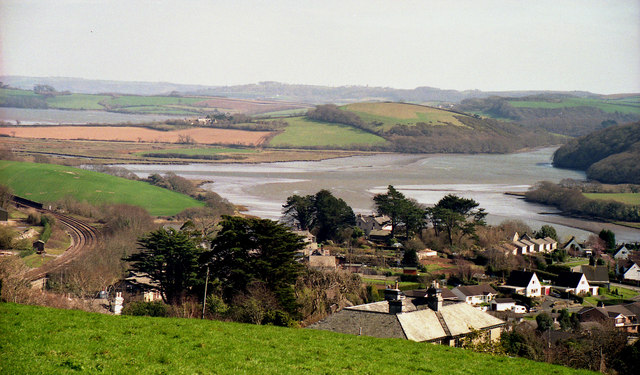
Lelant Saltings from The Causeway - geograph.org.uk - 72871.jpg - GeographBot

Southdown on the Insworke Peninsula - geograph.org.uk - 36899.jpg - GeographBot

Neal Point, Landulph - geograph.org.uk - 76287.jpg - GeographBot

Torpoint, north shore of St John's Lake - geograph.org.uk - 72332.jpg - GeographBot

Helford River, near Gweek - geograph.org.uk - 82258.jpg - GeographBot

Evening on the River Lynher - geograph.org.uk - 133532.jpg - GeographBot

The River Tiddy, Salt Marsh and Mudflats - geograph.org.uk - 133328.jpg - GeographBot

View From the Lynher Viaduct - geograph.org.uk - 133319.jpg - GeographBot

Looking out to sea from Dennis Cove - geograph.org.uk - 167590.jpg - GeographBot
St Germans - geograph.org.uk - 163888.jpg - GeographBot

Church Creek at Old Kea - geograph.org.uk - 245889.jpg - GeographBot

Millbrook Lake - geograph.org.uk - 224162.jpg - GeographBot

Shoreline at Southdown near Millbrook - geograph.org.uk - 224164.jpg - GeographBot

St John's Lake - geograph.org.uk - 224153.jpg - GeographBot

North end of Percuil creek - geograph.org.uk - 237205.jpg - GeographBot

Looking upriver from Terras Bridge - geograph.org.uk - 270585.jpg - GeographBot

Looking upriver towards Terras Bridge - geograph.org.uk - 270603.jpg - GeographBot

Down river from Cotehele - geograph.org.uk - 337392.jpg - GeographBot

Forder Creek - geograph.org.uk - 331179.jpg - GeographBot

Forder Viaduct - geograph.org.uk - 331168.jpg - GeographBot

Skinham Point - geograph.org.uk - 337398.jpg - GeographBot

Another view across estuary - geograph.org.uk - 345431.jpg - GeographBot

Coaster parked up at Southdown - geograph.org.uk - 347770.jpg - GeographBot

Delightful corner of Cornwall - geograph.org.uk - 344905.jpg - GeographBot

Estuary Head with fields in background - geograph.org.uk - 347758.jpg - GeographBot

Estuary View at Low Tide - geograph.org.uk - 344893.jpg - GeographBot

Fosse Quay - 'Coronette' just been launched - geograph.org.uk - 340396.jpg - GeographBot

Headland View over mudflats from Sango Point - geograph.org.uk - 341375.jpg - GeographBot

High Water Mark - geograph.org.uk - 344887.jpg - GeographBot
Ince Castle - geograph.org.uk - 344828.jpg - GeographBot

Insworke Barton - geograph.org.uk - 347759.jpg - GeographBot

Maintenance on Yacht - geograph.org.uk - 345254.jpg - GeographBot

Marsh Wall - geograph.org.uk - 344104.jpg - GeographBot

Old Bridge Support - geograph.org.uk - 344883.jpg - GeographBot

Old Railway Bridge Support - geograph.org.uk - 344870.jpg - GeographBot

Rocks at Sango Point, Devonport in distance - geograph.org.uk - 347765.jpg - GeographBot

Sango Island - geograph.org.uk - 341175.jpg - GeographBot

Shipwreck on beach - geograph.org.uk - 347768.jpg - GeographBot
The sun shines bright on a fresh day - geograph.org.uk - 347766.jpg - GeographBot

Trees reaching out for light - geograph.org.uk - 347769.jpg - GeographBot

View SW across grassland - inlet - woods - geograph.org.uk - 344863.jpg - GeographBot

View across Estuary - geograph.org.uk - 345428.jpg - GeographBot

View across marsh wall to Sango Island - geograph.org.uk - 344109.jpg - GeographBot

View across to Ince Point from Shillingham Point - geograph.org.uk - 344900.jpg - GeographBot

View across towards Shillingham Point - geograph.org.uk - 344912.jpg - GeographBot

View from Sheviock Wood over Estuary - geograph.org.uk - 345419.jpg - GeographBot

View out over mud at low tide - geograph.org.uk - 344850.jpg - GeographBot

View over Grassland and Mud towards Woods - geograph.org.uk - 344860.jpg - GeographBot

View over Mud and Grassland - geograph.org.uk - 344856.jpg - GeographBot

View over Mud at Low Tide - geograph.org.uk - 344874.jpg - GeographBot

View over fields towards Cremyll in the far distance - geograph.org.uk - 341209.jpg - GeographBot

View towards Millbrook from Sango Island - geograph.org.uk - 341193.jpg - GeographBot

Home Farm Empacombe - geograph.org.uk - 356078.jpg - GeographBot

Lynher River - geograph.org.uk - 359754.jpg - GeographBot
Millbrook village from Maker heights - geograph.org.uk - 357263.jpg - GeographBot

River Lynher towards Saltash - geograph.org.uk - 356419.jpg - GeographBot

St John's Lake - geograph.org.uk - 368525.jpg - GeographBot

Road to the Ford - geograph.org.uk - 373007.jpg - GeographBot

Taxi at the Ford - geograph.org.uk - 373015.jpg - GeographBot

Tidal Creek and Saltmarsh, St John's Lake - geograph.org.uk - 372998.jpg - GeographBot

Wacker Lake - geograph.org.uk - 370152.jpg - GeographBot

Seagulls at Lelant Saltings - geograph.org.uk - 394488.jpg - GeographBot

Crane at Cotehele Quay - geograph.org.uk - 524405.jpg - GeographBot

Coming up to Cotehele Quay - geograph.org.uk - 674354.jpg - GeographBot

St Dominick, dock at Cothele Quay - geograph.org.uk - 673409.jpg - GeographBot

Quayside, Cotehele - geograph.org.uk - 885397.jpg - GeographBot

Quayside, Cotehele - geograph.org.uk - 885400.jpg - GeographBot

Cotehele Quay - geograph.org.uk - 978374.jpg - GeographBot

Cotehele Quay - geograph.org.uk - 984583.jpg - GeographBot

Towards Ince Castle from Churchtown Farm nature reserve - geograph.org.uk - 1191784.jpg - GeographBot

Cotehele Bridge - geograph.org.uk - 1211143.jpg - GeographBot

Crane on Cotehele Quay - geograph.org.uk - 1215537.jpg - GeographBot

Docks at Cotehele Quay - geograph.org.uk - 1215522.jpg - GeographBot

Cotehele Quay, Cornwall - geograph.org.uk - 1534285.jpg - GeographBot

Hoist on the quay at Cotehele - geograph.org.uk - 1616281.jpg - GeographBot

The quay at Cotehele - geograph.org.uk - 1616285.jpg - GeographBot

Statue of 'Nelson', Looe.jpg - Nilfanion

Laid up (5032770651).jpg - File Upload Bot (Magnus Manske)

Devonport from Saltash.jpg - Nilfanion

Lynher Estuary at Antony Passage.jpg - Nilfanion

HMS Brecon on the Lynher.jpg - Nilfanion

Boat in West Looe River.jpg - Nilfanion

West and East Looe Rivers.jpg - Nilfanion
West Looe River and Trenant Wood.jpg - Nilfanion

West Looe River above Looe.jpg - Nilfanion

Tree opposite Kilminorth Wood.jpg - Nilfanion

Lerryn Estuary 1.jpg - Nilfanion

Stepping stones in Lerryn.jpg - Nilfanion

Lerryn Estuary 2.jpg - Nilfanion

Lerryn Estuary 3.jpg - Nilfanion

Lerryn Estuary 4.jpg - Nilfanion

Red Store, Lerryn.jpg - Nilfanion

Wacker Lake.jpg - Nilfanion

HMS Brecon in the Lynher.jpg - Nilfanion

Antony Passage.jpg - Nilfanion

West Looe below Trenant Wood.jpg - Nilfanion

Devonport River - panoramio.jpg - Panoramio upload bot

Devonport River - panoramio (1).jpg - Panoramio upload bot